Trips
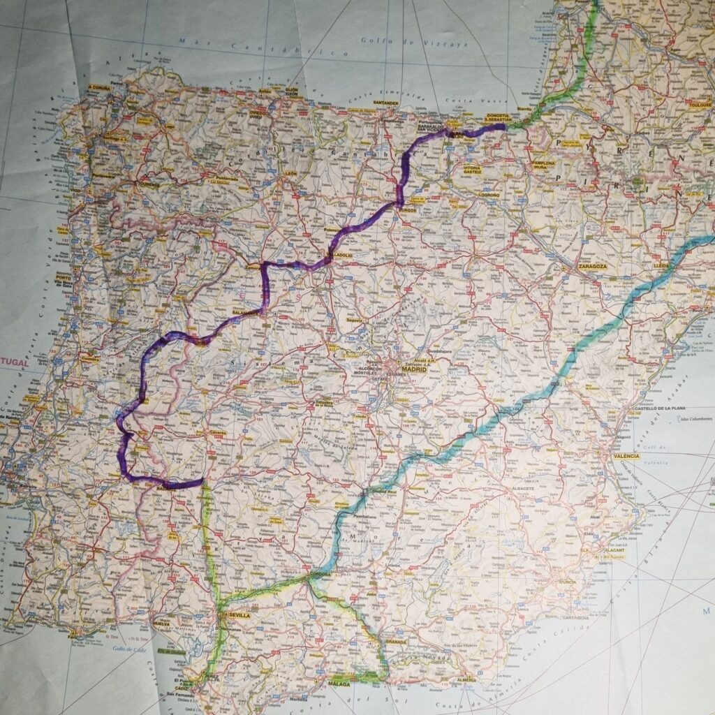
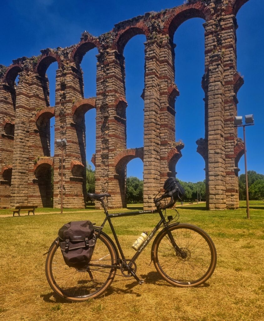
A 1,350km ride linking Merida and San Sebastian (Donostia), via eastern Portugal.
Riding a Swabia with 700c G-One 45mm tubeless and 50:19 gearing, we chose late May and June to avoid the intense heat of the Iberian summer. Merida was the northerly end of our 2008 Andalusian ride and San Sebastian was the southern end of the 2024 France ride. This was a link ride. We have previously also ridden from Nice to Cordoba and, overall, have developed an affection for riding in this corner of Europe.
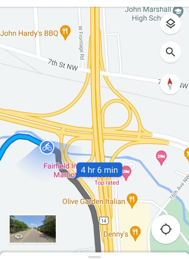
There are bike riding apps like Komoot but it’s just so easy to use google maps and so handy to be able to change things on the day. Google allows you to quickly check out riding and driving routes. Often the “N” roads (the old highways) are the best ways to ride. Or at least for sections. The bike option may not suggest the N road and checking the car option does. In Spain and Portugal, the traffic is mostly on motorways and the N roads are often not at all busy. They have shoulders.
I divide days into two or three stages and for each one plot a route and email it to myself. The final stage has the night accommodation as the end point.
When using the bike option, you must have the screen open to watch for corners. This runs the battery down and in coffee stops I’m sitting near the power point and have a fast charger.
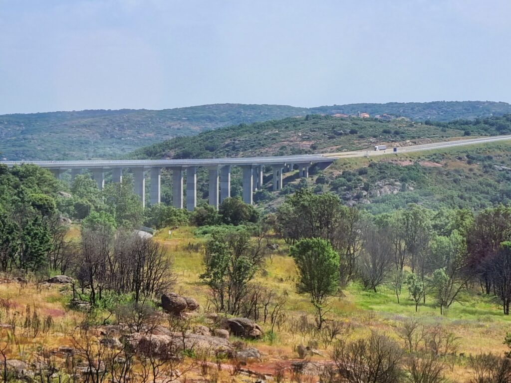
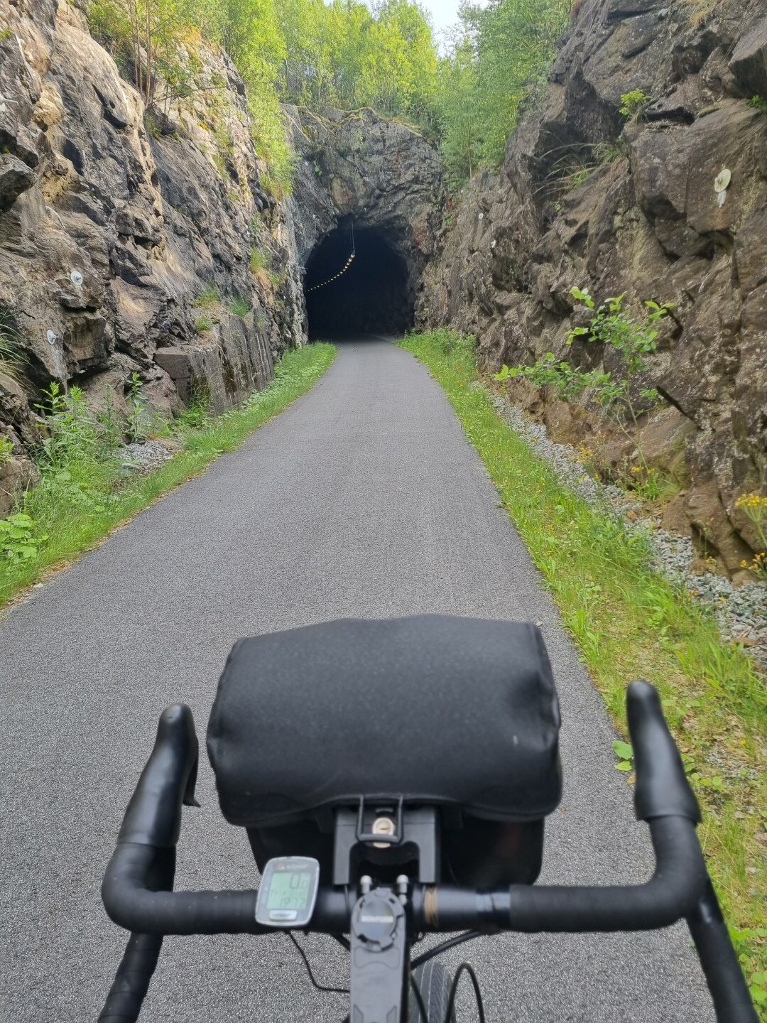
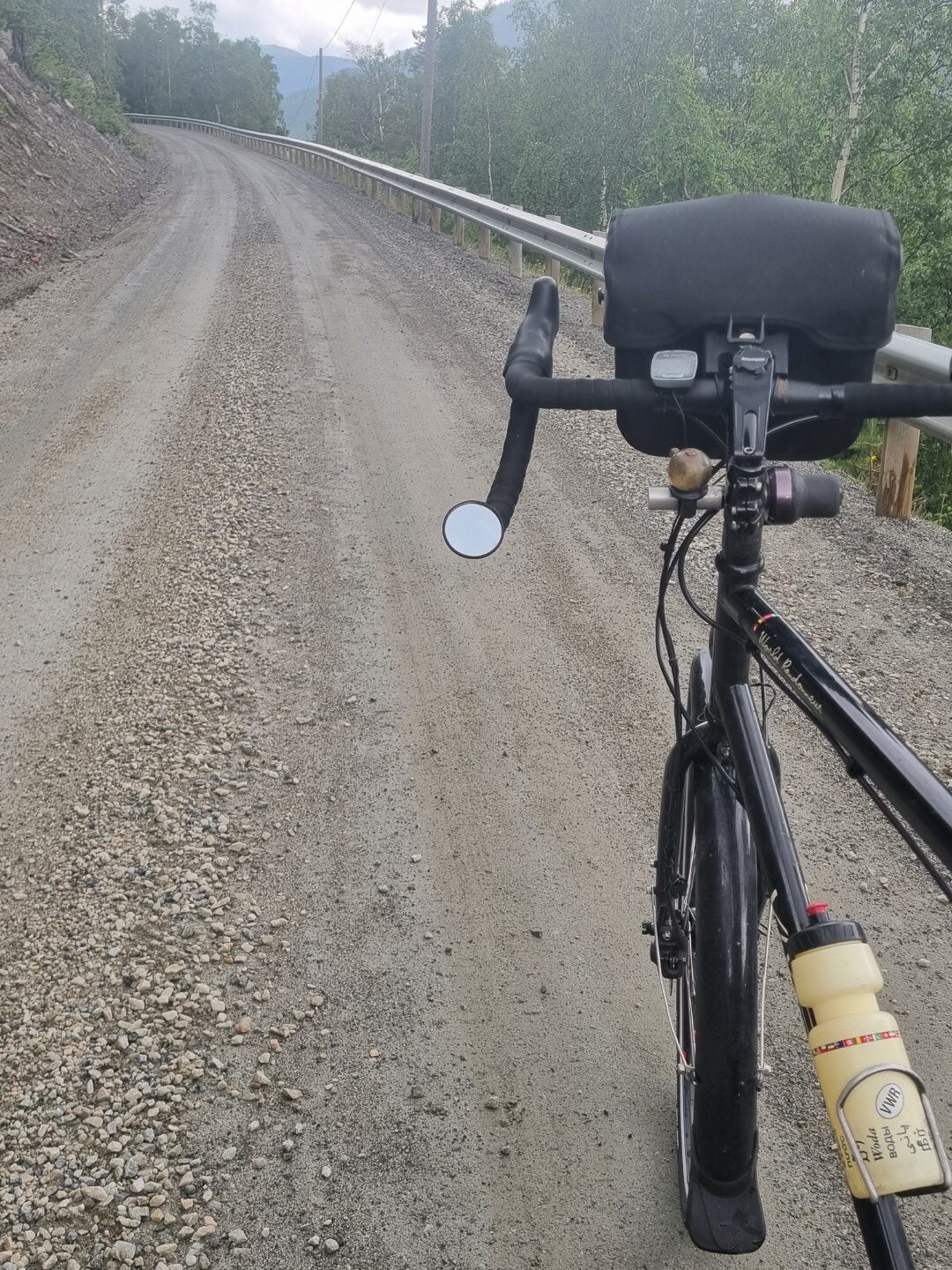
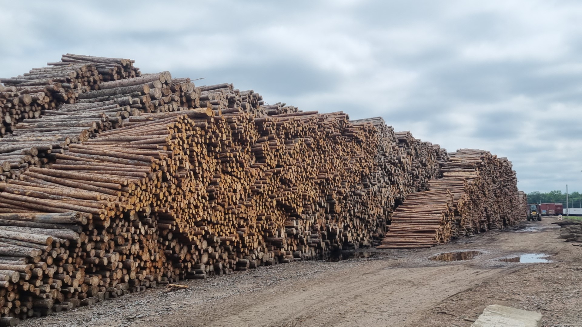
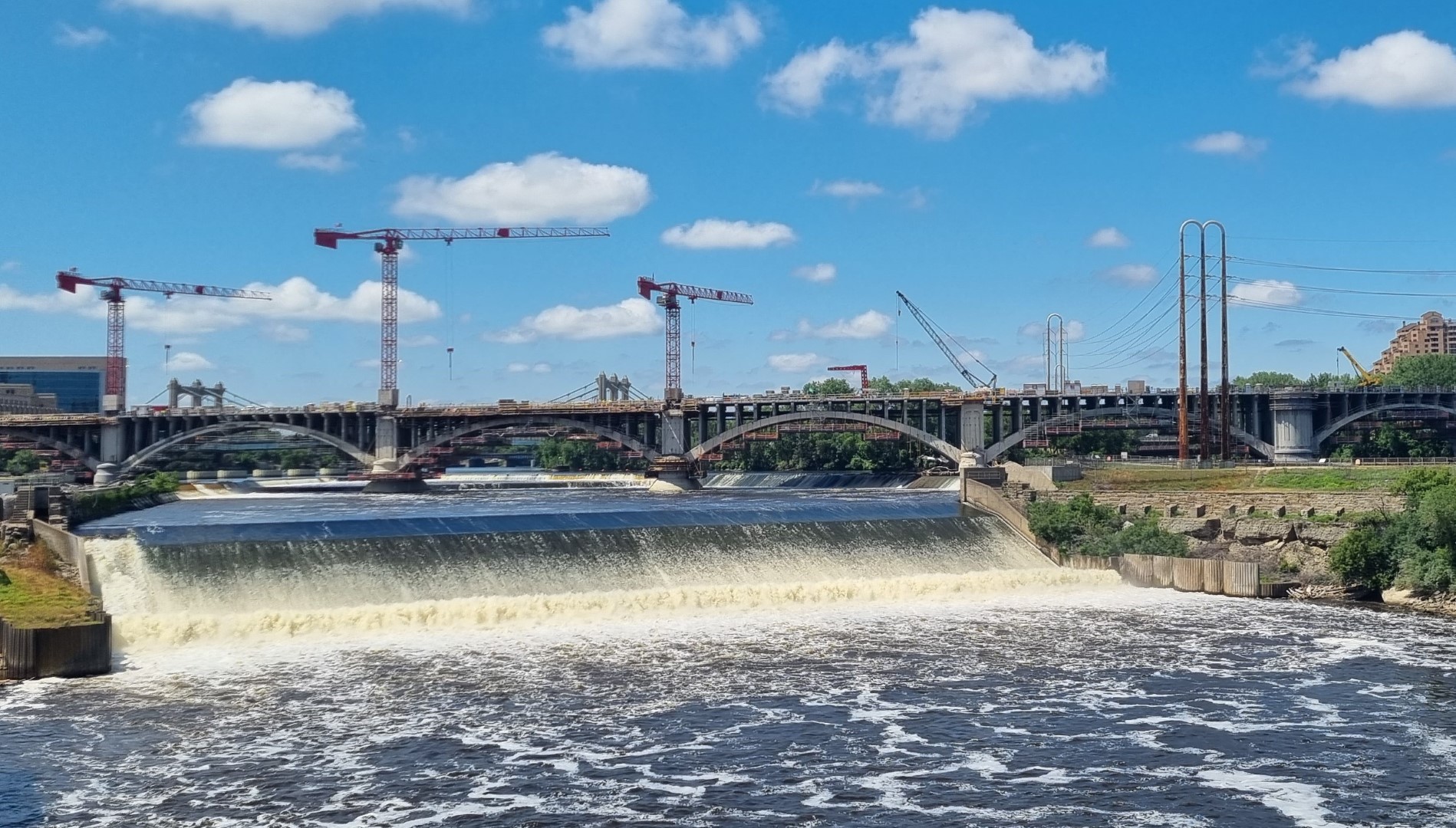
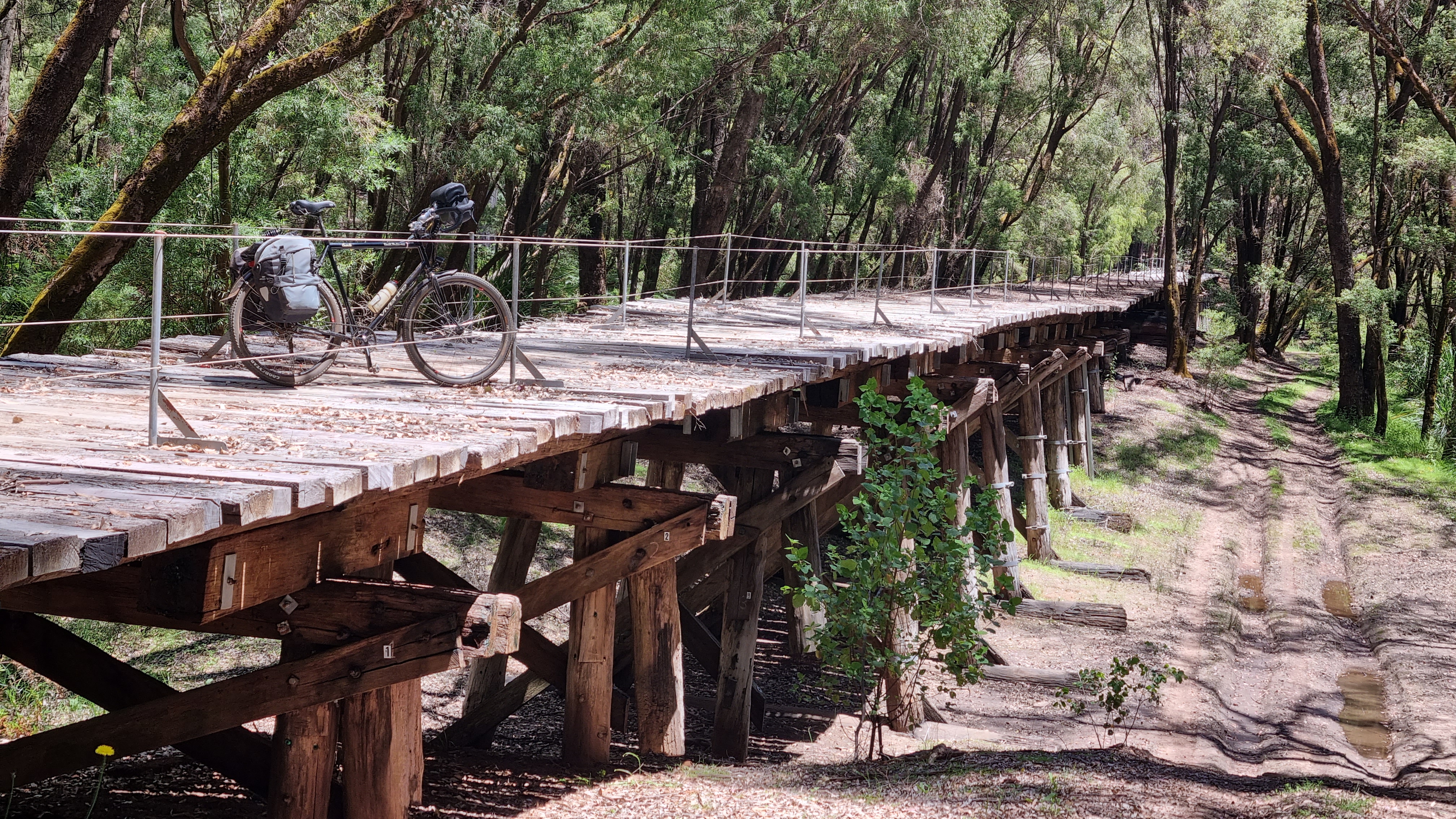
A new motorway provides a bridge over a deep ravine in Guarda province in Portugal. The old highway (N16) goes right down to the Cao River, is superb and has no traffic at all.
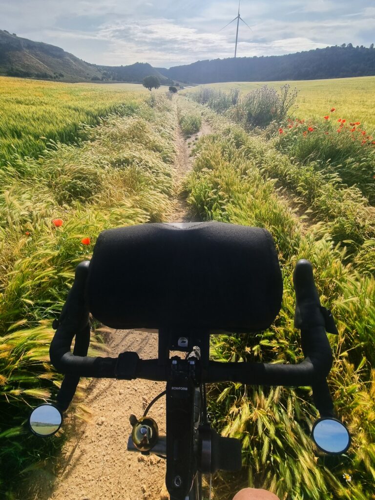
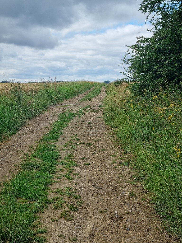
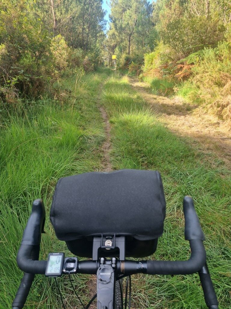
Sometimes the bike route Google gives is pretty hectic. This is north of Palencia. A 25km stage overgrown track. A bike with a rear derailleur would not have been rideable and that’s along walk! Plus, it’s only one stage of a 105km day to Burgos.
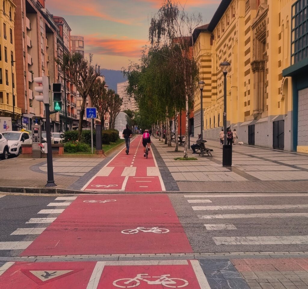
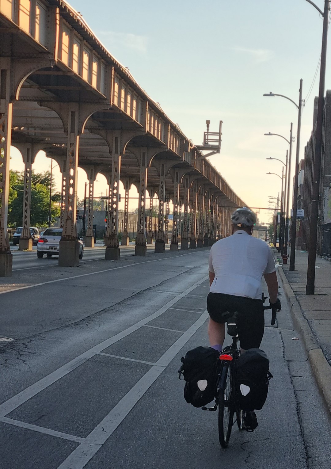
Other times, especially in and around the big cities, google knows the bike routes. Out in the country I’ll often use a car route. But in and out of cities, where there is always bike infrastructure, it’s better to turn on the bike option in google and follow it carefully. This is in Bilbao.
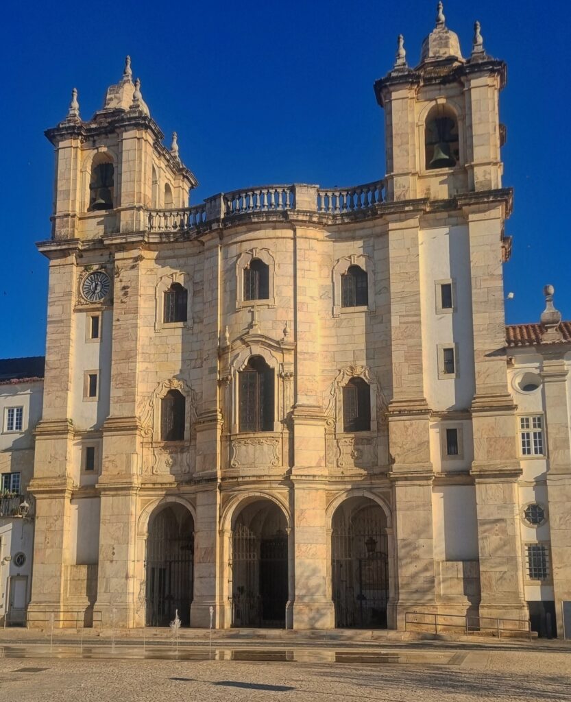
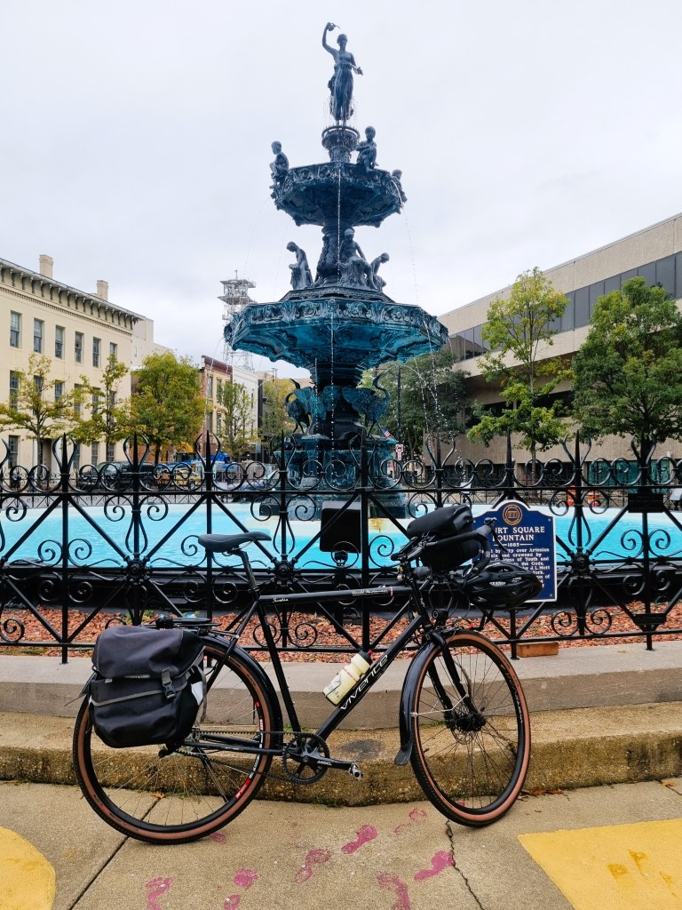
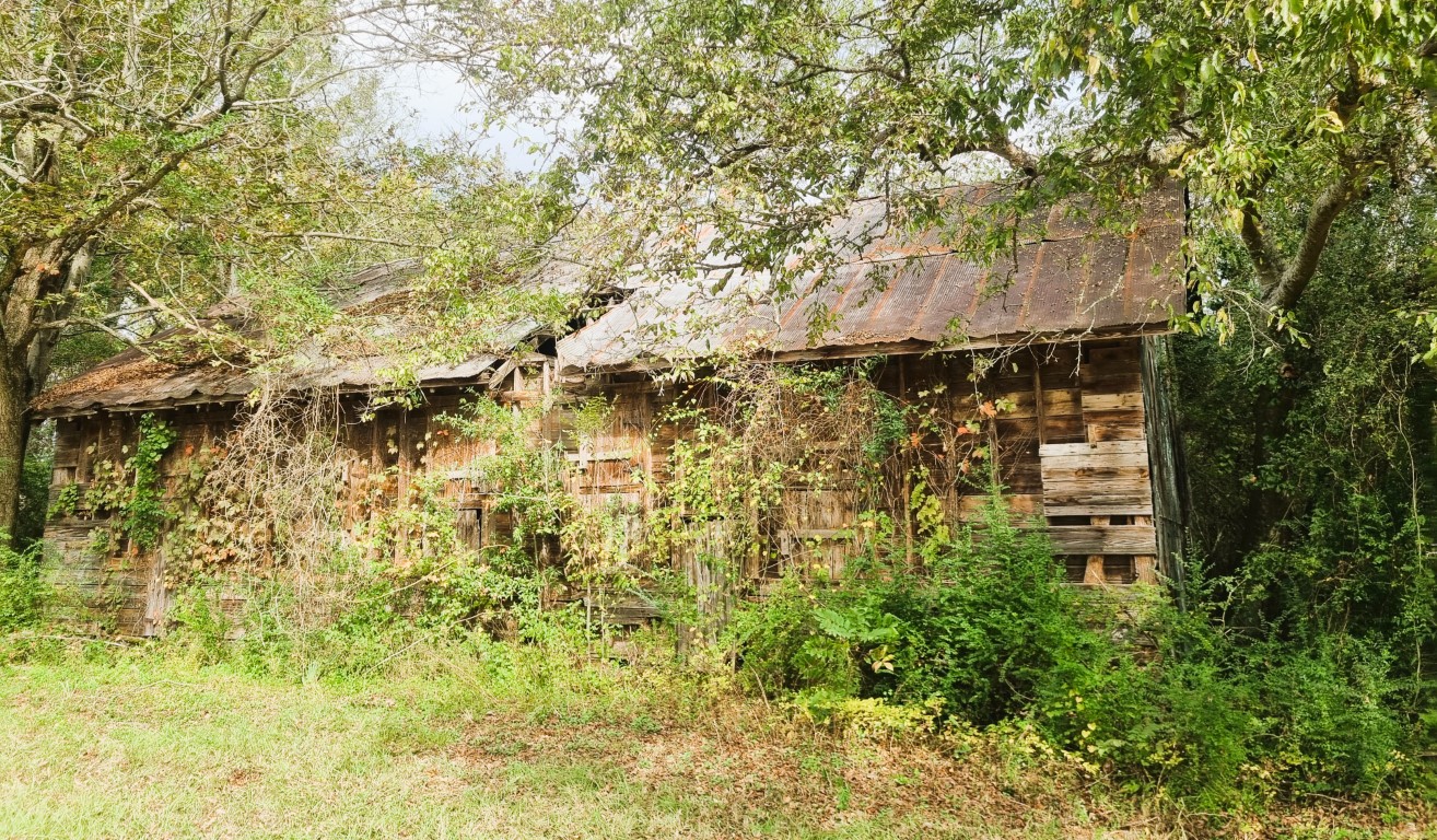
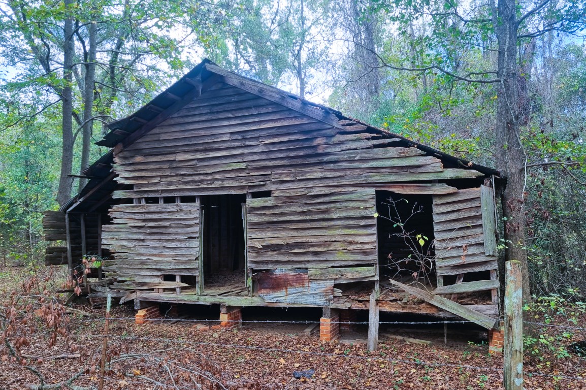
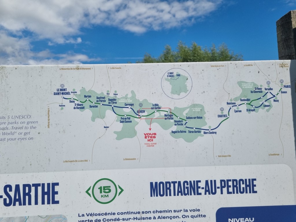
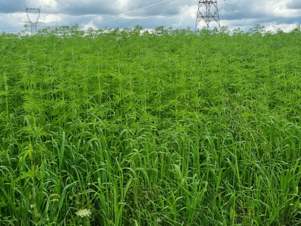
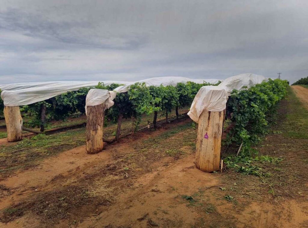
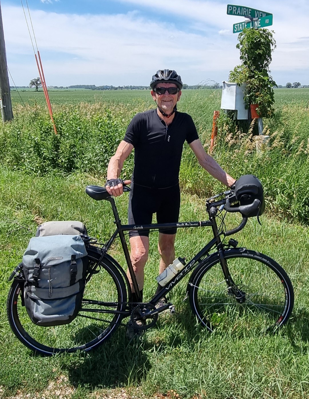
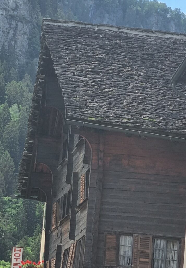
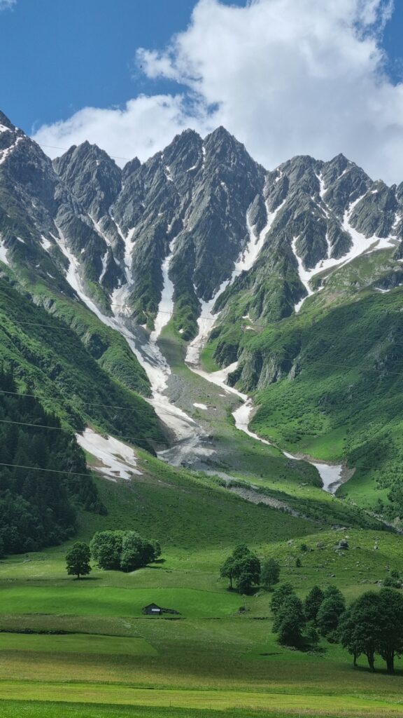
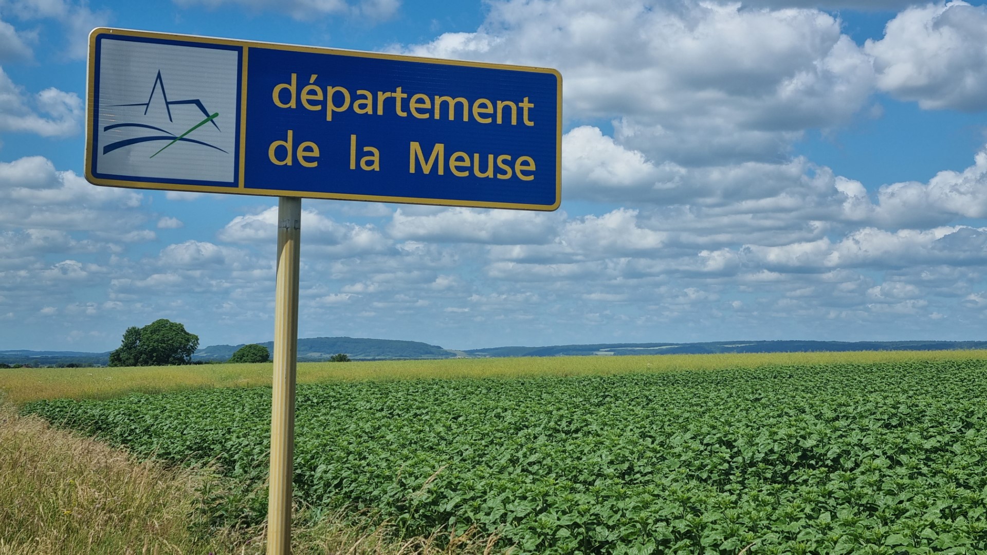
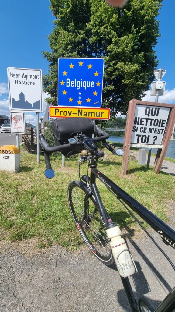
This ride took me into eastern Portugal. Westward from Merida and Badajoz in Spain to Estremoz in Portugal. Estremoz happens to be the source of much of the world’s marble. Cobblestones are marble. The buildings are marble. The vanity basin was carved out of marble. The cemetery is marble. They even grind marble up and mix it with paint.
Portugal is experiencing the over-tourism problem, especially in the south (the Algarve) and on the west coast (Lisbon and Porto). House prices are too high. People say there are too many “golden visas”. Populist anti-immigrant parties are winning elections.
But this was not al all an issue in the east of the country. Local businesses were happy to serve me.
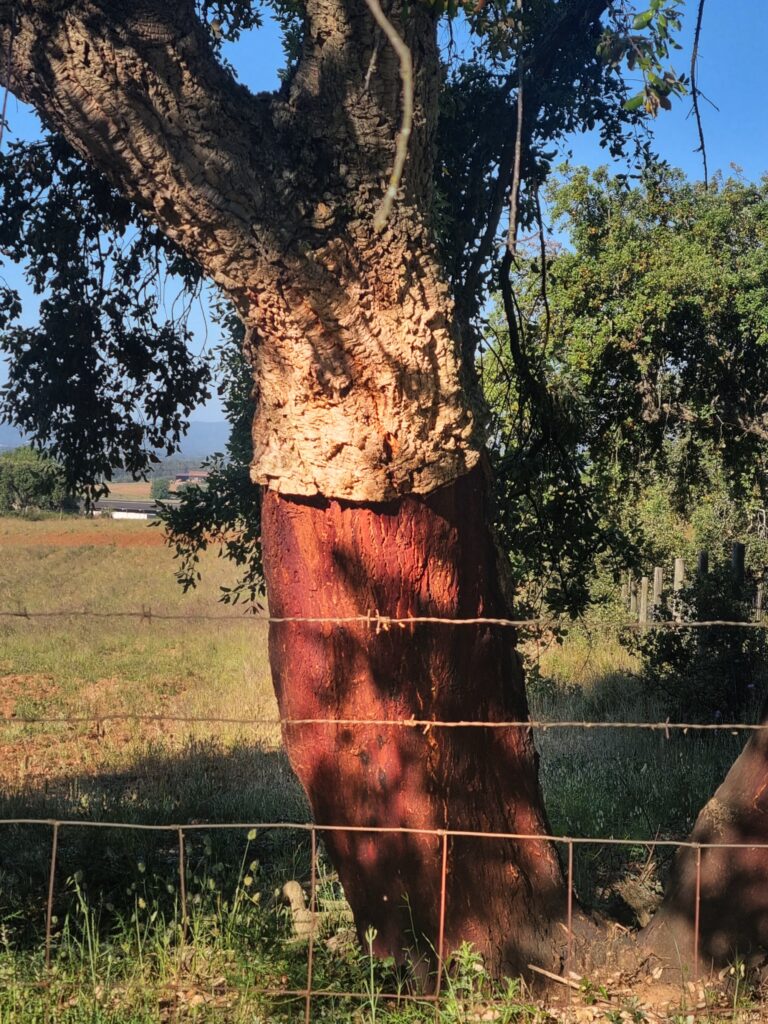
An interesting crop in Portugal is cork. Cork is an oak tree that lives for about 200 years. The bark is harvested ever 9-12 years. You see hundreds of the trees along roadsides.
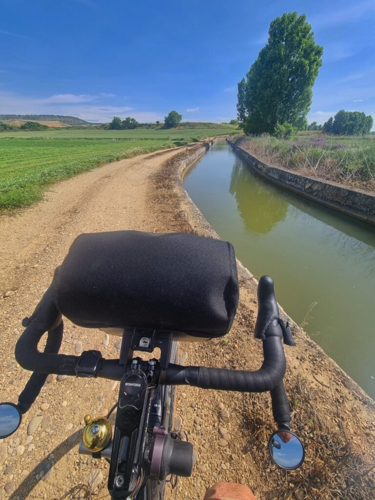
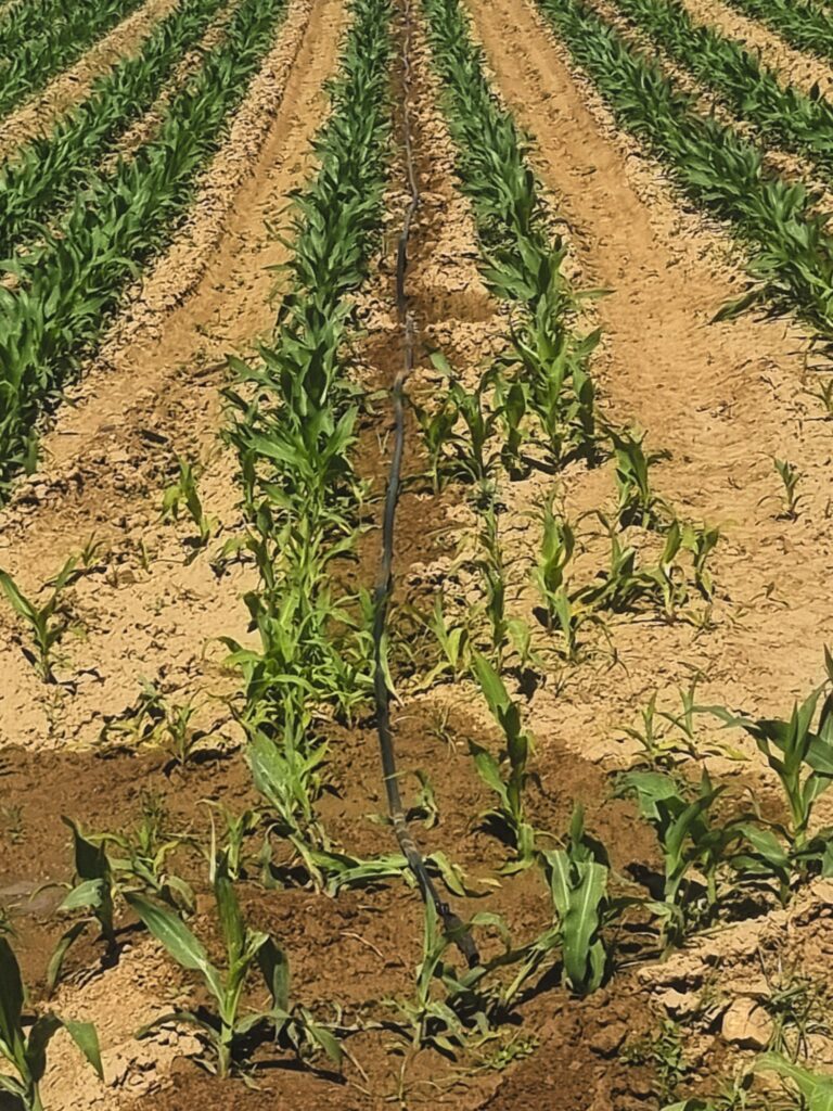
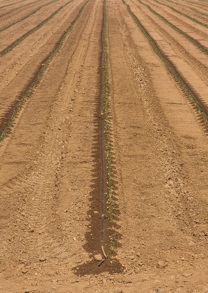
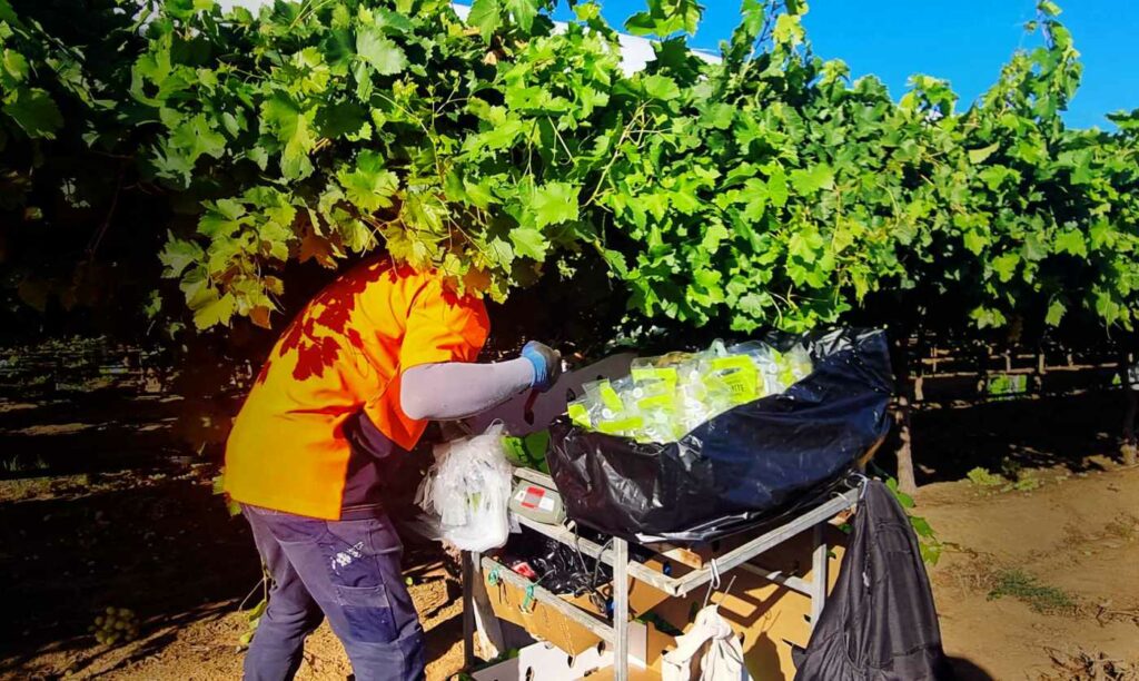
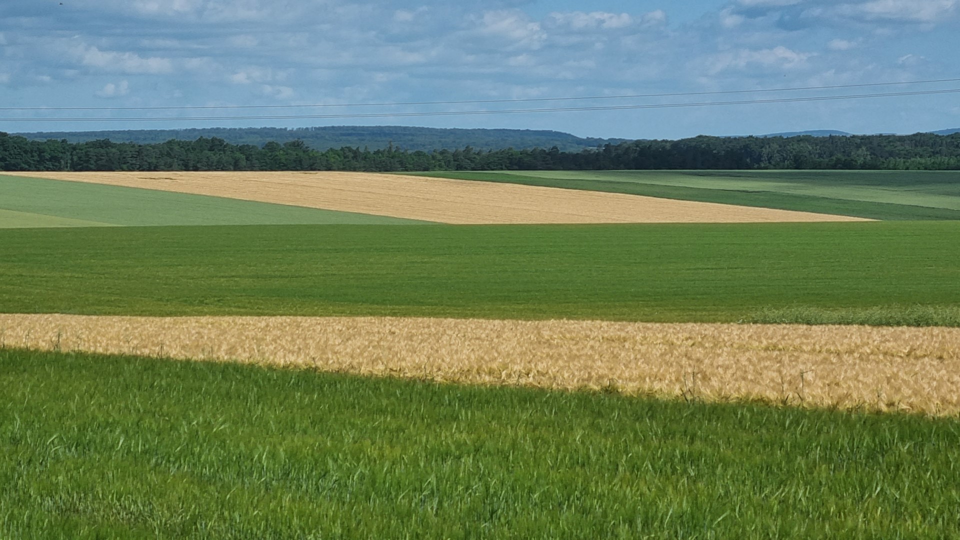
Spain and Portugal are experiencing a long-term reduction in rainfall. Along with increasing temperatures this is causing an expansion of aridity. One result is that water for farming is being treated with greater value. Irrigation is in concrete canals. Compare that with the Murry-Darling basin in Australia where water is running in dirt canals giving rise to massive losses.
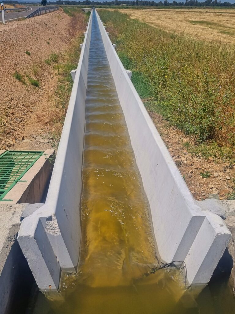
When they use the water, they try do so in the most efficient way as shown in these crops of tomatoes and corn. Meanwhile, in Australia, precious water is being wasted big time.
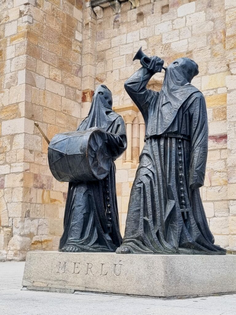
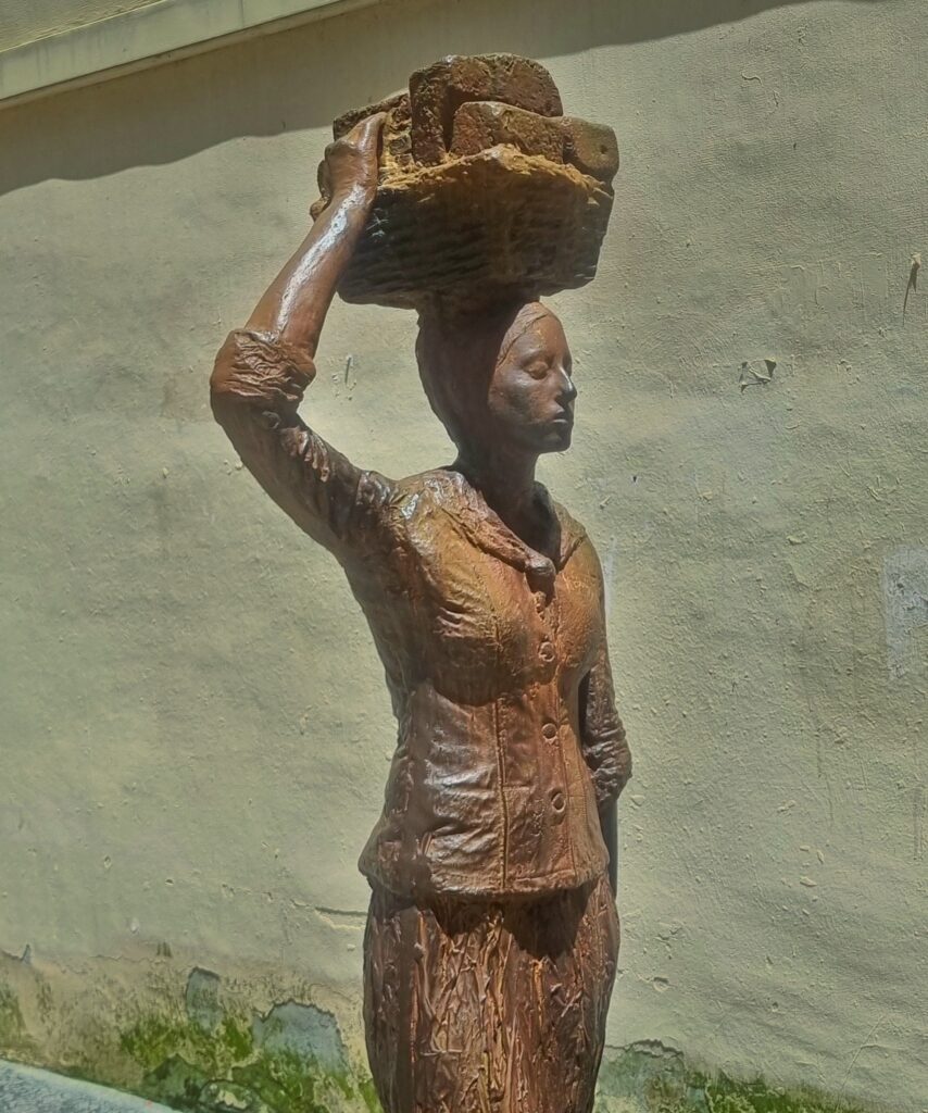
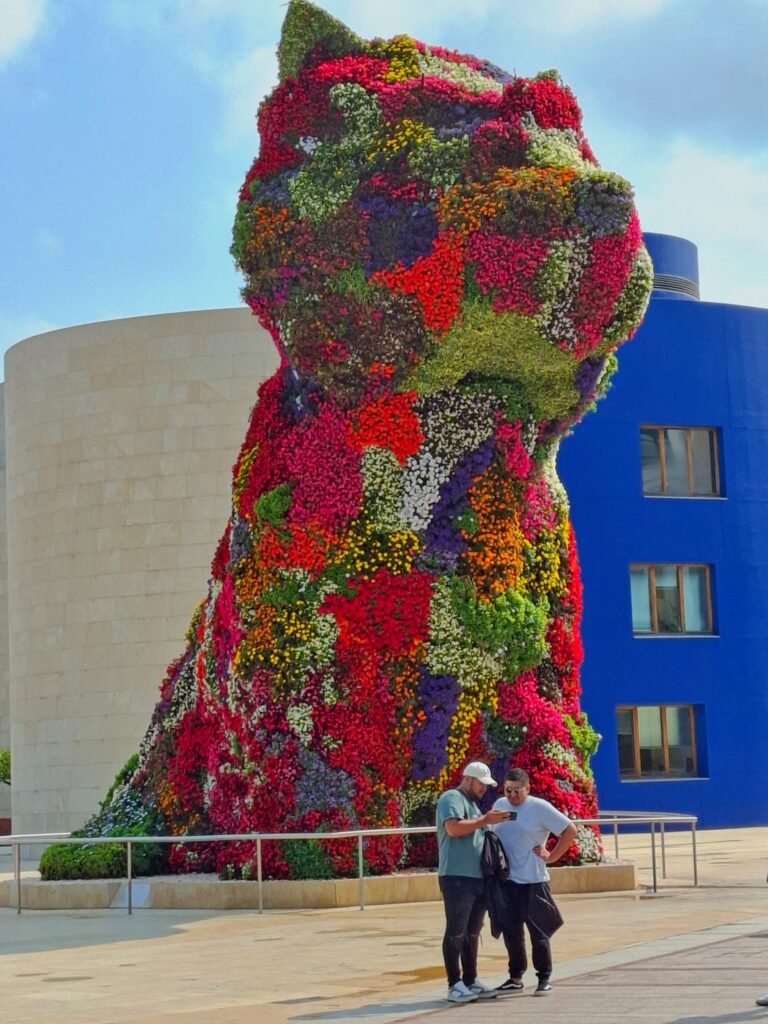
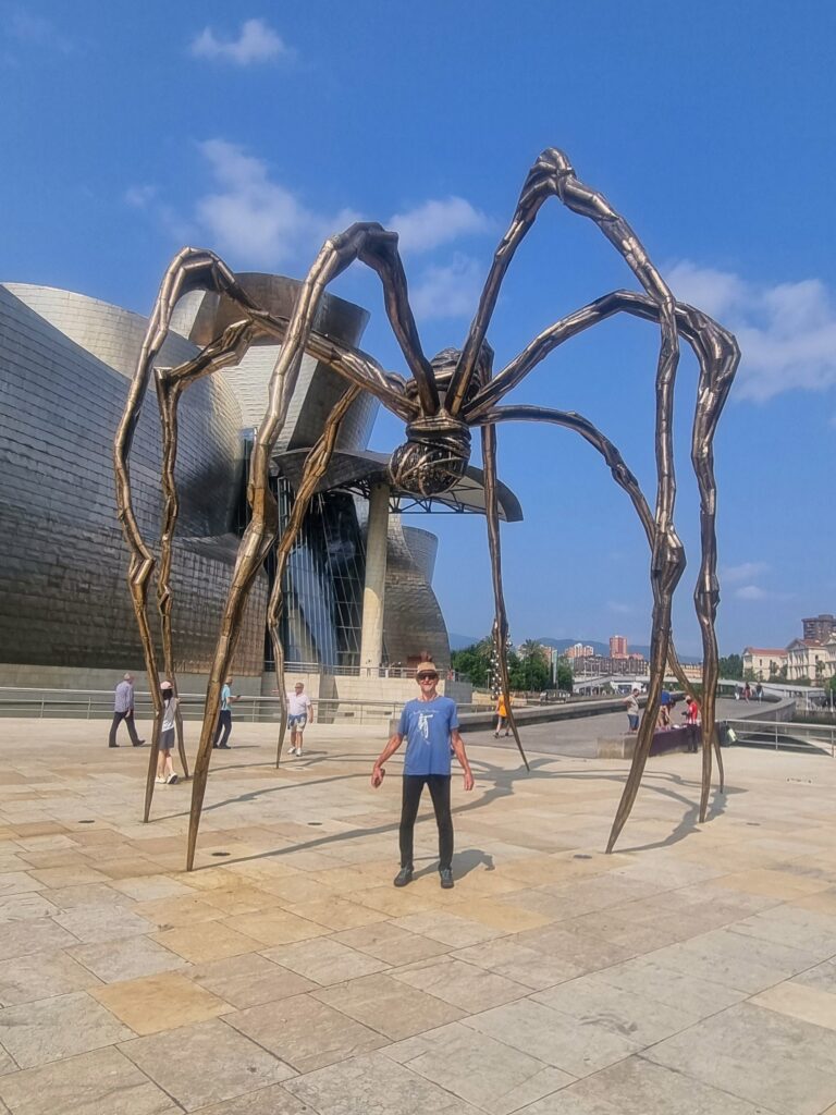
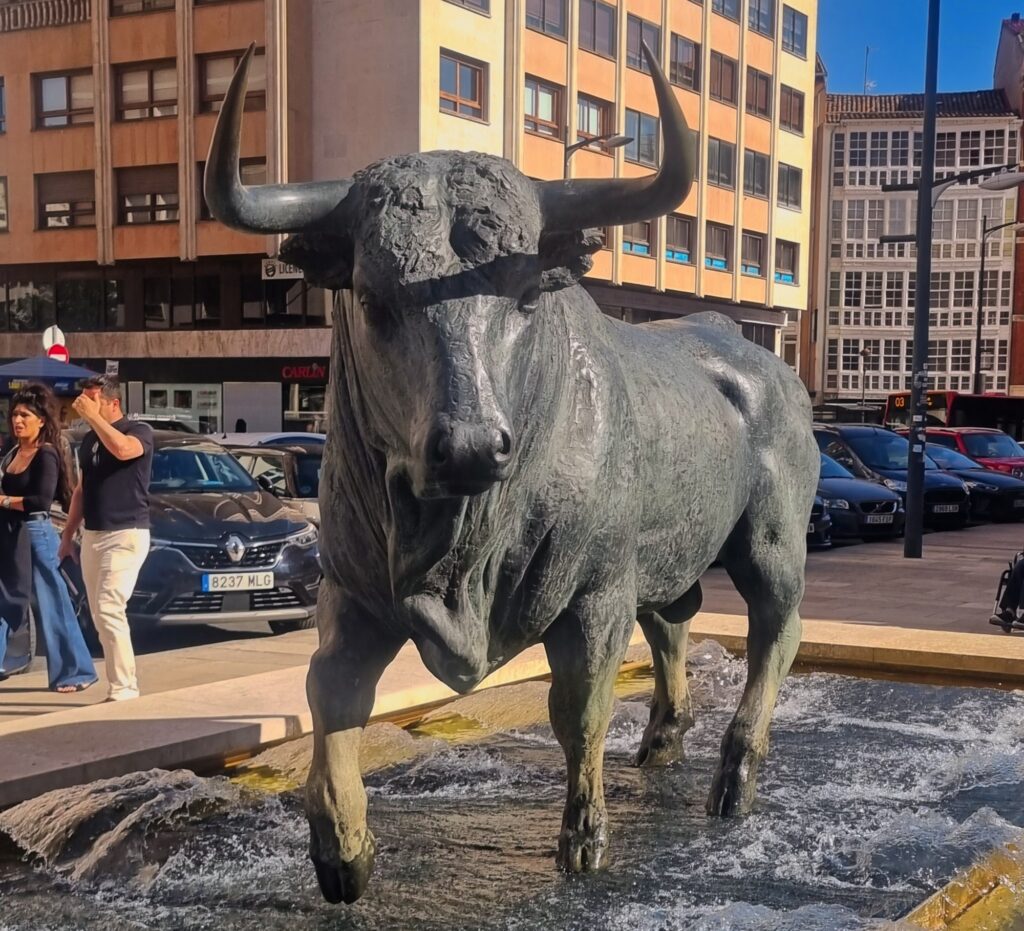
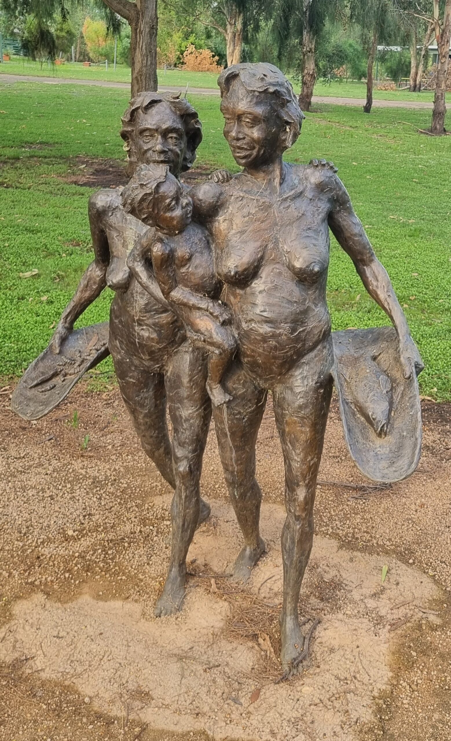
The art of Spain
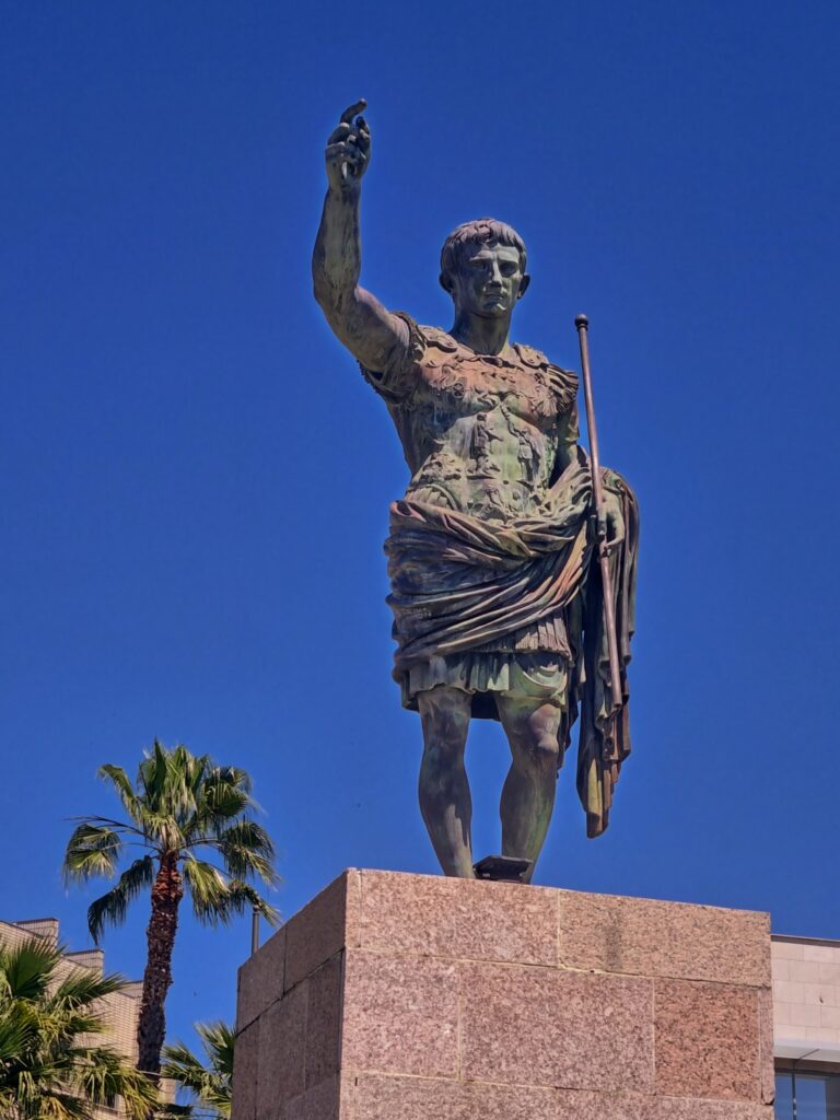
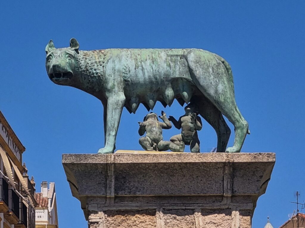
The quality and amount of public art in Spain needs to be mentioned. Below are just a few examples.
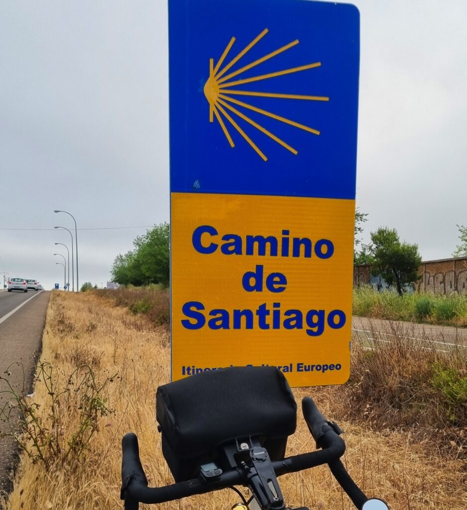
Everyone knows about the Camino de Santiago pilgrimage route. But I did not realise there are multiple routes.
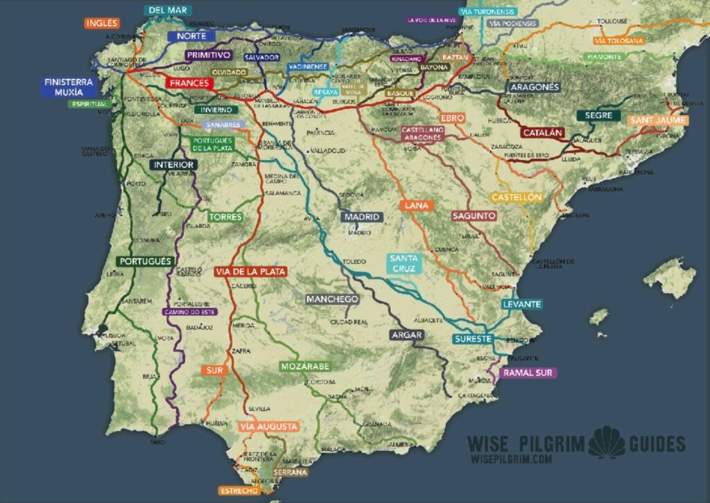
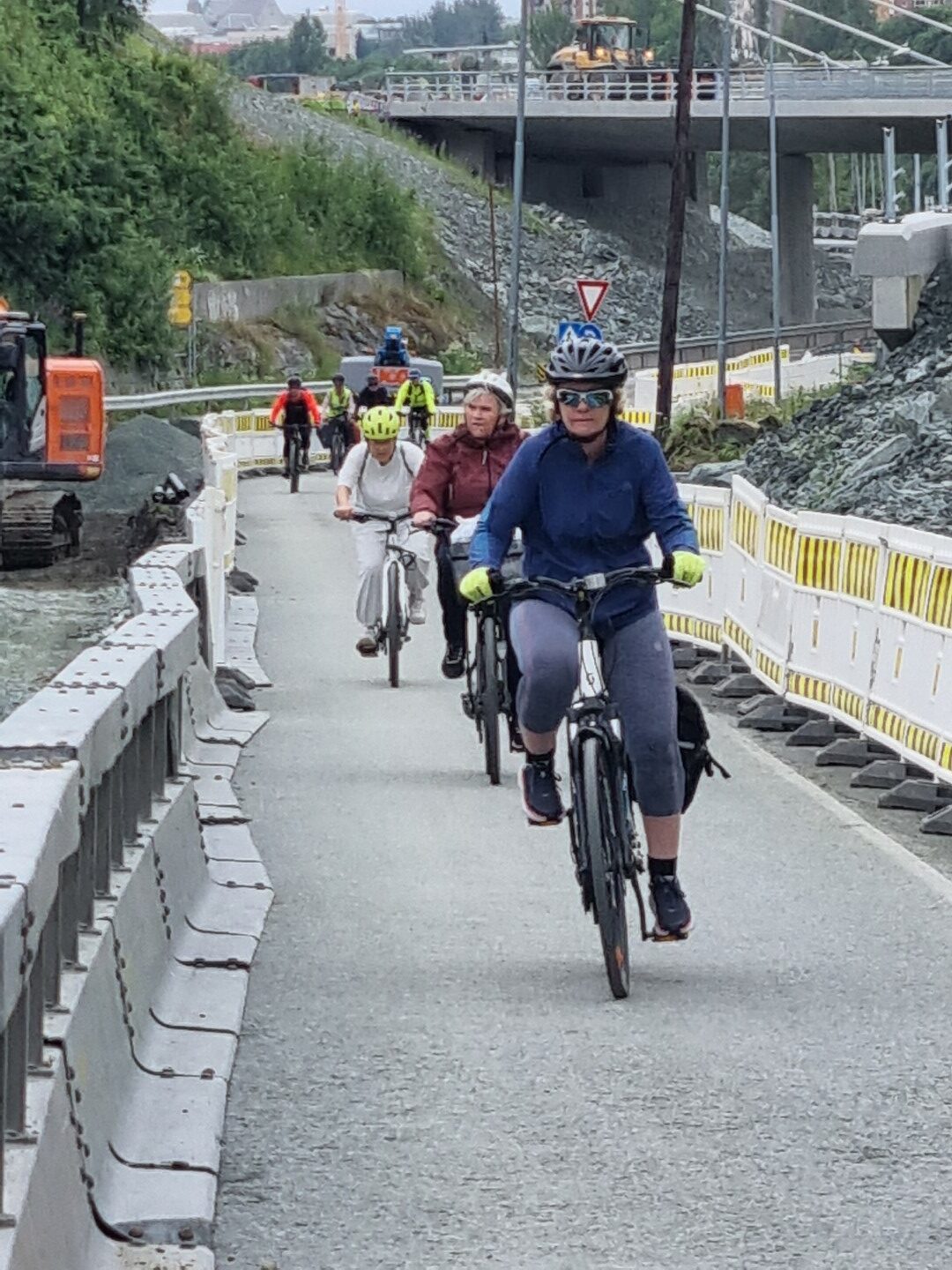
As I moved north, I found I was regularly riding on one of the routes. There are bikers and walkers. Accommodation gets a bit tighter as you approach the Basque country where the routes often converge.
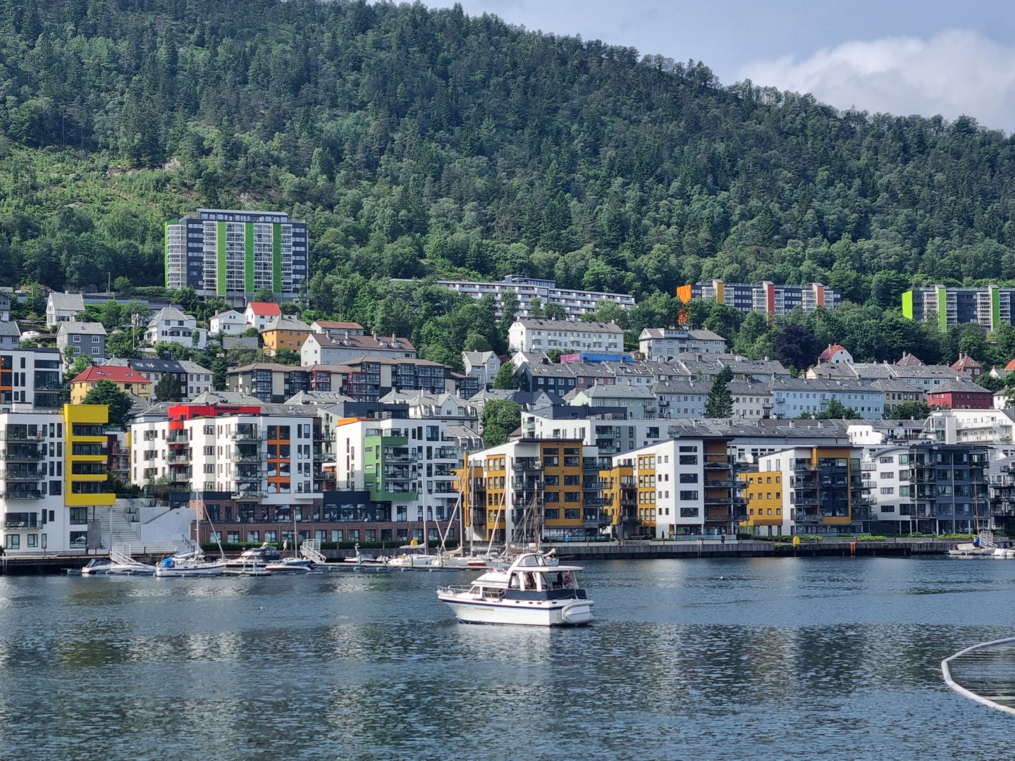
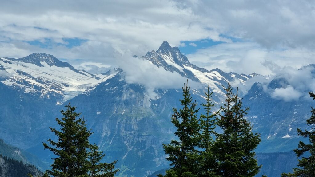
A feature of this ride was having more time in the Basque Country. The language is completely different to Spanish. The absolute treat was having a few days in Bilbao. This city has to be one of the most pleasant on the whole planet. It’s highly recommended!
San Sebastian is a day or two ride to the east of Bilbao. It’s focused on the beach whereas Bilbao is inland a little and hemmed in by forested mountains. Along the Bay of Biscay coast the rainfall is higher. It reminded me of the Black Sea coast in Turkiye.
Bilbao has a population of 350,000. It is relatively flat with a grand layout and 4-8 story buildings. There are very few cars. There’s an underground metro plus lots of walking and cycling. The Guggenheim was opened in 1997 and has become the #1 drawcard.
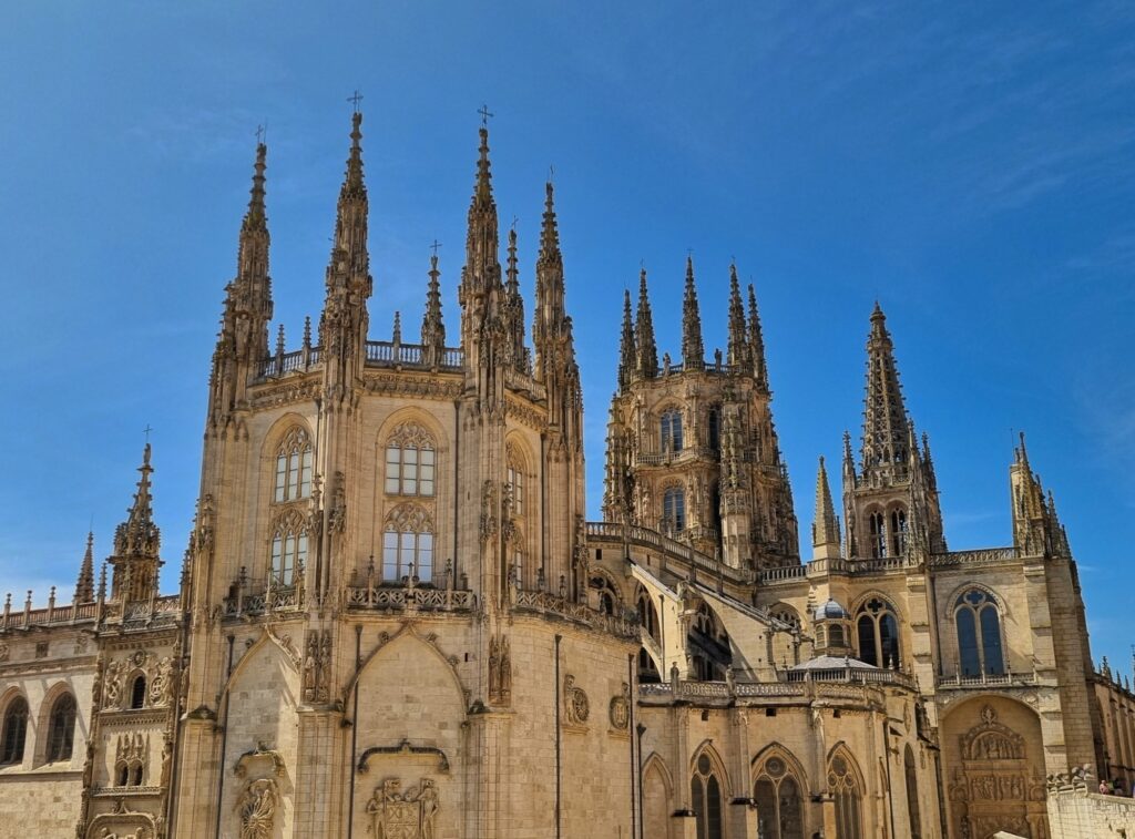
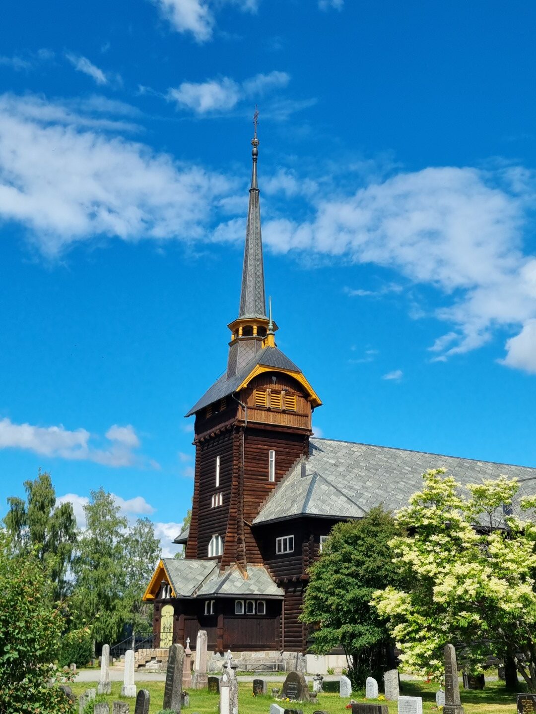
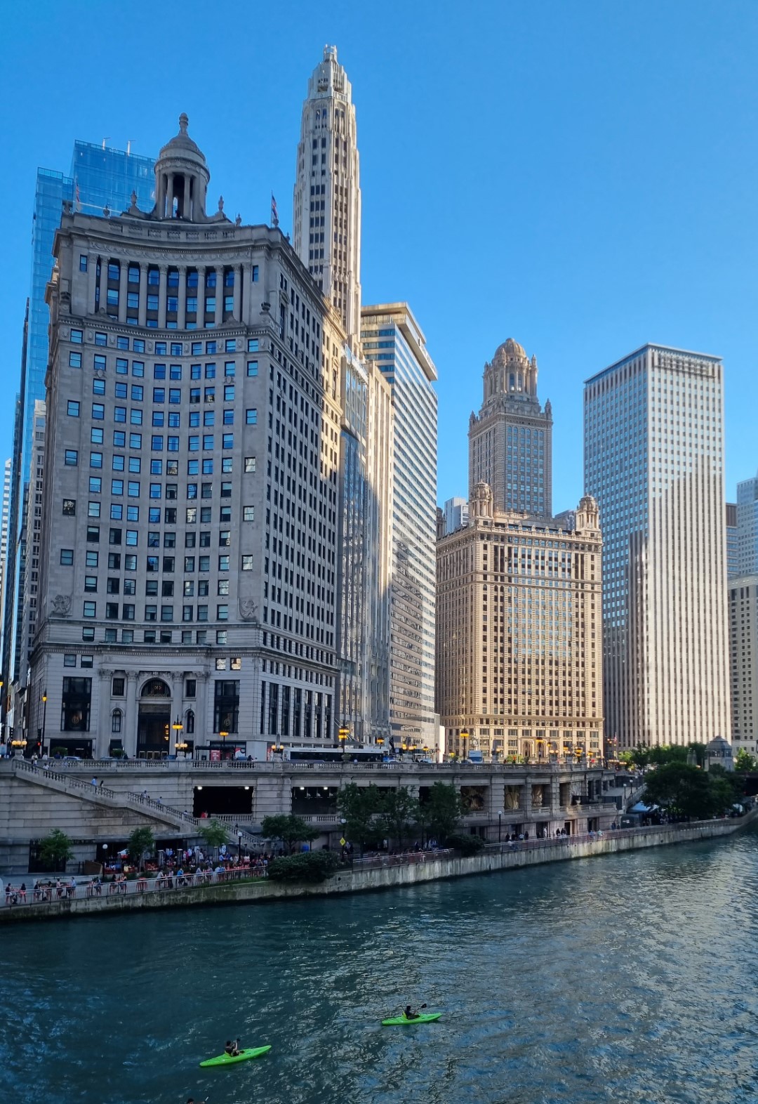
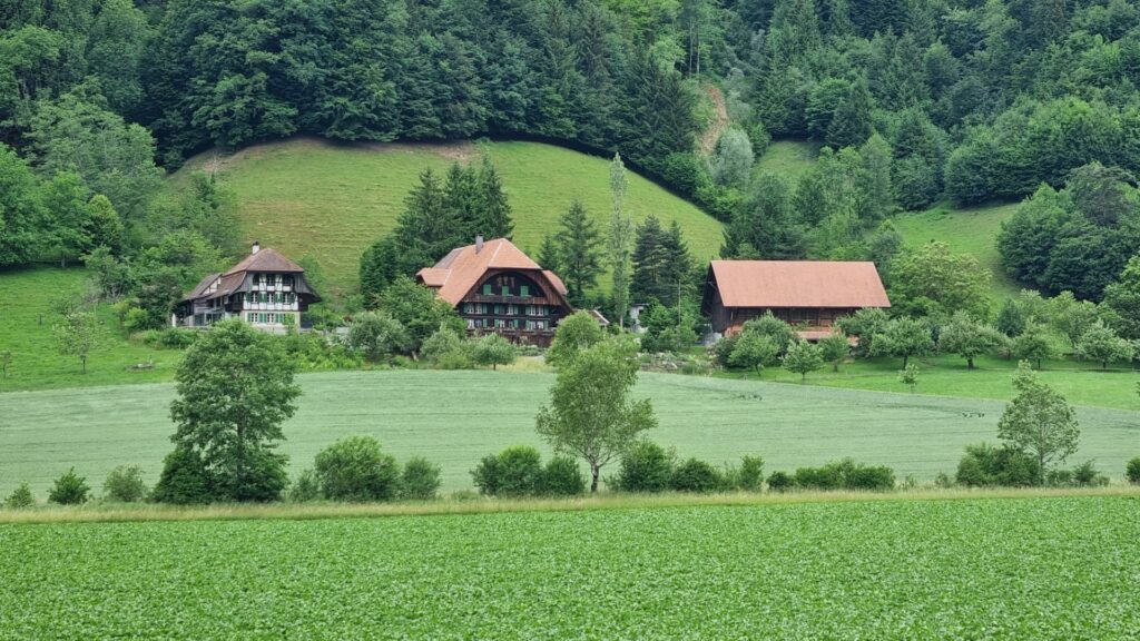
Bike tours in Spain do have the feature of going through some great cities. Apart from the Basque coast, this trip had me riding through Madrid, Merida, Salamanca, Valladolid and Burgos. They all warrant a rest day and there is no shortage of stunning things to admire.
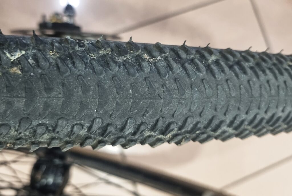
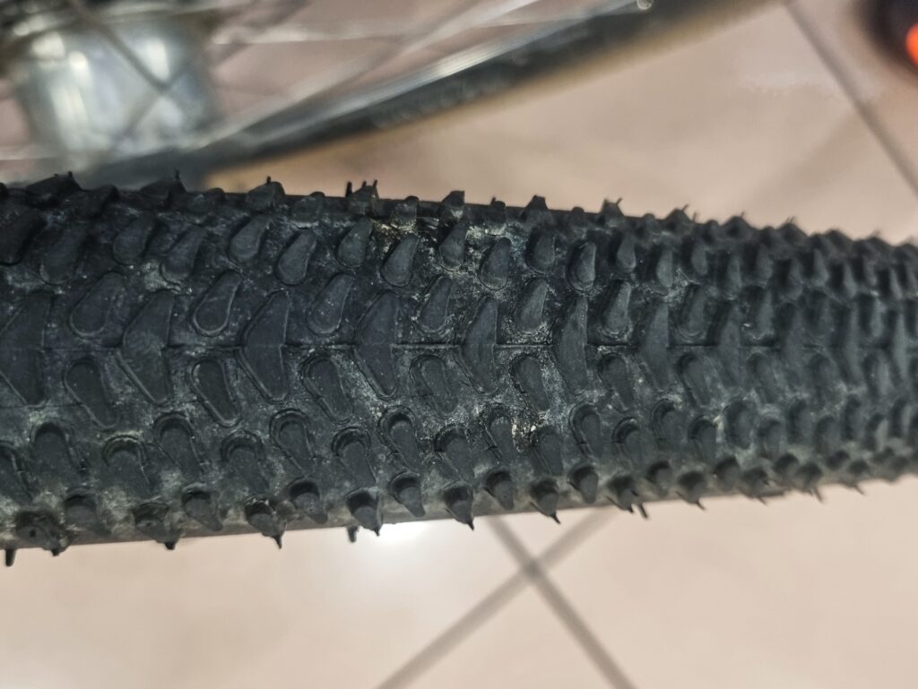
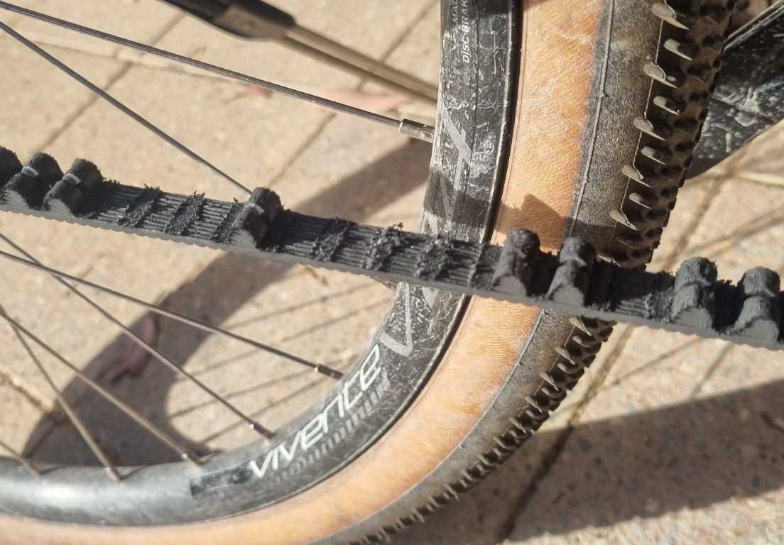
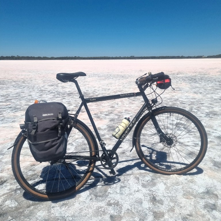
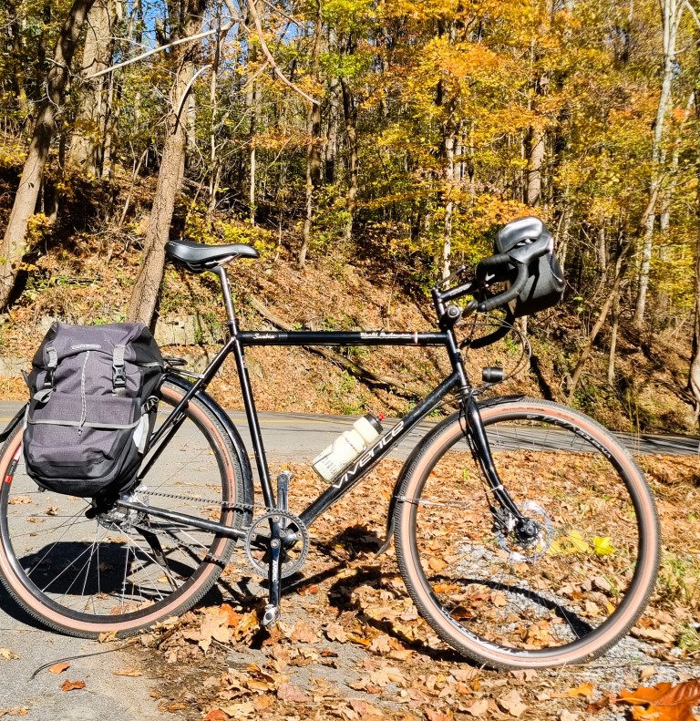
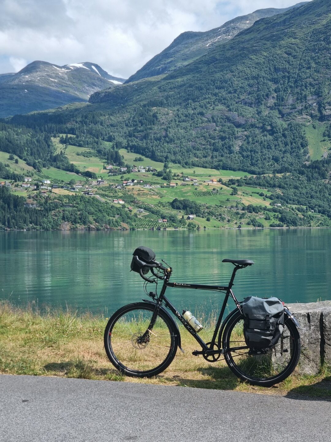
Riding a Vivente with Gates belt drive and Rohloff transmission is, in itself, mechanically uneventful. Nothing goes wrong. So, there’s not much to say about the bike. However, on this ride I had chosen to be tubeless and to not even carry an emergency tube. It was just curiosity. How does if feel to be vulnerable?
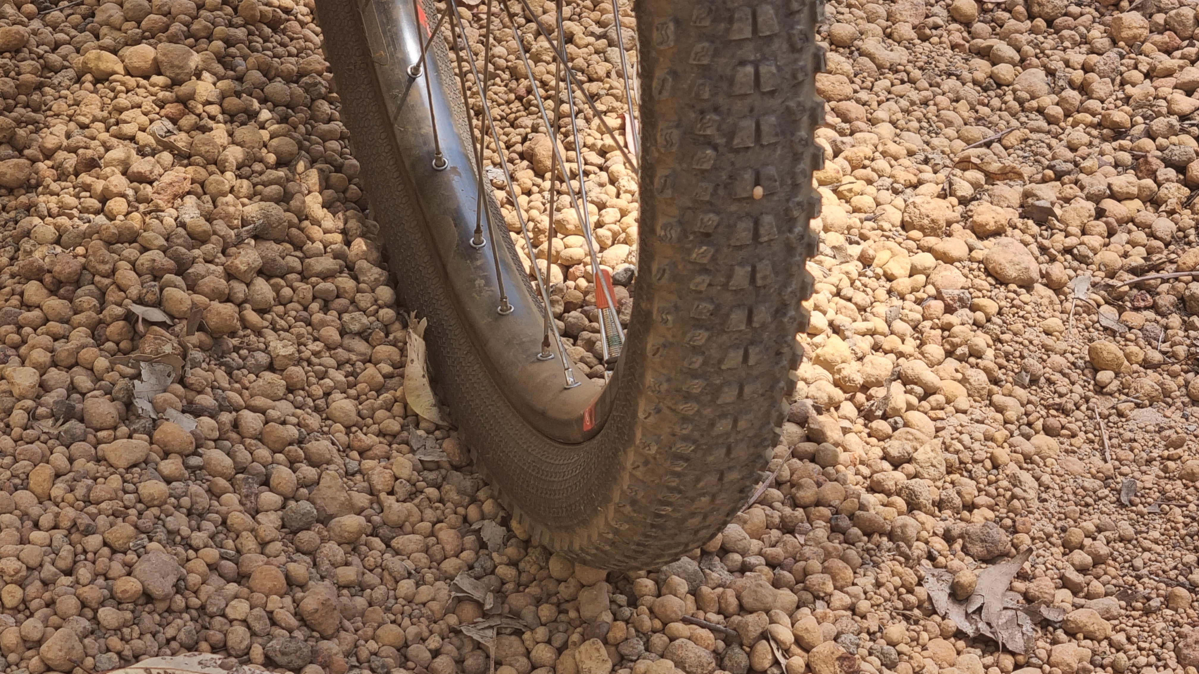
My tyres were Schwalbe G-One R 700×45. They are thin skinned, fast and light. They are made for competitive gravel racing. I carried dynaplugs but did not have to use one. I was in a lot of remote places and on some rough stony tracks. If I had a puncture, it was sealed by the solution, and I was unaware of it. I added air using a Lezyne pump with a gauge about every 10 days.
These tyres wear out and are not suitable for a very long trip such as around Australia. They had been on my 700C wheels in the US ride last November, Victoria and South Australia last January and now on this ride. When they reached 3,500 km from the start in the US I decided to rotate them. I had that done at a bike shop in Valladolid. No booking! It was done whilst I had a coffee over the road. New solution and labour cost AUD$50. The rear tyre wears much faster. Now that they are rotated, they might have another 3,000km in them. The below shots were just before the rotation.
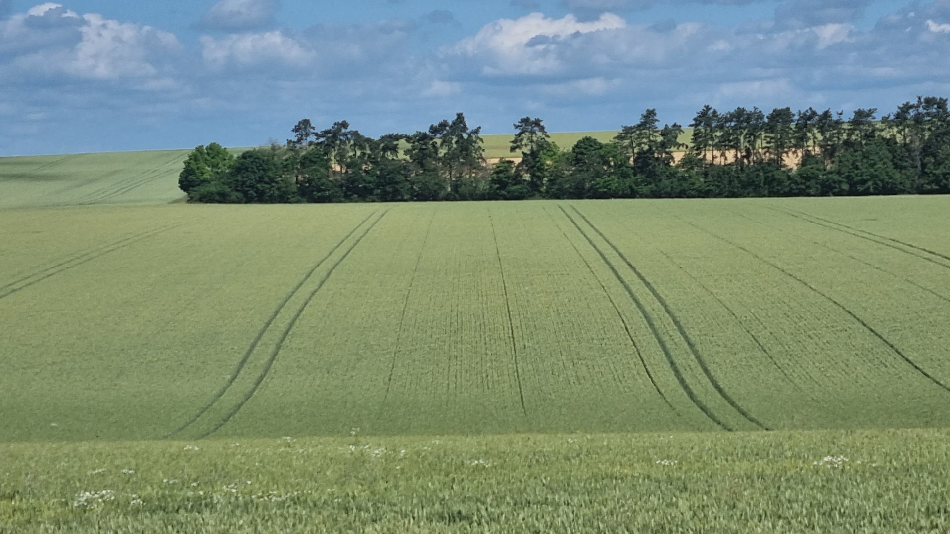
Riding a bike through Spain and Portugal, you spend a lot of time in beautiful and quiet places.
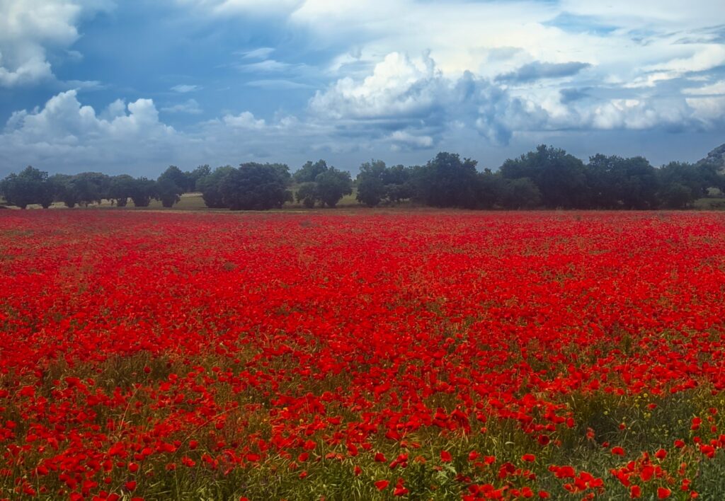
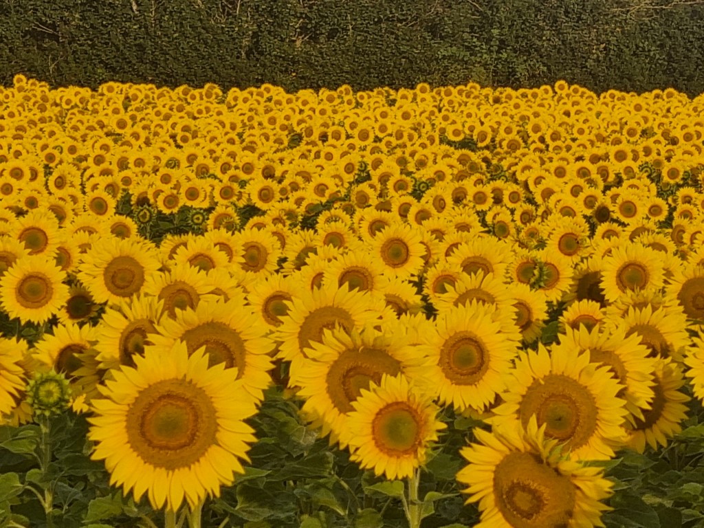
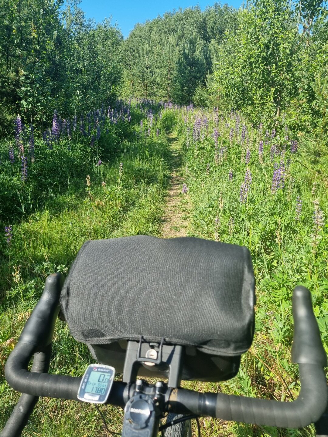
It is poppy season in May and June.
On a track between two valleys, north of Burgos (MP4 file called quiet places)
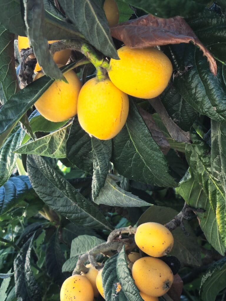
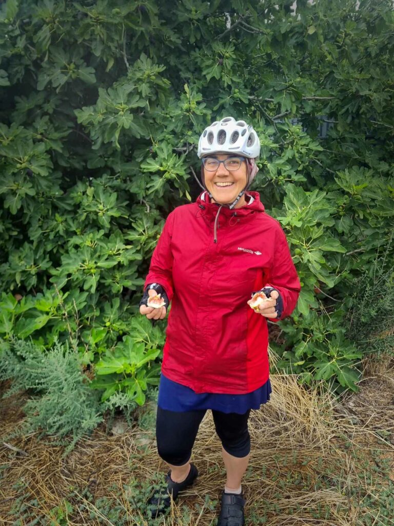
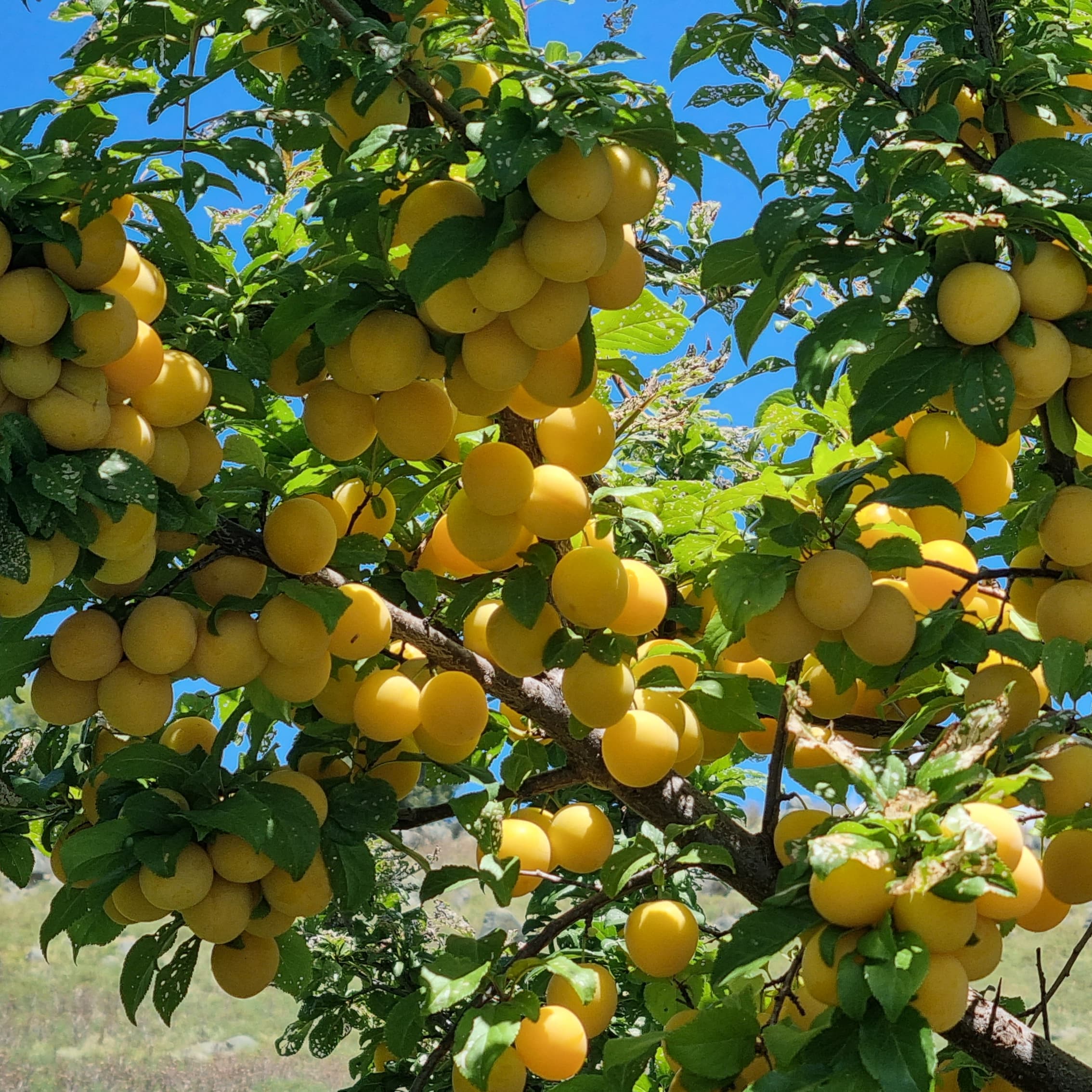
Another delight of travelling by bike is the roadside fruit. For the Iberian peninsular the best time is autumn when there are figs and grapes everywhere. In June there’s not so much but there were loquats in many areas and cherries in the north.
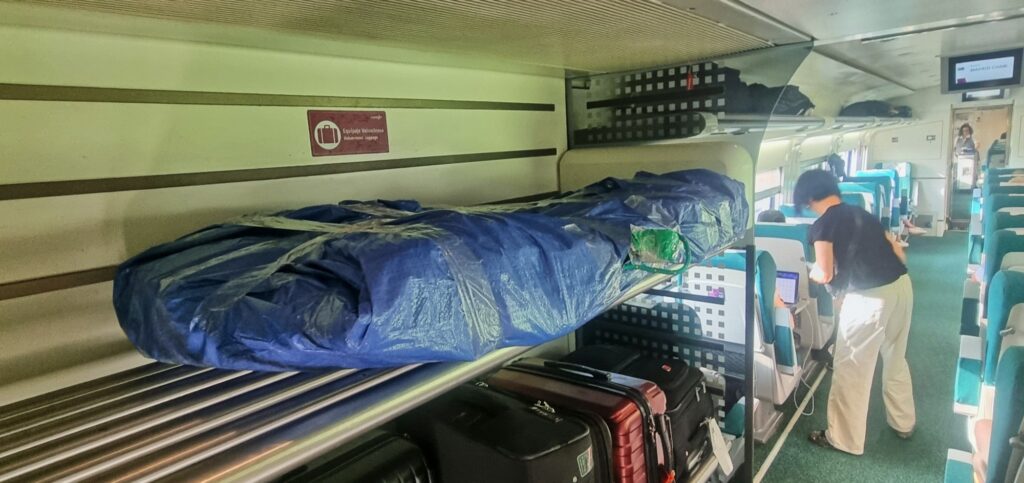
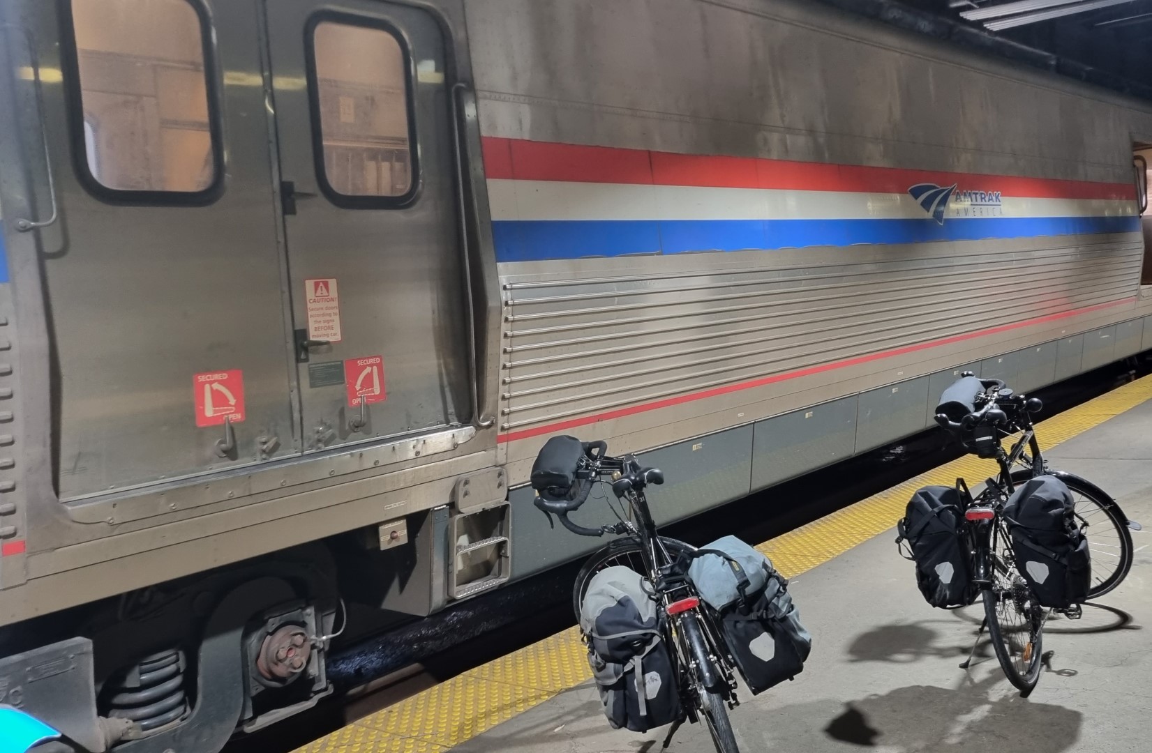
If you need to cover distance in Spain at the start or end of a ride you can use the trains. You need to pack the bike in a tarp. (broken down like we do for flying). Just get a small cheap tarp at the hardware. Best to book a week in advance.
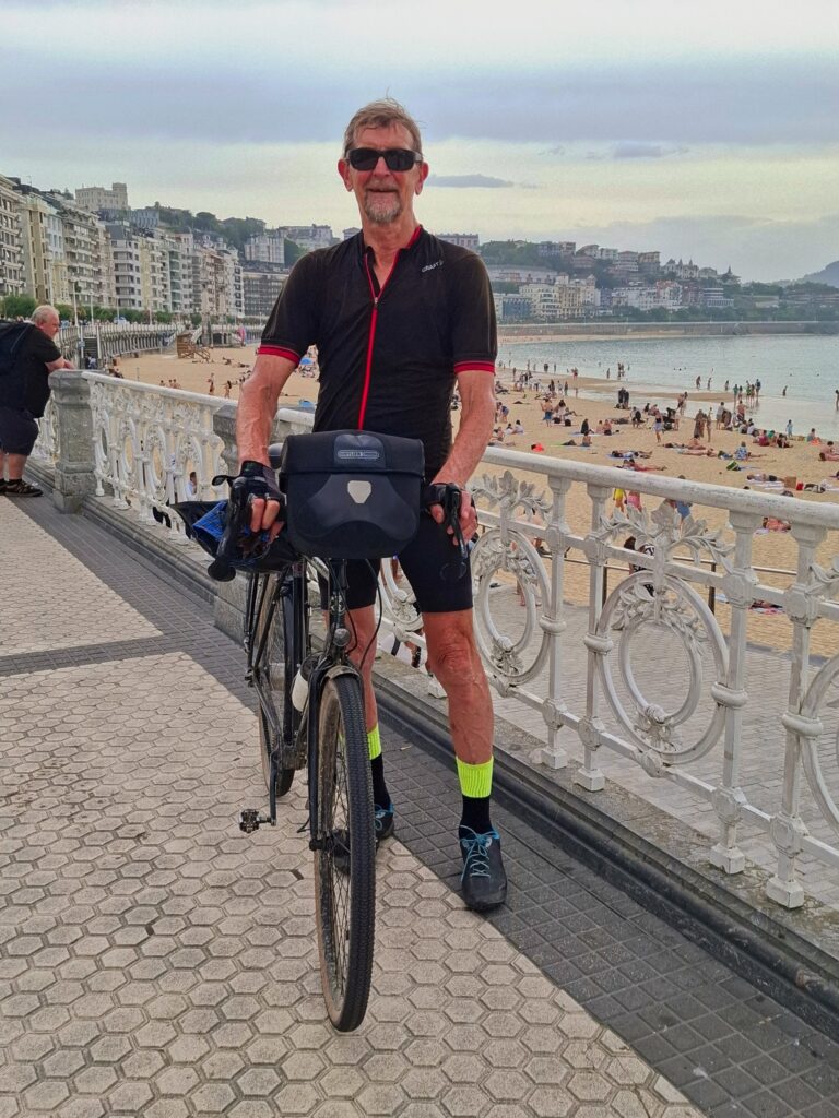
There’s always a great feeling when we arrive in the last city. This is at the beach in San Sebastian. Note the tradie socks!
Cycling in Spain
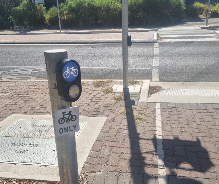
The Spanish really “get” bike riding. Bike infrastructure is fantastic and treatment on the roads could not be better. There was not a single dangerous moment in 1,350km.
Below are two shots from Madrid, demonstrating how much cyclists are cared for by the road designers.
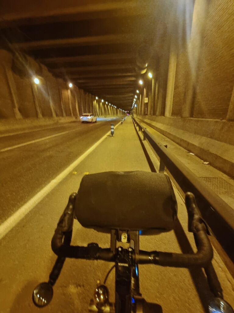
There is a 2.2km road under Madrid airport. That’s a long tunnel! There are two traffic lanes each way with a wide, clean, well lit, protected bike lane in each direction.
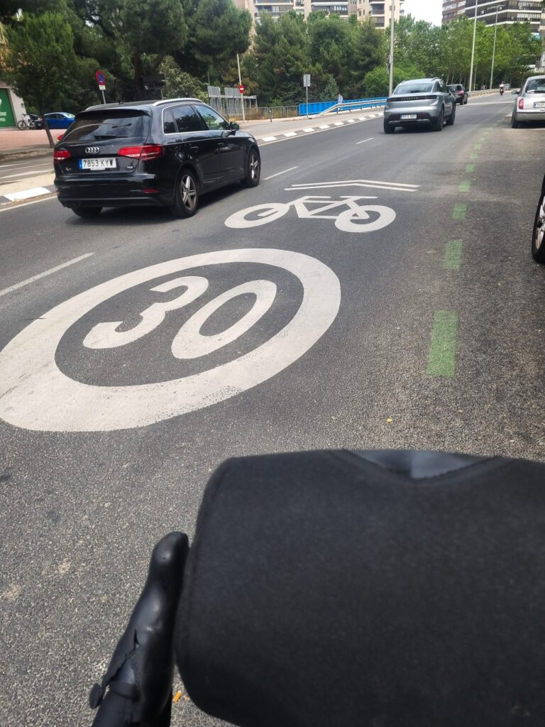
In Spanish cities there is a road marking which means (a) a car must stay behind a bike when there is a bike and (b) in any case, a car may not exceed 30kph. This happens even on some 6-lane roads.
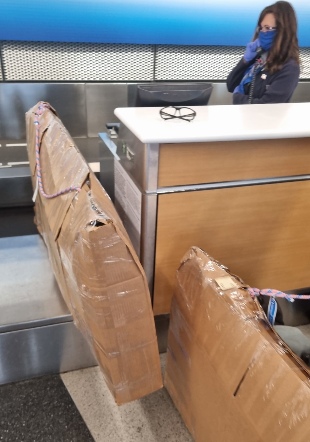
At Madrid airport bike cartons are available at the Left Luggage.
Thinking ahead for further Iberian rides, an option could be Barcelona to Santiago de Compostela via Zaragoza, Pamplona, the Basque and Galicia. In Autum when the figs and grapes are ripe. Spain is so good! And we need to keep testing our bikes.
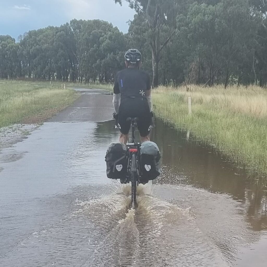
After taking the Spirit of Tasmania ferry from Devonport to Geelong we completed a 1,500km tour in January 2025, avoiding bushfires and heatwaves. There had just been big fires in the Grampians, but we adjusted the course. Then, a week after we had a coffee break with the locals in Dimboola, the town was evacuated, and the highway was closed. Some would say it’s a bad idea to tour here in January, but it was fine. Heatwaves come and go, often only lasting a few days. You can adjust your route, you can schedule a rest day, you can leave early in the morning and you can be lucky. We even mostly had tail winds.
The initial target was the Aboriginal site at Lake Condah, then the Murtoa Stick Shed, then the Coorong, the mouth of the Murray, the Fleurieu, the Warrawong Sanctuary and finally, Adelaide. We would work out the in-between bits along the way.
I’m testing out various new things. The main one is new handlebars. I’m calling them “Barcoo”.
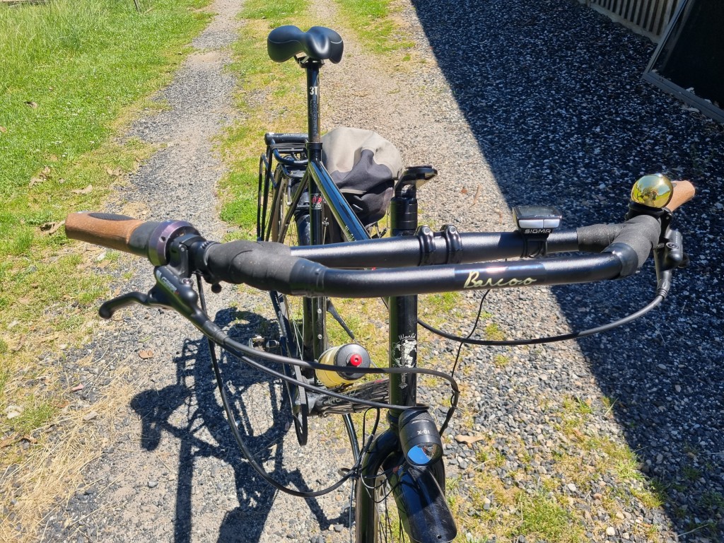
The bars are swept back with an added front section. There are special Ergon GC1 grips that “correct” for the angle. There are bags made to hang down from the front section. We need to know how this bar set-up works out. (see below for more information)
Another test on this ride is of a light to alert oncoming cars from behind. There is a switchable headlight facing rearward.
When you are riding and have a buddy a few hundred metres behind, in your mirror, their headlight is very noticeable. Hence the idea of projecting a headlight rearward and being able to “on/off” it after seeing particular vehicles in the mirror and in particular places. But, after trying this out, we decided it’s not much of a benefit. If we must ride on some highway sections where there is fast traffic, a road shoulder is what is really needed.
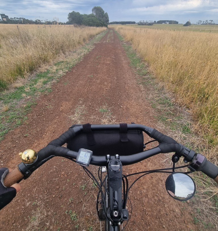
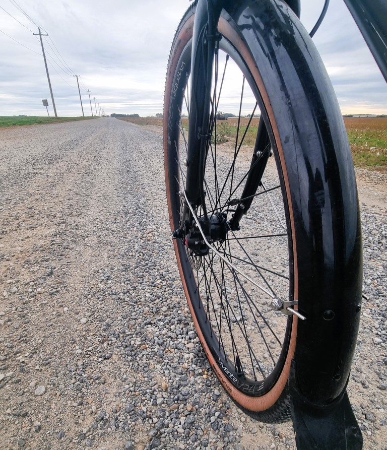
This time there have been frequent gravel roads, and the grip of the 45mm has been valuable.
At 45mm it is still a relatively narrow tyre. We compare it to a more traditional 40mm Marathon.
On unsealed roads, when there is no loose material, the embedded gravel and corrugations are bumpy in these parts.
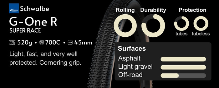
The 45mm tyres at 50psi were more comfortable than the traditional 40mm touring tyres. Kevlar belted, 40mm tyres, at 60psi, are less supple and feel rougher.
In loose material, thinner tyres sink in further. It’s not that thinner tyres don’t work; On good tar they are excellent. But in these regions, on mixed roads, the G-ONE R’s were ideal.
There are catheads in this part of the world too, so the 45mm tyres have been running tubeless, with 60g of Schwalbe solution per tyre and a spare bottle with 60g in the luggage.
Before the start of this ride the Gates belt had already lost one tooth but we didn’t replace it. It had already travelled 32,000km. Going around the Grampians there was a lot of sand, and the belt felt increasingly gritty. Washing it from the water bottle about four times a day seemed to fix that. But, over the coming days, more teeth came off and inspections showed several other teeth were half-loose.
Omafiets in Sydney got a new belt delivered to Murray Bridge in 48 hours after notice. We didn’t need to run the belt down to this point and next time we probably won’t. But it is good to know how long they last. And it’s good to use things for as long as they work. There are people ready to look after Vivente riders. You don’t need to carry much with you. This belt took 33,000 km to wear out and only 15 minutes to change. Read more about Gates belt-life expectancy and belt replacement.
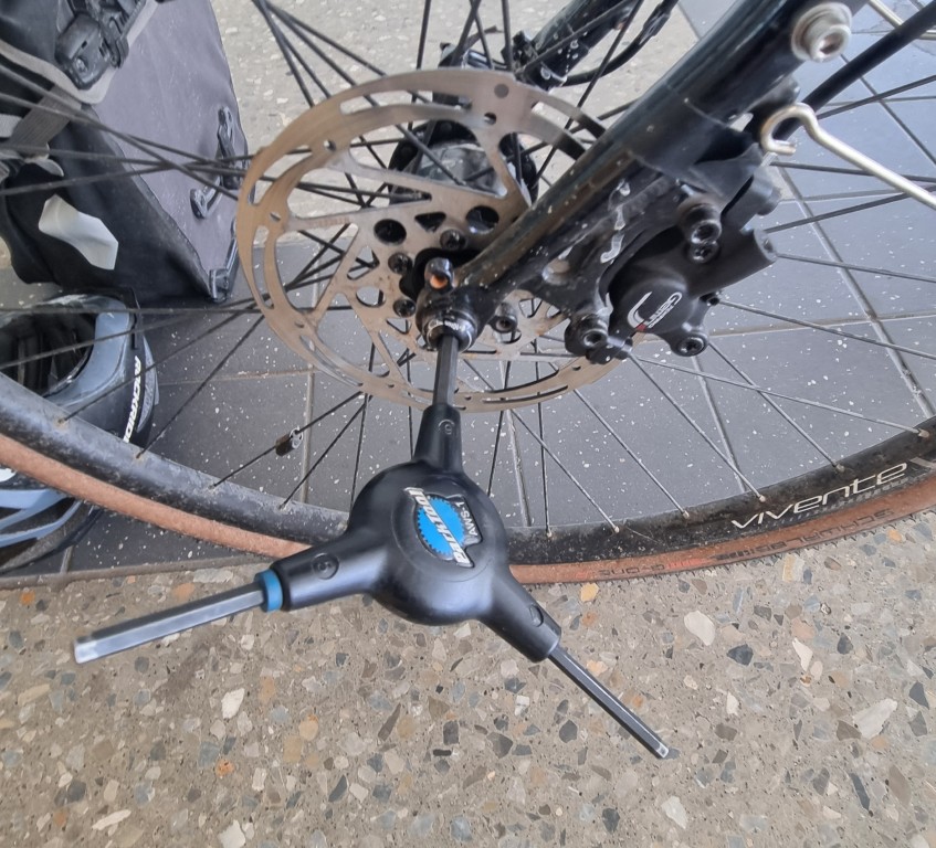
For this ride we use a different front through axle. This one uses a 6mm Alen key, instead of the pull-out lever type that we use on Vivente bikes. A few people have found the pull-out lever annoying, so we have brought in some of these 6mm hex-key ones. The only time it was touched of course was packing at Adelaide airport.
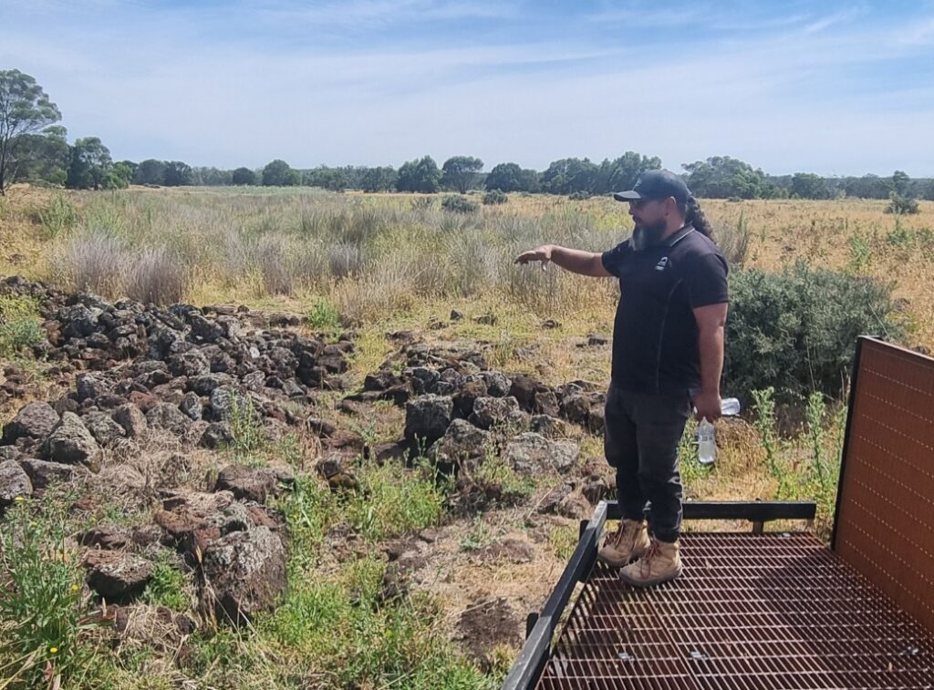
Lake Condah
Lake Condah is a day’s ride west of Warrnambool, in Gunditjmara country. You stay at a little town called Heywood and it is a 30km out-and-back ride to the site.
About 30,000 years ago, a volcano left lava flows crisscrossing wetlands and shallow lakes. The lines of lava created a maze of routes for migrating short-finned eels. They had floated down from the Coral Sea and swam up what is now called Darlot Creek. Clans of the Gunditjmara people learned ways of farming them and there were permanent settlements based on eel farming and trade. About 200 stone structures that were houses remain. For thousands of years, eels were kept in dammed sections. Conical one-way nets let only the small eels through. It is thought to be the oldest practice of aquaculture on this planet. The Henty brothers moved in, stole the land, drained the wetlands for grazing and dried up the lakes. The few Indigenous people that survived were herded into the Condah Mission, where they were not even allowed to speak their language.
The lake was dry by 1955. Post WW2 soldier settlement had been the last straw. But 30 years of activism brought about policy change. (Onus V Alcoa) The lake returned in 2012 and is still recovering. Eels are back! It is now a declared World Heritage Site.
Leaving Condah as we head North, and, because of last week’s bushfires, we skirt to the east of the Grampians. We were in and out of fire zones, but the weather got better.
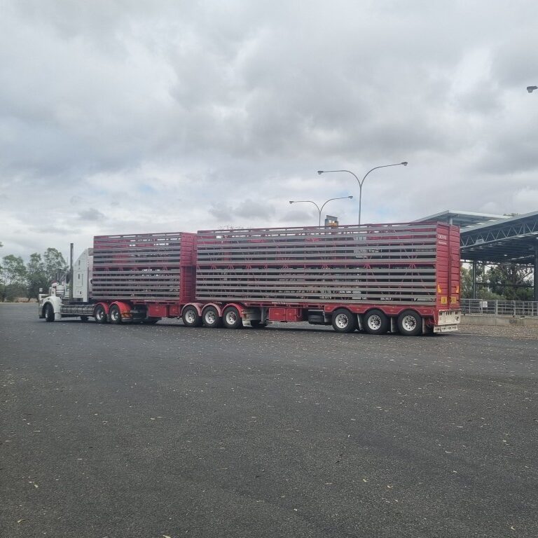
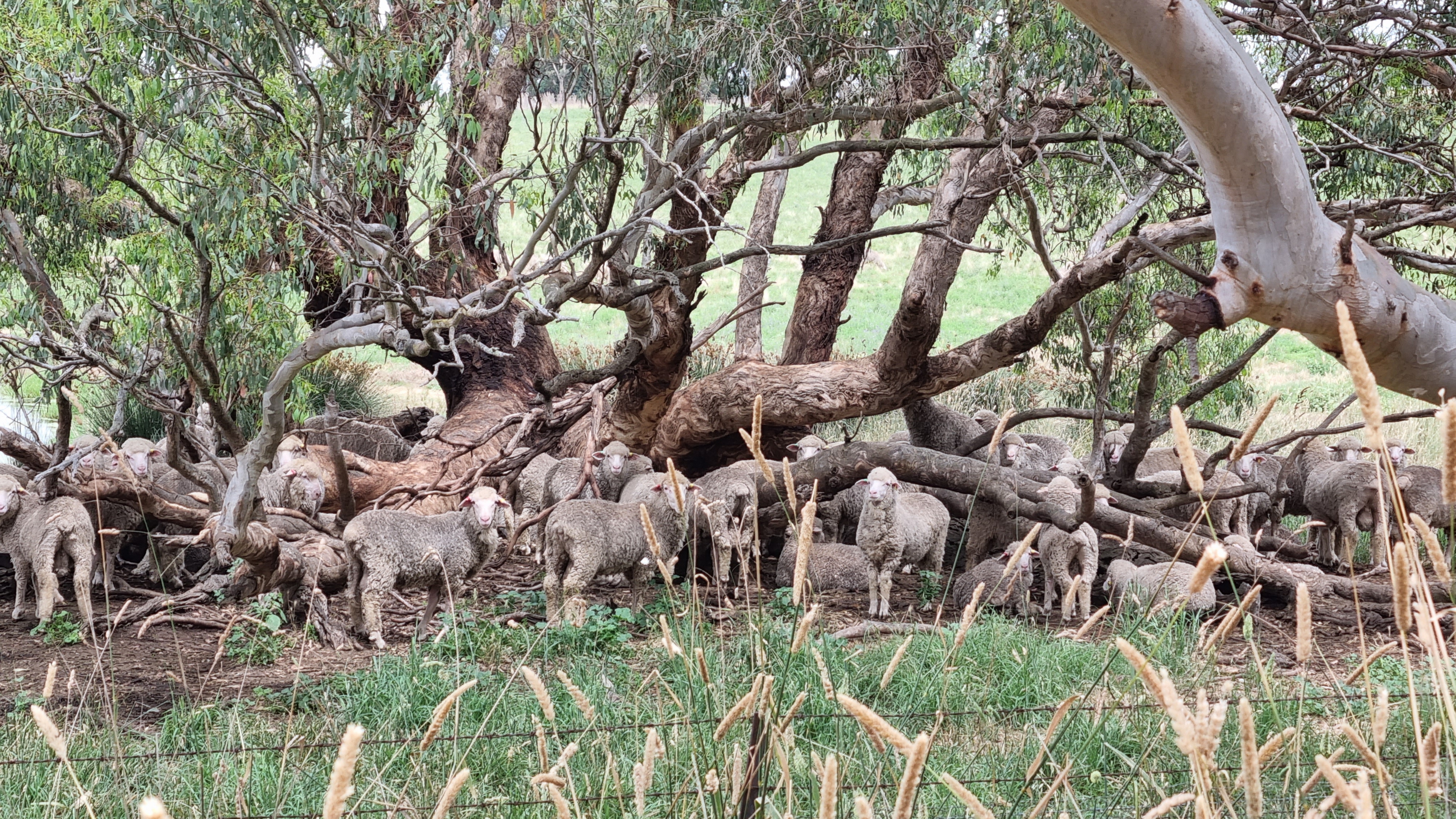
Just out of Horsham there is a huge sheep saleyard. The sales are on Wednesday mornings, and this was an opportunity to get close to this local industry. There was a yarding of just over 10,000 sheep.
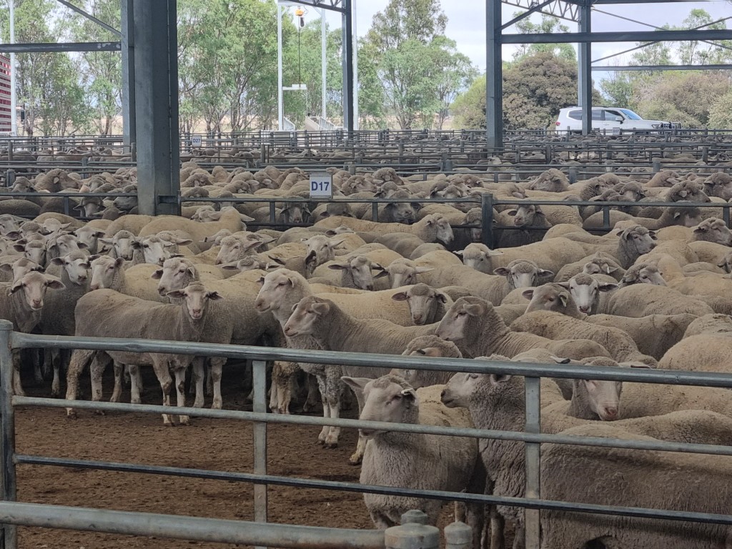
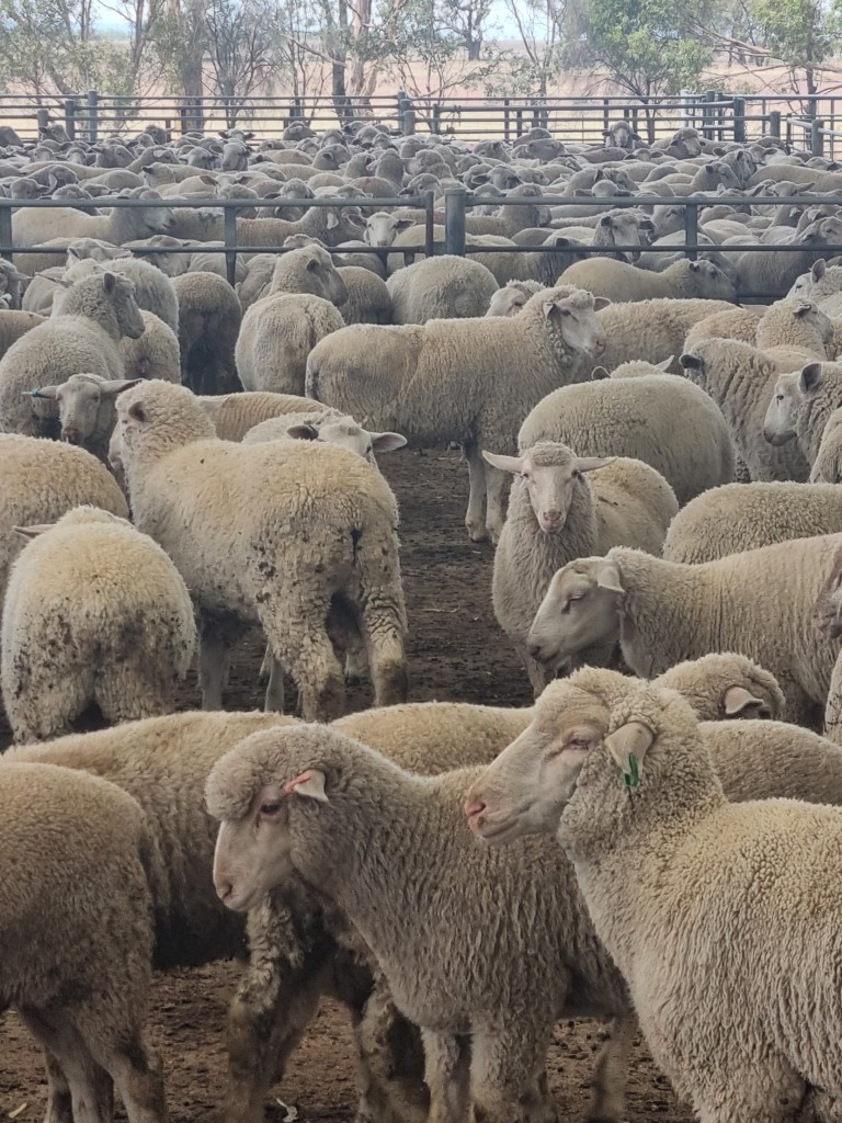
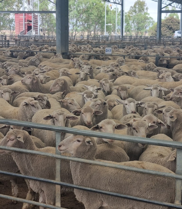
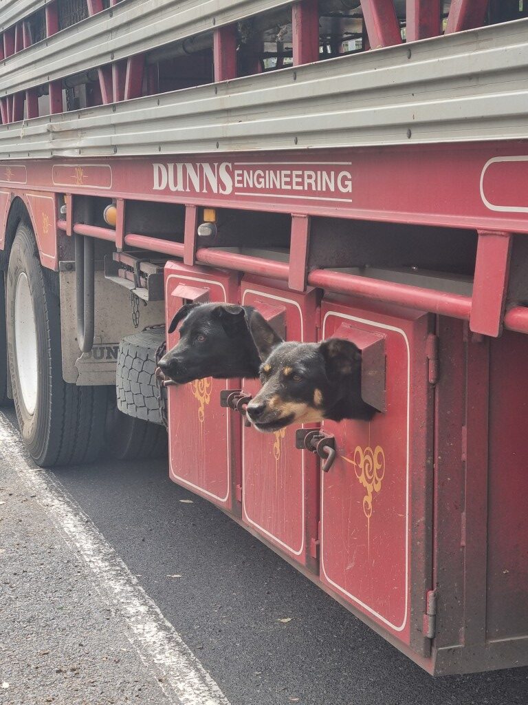
Have you ever had to reverse a car with a trailer? Can you imagine what it would be like reversing a semi-trailer with an extra trailer behind that? It’s extraordinary to watch the skill of the drivers. Once in place, the driver has to load the sheep. They have sheepdogs on board rearing to help. Muzzles are mandatory.
The Murtoa Stick Shed
In 1941, the war was preventing the export of wheat. There was a shortage of jute bags that wheat was mostly stored and transported in. A bumper crop was forecast.
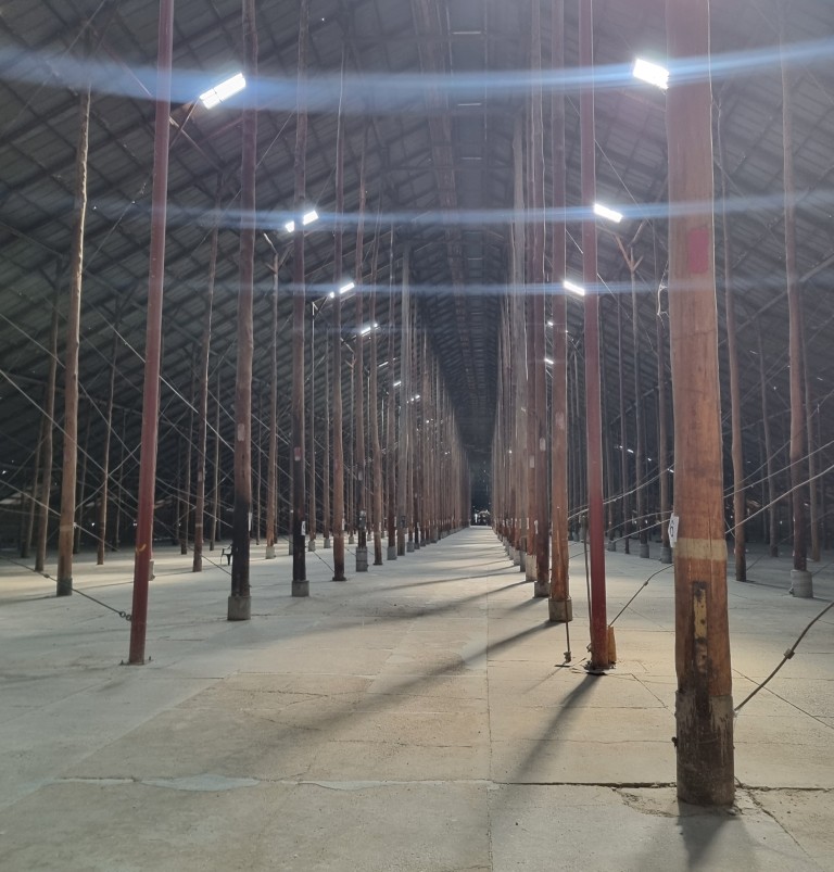
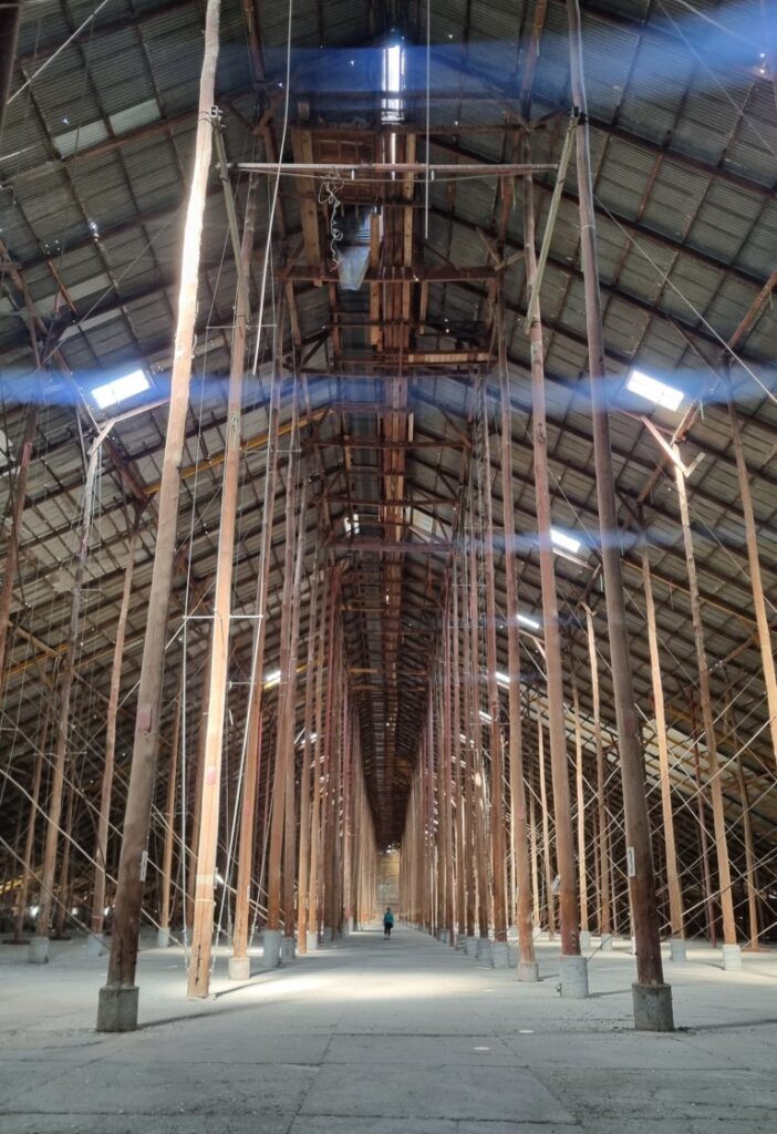
The Grain Elevator Board decided to build 29 grain storage sheds, and it had to be done fast. Only this one at Murtoa had a concrete floor and it is the only one still standing. The roof is over five acres. It was built in only four months.
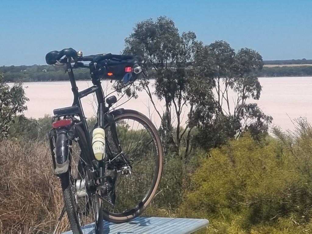
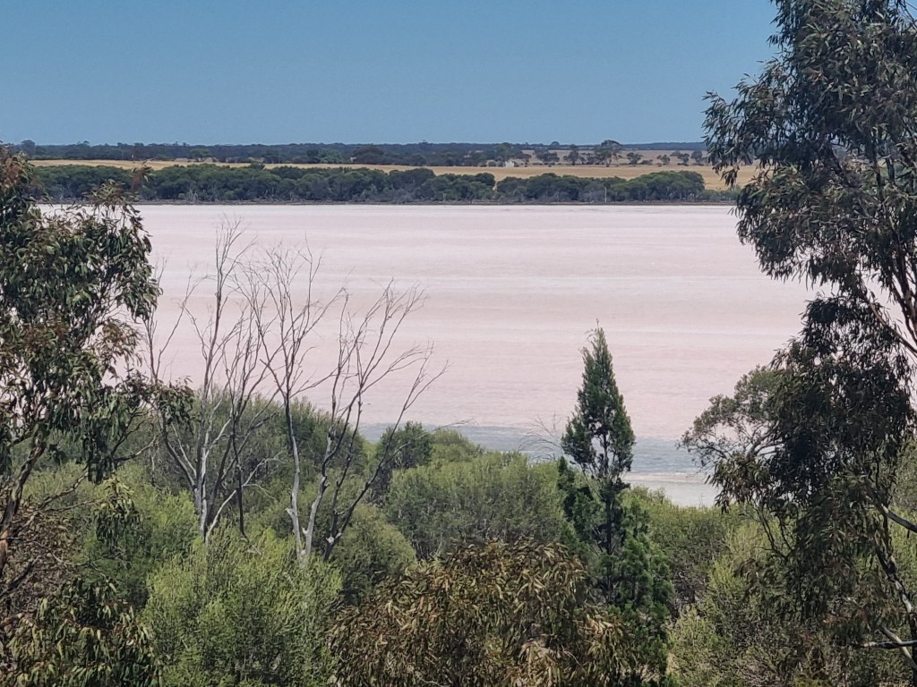
Pink Lake
Just off the road between Dimboola and Nhill is the Pink Lake. There are a few others that have these particular algae, and they change colour from time to time. It is a bit of luck to be able to see pink and our luck is good.
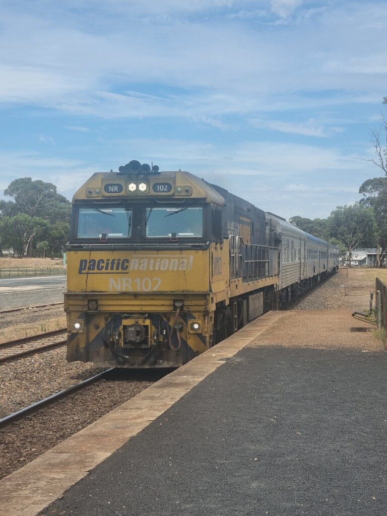
Although it has many side trips, this tour is from Geelong to Adelaide. There is a train, called The Overland, which runs twice a week each way between Melbourne and Adelaide and allows fully assembled bicycles on board. That’s always interesting when planning a three-week bike tour. If you are riding around Australia, you don’t catch a train. But we didn’t need to ride the Bordertown to Murray Bridge section. It is a flat 200km stretch of semidesert, that is mostly straight, and with almost no shop. It’s a busy highway. Being able to just wheel the bikes on is appealing.
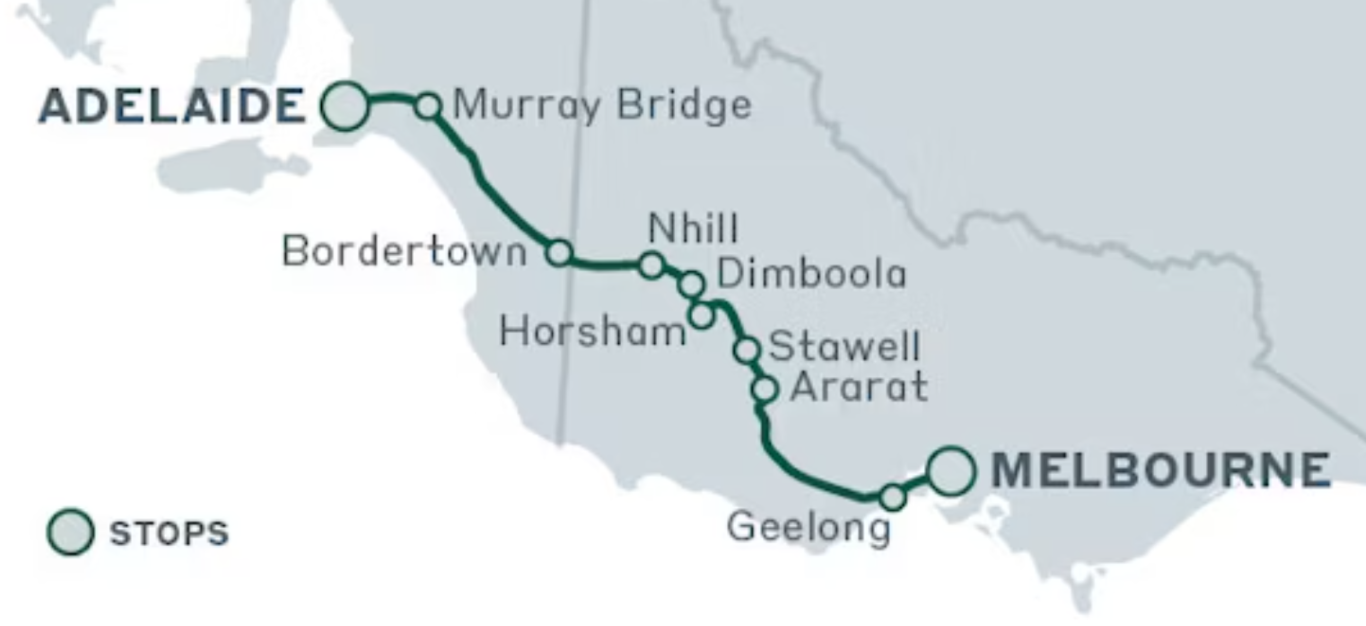
We got to ride through Dimboola and Nhill, to see the Little Desert National Park and the Pink Lake. Then at the SA border we were on the train, covering the 200km in 2 hours!
South of Murray Bridge the mighty Murray flows into Lake Alexandrina and Lake Albert. These fresh-water lakes are about 40km across and are a bird watcher paradise.
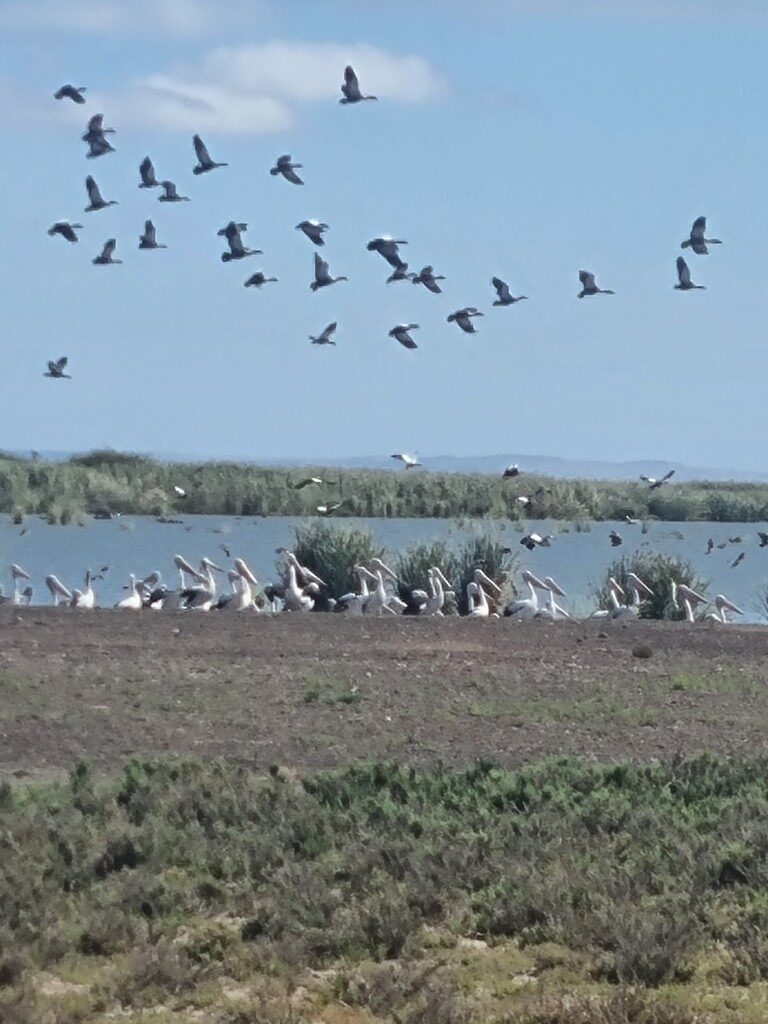
On the eastern side, between the desert and the ocean, is a narrow neck of sand dunes stretching 150km, called The Coorong. It is a fantastic landscape. Rainfall is so low that there are no water courses. In the hinterland there are numerous “ephemeral” lakes which, now being summer, are dry salt pans. The juxtaposition of the permanent freshwater lakes and these salt pans, sometimes only metres apart, is amazing.
In this pic, the white in the middle is salt. The grey-blue behind the white is fresh water in Lake Alexandrina.

Ferries cross the Murray River and at Narrung lakes. They are free and run 24/7. At Narrung, which is a fantastic side trip out of Meninge, the operator said she sees only one bike about every two months. But at the Murray, 10 bikes a week.
Heading down the west side, in the Currency Creek area, there are Aboriginal Canoe Trees. It’s thought that the canoes were cut at least 200 years ago. In the movie Ten canoes, there is a scene where this was done. As it is being cut it is held all around by many hands, so it doesn’t fall and crack. The cut bark is then soaked in water to soften it and later tied together at the ends using kangaroo sinews and plaited reeds.
On the Southwestern side of the big lakes is Goolwa and the mouth of the Murray River to the Southern Ocean. In times of low river flow, saline water used to come into the lakes and up the river. To prevent this, and to manage the river height, in the 1930s “barrages” were built. The intention was to foster irrigation along the river and enhance town water supplies. Currently, the fresh water is 0.75m above sea level. So the barrages are also dams.
From the Goolwa area (Goolwa South) to Encounter Bay just West Victor Harbor, is one of the best ocean bike rides anywhere. It reminded me of the French Riviera. Gorgeous coastal views along a 28km bike path. Many worked on it, but a local hero got it over the line. It’s called the Encounter Bikeway.
After weeks of dry, flat country it’s a nice change to arrive in the Fleurieu peninsula. This is the home of the Tour Down Under, the Adelaide Hills, the Mount Lofty ranges, the Coonawarra and McLarenvale wine regions and where Hans Hysen painted many of his familiar masterpieces. This is South of the Goyder Line which demarcates rainfall in South Australia. A Mediterranean climate with mild wet winters and hot dry summers. Only 50 km to the east, in the rain shadow, we were in a desert.
Rather than take the easy way around the West coast, we head up the centre through Meadows to Hahndorf, wanting to stay in the bush as long as possible. After weeks of flat, the climbs feel brutal. It’s 35 degrees and windy. But the next day we had that marvelous 600m descent from Crofters into Adelaide.
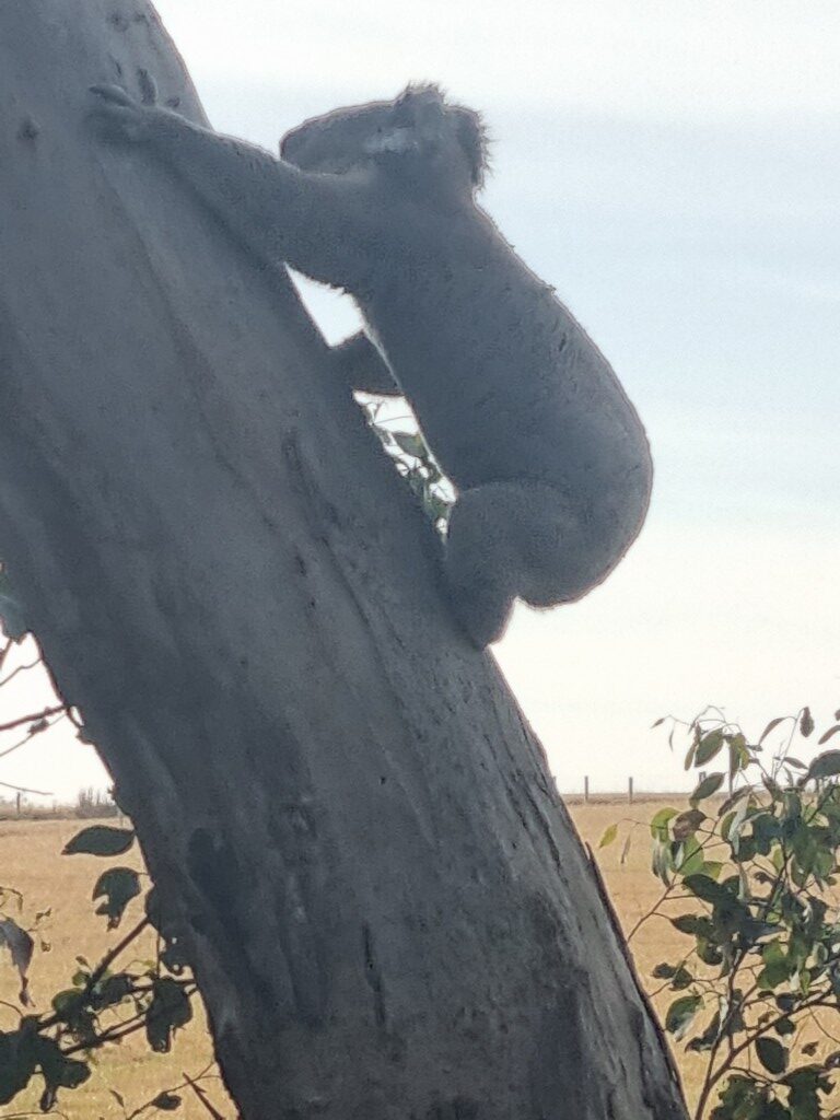
During this ride there were good roadside fruit and berries (figs, plums, grapes and blackberries) and we saw a lot of wildlife including eagles, koalas, echidna, kangaroos and beautiful Lowland Copperhead snakes.
PLUGS
The Overland Train
You can wheel your bike on and off at any of the stations. If you embark in Melbourne or Adelaide your bike will go in a luggage car but at intermediate stations it will be in the passenger carriage where there is also room. You don’t book the bike. You mention it in the notes when you book your seat. The conductor calls (phones) ahead and tells you where to stand on the platform. They even serve tea and cake on crockery!
Victorian Regional Cycling Infrastructure
Small and mid-sized Victorian cities are the best provisioned for bikes in Australia. Victoria is consistently good. Being able to take bikes on trains adds to it. A combination of wide streets, decades of activism by Bicycle Victoria and several favourable Victorian Ministers of Transport have normalised bike riding. Compare, for example, Griffith NSW and Horsham Vic. It is a very different experience. Few people in Griffith ride down Banna Avenue. Bendigo, Ballarat, Warrnambool, Shepparton, Horsham, Mildura and Echuca all give us room to ride. Ironically, Albury just over the border does too. That’s another story though and also about the importance of a local hero, Patricia Gould.
Adelaide
This is the easiest capital city in Australia for cycling. There are numerous bike provisions, including this fast-response bike crossing light. CBD bike use is quite high. Adelaide is a pleasure to ride.
Adelaide has not had the pressure of population growth that has kept space from cyclists in other cities. Other cities have focused more on trunk routes and connections. In Adelaide it feels like you can ride on all the streets. It’s not surprising that more rapid urban population growth, in addition to bringing all sorts of other problems, is likely to be worse for cyclists
Barcoo Bars Report
Our Barcoo handlebar, and also, a new bike in our range, the Vivente Barcoo, are named after the Barcoo river that feeds into Kati Thanda Lake Eyre
Handlebars are subjective and not a bike part that one person can readily say will be good or bad for someone else.
As a traditional drop bar rider, I don’t expect to really like a bar that’s in the sit-up style. Not that on drop bars we don’t sit-up anyway.
The GC1 grips have so much surface that you can lean down on them slightly more without hurting your hands. Therefore, you can bend over slightly more. After the first few kilometers I moved the bars down three spacers.
There are several different ways you can put your hands on the grips. You can move around, including to the taped junctions of the outside bar and the cross bar. That is a more aero position. That does allow a complete change of position, but you have less steering being in closer to the axis. That position is best for good roads and lower speeds.
Having done the Munda Biddi Trail on a Swabia, for me, the Barcoo bar would have been a better choice.
In the CBD of Adelaide, the (720mm wide) bars felt a bit wide and vulnerable in traffic. Probably in part that I wasn’t used to riding in city traffic just then. I wouldn’t ride this set-up in inner Sydney (if I could have a Swabia). But, out in the country, the Barcoo bar is a strong a contender for me.
Steering a drop-bar bike is more from leaning on the side of the saddle. Steering this sweptback-bar is more by pushing a side of the bar down.
In descents, you can get down low. Not as much as on a drop bar. But more than on a trekking bar.
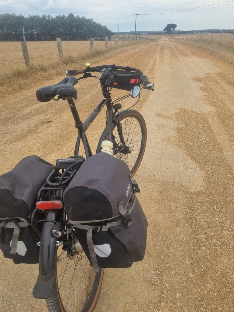
If this 1,500 km had been entirely on tar, the Barcoo bar would likely have been fine but so would other bars. However, on this ride, there were regular gravel and bumpy road sections. The width gave the added steering. The larger surface-area of the GC1 grips in the swept back position were comfortable on what were often jarring surfaces.
SGB bag
The Skingrowsback bag (SGB is made in Melbourne) was fine. Did the job. but a bit small at first. Unlike an Ortlieb HB bag, it stays on the bike, so I used a Topo shoulder bag too. The SGB HB bag has less capacity but for those few essentials it is fine.
For a November test ride this year we chose the deep south of the USA, primarily Alabama and Tennessee. It’s a cultural region, defined not by landscape but by history.
It’s autumn and nice and I’ve brought a Swabia XXL with 50:19 gearing.
We are checking out the use of “race gravel” tyres for normal touring. The Schwalbe G-One R, a 700c in 45mm width. It’s a light tyre, but high quality and strong. It’s not the tough-as-nails tyre. But perhaps it is? Expected to be run tubeless but we are running front tubeless and rear with a tube just to see if there are differences. More later on this.
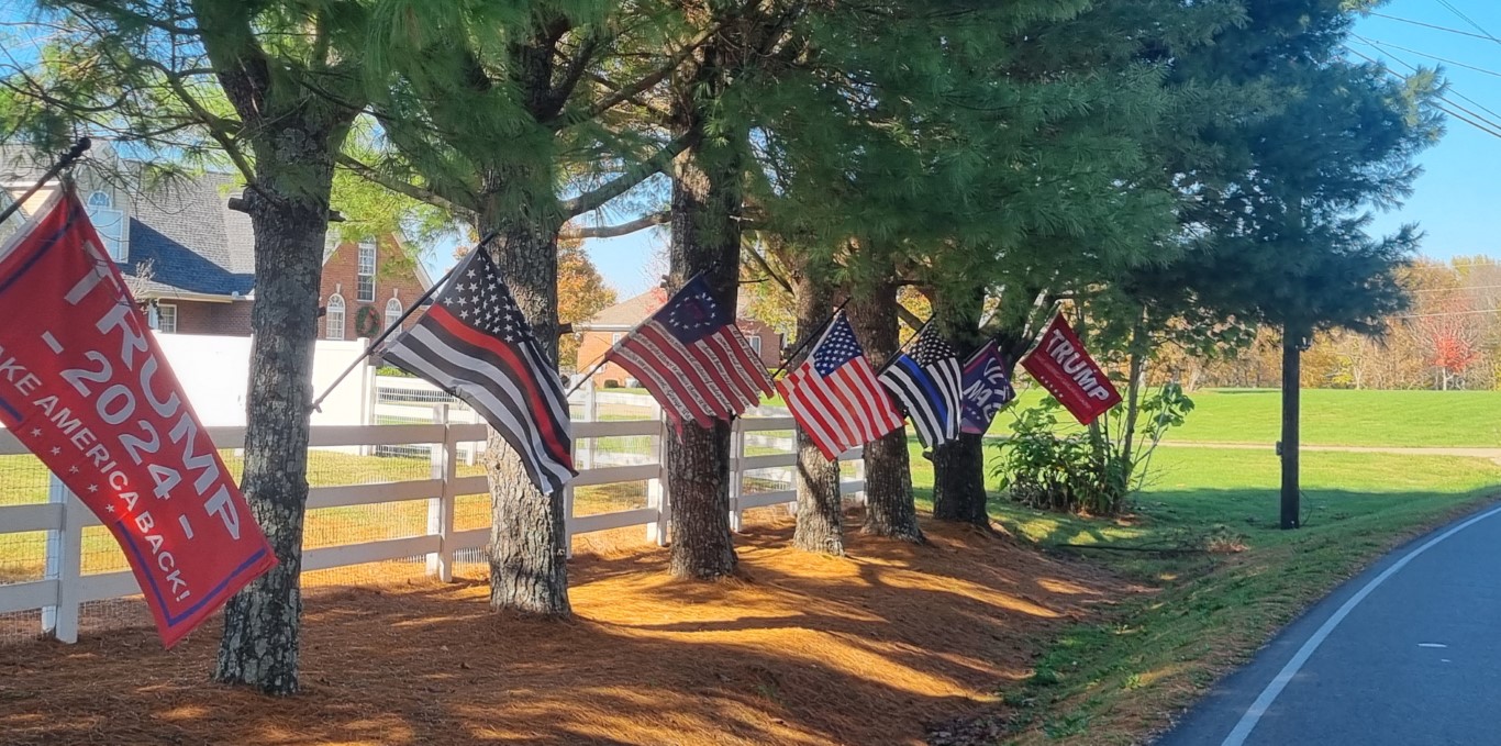
Arriving on Nov 5th, election day, added a twist. Trump signs were everywhere. Just a few days after the election, some counties were putting up signs saying how much their county had voted for Trump. This one, 88%.
Petrol (or gas as they call it) costs AU$1.12 a litre. Australians and Europeans know this is ridiculously cheap. But America is the home of more-is-better. Cheaper gas means more money in your pocket. Here in the South, there are no busses or trains. Leadership turns on gas prices. In the 2016 election, Cambridge Analytica, a Facebook data centre, targeted messages and manipulated people. In this election, Elon Musk has done that.
This was a road trip. There are very few bike paths in these states. The few they have are short too.
You don’t even see other people on bikes in the South. In Northern Tennessee there are some, but from south of Nashville and all through Alabama there are virtually none. It may be why dogs are unchecked. More later on dogs.
The USA is generally good for bike travellers given the quality of the roads, the moderate speeds on them, and the easy availability of accommodation. US Highway motels really work for bike travellers. They are cheap because there are too many. They are from when people drove distances which they now fly. Under and around AU$100 a night. Microwaves but strangely, no jug/kettle. Check in early? No problem.
The culture is unsubtle. Food is tricky but possible. The people, of course, are nice. This was a history lesson.
Flags
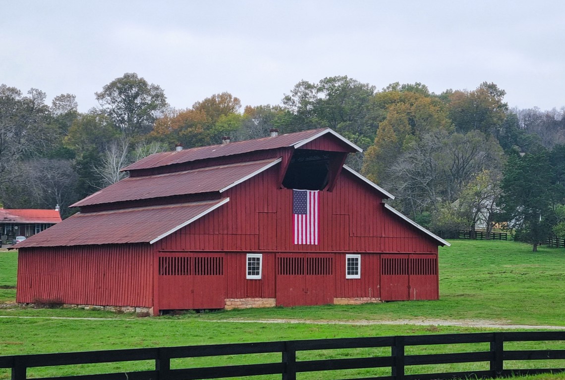
The USA is one of those countries into flying their flag a lot. There are not many that do. Turkey is another. In the USA, the flag means different things to different people. That’s the irony of them having so many flags.
Sample counts were done, and we report that in rural Alabama, there are on average 4.5 US flags per kilometre. Beat that!
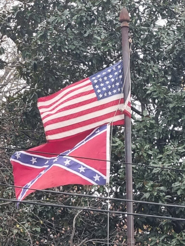
State flags are also to be seen everywhere whilst in most countries they are not seen at all. In the deep south the confederate flag still flies. Also, MAGA and “ULTRA MAGA” flags as in the image below. The black one with the blue stripe is something to do with police.
Slavery in the Deep South
12.7 million Africans were kidnapped and shipped to the Americas overall. 2 million died on the way. By the mid 1800’s much of the world had rejected slavery but the Deep South held out. Alabama and Tennessee were two of the thirteen confederate states that tried to break away from the US in order to preserve slavery. In 1860, 44% of Alabama’s population, or 435,000 people, were enslaved Africans.
Enslaved people built much of the state’s infrastructure. Local government could either purchase their own slaves at the slave markets or lease them from slave owners.
Prior to the Civil War, nearly every railroad in the American South was built entirely using slave labour.
It was a classic settler society but with slave labour added. Ironically, it is thought that it was slaves joining the Union, that made the ultimate difference in the Civil War.
Slavery was abolished in 1865 through the 13th amendment, but racism persisted through Jim Crow laws that used segregation (different busses, different schools), voting restrictions, interracial marriage restrictions, even different school textbooks for black and white kids, all to entrench and broaden division. White mobs lynched black people. Lynchings were advertised in newspapers and attended, sometimes, by thousands. This continued well into the 20th century.
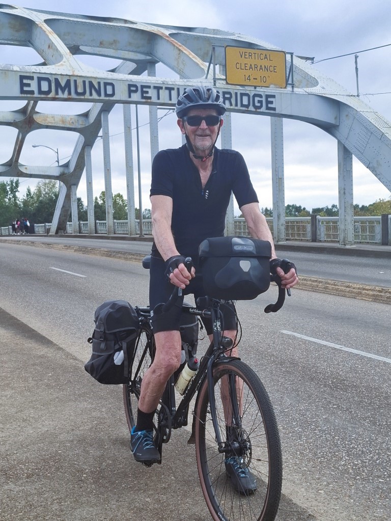
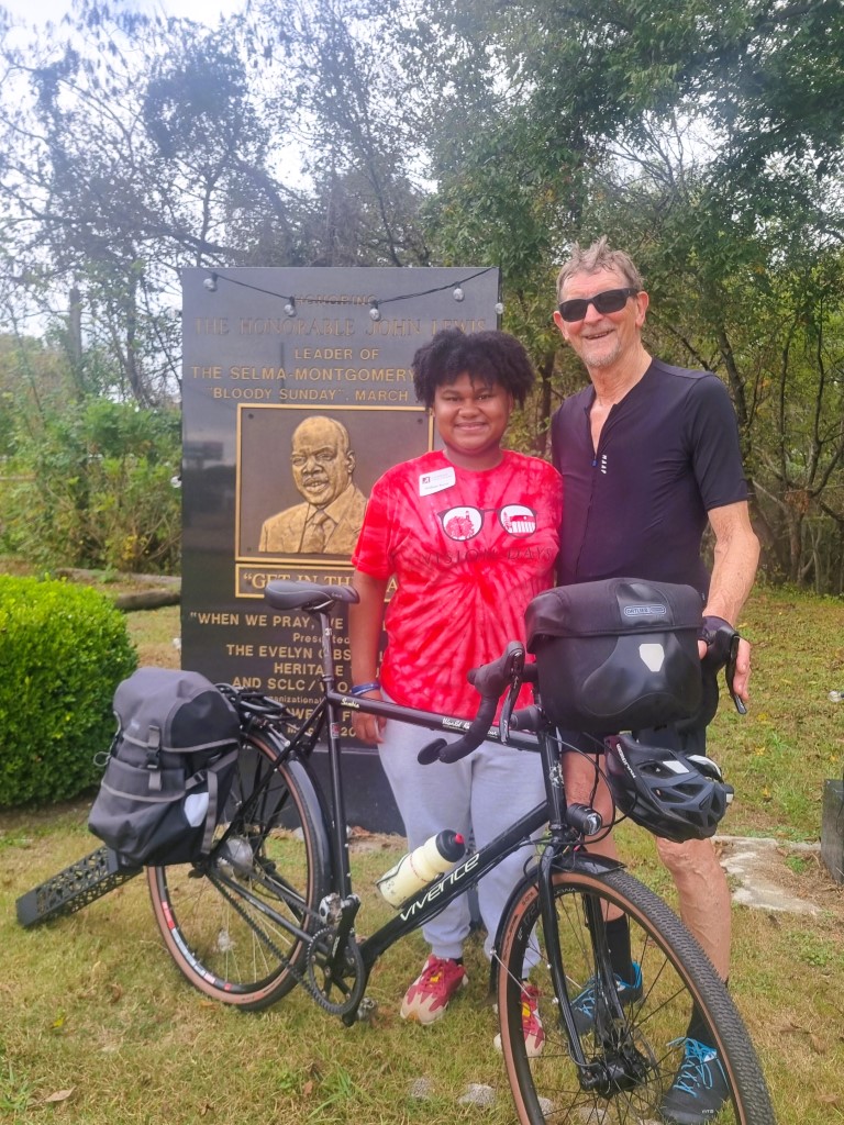
The Civil Rights Movement began in central Alabama. On the Edmund Pettus Bridge in Selma, 50 miles from Montgomery, freedom marchers setting out for Montgomery, were brutally attacked by the State Police.
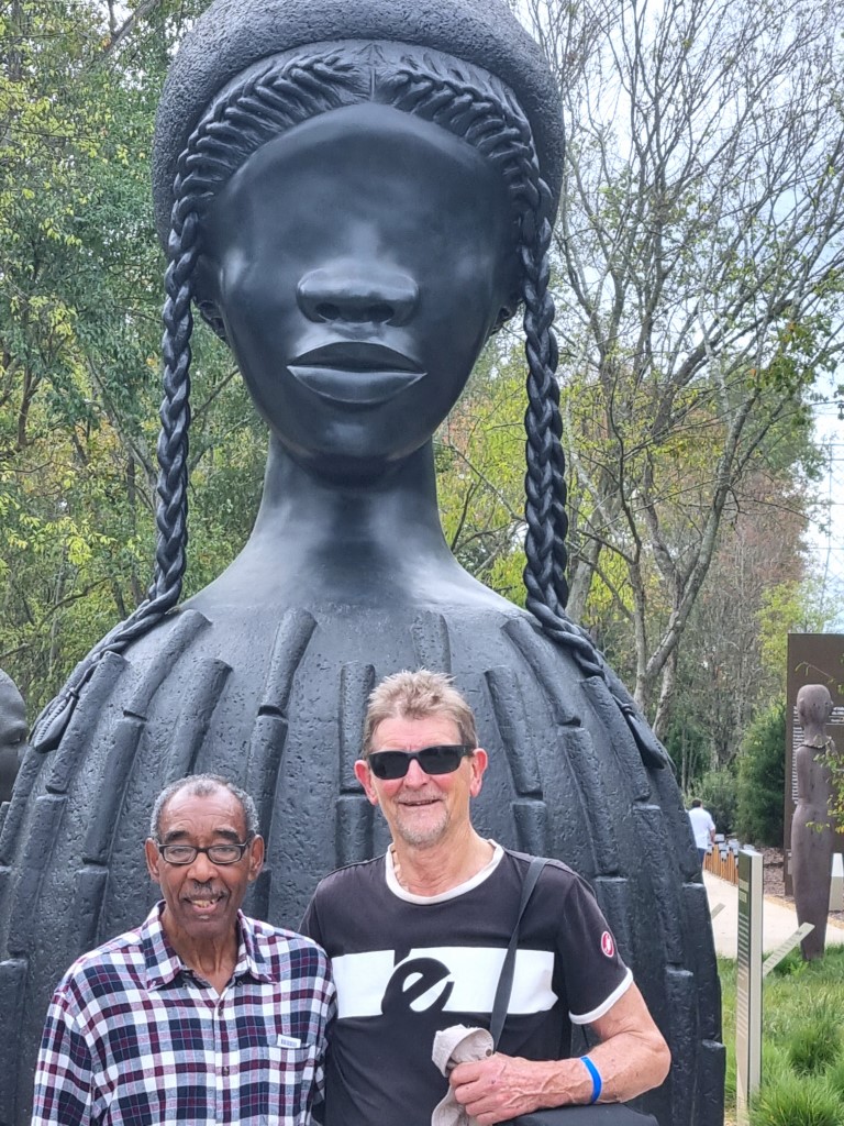
Truth-telling is a critical and first part of the path for communities that have suffered as horribly as has happened here. In Montgomery the truth is laid bare in the Legacy Museum and in the Freedom Monument Sculpture Park.
They are both must-visit places and are indescribable. Photography is not allowed.
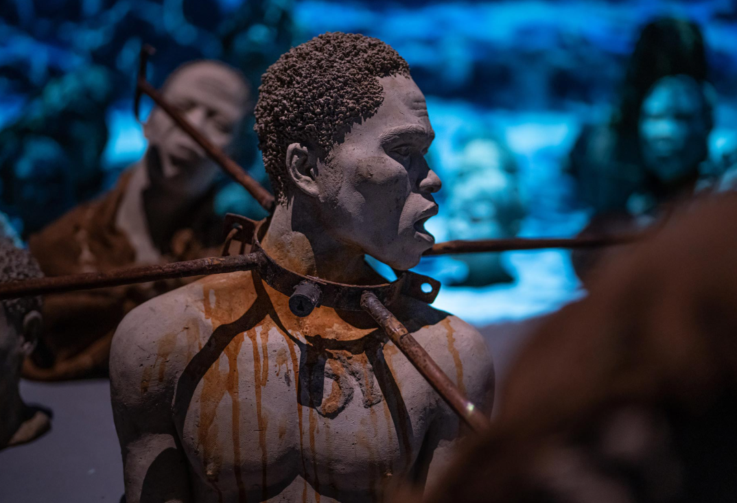
In the Monument Park there are two slave huts. They are not replicas. They are real. 10 or 12 enslaved people slept in each hut.
You also see the homes of the families that owned the slaves. Riding past them you have to wonder if the descendants may feel rather pleased with their lot in life.
The history is extraordinary. Black people were totally subjugated.
Now they are the poor. And the incarcerated.
Seeing what happened to the indigenous people and then to the black people is shocking in part because it’s not what we have been told.
Hollywood commodified slavery and gave us movies like “12 years a slave” that made it look mild. In reality, most enslaved people did back-breaking work and were flogged, even daily, if they didn’t do enough of it.
Hollywood made the invasion and then occupation by Europeans, of native American land, look like self-defence. Resistance to white invasion has been shown as militancy.
American heroes are shown in line with the narrative. It’s the official version. Taught in schools.
Thomas Jefferson is renowned for saying… “We hold these truths to be self-evident, that all men are created equal, that they are endowed by their Creator with certain inalienable rights, among these are life, liberty, and the pursuit of happiness, that to secure these rights governments are instituted among men.”
He is not so well known for hypocrisy and racism. But he should be. Thomas Jefferson, the third president of the United States, owned more than 600 enslaved people over his lifetime. He freed only seven enslaved people during his life, including two of his children with his slave Sally Hemings.
Dogs
There is a lot to recommend about this part of the USA for cultural immersion and cycle touring.
But daily dog attacks in Alabama and Tennessee have been hard to take. It’s ok if you are going downhill but that’s often not the case. Typically, the dog owners won’t come out of their houses. When they do, they typically say the (big, aggressive and angry-sounding) dog is “harmless”. One owner told me to “go back to my country”. The dogs in the rural south are even worse than the dogs in Turkey. Dogs in some places are weak and can only go about 28kph. These are faster. Interestingly we are within our rights to “stand our ground” and shoot a dog dead. I pondered mentioning that but decided not to.
As the adrenaline was surging, I could not even get a picture of a dog attacking me. But it happened a few times a day. These dogs may have never seen a human on a bicycle, let alone one with a high-end headlight.
North into Kentucky, the problem faded away.
Churches
There are a lot of churches. On Sunday mornings their carparks are nearly full. They are well attended. Not like in Australia or much of Europe.
So, we wondered what it was that works for churches in the deep south of the USA. Perhaps negro spiritual singing? We listened but didn’t hear it. Or is it what they have to sell/offer? Most of the placards and signs outside the churches are biblical quotes, encouraging us all to be good. But some go further. The most interesting ones we came across seemed to be saying you could put your neighbourliness aside. What’s in it for you?
Church signs are part of how, in the USA, things are in your face. The advertising. The preaching. The warnings. The shouting.
Y’all have a nice day. Hmmm.
eSims
Bike travellers often get short-term Sim cards when they arrive in new countries but these have required removal of your normal sim. On the flight from SYD-DFW an eSim was advertised. Then in the USA, on a YouTube channel, there was another eSim ad.
The reason I checked them out was not just the savings or curiosity. On the fourth day I found myself with no internet connection, way out in the bush. As I navigate using online (google) maps, that was annoying.
That night I got the Holafly eSim which turned out to be (in the USA), the AT&T service. Coverage was 100%. After the number of days I’d purchased ended, I went into my phone settings/connections.sim_manager and reselected my Telstra sim.
Google mapping
Once again we are using google for route planning, mapping one day in advance and resetting the route during the day. Choosing the least dog-infested.
With the availability of good quality, quiet roads it is a breeze. The motels are just off the big highways. The locations are accessible from quiet country roads. Google does, in some countries, send you on a track across a paddock. But the only mistake in this 1,000km was a gated community. Google knew it was a road but didn’t know there was a closed gate.
Road Safety. The deep south is good
It’s never been clearer that Australian speed limits are too high, especially considering road quality. In the USA Deep South, although there is almost no cycling (you ride for days without seeing anyone on a bike) it is quite safe to ride.
You must wonder why? If we knew why one area is safer, we could apply it elsewhere.
Many US states have “Move Over” laws. They were brought in to protect emergency workers, police and road workers. The focus was on vulnerability. It’s in the driver education and seems to be broadly accepted.
A motorist will slow right down until they can move right over into the oncoming lane. I wasn’t passed dangerously at all.
Also, in the USA there is a large ambulance-chasing industry. Thousands of billboards for law firms suggesting if you have suffered in any way, on the roads, you can get money.
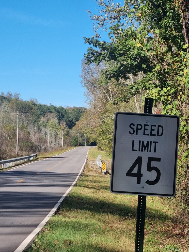
Speed limits are more sensible. This is a quiet, wide, fairly straight and flat country road in Tennessee. 45MPH is 72KPH.
This is near our factory in Tasmania. Where that second car is in the distance, there is a blind bend to the left with no warning and no shoulder. To the right is a steep embankment. There is no guard rail. 100KPH is 62.5MPH. It’s such poor design.
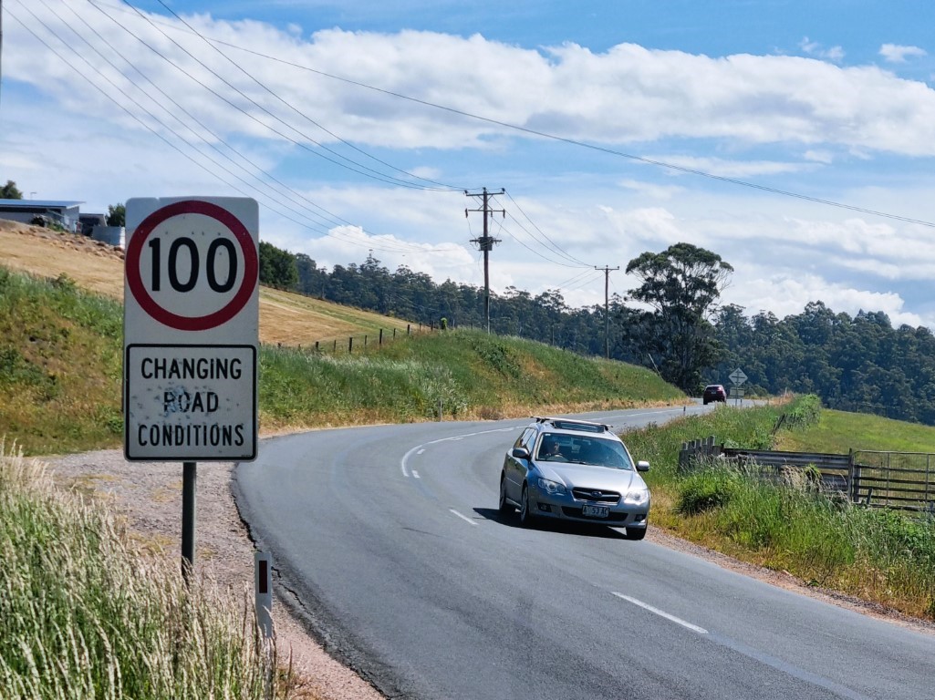
Tasmania is a poor state and can’t afford better roads. It’s in debt already. But the speed limits should be set to suit the poorer road condition, and we need Move Over laws. Any emergency worker will agree.
It is so ironic that higher speed limits cause people to think they have to hurry.
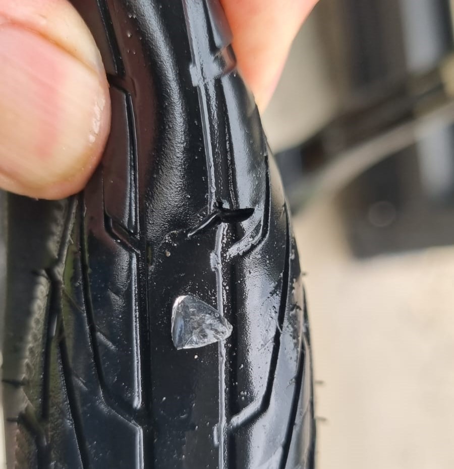
Schwalbe G-One R 700 x 45 – one tube and one tubeless
No punctures in 1,000km but the roads are good so that’s not surprising.
If you hit gravel sections, these tyres are easy. Only 45mm wide and with a race tread, these are light to steer. But they are noticeably fast on tar. That’s their best feature.
They are rated to 55psi but with the bigger bag you can have a lower pressure and softer ride. Just increasing the tyre diameter from 40mm to 45mm, increases the tyre volume by 27%.
Bikes on Greyhound
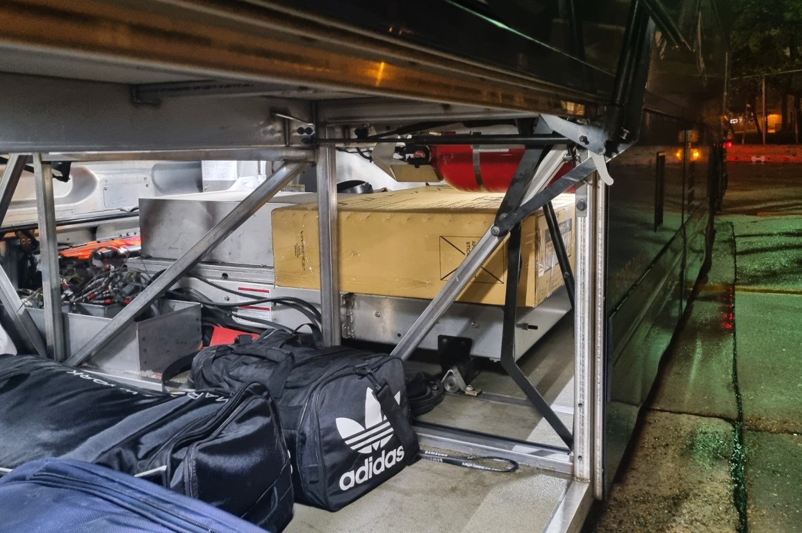
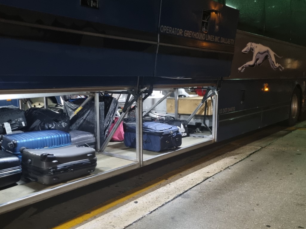
From Dallas in Texas into central Alabama is a bus ride. The bike needs to be in a carton. In an online booking, I added an oversize item. A normal bike carton is a little over the allowable dimensions, but no one seems to care. On the far side of the bus, towards the rear, is another door where fold-up wheelchairs are meant to fit. It’s a great spot for your bike carton.
Timing-wise, this November ride has been good. It fits into our seasons. We have heard, in the US south, that Memphis is good. But India is calling. It is so comfortable to travel in. We are planning a November ride in central Maharashtra. Nagpur to Aurangabad through Yawal Wildlife Reserve and then calling in on the Ellora and Ajanta caves. We’ll need to test something for sure!
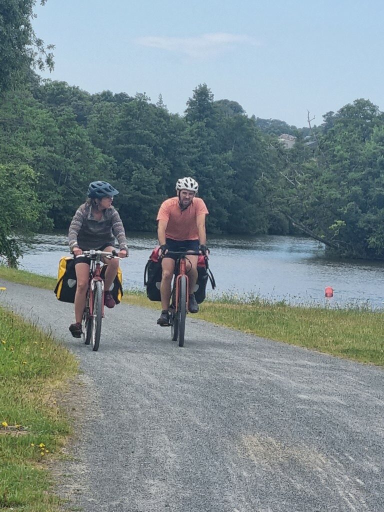
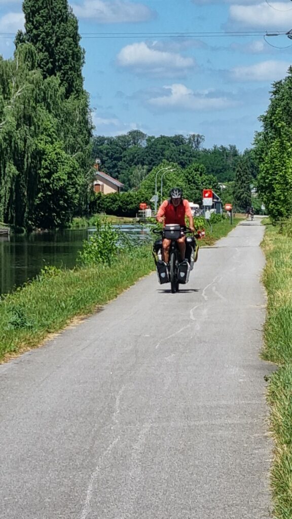
We hear more about European heatwaves, droughts and floods but, on this July 2024 ride I enjoyed perfect conditions. In the bike-traveller community, there is a tendency to talk about how tough conditions were. Not so here. The countryside has been green, temperatures 18-28℃, the winds were gentle and no mountains.
I’m on a Swabia (drop bars), with standard 50:19 gearing (low of 20.5”), and I’m trying out the 57mm version of Schwalbe G-One tyres running as tubeless. When I took out the tubes and put in the tubeless solution, each wheel became 200 grams lighter. Unsurprisingly, I got no punctures. Before the outbound flights I let a little air out, down to 30psi. Over the following three weeks and 1,500km I added more air only once. As an emergency I carried a 100 gram TPU tube and no repair kit. So that saved another 150 grams. Now, 57mm tyres are not fast, but the G-One tread has less rolling resistance than knobby MTB tyres.
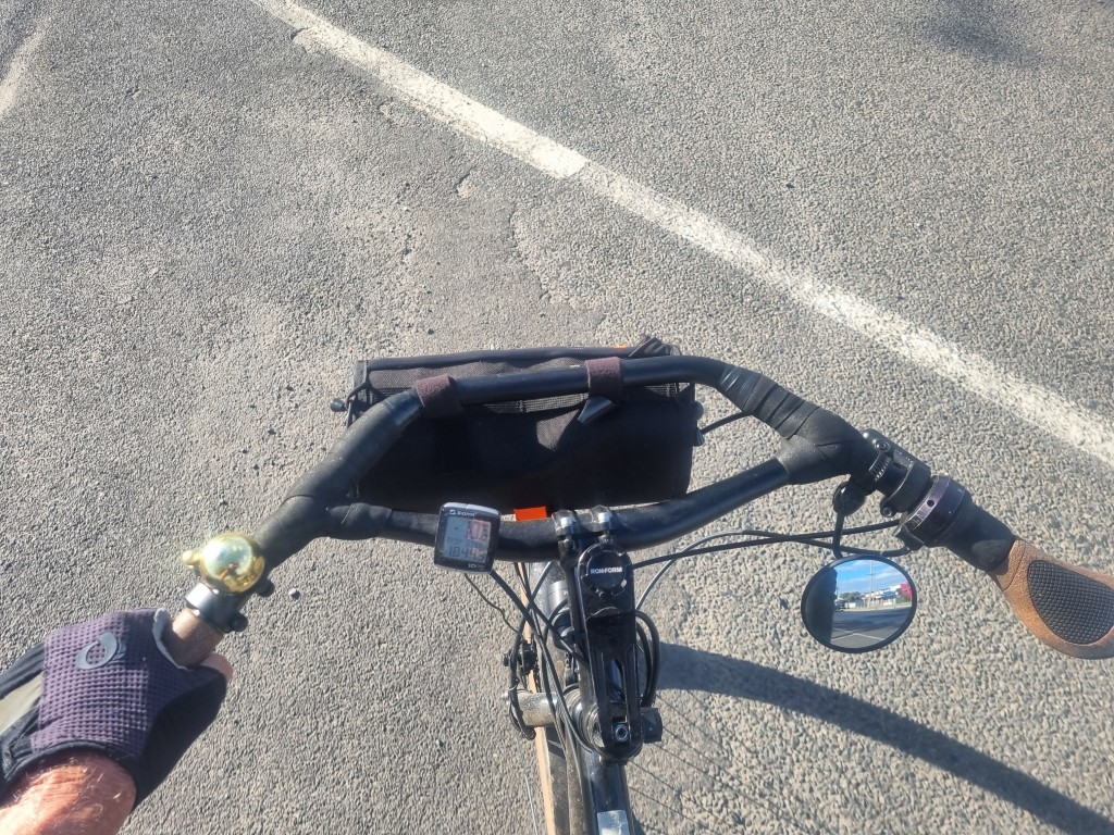
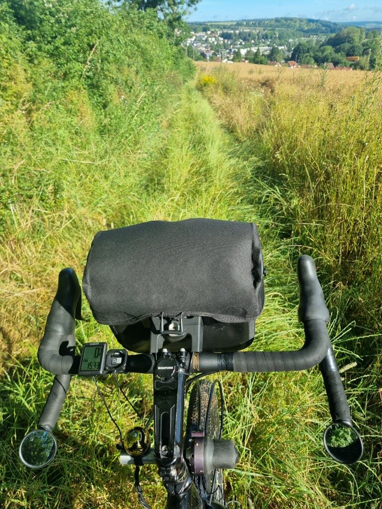
There are good route planning apps like Komoot, but I use google maps. These days we have our phones mounted in front of us, in my case on a Rokform mount. For a short trip it is worthwhile paying the $10 per day and getting the internet. On a longer trip you might not want to pay that, and therefore might want embedded maps such as from OSM and preplanned routes downloaded as tracks. But with internet and using live google maps you can pick up fresh destinations and recalculate routes during the day. If you don’t like the look of something, you can zoom in on the map and choose a secondary road for a section. You do need a compass or a compass app as changing hemispheres and seasons is quite disorientating.
With modern phones and fast charging you can get away without a spare battery and just grab extra charge whilst at a coffee stop. In less settled places there is less need to consult the map. There might only be one road. So less checking and less drain. But in most of France there are so many routes you could take. That includes along the big rivers such as the Loire. It’s not as if there is just one bike path with clear signage. Far from it! You really are better off with live navigation.
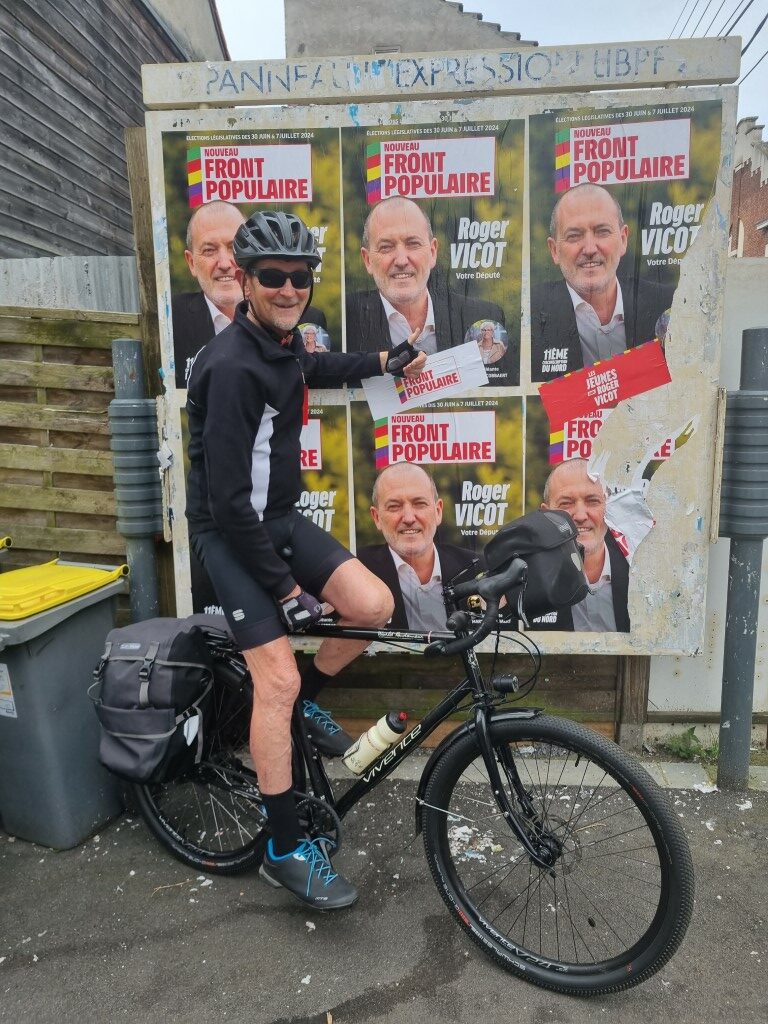
There was an election in France and posters everywhere. France doesn’t have preferential or mandatory voting. In presidential elections they have two rounds. The country seems polarised during the campaign, but my impression is that it is a relatively diverse, cohesive and inclusive society. As is the case with all of the Western European countries, much of the wealth dates back to the slave and sugar trade. But the actual slaves were in the Americas and today, the resulting problems are there.
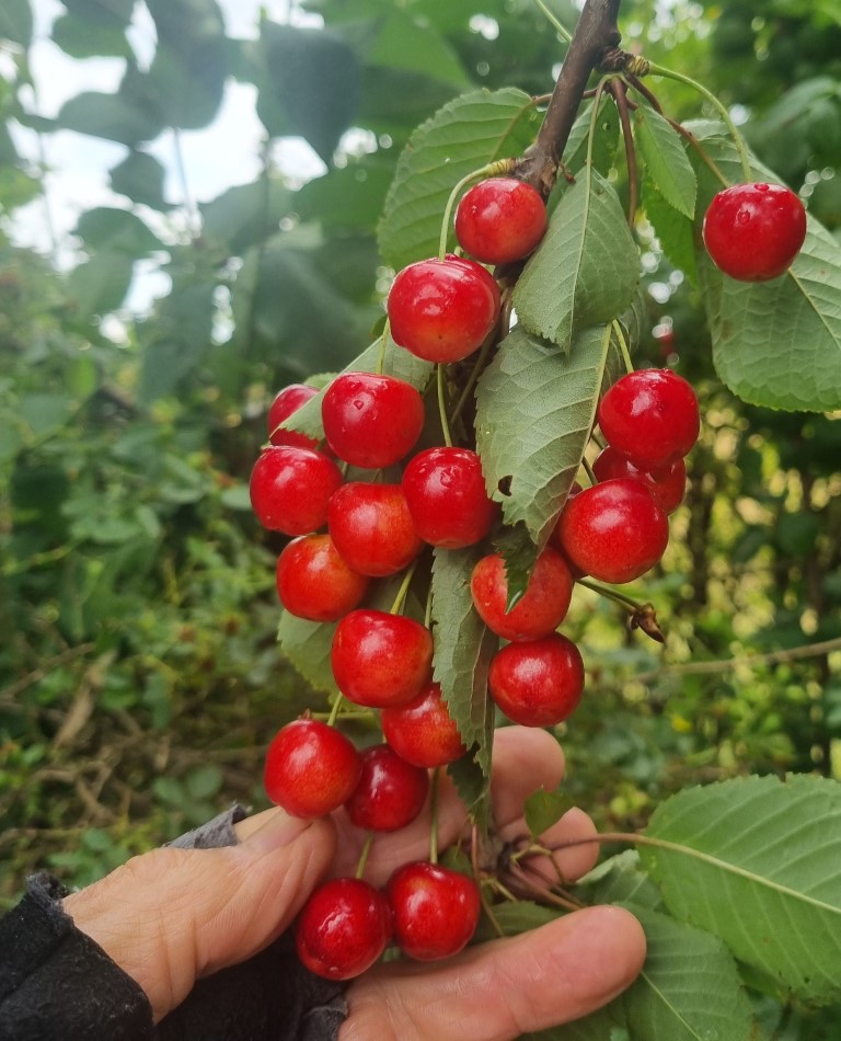
Bike travellers know their seasons by what roadside fruit and berries are ripe and to be snacked on. In the north it was still cherries. In the south blackberries. It was too early for figs and grapes which were growing wild along the roadside towards the south. You want to be in Europe in September for those.
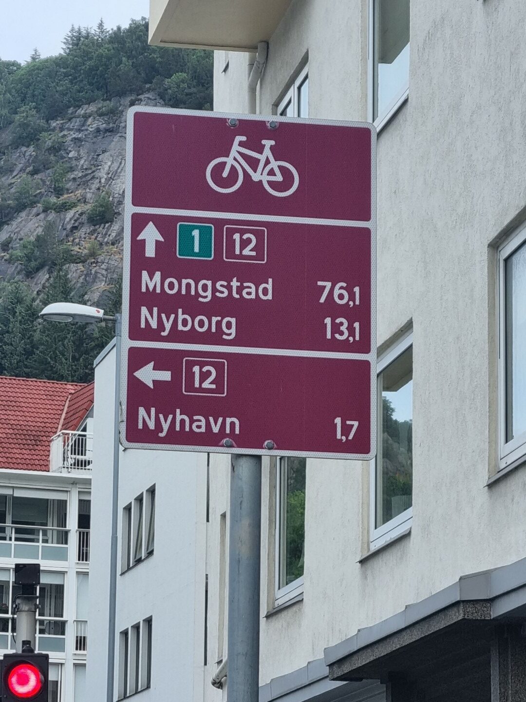
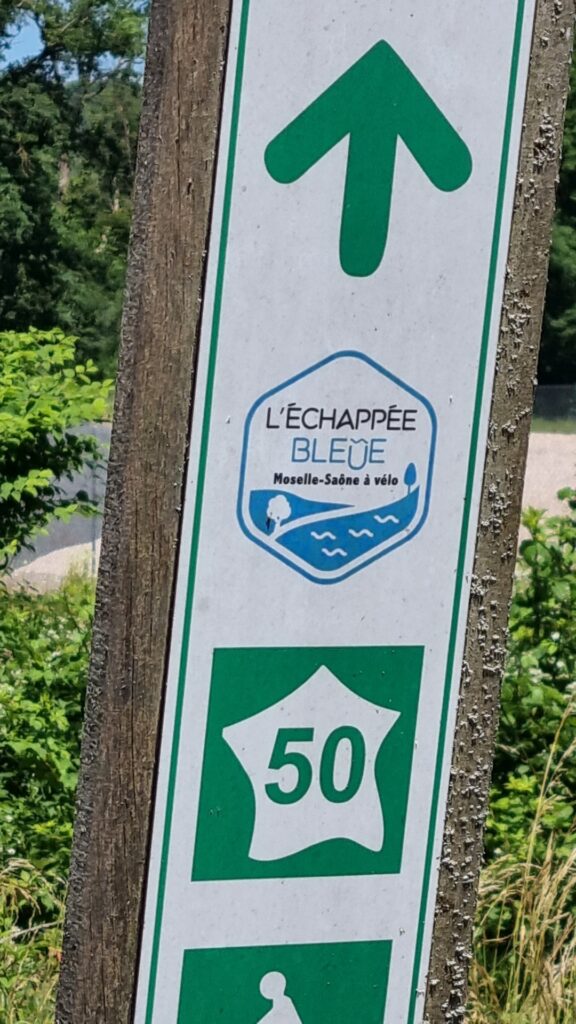
A lot of European bike tours follow the Eurovelo (EV) routes or along the river valleys. This ride, from Lille to San Sebastian, crosses many of those routes, and briefly follows bits of them. It is a marvellous thing about European riding that there are so many long routes that you inevitably come across them even when not deliberately looking for them.
I crossed the Loire, the Seine, the Dordogne, the Mayenne and the Somme rivers. Google took me along the EV path on the Loire for a whole day. I discovered the 450km path from Paris to Saint-Michel which I followed for 40km.
It’s mainly on these paths that you see other travellers. Lots of them. And you see beautiful, serene places.
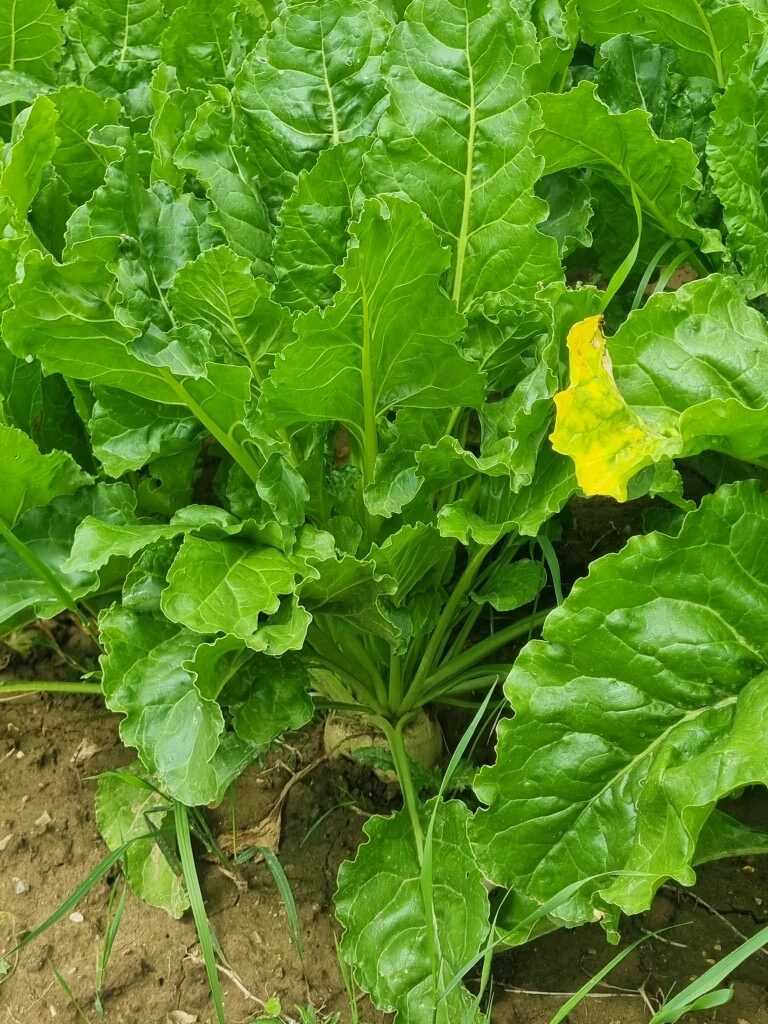
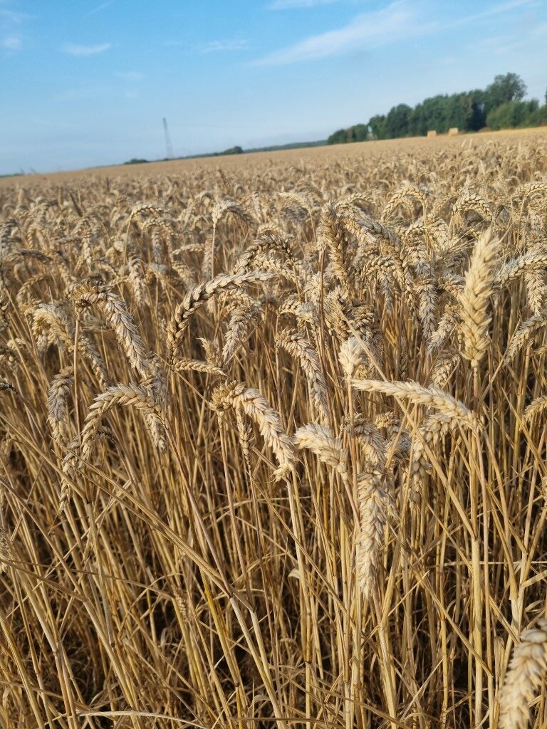
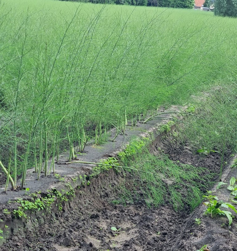
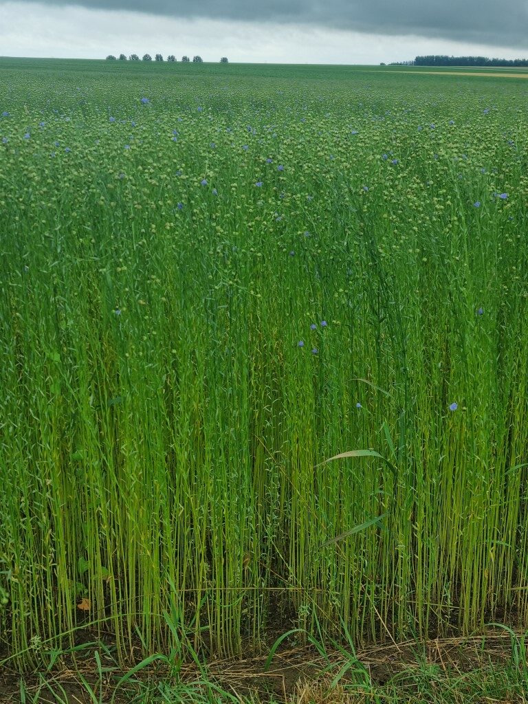
As bike travellers, we spend most of our time out in the country. Vivente is closely connected to the land. Our factory is on a farm in Tasmania. Touring the world is touring often through agriculture, seeing how humans grow their food and what is in season. Western France is most impressive in this regard. In the north there was a lot of sugar beet, flax (linseed), potatoes, hemp, and asparagus. In the south, more grains, vineyards and sunflowers. Some great farm buildings as well.
Somehow, the Europeans, or at least the French, have avoided urban sprawl. The cities have boundaries and don’t invade the countryside. Perhaps this is because populations are not increasing. You don’t see high-rise wrecking the charm of the old cities. I make a point of visiting cities and rode through Lille, Arras, Nante, Angers, La Rochelle, Laval, Rouen, Bordeaux, Bayonne and, in Spain, San Sebastian.
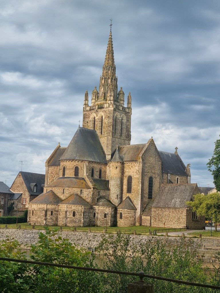
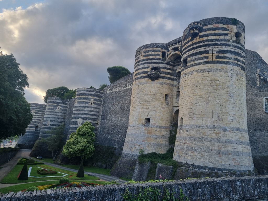
You really have to be there. Postcards don’t do it. But here are two anyway! The castle in Angers and a church in Laval.
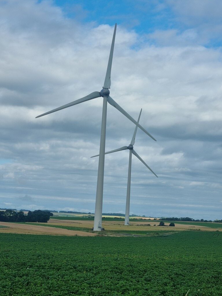
The French seem to have missed (or solved) the NIMBY issues around wind turbines and solar that are currently in play in Australia. I ride past thousands of turbines. They are part of the landscape. Many farms have their own solar.
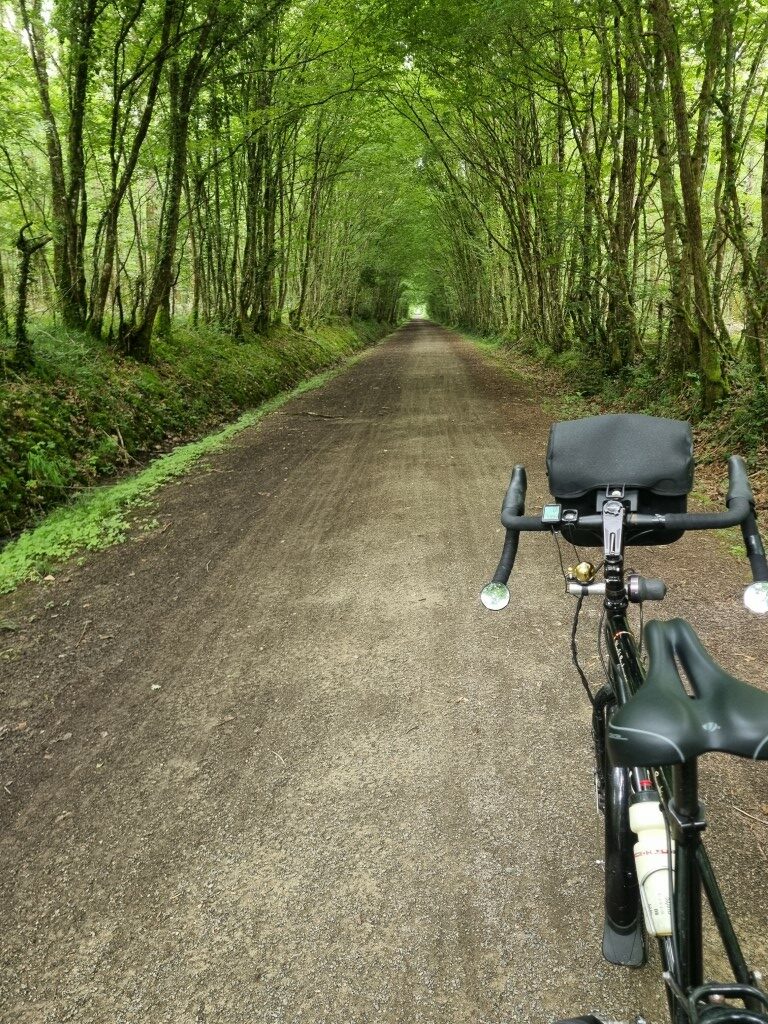
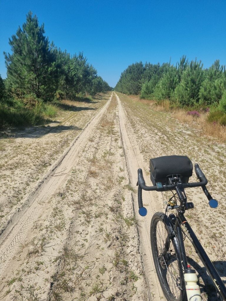
Having the 2” (57mm) tubeless tyres on allows me to go pretty much anywhere. When you allow google to choose the route you can end up in places that don’t even look like a trail let alone a road. There must be an old “public access” status. Probably it was once a road but is no longer such. Online mapping, a compass and wider tyres are best for this. A rear derailleur would be vulnerable, so Rohloff is good. If you are covering 100+ km a day you simply don’t have time to check out every bit of the suggested route in advance.
For decades, Vivente has been involved in bike advocacy. Our global travels have tested all sorts of bike parts but inevitably have witnessed culture as it affects cycling and public administration as it affects infrastructure.
There is a video doing the rounds at the moment about the difficulties of cycling in the UK. It calls the car-dominant culture there “moto-normativity”.
What is the status of cycling in France in 2024?
This 1,500 km tour, through several Departments, cities, country sides and villages has proved that car dominance is not the norm in France. Speed limits in urban areas are mostly 30km/h. Country roads are 70 or 80km/h. There are lots of places bikes may go but cars may not. Cars are restricted in many ways. Almost all one-way streets are bi-directional for bikes. There is relatively little public space given up to car parking. Cycling infrastructure is not just in isolated pockets and does not abruptly end, leaving us stuck. Car drivers slow right down and don’t seem impatient and cross. In fact, there are not that many cars on the roads. Young and old, male and female, in cities and towns, the French cycle as if there is nothing to be concerned about. They don’t wear helmets, and they ride well. The French also walk a lot. Unsurprisingly, obesity levels in France are much lower than in the UK, the US and Australia. French public health costs per person are half of the USA for example.
I would not have mentioned this; It just felt natural. But seeing that video and then being overtaken dangerously several times whilst riding back from Devonport airport (in Australia) to our base at Sheffield made me want to mention how admirable French road culture is. Food culture too but that’s another subject. What I don’t get is that when speed limits are higher, people are in more of a hurry. It should be less. We have to make cars less convenient. Don’t let them go so fast. Don’t let them hog all the space.
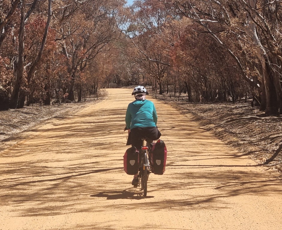
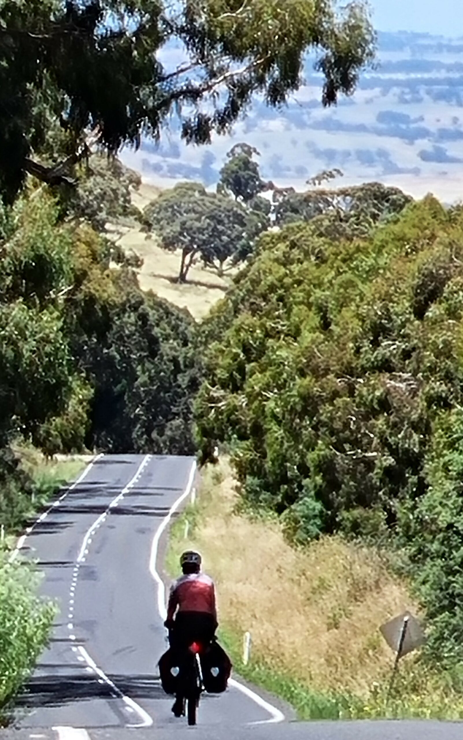
Continuing our post-Covid thinking of doing more test rides in Australia, we rode down the Murray from Albury to the junction of the Darling. We chose January, and were fortunate to not strike a heatwave. I was testing Schwalbe G-One Allrounder 2.8” (70mm) tyres, and I was using the new Baramind handlebars which have a bit of downward flex in them. The second bike was a standard drop-bar Swabia.
In the world of bike travel, there are those journeys that last for many months and even years, but there is also our lifestyle: working normal jobs and taking 3-week bike tours in breaks. Our ride was the latter.
Cycling infrastructure is the responsibility of local government. Thirteen councils on both sides of the river have formed Murray Regional Tourism. They have endorsed the idea of a cycle route along the River but it is early days and we didn’t see another travelling cyclist for 1,000km. It will develop over time, though, and there are lots of rideable roads, some separated paths, especially as you approach the towns.
There’s plenty of accommodation along the way. Wild camping would be easy, and there are many campgrounds and motels. But on a 3-week ride, we opted for motels and hence only had rear panniers and handlebar bags. The motels all have microwaves and fridges and typically only had to be booked a day in advance and cost about AU$125.
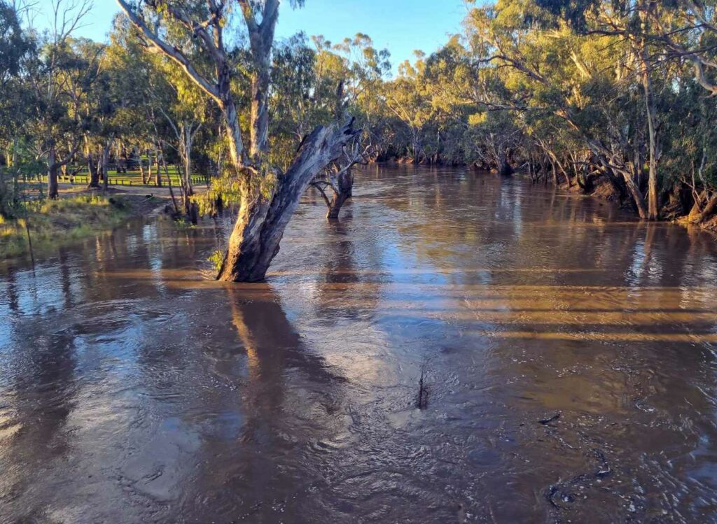
In this era of strange weather, bike travellers have to keep an eye on forecasts. There are several rivers that rise in the south of Victoria and flow north to the Murray. At one stage we knew the Campaspe river was going to flood and we had to get across it by a certain time or risk waiting out the flood.
Summer on the Murray is the time of year when the dirt tracks are mostly rideable. But a bit of rain can switch from dirt to tar on short notice. This is part of riding in the region. You certainly don’t want too rigid a plan.
The Swabia had 40mm tyres and that kept us more on the sealed surfaces. The Diamantina with 2.8” tyres seemed to be happy everywhere. Wherever we were though, we were on the lookout for puncture risks.
The 2.8” (70mm) tyres deserve their own discussion which is best done under the heading of touring bike wheels.
The best defense is to see them in advance. In January, the new crop is not yet hardened. But there are still puncture risks. We got three punctures. One from a staple on the 2.8” tyres that have no Kevlar belt. And one on each bike from three-cornered jacks. Tubeless most likely would have prevented all of them. But you have to balance that with the work of setting up tubeless on relatively short-duration rides. See our separate article on this.
Mallee fowl were a hope but talking to park rangers revealed just how rare it is to see one of these amazing creatures. That’s a bit surprising given how the related common brush turkeys are now on the east coast. But feral cats and foxes are the main reason mallee fowl are endangered.
Bike travellers spend most of their time in wilderness or farming regions. Some of us are actively interested in farming and there’s plenty to see along the Murray.
Another interesting crop is saltbush. They grow it so as to produce saltbush lamb. Join the club if you have never heard of it. According to the marketing… The protein-rich foliage and high mineral content of Oldman Saltbush gives the meat a very clean, crisp, lean and delicious flavour, a unique characteristic.
The Murray was the boundary for different Indigenous tribes. Europeans took their land and, in some cases, massacred them. There is little sign now that up to only 200 years ago, a civilisation dating tens of thousands of years lived here. But we did come across one extraordinary relic from olden times.
Mildura is the main departure point for tours to Lake Mungo. This is not rideable. You travel through vast stations. Camping on them is not allowed. You need to carry all of your water. But there are a few operators that will take you out there and ours was faultless. Visiting Lake Mungo is an incredible experience.
The lake was one of five in a system that for many thousands of years drained the melting ice sheet on the eastern highlands. In 1968, an ANU geologist studying ancient and now dry lakes went there and found human remains. Named Mungo Woman, the remains are part of the earliest human settlement known anywhere. The lake dried up 14,000 years ago!
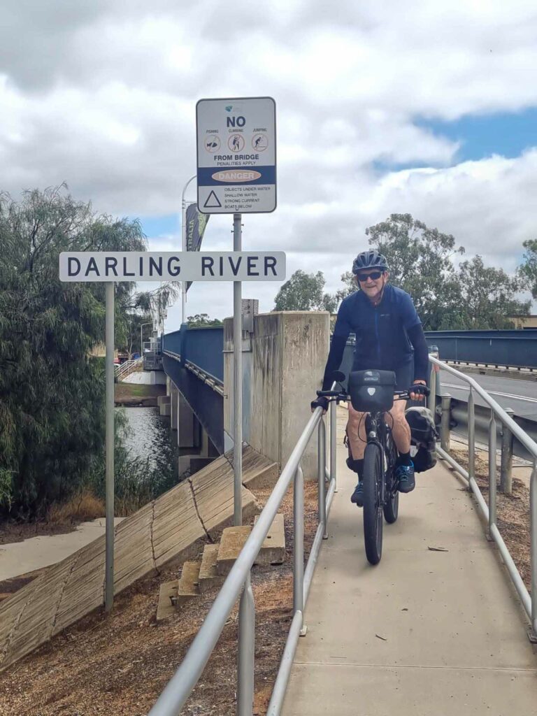
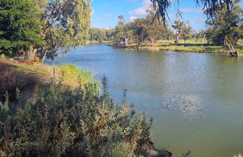
About 35km beyond Mildura is Wentworth. This is where the Darling River joins the Murray. You can do a loop and see both sides of the river. You can also, from Wentworth, ride up the Darling. Towns peter out though and that’s another type of bike tour. We went as far as Pomona.
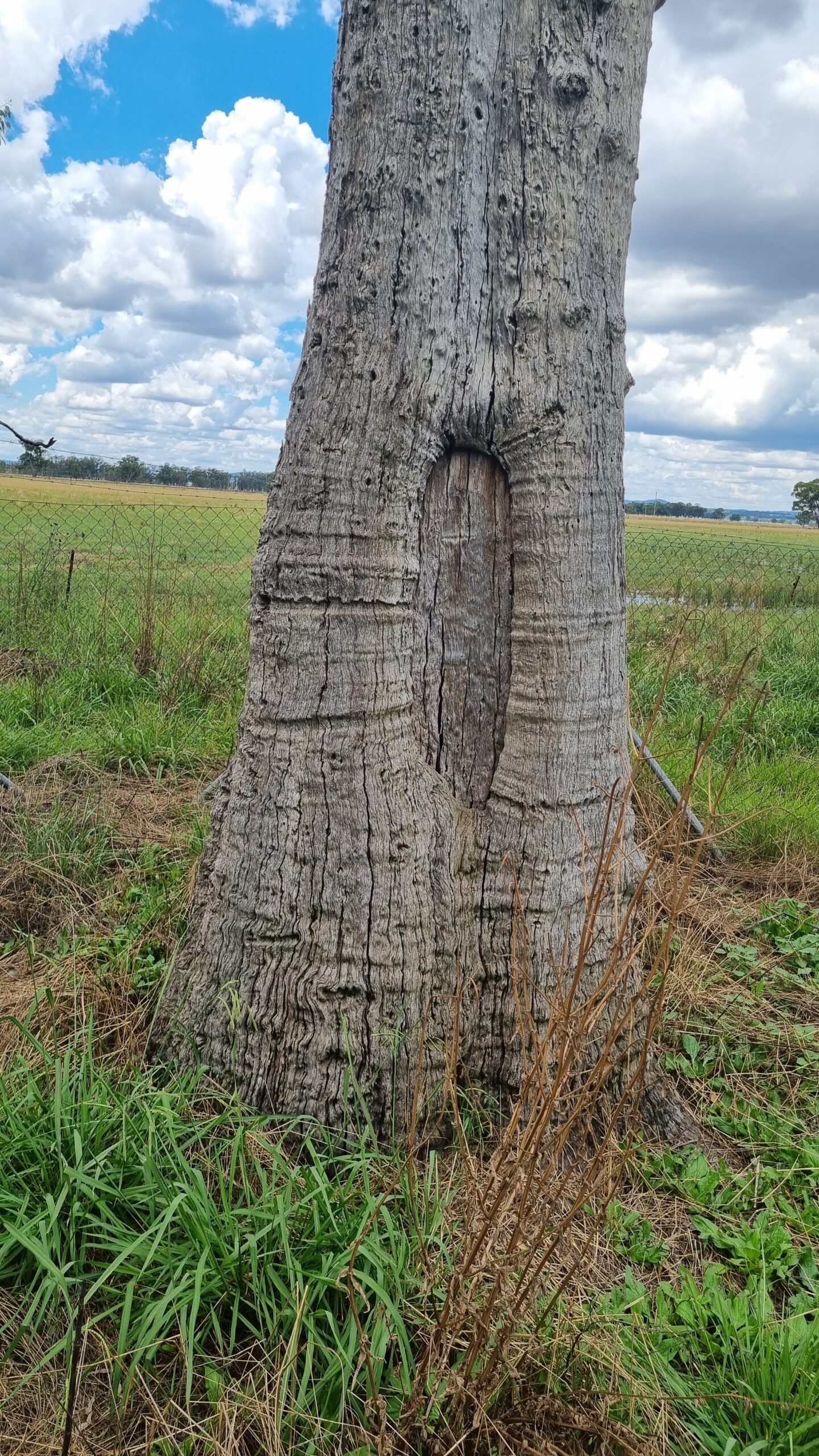
IMG14 – Big tree
“Buy-back” in the Murray Darling catchment, refers to policy whereby government would buy back some water entitlements from farmers.. How wrong could buying back water entitlements be? I expected people that we’d encounter along the Murray River would have a “whatever-it-takes” attitude to achieving what was set out in the Murray Darling Basin Agreement. That was signed up to in 2007 and was to be achieved by 2024. But almost none of the promised environmental river flow has come about. There is irrigation everywhere. The farmer first needs to own a licence. That might be worth $4,000 per megalitre (ML). High Security licences are up to $7,000. Then he/she buys the water which, in a normal year, is (an extra) $80 per ML. The value of licences has gone up a lot. As much as 25% a year. They owners don’t want to sell. So, there is an impasse, and, as a result, our environment suffers.
Successive governments have over-allocated the water. Taxpayers (the governments) want to buy back enough licenses to achieve the environmental flow they agreed on. But talking like that along the Murray River is not smart. Tentatively, I would ask…”what percentage of people around here are against buy-backs?” 100% was the answer every time.
But the fouling might be upstream cotton industry- driven pesticide pollution. When I got back to Sydney and went to the Invasion Day rally in Belmore Park, a speaker was talking about how the Darling and especially its northern tributaries are poisoned by the cotton industry. I found more, including this article on the subject. The claim was that cancer levels amongst Aboriginal workers in the cotton industry around Moree are high. It looks like that is true.
Whether or not you share these concerns about the environment, a ride down the Murray River should be on your list. You can alternate between NSW and Victoria, there are towns along the way and plenty of places to stay. There are dramatically different landscapes. At Mildura you can fly to either Sydney or Melbourne. We were able to get bike cartons at the airport.
Shout-Out to Victorian Trains Taking Bikes
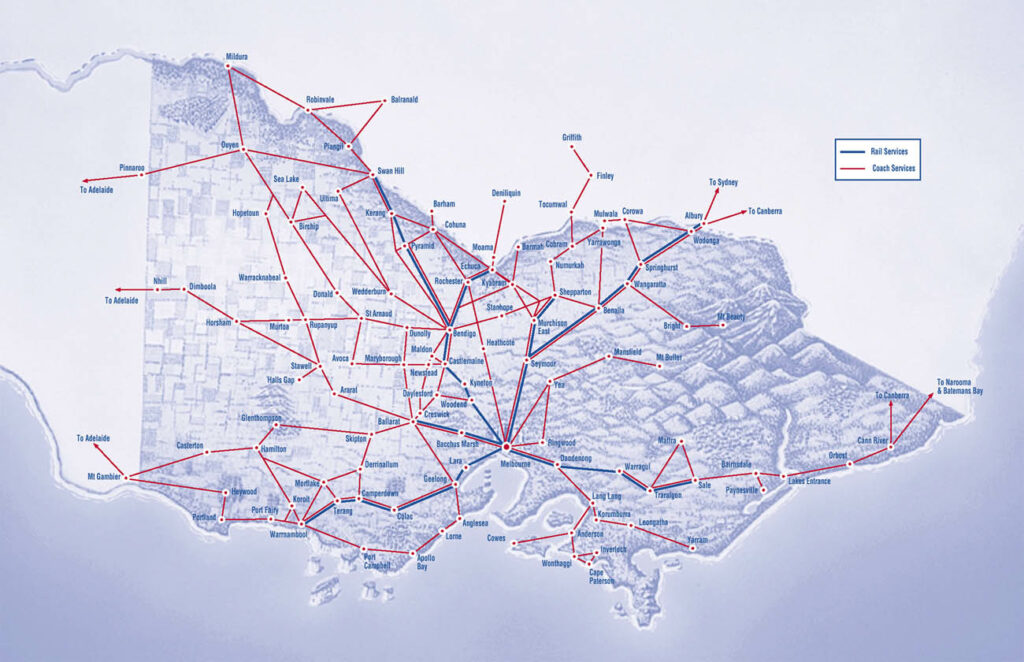
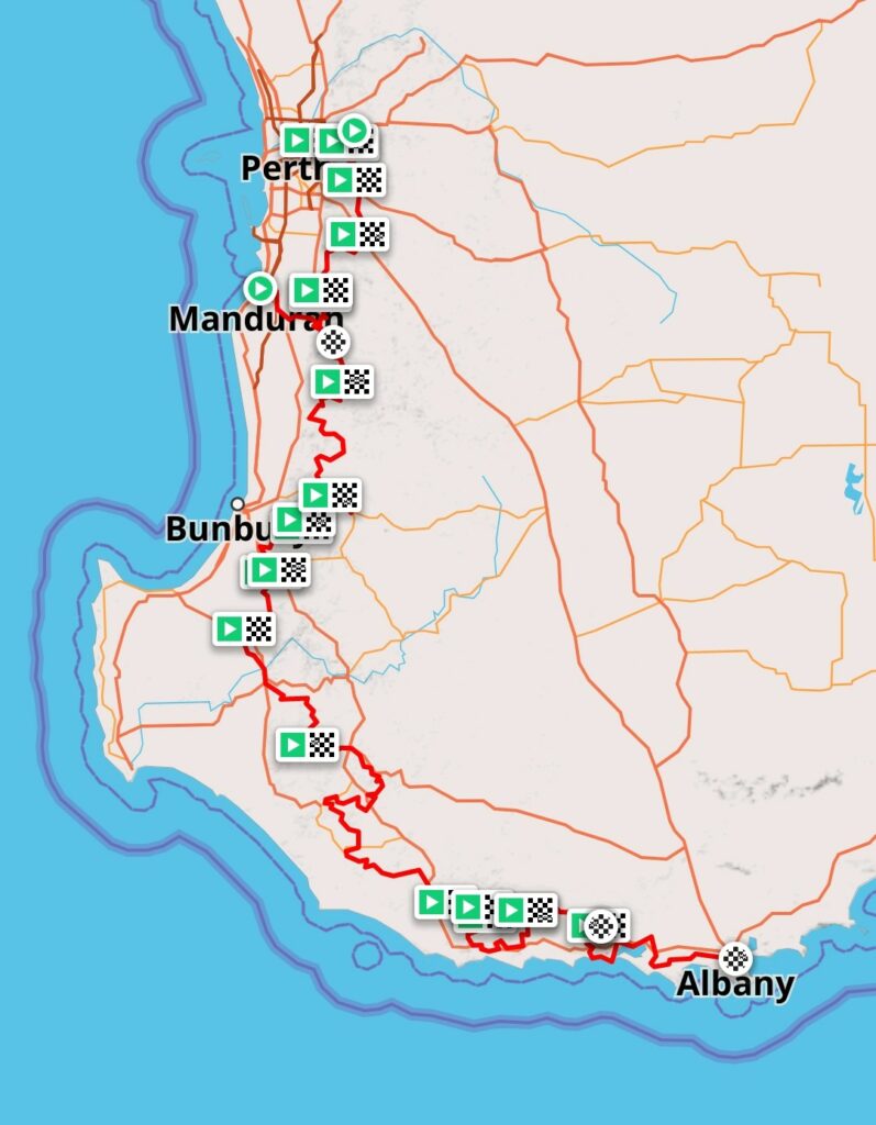
You can wheel your bike on and off Victorian trains. The lines go to Warrnambool, Sale, Wodonga, Echuca, Swan Hill, Ballarat and Shepperton, although there are a few time periods when it’s best not to. Read more about Bicycles, luggage and animals on Victorian Trains.
In addition to the train lines on this map, there is also the Overland between Melbourne and Adelaide. They accept bikes too but they need to be booked 72 hours out. You could get on or off at a number of stations.
It’s a long way from Australia and seeing this part of the world had waited until I was in Europe anyway. Eurobike was in Frankfurt and I flew to Oslo from there. I’m lucky to have friends here.
It’s a big country and I only have a few weeks. In addition to warm-up rides close to Oslo, I’ll concentrate on Bergen to Trondheim.
The roads are a bit narrow so it’s best to find less-busy routes. That’s not hard. There are SO many tunnels and they normally say “No Bikes or Pedestrians” (for good reasons).
Bergen happens to be the wettest city in all of Europe. Fortunately it was fine. The route north is well signposted.
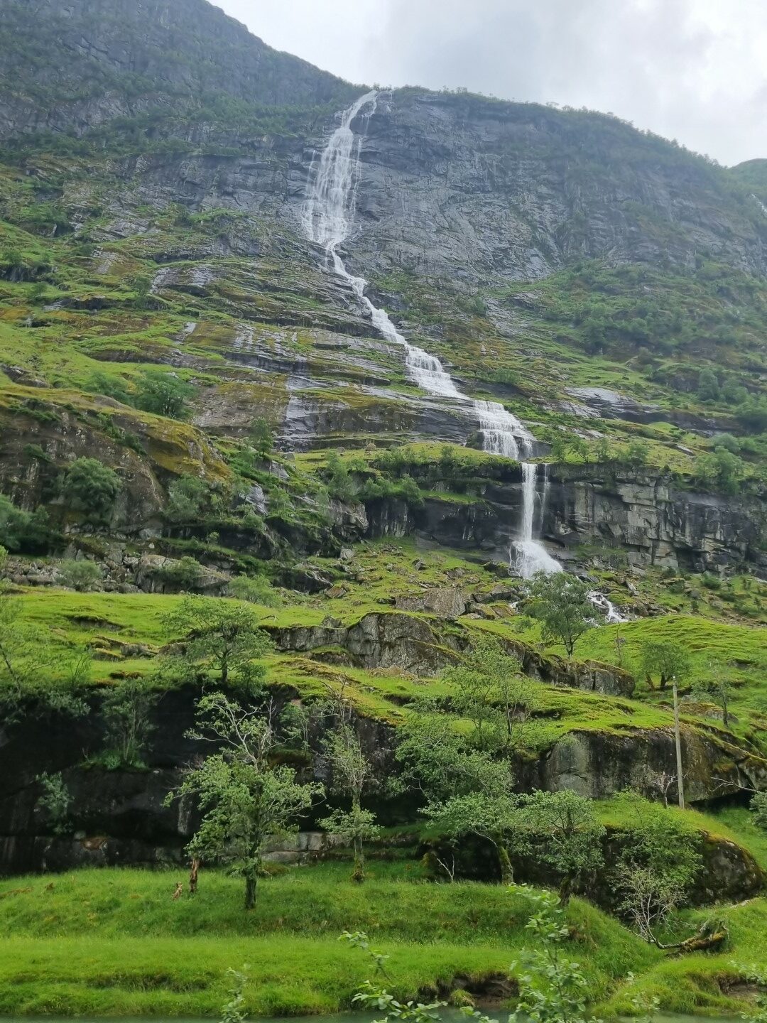
There are waterfalls coming off the U-shaped valleys virtually everywhere. It’s snow melt as it has not been raining much.
There is a long-term government policy of having human settlement throughout the country. This has meant long-term farming subsidies. Often small farms that can only grow grass and other animal feed, can actually survive.
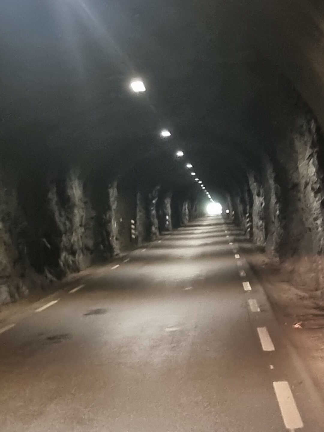
This tunnel didn’t have the No Bike sign. Nor did it say how long it was but there was so little traffic so I went for it. It was only 1.1km. The B&M headlight is great.
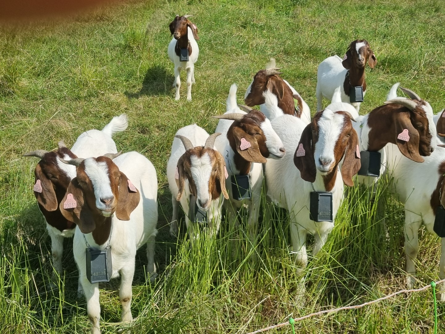
Boer goats doing well in an environment very different to where they originate from.
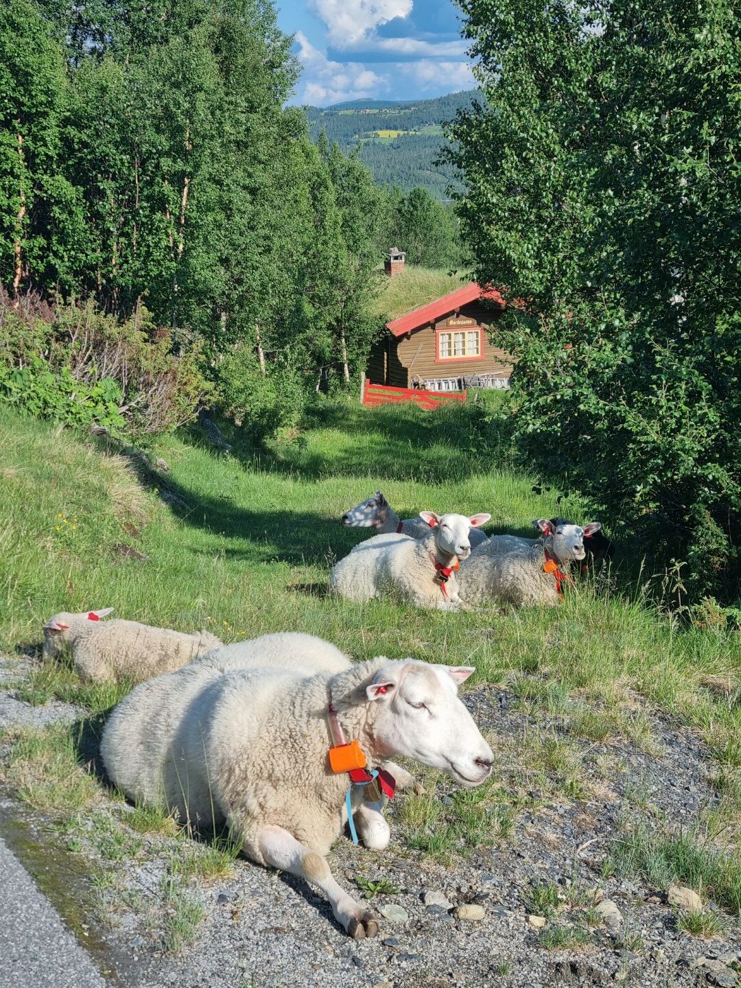
There are also quite a lot of sheep. Kept indoors for months and in the summer allowed to graze on roadsides in the mountains. They have bells and are not at all afraid.
Some days it’s too far between towns. I’m finding Airbnb’s on farms, booking one day ahead. This is out the window from one West of Stryn.
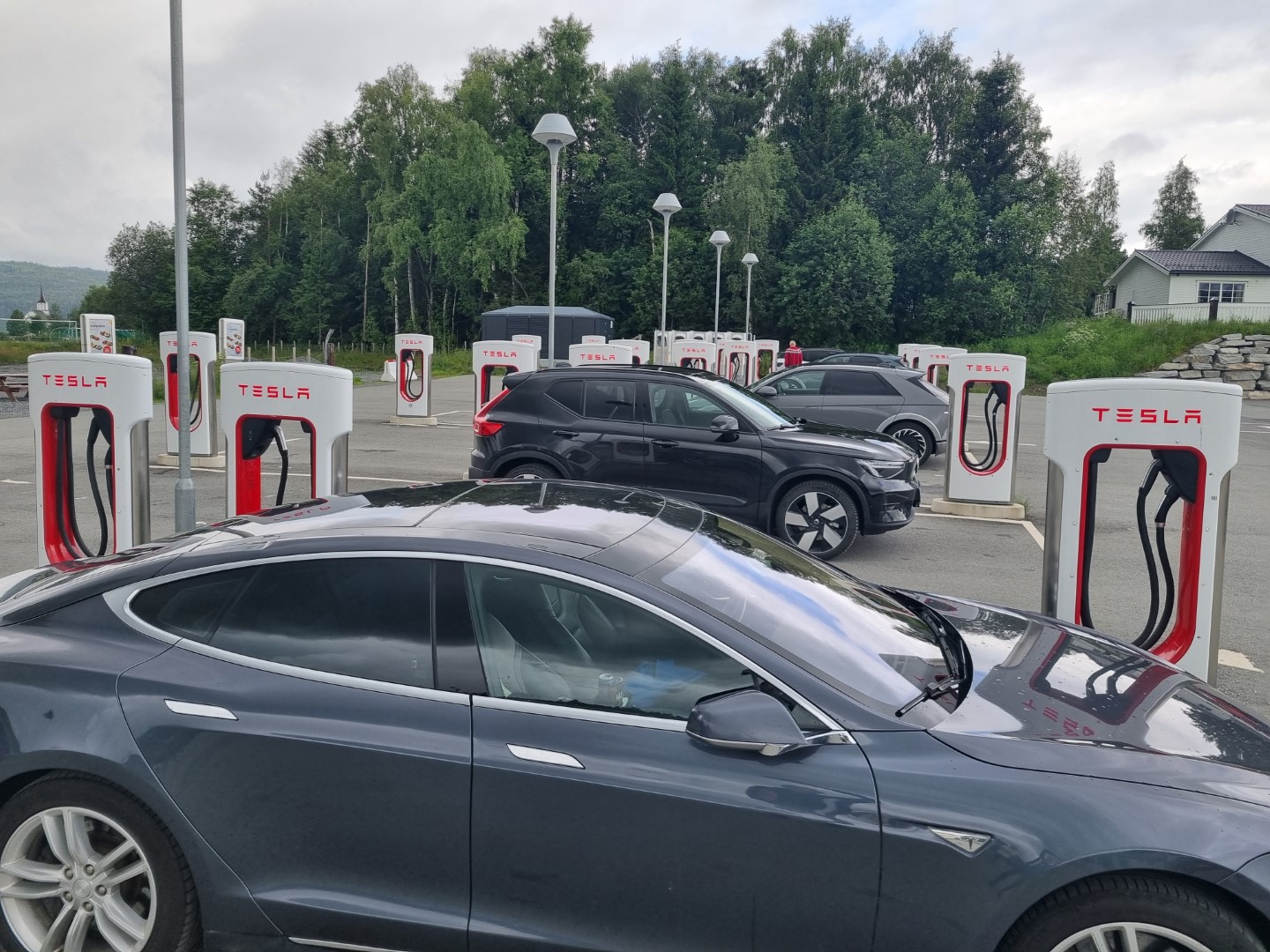
Norway is a rich country having discovered oil off-shore six decades ago. This is government owned, allowing Norway to have a big sovereign wealth funds. It’s actually the biggest in the world. But they can see the future and have policies that make an electric vehicle cost only half of its diesel/petrol equivalent. 80% of new vehicle sales are electric. The highest level in the world.
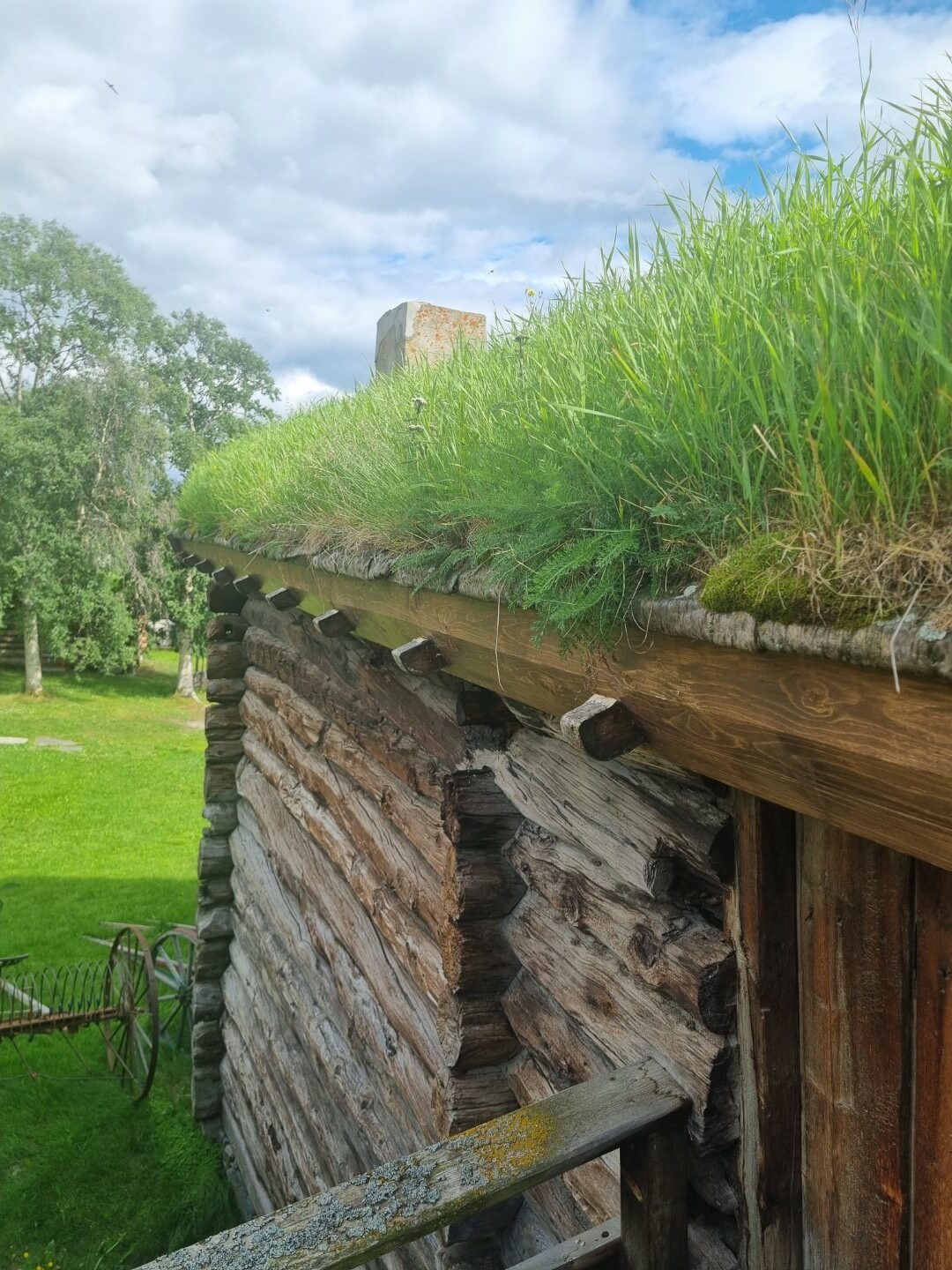
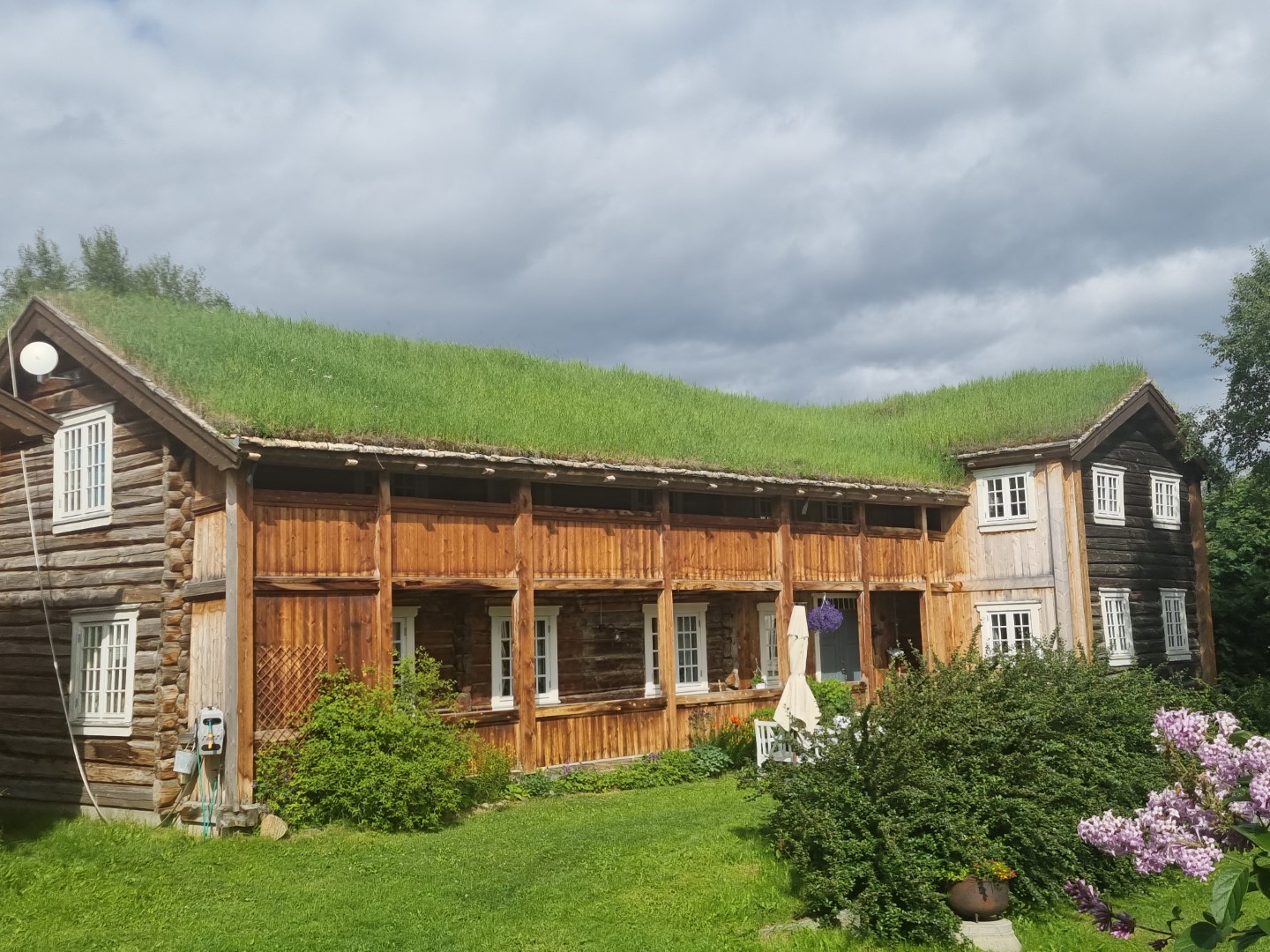
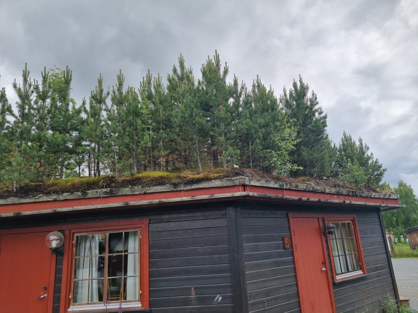
Norway must be the home of sod roofs. Or are they spread around the globe at this latitude? They even have sprinklers set up to water them. They even allow trees to grow on them! You may well wonder how this does not just hasten the failure of the roof? Apparently not so though. The barrier between the wooden substructure and the sod is a layer of birch bark. Newer ones use a sheet of plastic. The sod roofs weigh it all down and help reduce the spaces between the logs.
Timber has always been the primary building material and source of heating. Small farms often have additional forest land and PTO-driven splitters with elevators loading up 1.5CUM cut-wood baskets. It’s all softwood. Houses are super-well insulated. They test the seals by pumping air into houses and measuring the pressure decline rate!
You can’t expect separate bike paths everywhere but there are plenty along fjords, through old railway tunnels, and alongside major roads.
An impressive wooden church. Some are many hundreds of years old.
Called a Potato House, this is cool-room for vegetable storage through a cold winter. Rock is used extensively. Norway is basically rock.
I chose 650B wheels and 50mm tyres for this ride and I sought out off-road trails
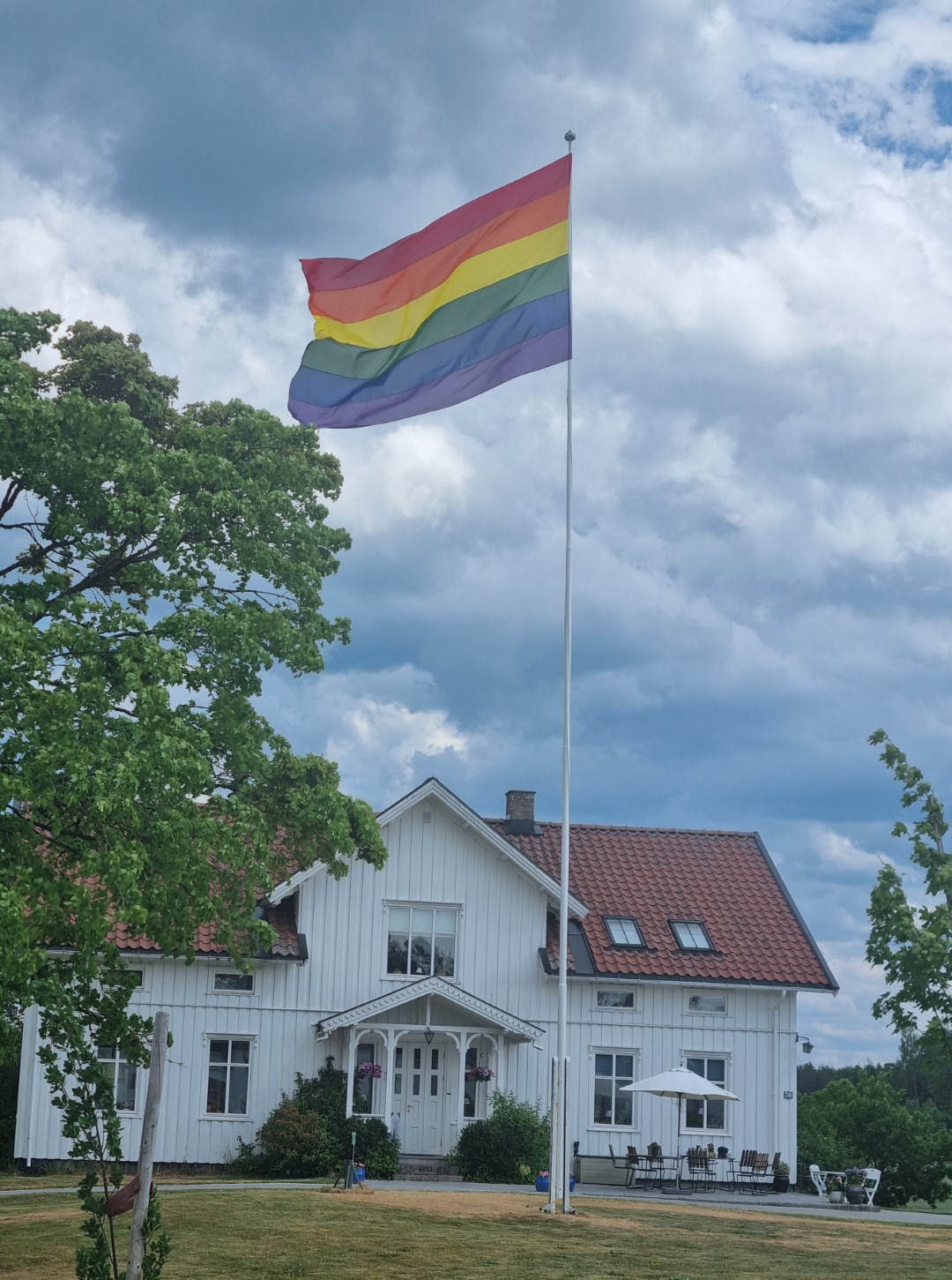
Norway celebrates diversity. It was Gay Pride Week and there are rainbow flags everywhere.
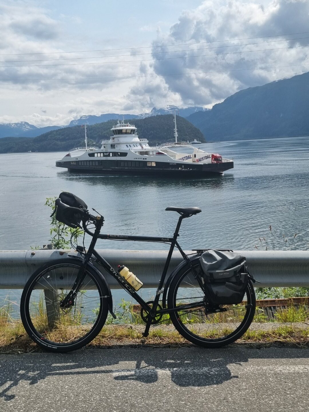
Ferries cross the fiords on the coast. Some fiords run inland over 100km so these are considered part of the road network. They run frequently and are free.
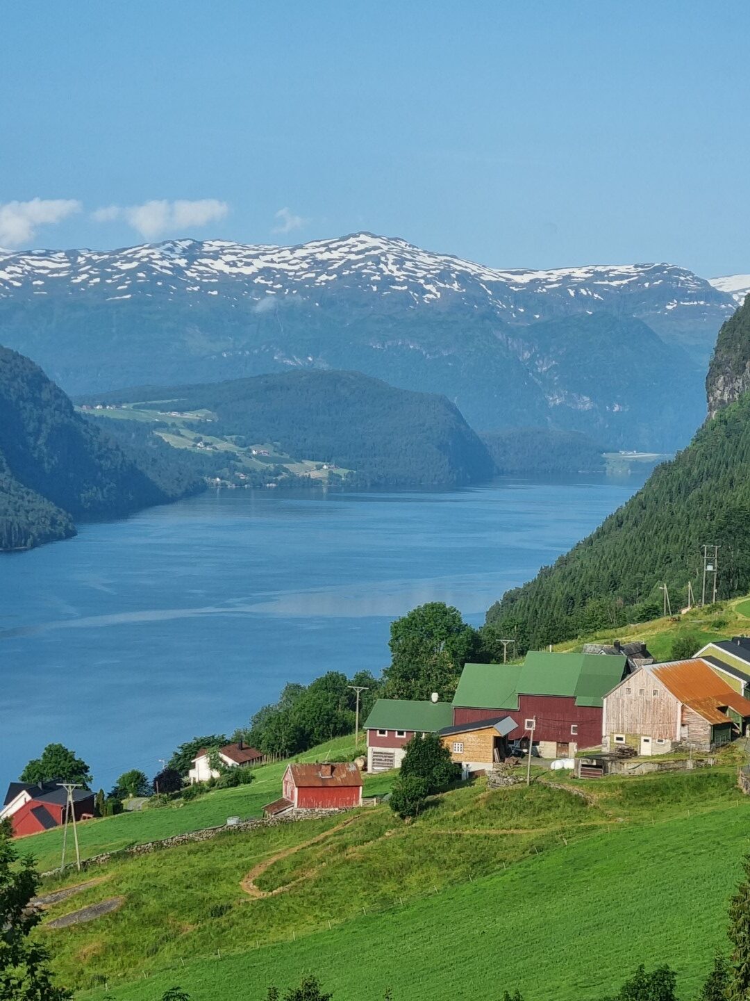
Catching up with an old mate. Agriculture is pretty challenging here. Mainly it is growing food for animals.
Coming into Trondheim in peak hour. It is 63.5degrees north. (Hobart is 43 S. Ushuaia is 55 S. Anchorage is 61 N.) Norway is warmed by the Gulf Stream.
The other way people visit Norway is by cruise ship along the coast.
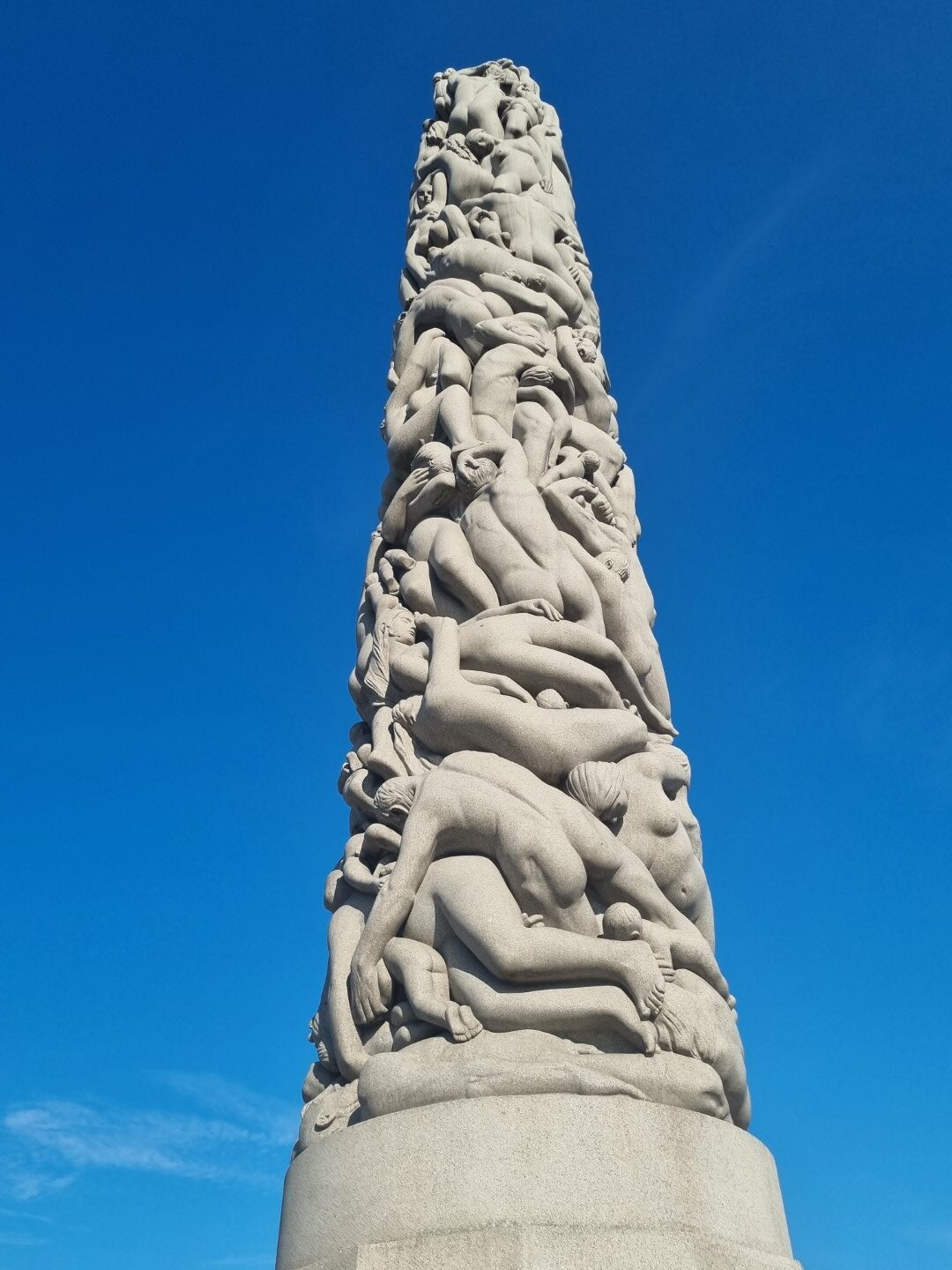
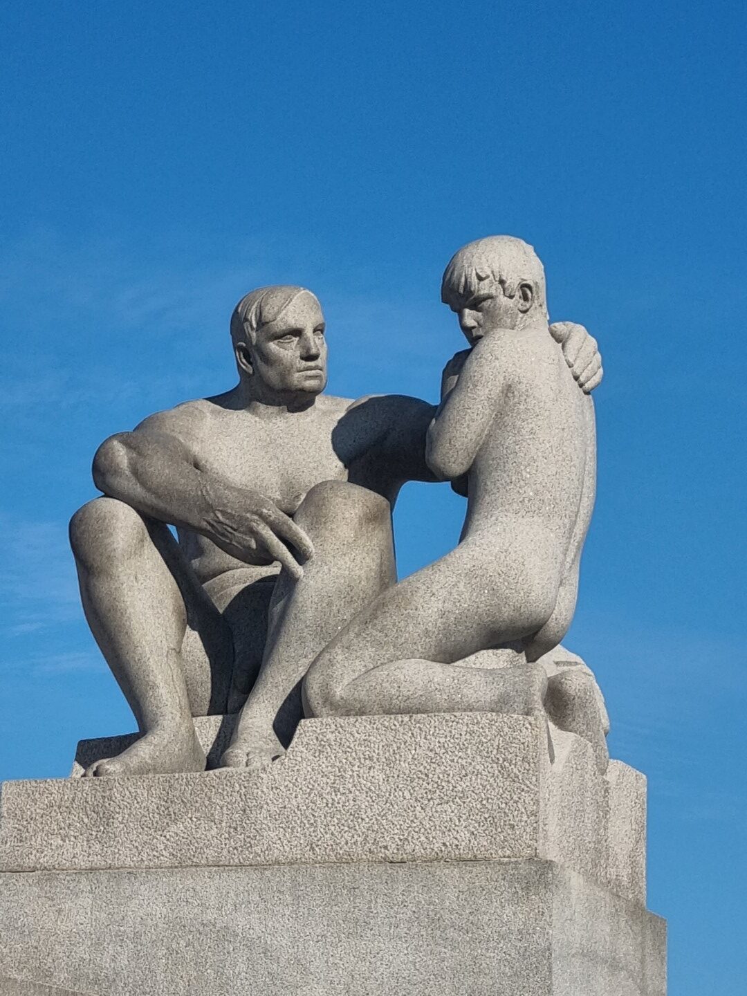
Vigeland Sculpture Park in Oslo is indescribably beautiful. There are 200 pieces. It is fantastic.
Heading out. Getting away from the country scenes and being reminded how modern living is a mix of realities. Or maybe just a very different way of experiencing them.
A 1,200km A to B ride in mid-summer, returning to Chicago and O’Hare airport on Amtrak. We are riding a Swabia and a Deccan, testing a few things including the new Busch & Muller IX-Q 100 lux headlight, Goodyear Transit Tour tyres, Rokform and Magsafe smartphone mounts. See the Test Report at the bottom of this page.
The ride takes us over the July 4th long weekend and there are flags everywhere. The weather is perfect, mid to high 20’s. The roads are so good that there is seldom a need to seek out bike trails. There is always a wide shoulder. There are some bumps in the tar due to harsh winters.
Drivers are courteous. In fact, they are some of the best drivers in the world, which I admit surprised me. We have been on several rail trails because google selected them and they have been great. Google route mapping has been good 99% of the time. You don’t need to plan routes much as there is just so much paved surface.
After landing at O’Hare, we put the bikes together and try to ride out but soon encounter a twelve-lane ring road. Instead, we catch the train 1 stop and then ride to Des Plains station and get the metro (NW) train to the city outskirts.
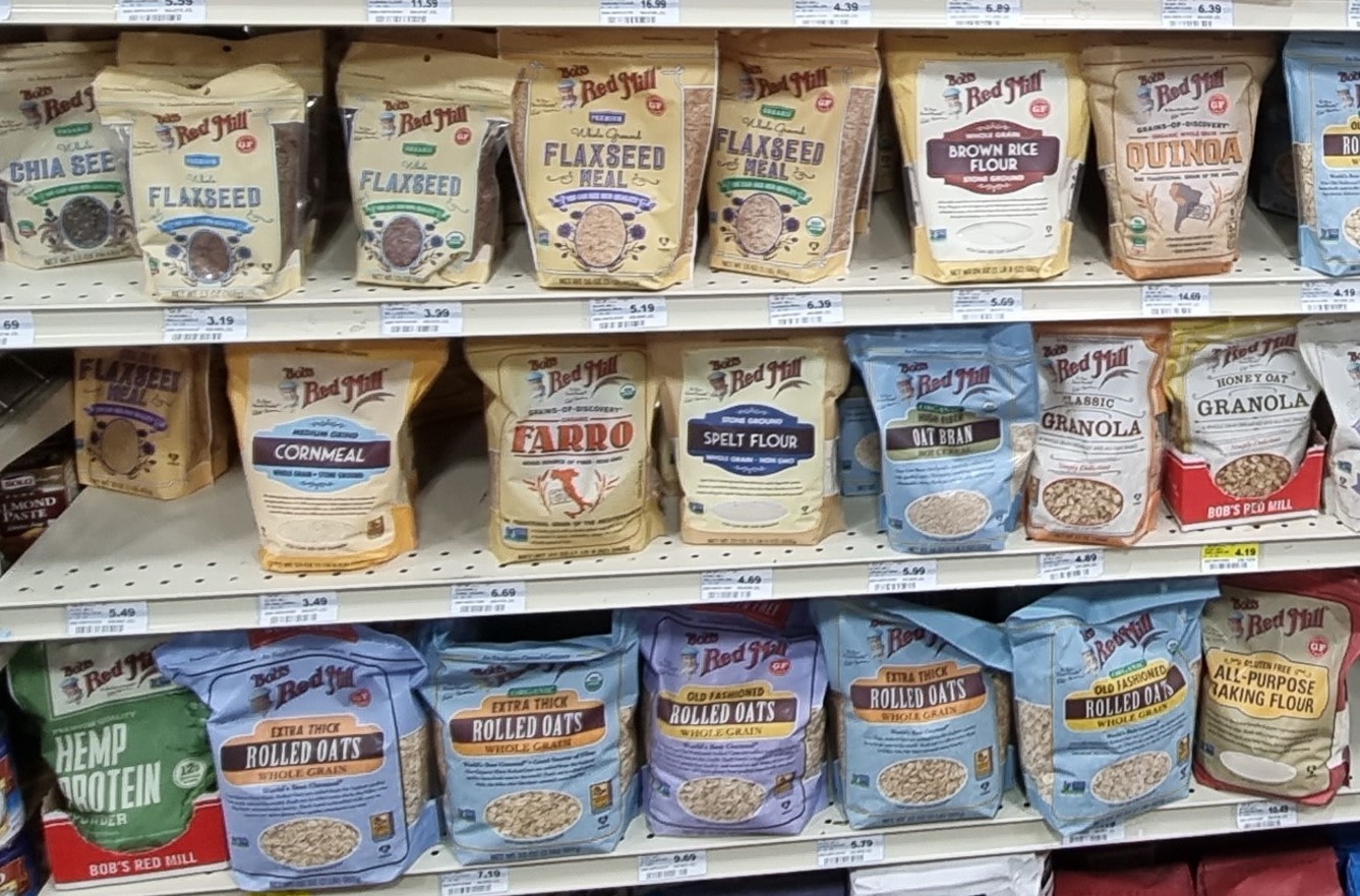
These days, my breakfast is a combination of grains (which I carry), fresh fruit and dairy. I soon find the grains (linseed, flax, oats etc.). Blueberries and strawberries are in season. I’ve never eaten this many strawberries!
We head north over the state line into Wisconsin. Over the next three nights stay at Delavin, Watertown and Princeton.
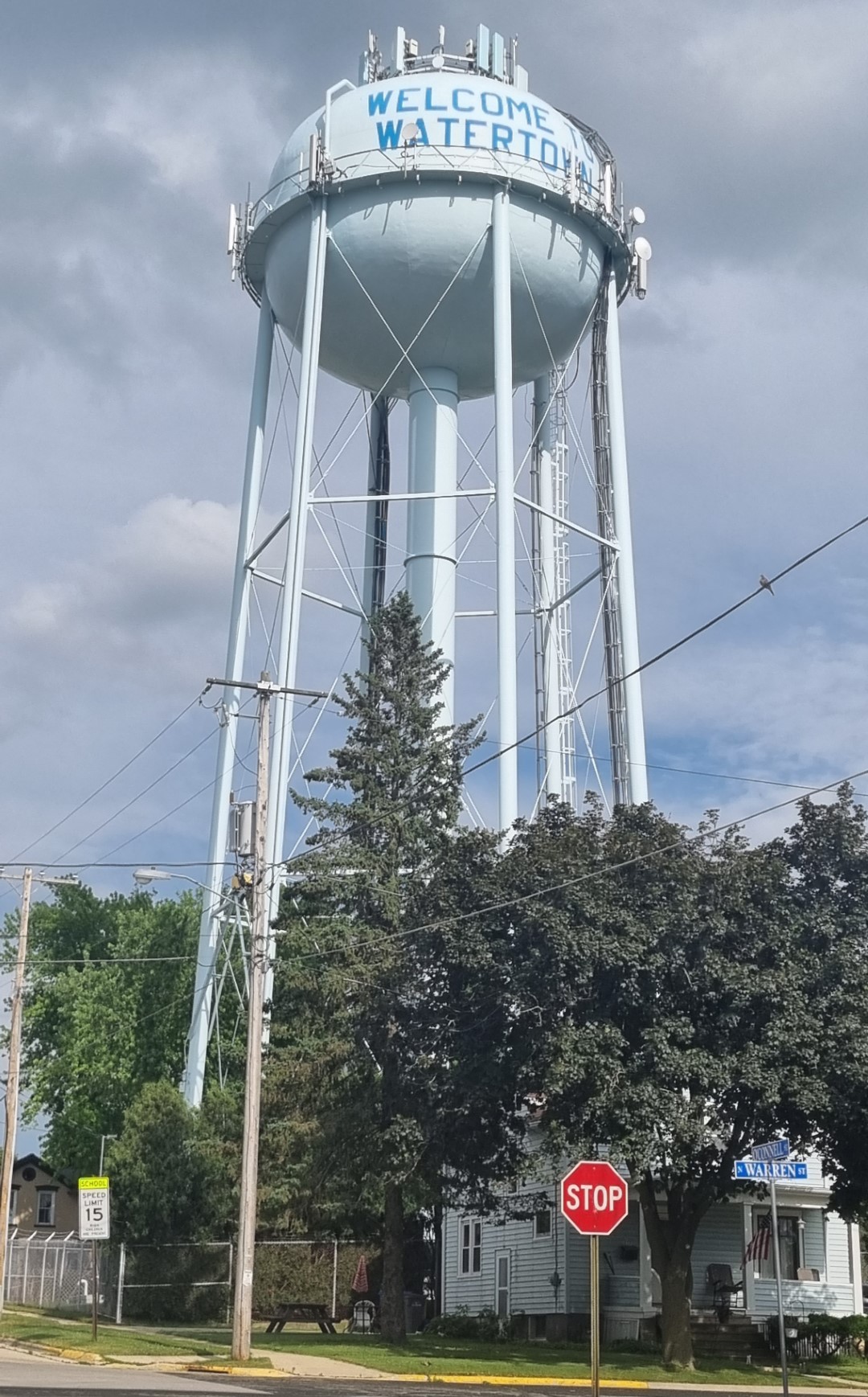
Just about every town has a water tower, often impressive and a landmark we can see from a distance.
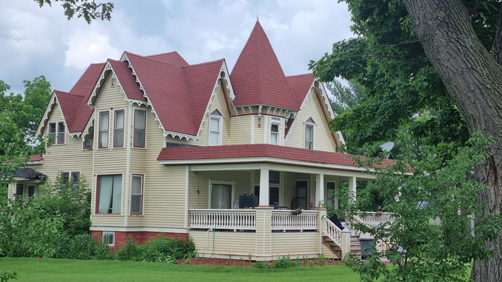
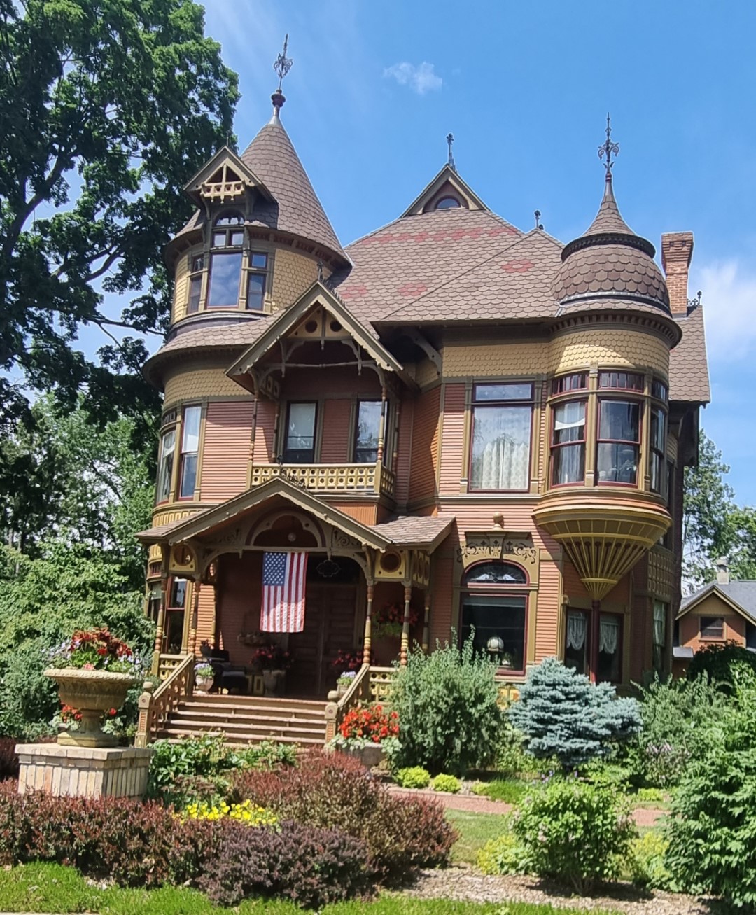
There are some fine examples of old timber houses in Wisconsin country towns.
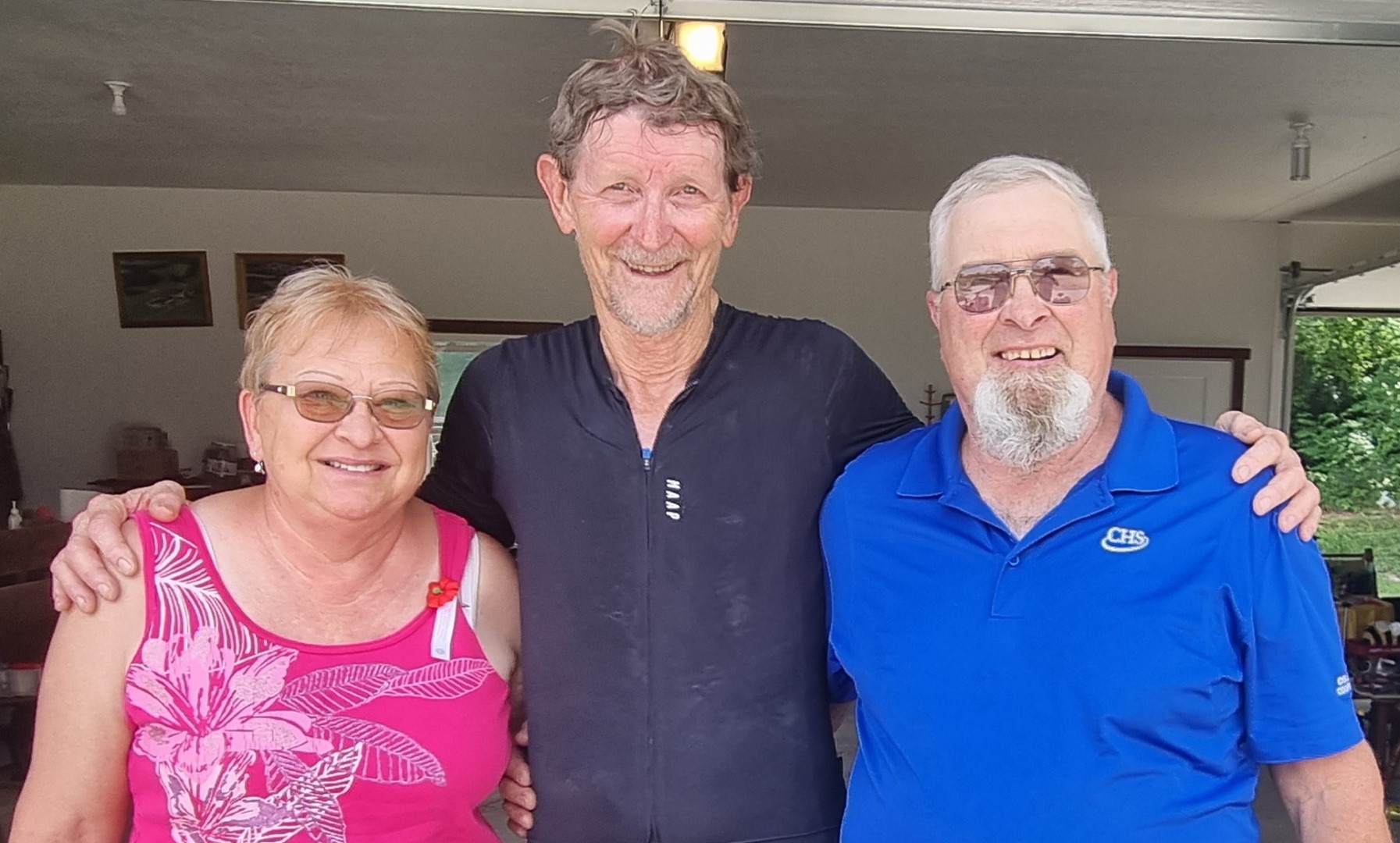
We call in on my brother and his wife near Waupaca. I was a foreign exchange student here when we were both seniors in high school. It’s so good to be back together and to catch up with old friends.
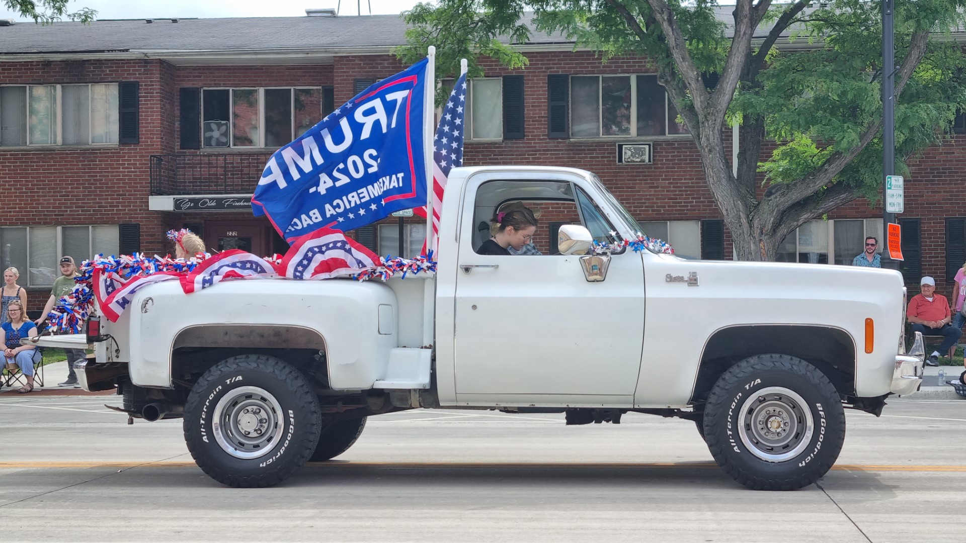
We are watching the Fourth of July parade in this central Wisconsin town. There are marching bands, veterans, fire brigade, active seniors, candidates for sheriff in the looming elections and the local branch of the GOP.
Mr Trump’s effort to still be the president, even though he was not elected, is not seen as an irony on this day when the country celebrates freedom from an unelected British king. That’s what 4th of July is.
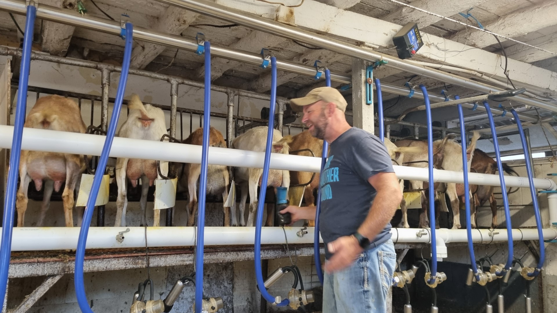
A dairy goat milking parlour. Tom and Kari are milking 120 does a day and each one averages one gallon (about 4.5l) a day.
At Wisconsin Rapids we pass a massive paper mill. This is a small part of the pine log stack.

Christian faith is strong here and sometimes the church signs make grand claims.
Long load shot. These are roof trusses.
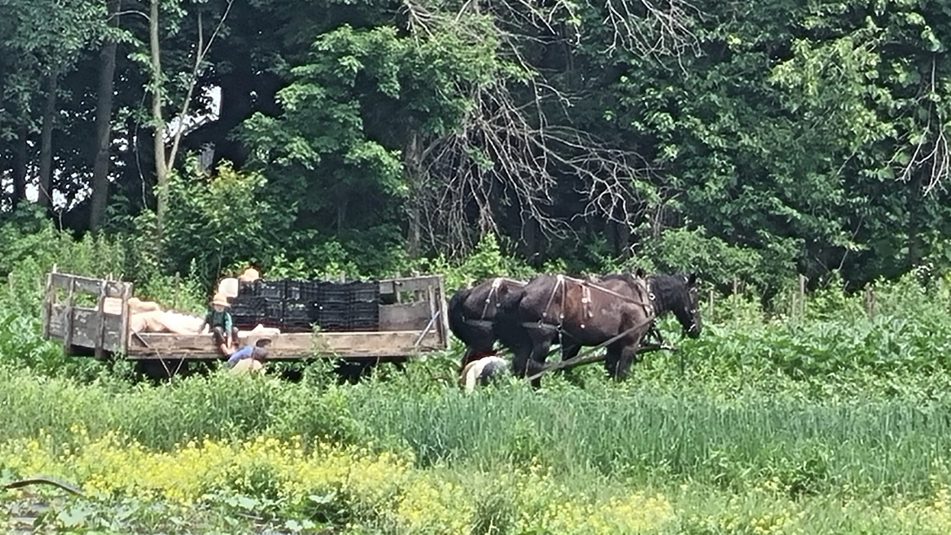
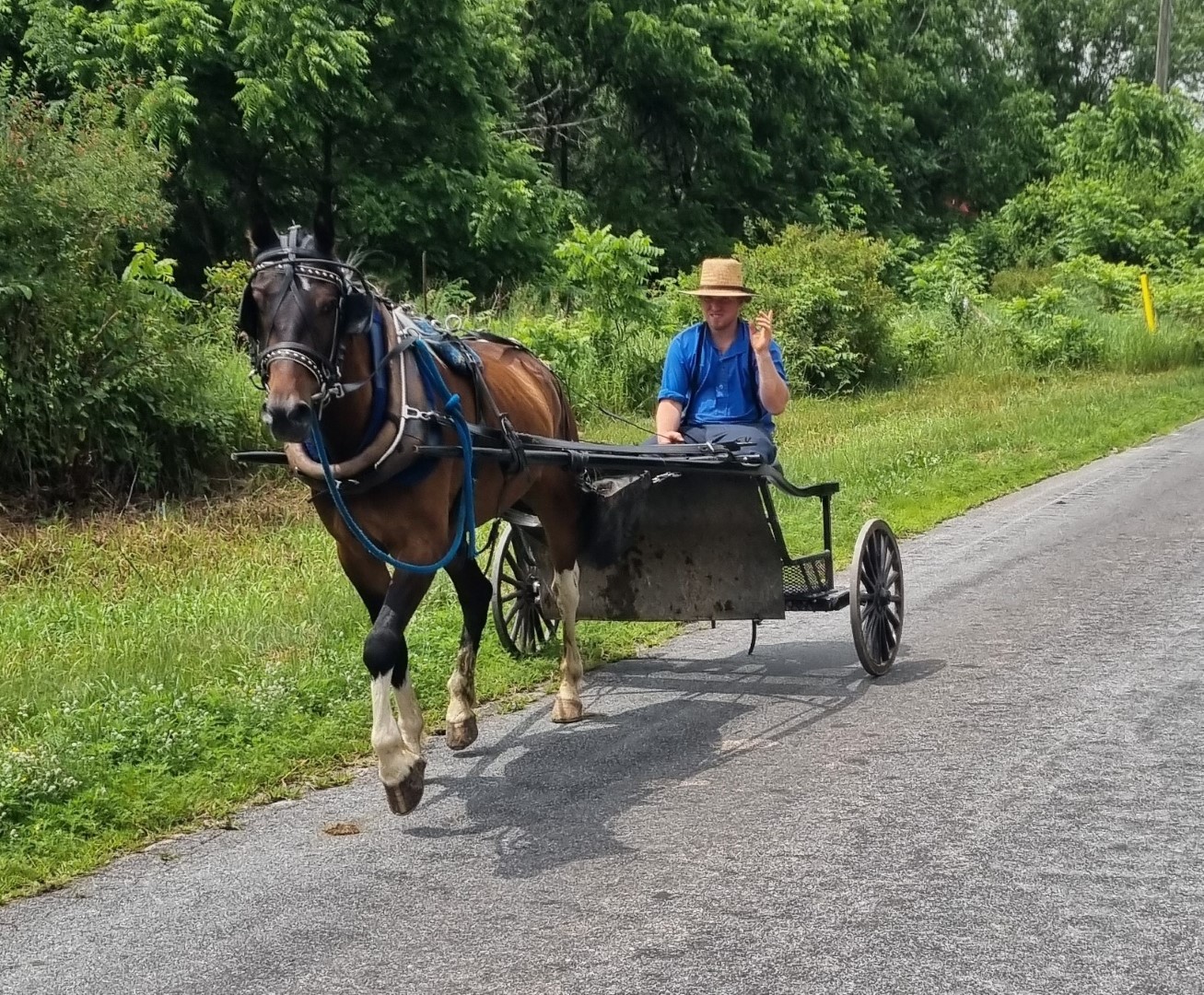
We are passing Amish communities daily. They use buggies to get around and use Clydesdales in the fields.
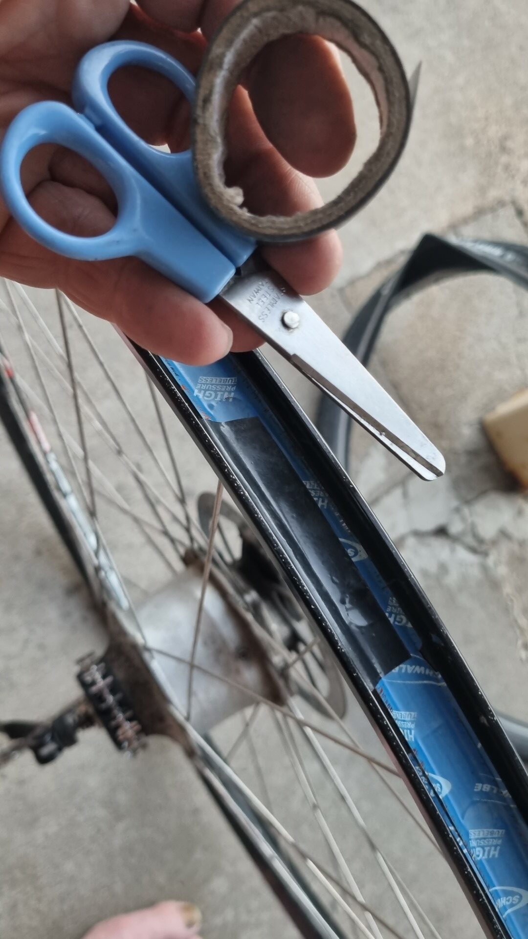
A plug for carrying a bit of insulation tape and a small pair of scissors. This Schwalbe rim tape is one of the extra strong ones made for tubeless systems. It has cut the inner tube.
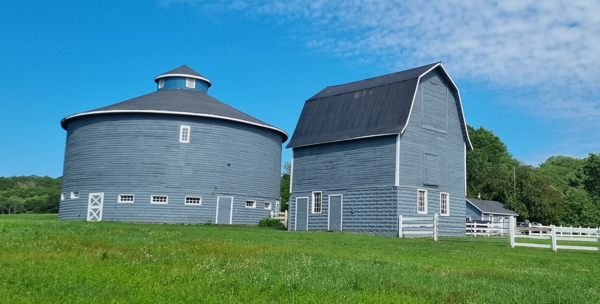
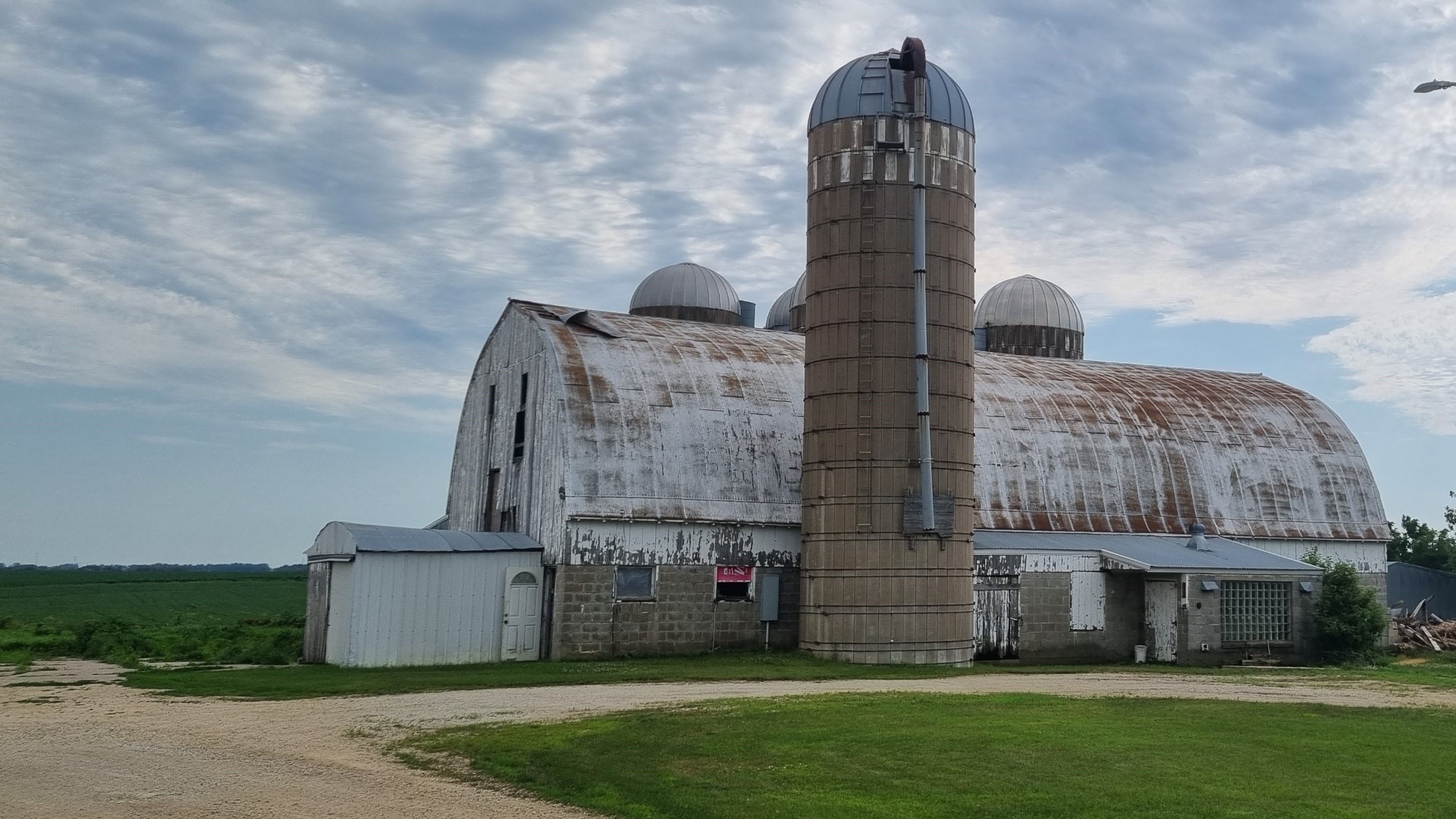
Farm buildings in Wisconsin and Minnesota. What they can grow in 4-5 months needs to be stored for the long winter.
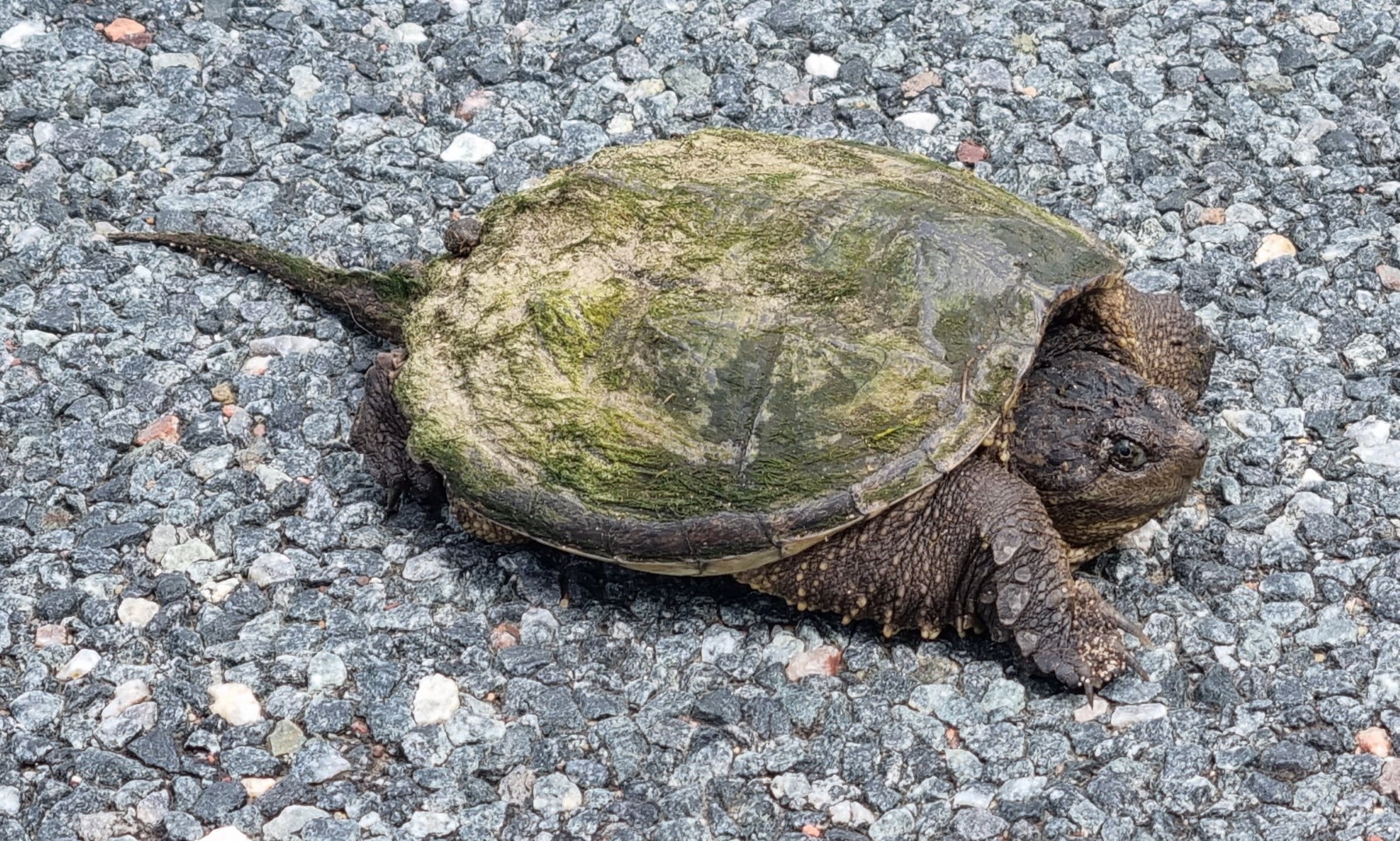
It’s not uncommon to see turtles when bike touring. Being reptiles, they sometimes sit on roads to get warm, and they sometimes get run over. So, I always move them off the road. Usually that is not hard as they retreat into their shells.
But this one (called a Snapping Turtle) is aggressive and objected strongly. It tried to bite me. She was not moving so I pushed her off with a stick.
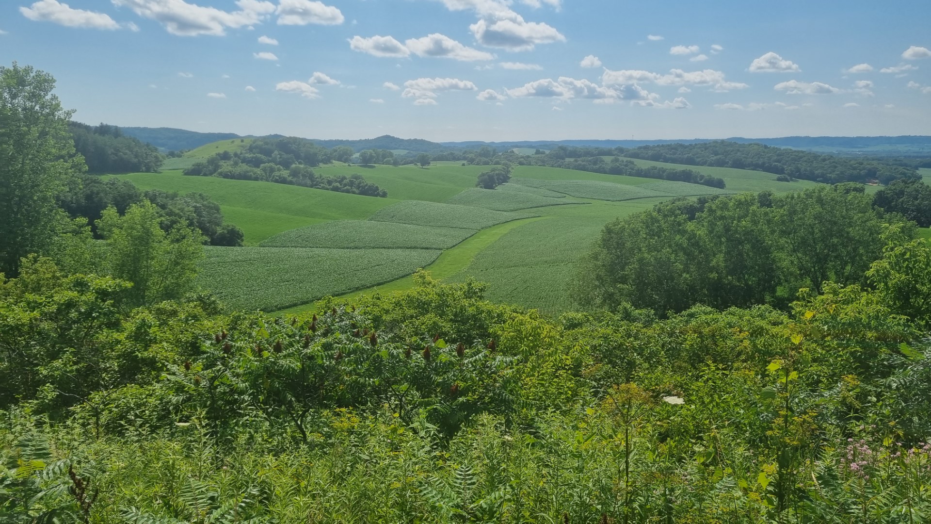
The “Driftless Area”. What is called moraine in Europe, in the USA is called “drift”. In southwest Wisconsin and southeast Minnesota there is an area that was not covered by glaciers.
Most of the upper Midwest was. The hilltops were not shaved off and the valleys were not filled by soil and rock (drift) as the glaciers melted. Hence this is called the Driftless Area. We are in hilly country for a few days.
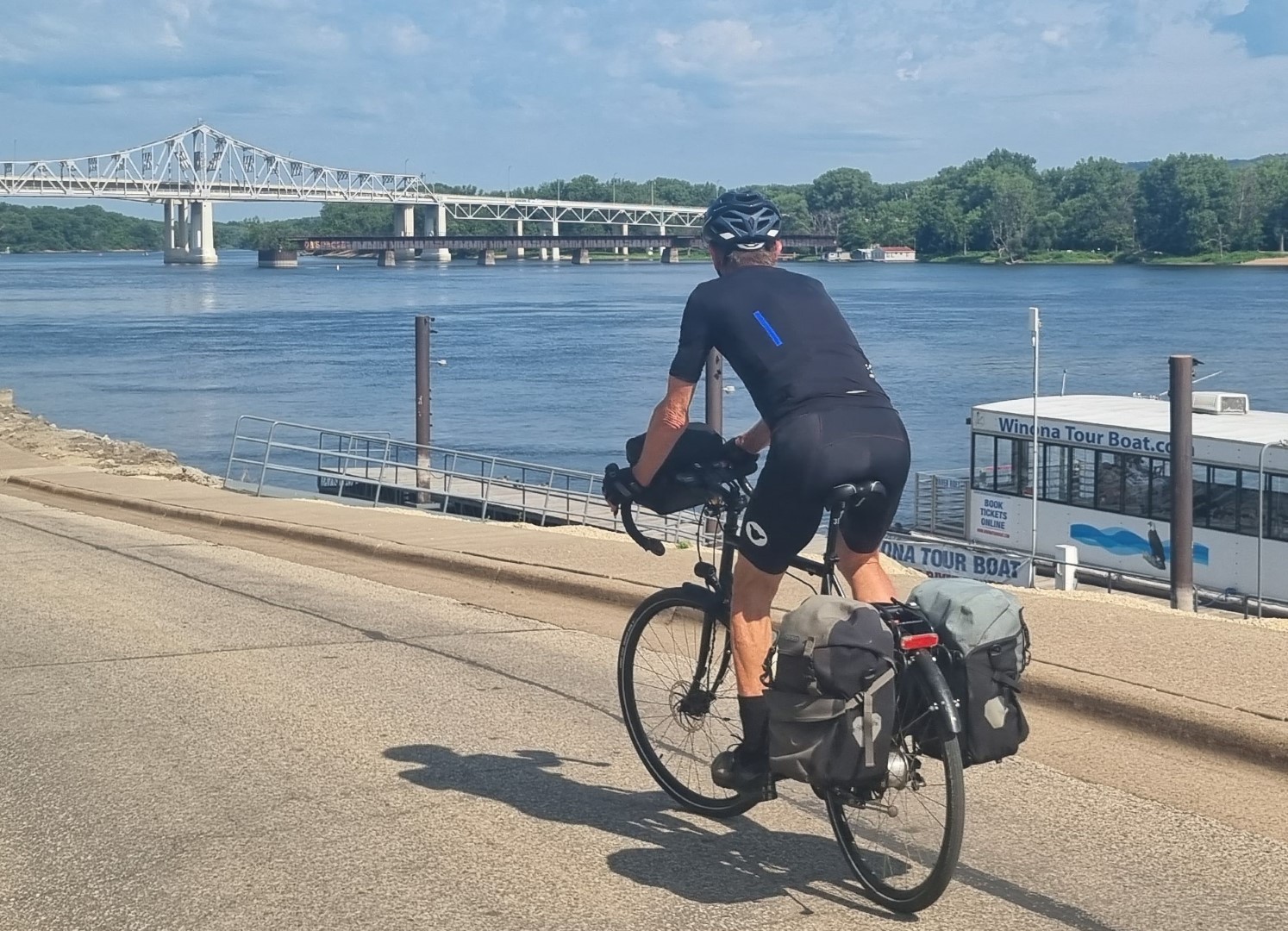
The mighty Mississippi
The small-town cafes and diners are good. There are flags everywhere. (By contrast, in Sydney there is a flag on the GPO and another on the Sydney Harbour Bridge. That’s about it.) But the US flag means very different things to different people.
Minneapolis. This is a bike friendly town. It was also George Floyd’s town and there are Black Lives Matter signs outside a lot of the homes.
We use Amtrak to return to Chicago in preparation to depart from the USA. Not all Amtrak lines have Baggage Cars (checked baggage service). Those that do, only offer to add or remove luggage at some stops. The “Empire Builder” from Seattle to Chicago does have a baggage car and we could put our bikes on at Minneapolis and get them off at Chicago. US$20 per bike.
Given the hostility of US airlines to oversize luggage, it’s worth remembering that Amtrak can move you and your bike around.
Chicago is a fantastic city to ride in. Very good bike routes.
Packing in the USA
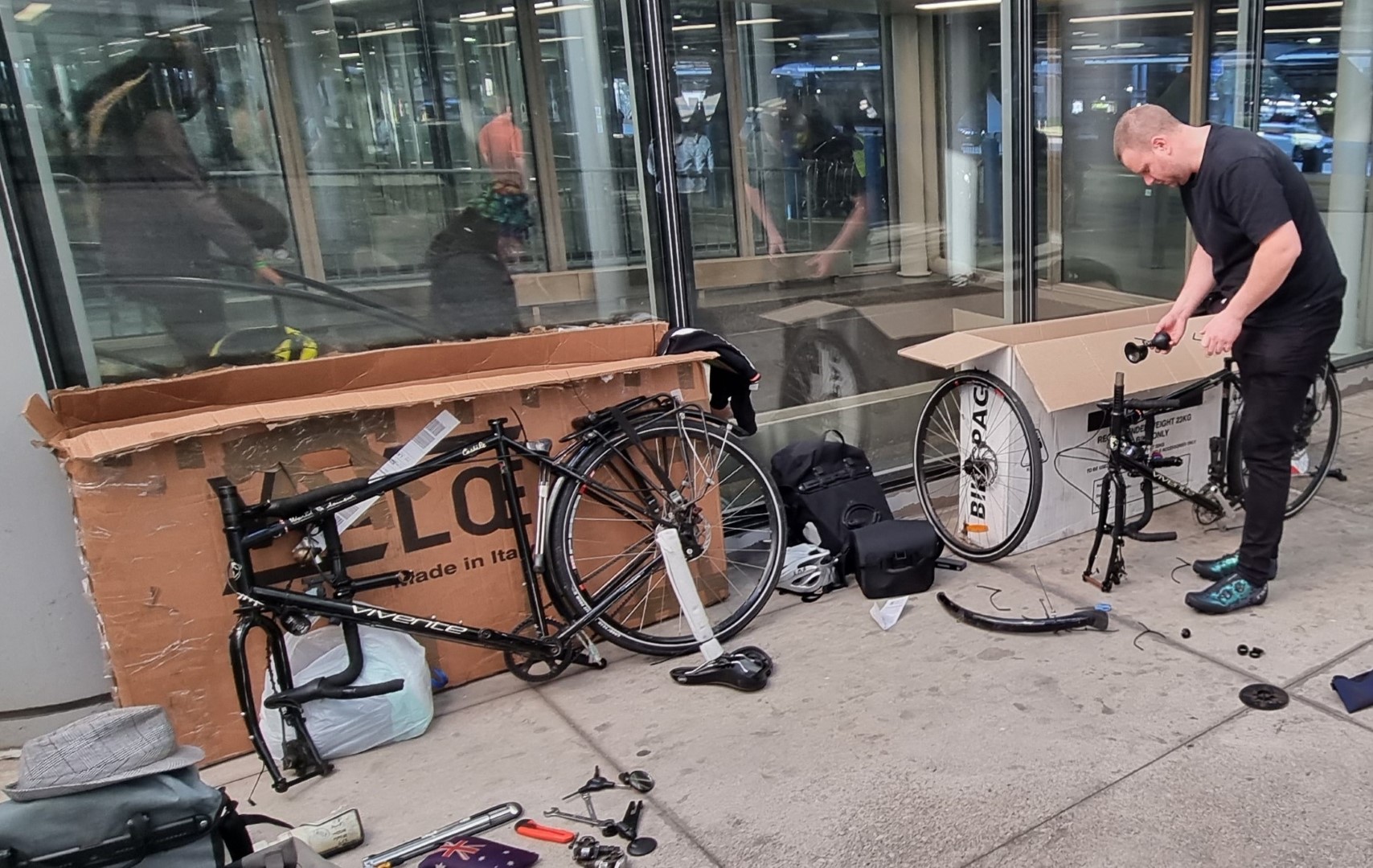
For starters, you cannot buy a bike carton at an airport. We have Qantas return tickets which means, even though we are catching AA flights from Chicago to Los Angeles, we are covered by QF baggage rules. So, we just need to pack the bikes somehow.
We choose a motel 5km from the airport that has an airport shuttle service. We can do the packing at the motel. There’s no bike shop for miles and, even if there was, how would we get cartons (if they had any) to the motel?
It’s raining and there are no taxis anymore. But nearby there is a storage place that sells removalist boxes. These are only 3-ply cardboard so are not really strong enough, but we have to make do. Learn how to pack your bike without a carton. In addition to the cartons, and from a hardware store, we buy a box-cutter, tape and zip-ties and some thick rope. We tie the rope to the headtubes and rear rack so that anyone wanting to lift the bike is forced to lift with the rope. It works perfectly.
Test Reports
Goodyear Transit Tour 700×40 S3 tyre
There was some glass on the roadsides, and I did get a flat due to a piece that probably would have punctured any tyre.
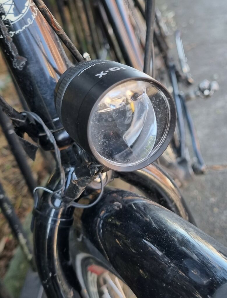
Busch & Muller IX-Q headlight
We have no issues with this headlight. It is the best light we have ever had. You leave it turned on all the time (DLR-Day Light Running).
Traffic can see it from a great distance. It does not blind oncoming cyclists on paths due to the beam shape. At 100 lux, it is bright enough and wide enough for very dark nights.
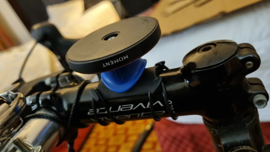
Rokform and Magsafe smartphone mounts
Our Rohloff bike has a Rokform mount and an android phone. We have used this mount for several years without ever having the phone come off. The Deccan bike was fitted with a Quadlock clamp with a Magsafe wallmount attached to it.
The iPhone was in a Magsafe case. Unfortunately, it did come off once when the bike hit a large pothole at speed. The phone survived with scratches, but it could have been smashed by traffic.
Google Map Route management
We’ve been test-riding and improving touring bikes since long before the internet was created. In the last 15 years google maps have been a steadily improving map option.
This ride was in the USA and there you can rely on Google Maps. Of course, that does in turn rely on you being on-line. Being able to zoom in and out, whilst riding, and confidently getting through, for example, massive road interchanges make the old paper-map days just a bad memory.
A post-Covid, A-to-B ride, from Milan to Brussels. If felt strange to be on a big plane again. A 100% packed A380, with everyone wearing masks. Everyone was going to Europe, and nothing was going to stop them.
I’d cycled across northern Italy before but not as far north as the lakes. And I’d cycled through Switzerland a few times but had never crossed the alps that separate Mediterranean and Germanic Europe.
There are a few routes, but I chose the Nufenenpass and the Grimsell Pass. These days there is the Gotthard Road Tunnel, which is 17km long and starts near Airolo in the south. It keeps most of the traffic off the old road over the mountain pass which is good except that there are a great number of motorbikes. On the Grimsell pass, for every 100 “vehicles”, 65 are motorbikes, 30 are cars and 5 are bicycles. That’s a lot of bicycles when you see the size of the alps. In most countries, on big mountains you see no bicycles.
Once over the mountains, I spent a few days in Interlaken and then headed to Rheinfelden near Basel, before turning west into France, at first on the Moselle, and then over to the Meuse Valley. This was supposedly a EuroVelo route (EV19) but the start of it is still in the planning phase.
The Lorraine region is a great cycling destination, and it was busy on the bike routes. The Meuse eventually reaches Belgium. I departed from Brussels, heading back to the Tasmanian winter.
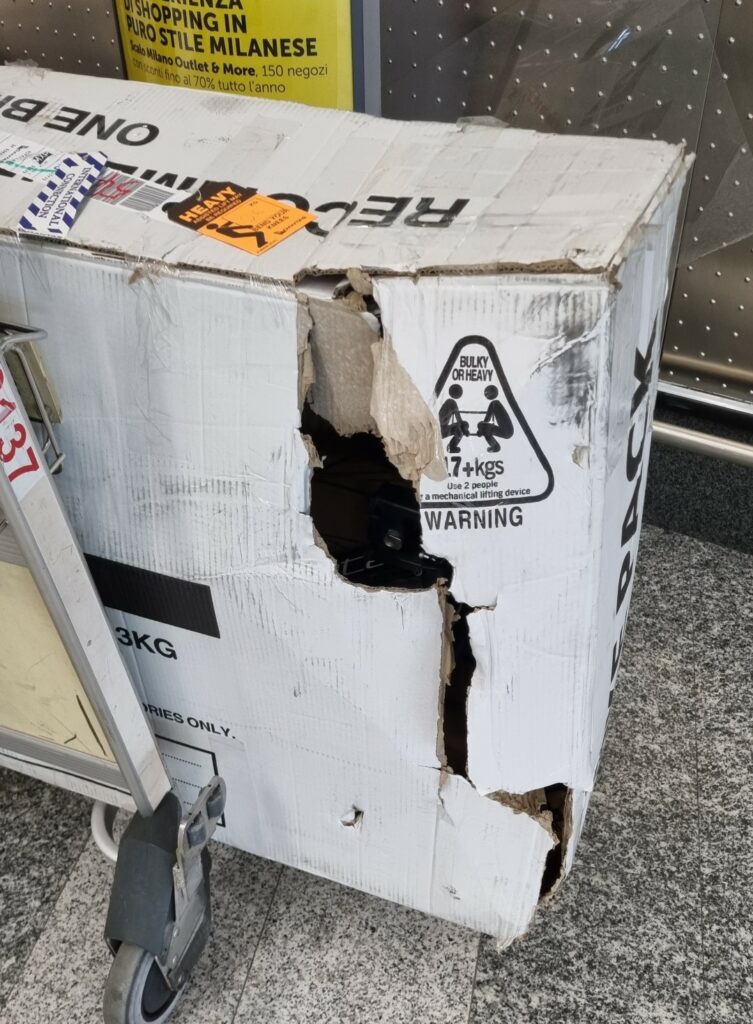
Bad start. My carton had been damaged. Most likely because it was raining in Melbourne when the small plane from Tassie was being unloaded. Nothing had fallen out because I always attach things to the bike because this damage can happen.
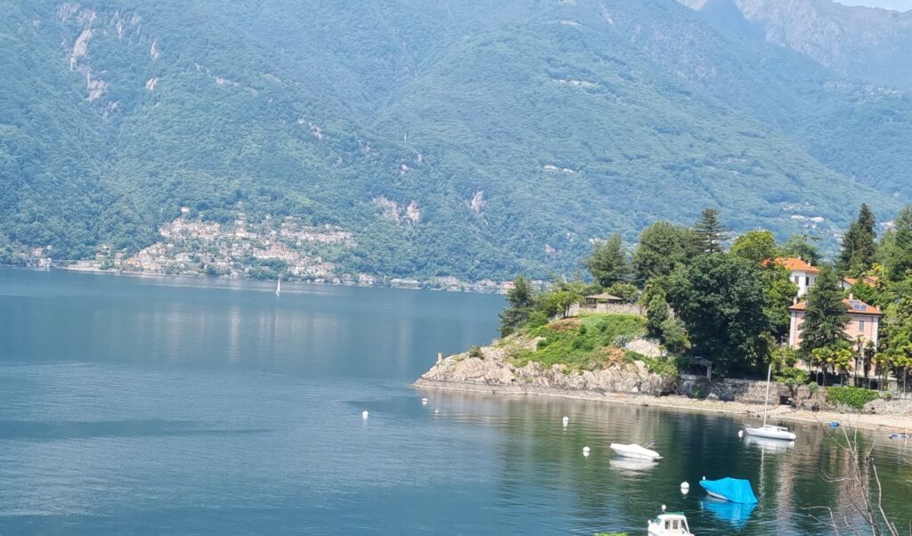
The Italian Lakes. This is Lake Verbano. There are bikes everywhere, mainly roadies in training.
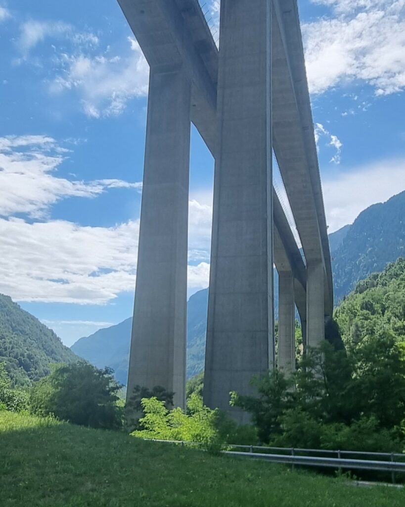
Starting to climb
Stone roof. It is always amazing to see this. Imagine the weight of it!
Out of Airolo the climb gets underway. Weather is ok.
Atop the Nufenenpass. About 2,500m. It’s ridiculously cold. According to Fabian Cancellara, this is the hardest climb in Switzerland. And he doesn’t have panniers! That night I stayed in Ulrichen.
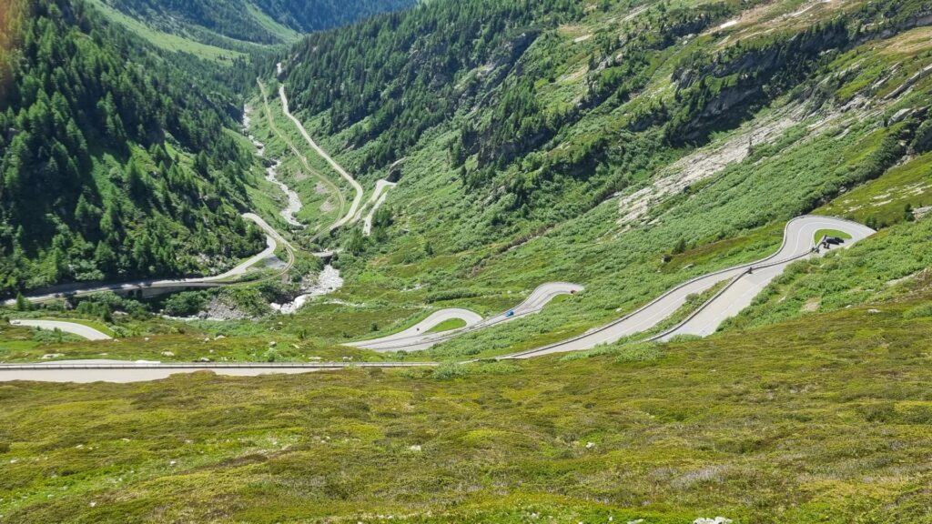
Climbing the Grimsell. This pass is a bit lower (2,160). The descent on the north side to Meiringen is 1,650m in only 32km. So, you need good brakes.
The Swiss scenery is classic.
More classic scenery. The bicycle is the way to see it as you can stop whenever you want.
Farmhouses east of Bern. I always stay at Airbnb’s in this part of the world. I look for places in or near villages that have a supermarket.
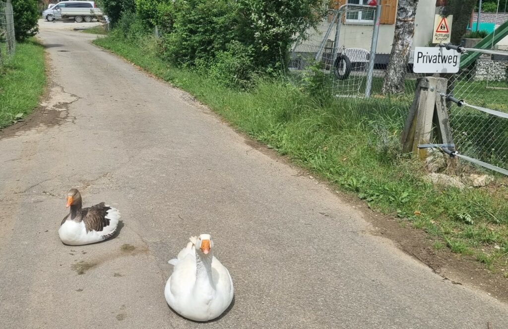
The bike path goes left here, and this pair make sure that I stick to the route. I could not capture it on the shot, but they gave me a nasty greeting.
After passing the corner where France, Germany and Switzerland meet, I’m heading down the Moselle bike path.
After passing the corner where France, Germany and Switzerland meet, I’m heading down the Moselle bike path.
Back at Place Stenislas in Nancy. I rode through here years ago. This is a stunning baroque square that is impossible to capture in one photo.
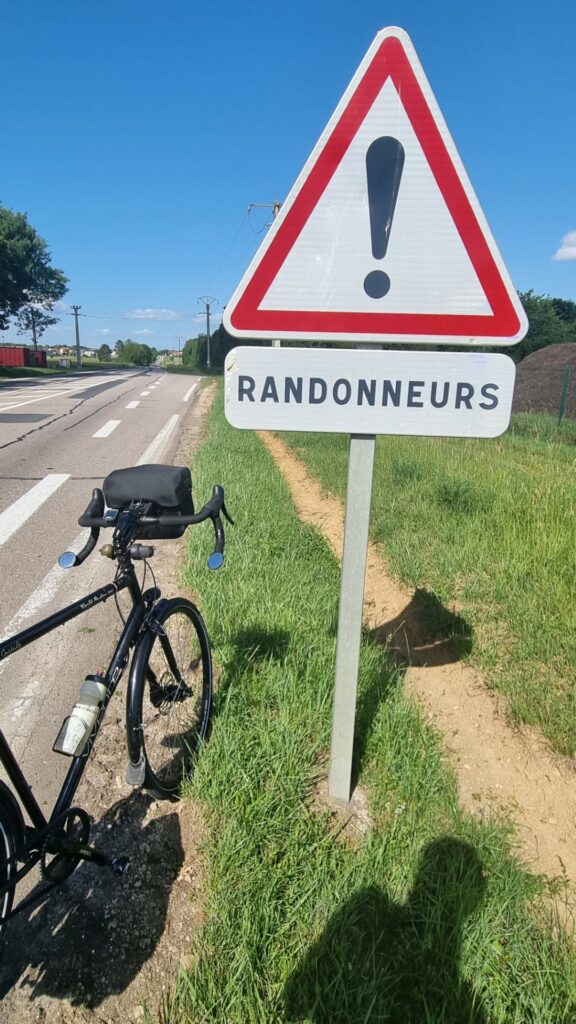
In the Lorraine region, motorists are urged to take care and respect travelling cyclists (randonneurs).
The Northeast of France is gorgeous. A real pleasure to cycle through.
A few days following La Meuse which is quite popular with randonneurs.
Into Belgium.
In Belgium, cyclists are everywhere. This is the bike parking outside a train station.
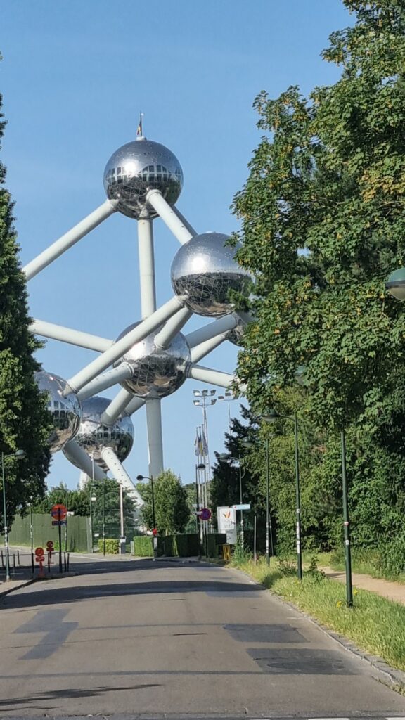
My tour ends in Brussels. I call into Velonaut, a great bike shop, very near to the Atomium, to see an old friend and he kindly supplies me with a bike carton.
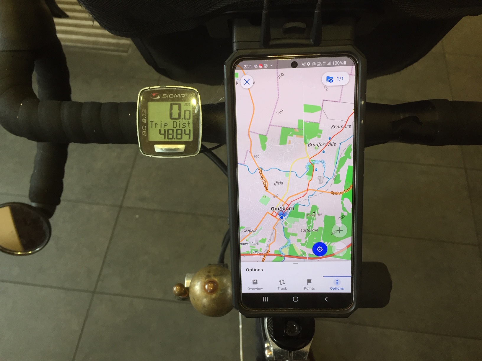
A Covid-period, A-to-B ride, using walk-on and off metro trains to access both ends of the route. We start in Bathurst and end in Goulburn, to catch a train back to Sydney. Riding out of Bathurst, we visit Orange, Mandurama, Cowra, Canowindra, Forbes, Parkes, Eugowra, Grenfell, Young, Harden, Galong, Boorowa, Crookwell, Taralga and Goulburn. 900km, mostly on secondary roads. We will write up a discussion about this as a case study in finding and managing routes within reach of the big cities.
We are both on Rohloff models. A Swabia (700c with 40mm tyres) and a Castile (650B with 2.25” tyres). Last January we rode the Central West Cycle Trail, a mostly gravel road ride, slightly to the North. Then we were both on 40mm tyres and did not think at the time that we needed wider tyres. This time the route is mostly on sealed but very low-traffic roads. I’m interested in observing how the off-road tyre version is to ride on tar. Does it feel slow? How do the fatter tyres handle? Can I still come down hills fast?
This region can be hot in January. But if you look at the averages, it is not too bad. We have a few days around 35℃ but most are mid to high 20s.
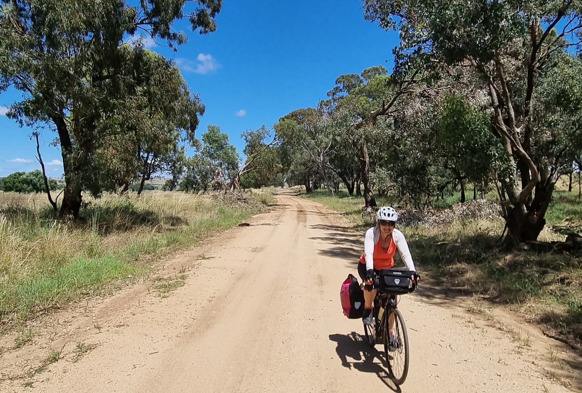
We start this tour with few real plans and no accommodation bookings beyond Bathurst. Each night we check the weather (wind and rain) and look for back roads using OSM and google maps. This is one of the best things about cycling on the western slopes of NSW. It is a vast area with towns large enough to have lodging in any direction. Mostly there is a main road plus optional back roads, many of which are sealed and yet quiet. We could zig-zag in many ways.
Wiradjuri Country
The ride is almost all in this tribal area.
The first Europeans to arrive simply followed tracks that the indigenous people had travelled for tens of thousands of years and now we are riding many of those tracks.
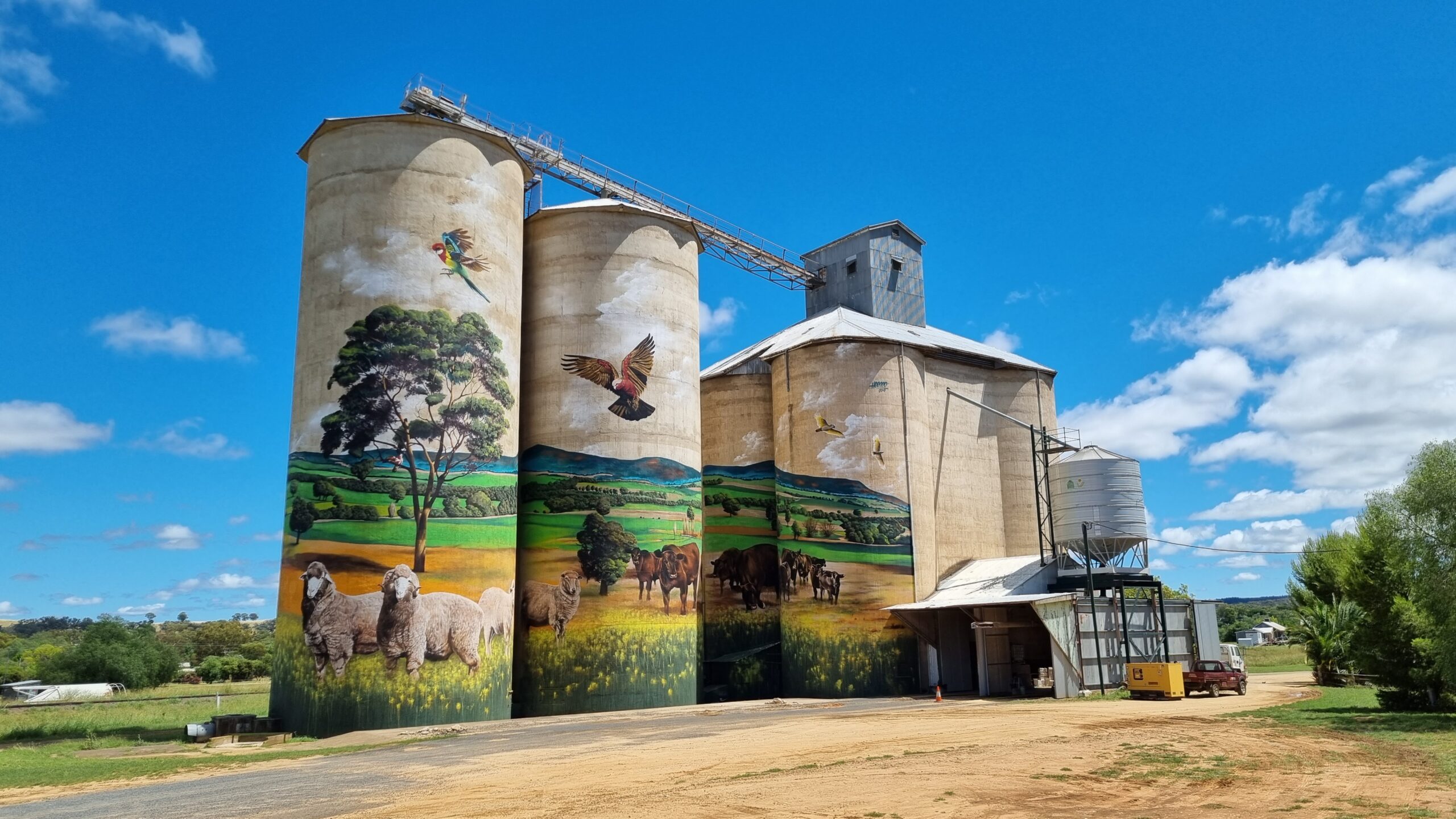
Painting massive murals on grain silos is a thing in Australia. This is a particularly good example at Grenfell. The design was a local collaboration and the artist was a Mongolian!
South of Harden. The local council is a consolidation of former and smaller councils. This is now aptly called Hilltops.
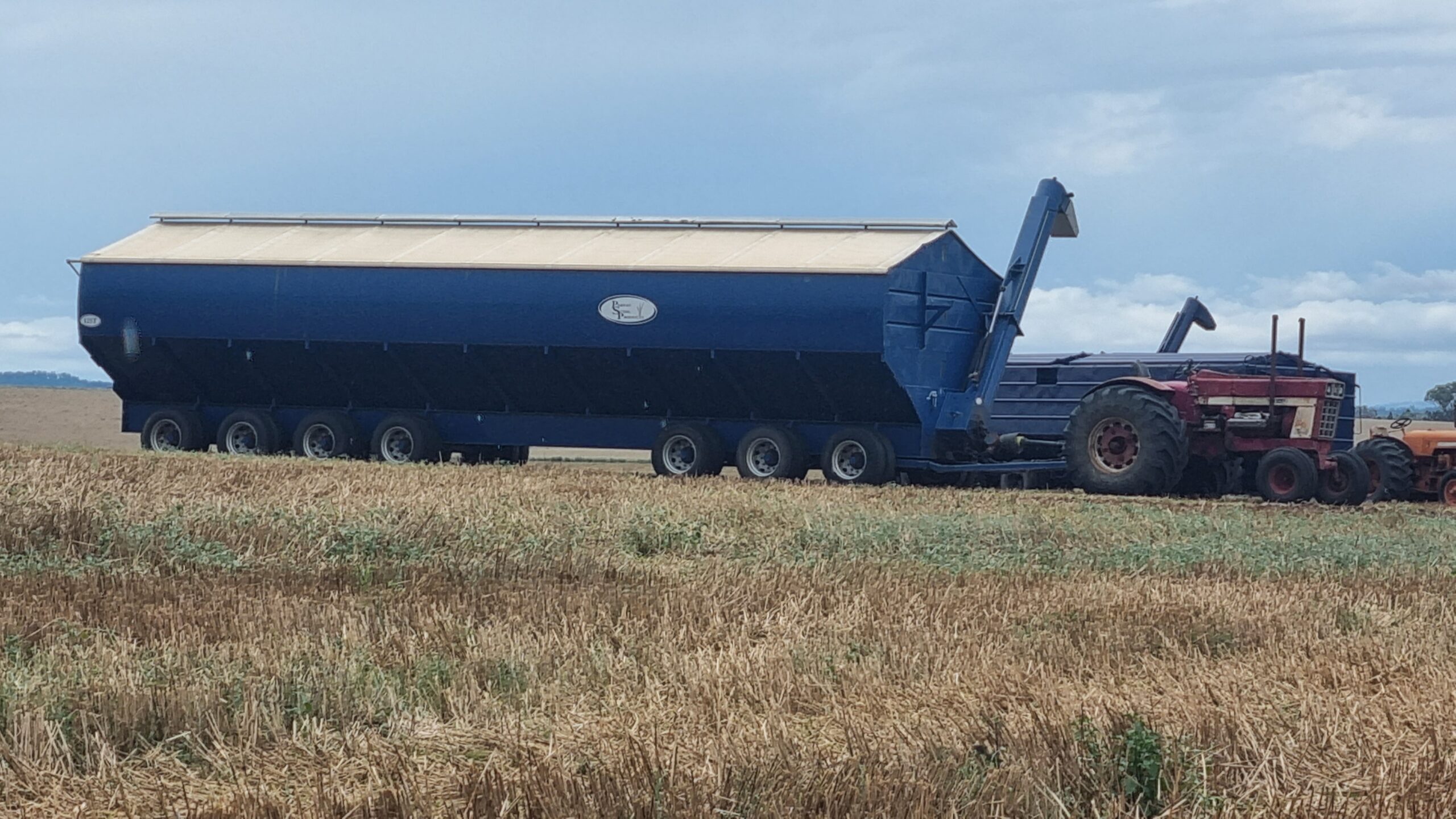
The wheat harvest has just finished. This is a bin that the harvesters transfer their grain into. It can take about 150 tons.
Around Canowindra we came across this interesting modification of a Vivente. Some people like drop bars, especially for the location of the brake hoods, for riding and for being able to occasionally use the drops. But sometimes they wish the bars were wider. I had this issue on the Munda Biddi Trail in WA. This pic shows accessory drop bar ends attached to a 35 degree swept -back riser bar. Is it a riser bar bike with drops or a drop bar bike with riser ends?
Many of the towns ignore the fact that until less than 200 years ago, the land was owned by the Wiradjuri.
They never ceded sovereignty. Forbes, as a town, is an exception. On the lakeside there is a beautiful park dedicated to the Indigenous people.
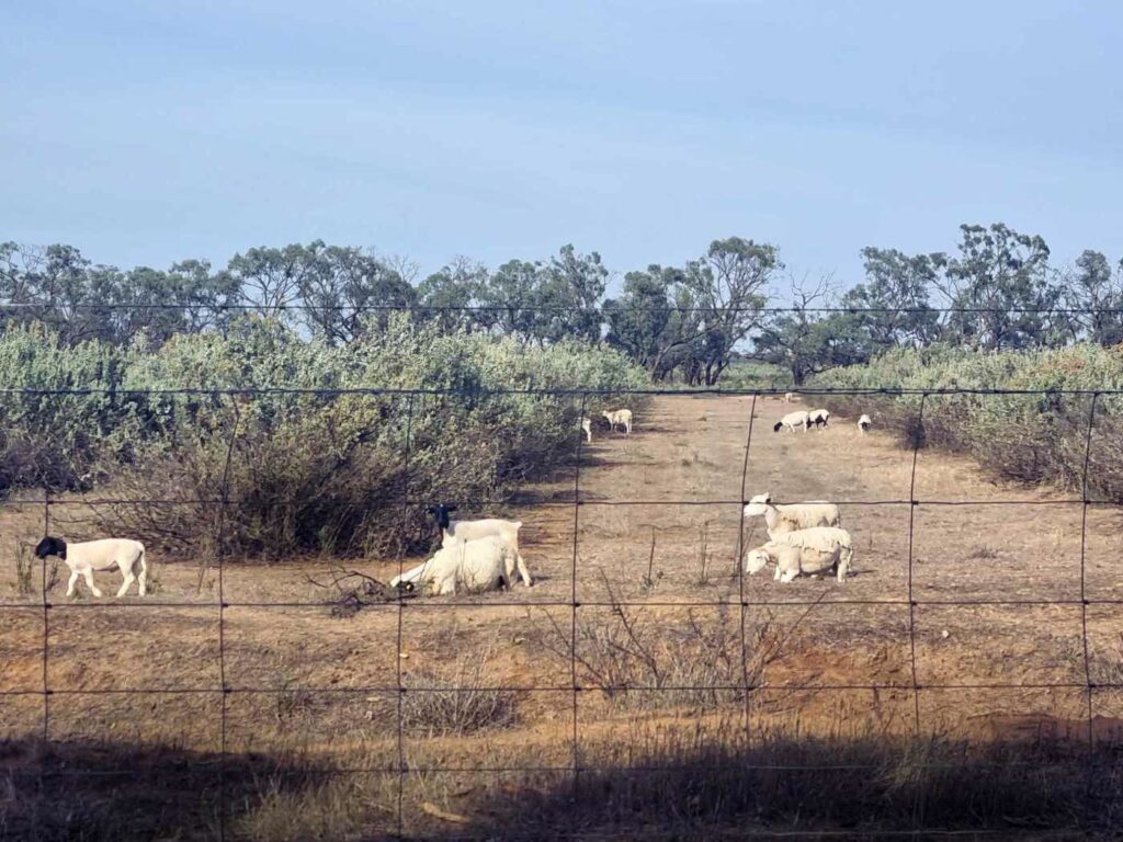
We are in sheep country most of the way. Prices are high and the farmers are happy.
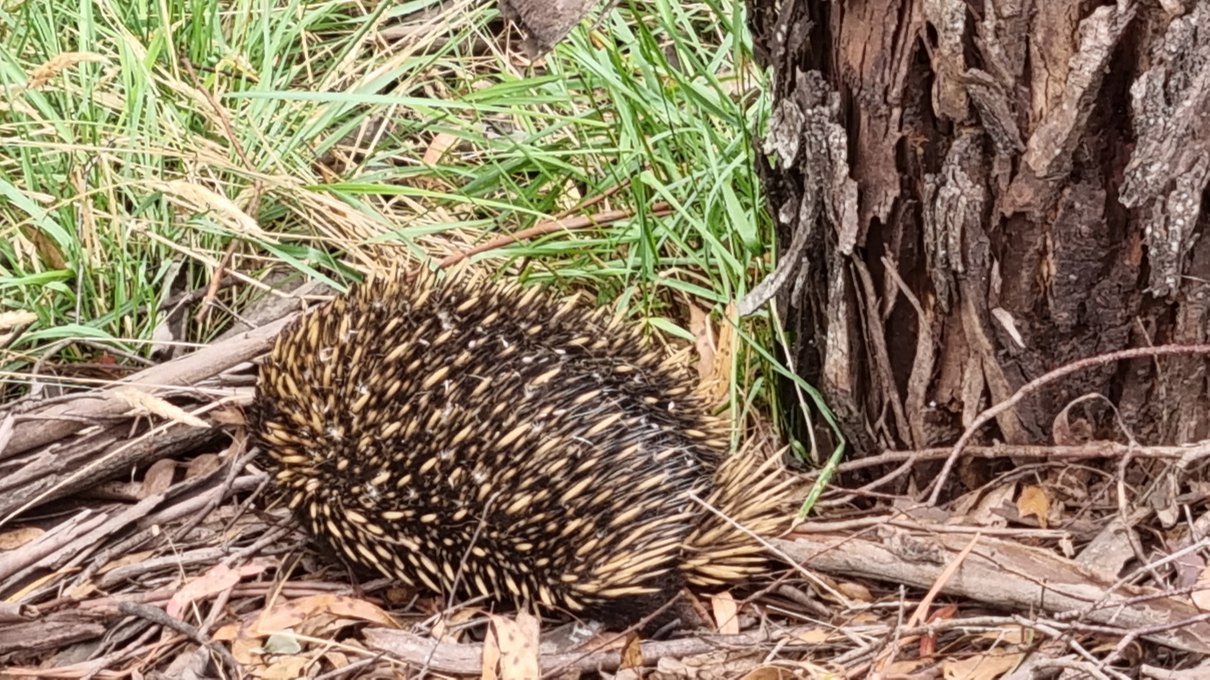
We are seeing a lot of animals but it’s hard to get pics of wildlife when you are riding a bike. This is an echidna but we also see turtles, superb parrots, peregrine falcons, snakes, blue-tonged lizards, foxes, kangaroos, magpies, white cockatoos, galahs and many other birds.
Between Galong and Taralga there are Superb Parrot sanctuaries The roadside trees are very old with lots of hollows. We see some huge wombat holes but no wombats in the daytime.
Every day there are options to take the quieter roads.
So many fruit trees on the roadsides. Also, asparagus that must have escaped the farms and can be easily picked for a snack.
Travelling along.
We stay in lots of classic old pubs.
A scar tree. One of many still there in Wiradjuri Country.
It’s a wet season and we manage to ride just after rain on several days. There is such an amazing smell in the air the from the eucalyptus.
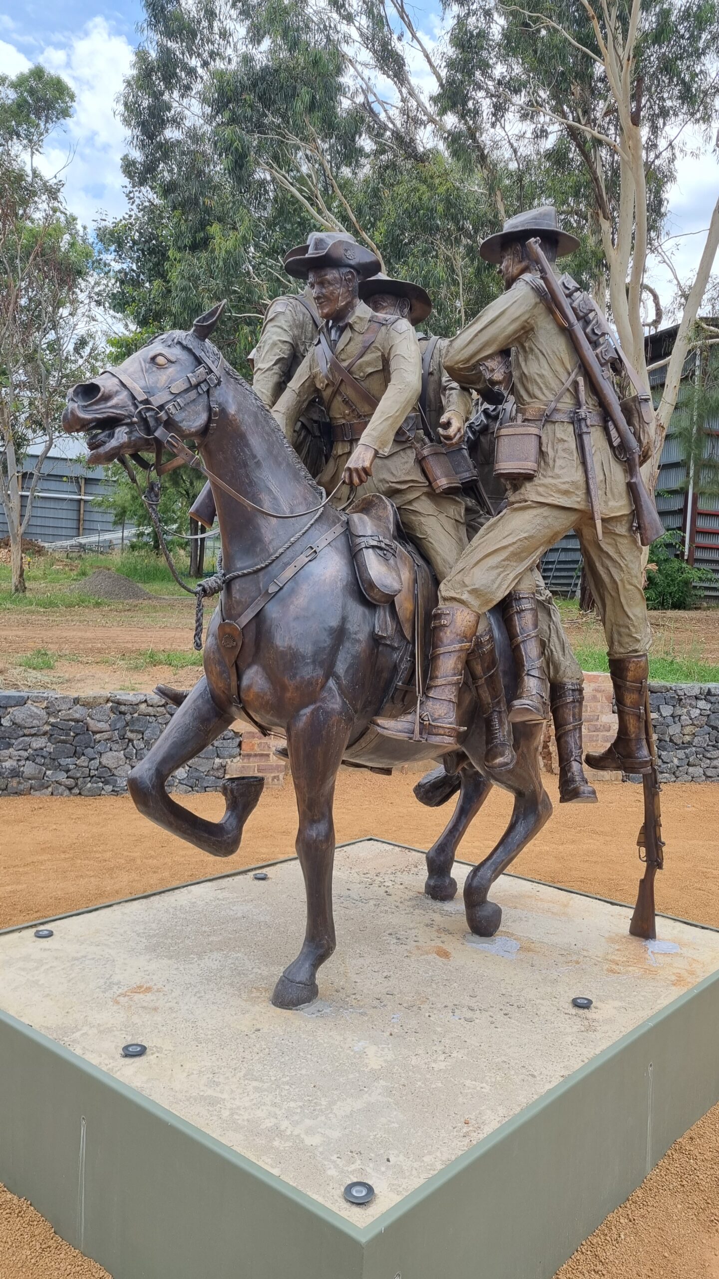
This is a really-worth-stopping-for piece of bronze work in Murrumburrah. It commemorates a horse, from that region in WW1. A horse that saved a lot of people.
We are at Goulburn station now.
I’m using my S21 (android) smartphone a lot on this ride. It is mounted on a Rokform mount that attaches to the top of the steerer. It can be tilted. I have a strong urge to be able to
- carry just one device
- refresh route planning any day
- not need to have phone/internet connection during the day,
- not need to carry power packs
- have a highly detailed and easily obtainable map (of anywhere) able to be embedded in the device
- always know where I am in relation to a planned embedded route
- to be able to view whilst riding
- to be able to share the route as a clean gpx file
- be able to zoom in and out
There is one step that is still unclear and we plan to raise it in a news posting soon.
A COVID-period ride in Western Australia (WA), made possible because I was in Tasmania, the only eastern state from which you could enter WA in November.
The Munda Biddi Trail was opened in 2013 and at the time was stated to be the longest (1,050km) off-road bike trail in the world.
“What is the widest tyre I can put on with the mudguards still fitted?”
It’s a region that gets most of its rain in winter so winter was out due to wetness, cold (and the need to carry more clothes), and short days. I chose the last week of November and into mid December. From the logbooks in the huts the most popular times are May-April and September-October, the latter being the best for wildflowers.
Bike-wise, primarily this is testing a 2.25” wide tyre, Rohloff version of the World Randonneur bike from recent production, fitted with 650B rims and tyres and wider mudguards. Over the last 7-8 years a frequent question has been…”what is the widest tyre I can put on with the mudguards still fitted”. Using 650B, it is probably 2.8”.
This is a long ride. It will really test several issues that might not be as noticeable on a day ride. Front suspension is one. Many off-road trails are not actually rough, but this one is. You are going over seas of big gum nuts, lots of fallen branches and some rocks. Will the lower pressure, bigger front tyre make it ok for my hands and wrists or is suspension necessary? To find out I’m testing a suspension stem. “Bottoming out” is the problem that all other suspension stems suffer from. But this one can’t bottom out.
I am also gathering date for electronic engineers that are working on better ways to save power via a reengineered dynamo hub and a super-capacitor storage system. A prototype front hub is fitted.
The Munda Biddi is undertaken from the North or from the South. I’m starting in the North in early summer knowing that the climate is a bit cooler and wetter in the south.
Although it is off-road, the MBT goes through several towns. There are caravan parks with tent sites and cabins, Youth Hostels, pubs and motels.
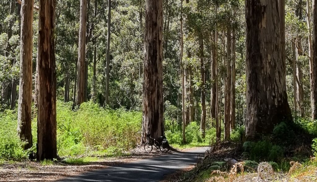
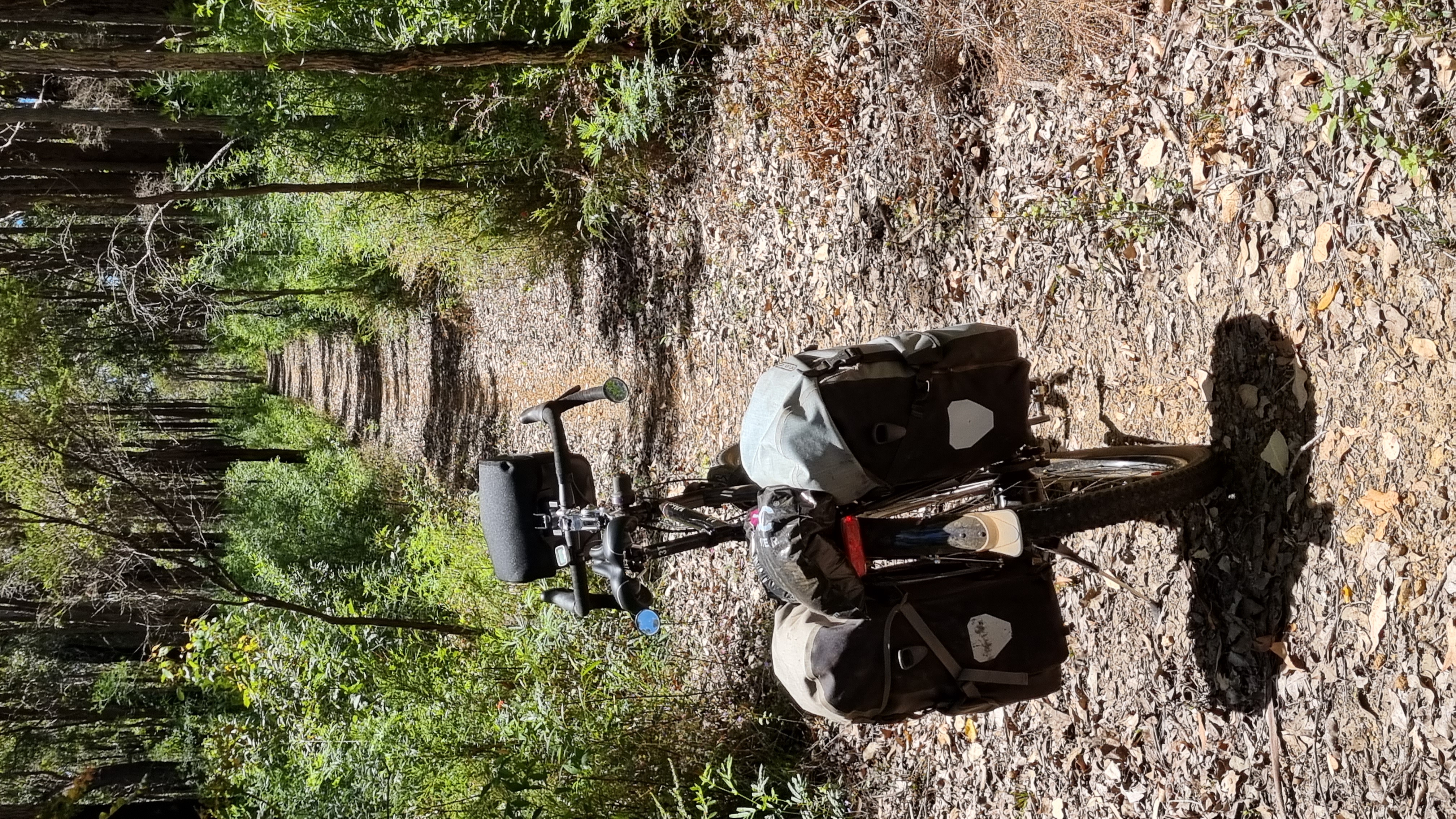
Mostly you are in forests.
In between most of the towns there are huts. You can’t book them. They are not getting maxed out. In fact, it’s common to be the only one at a hut.
It is recommended to carry a personal locator beacon (PLB) because there is no phone coverage in large areas. On this ride there were two pairs of days when I did not see another human. I found myself descending gravelly steep hills very carefully.
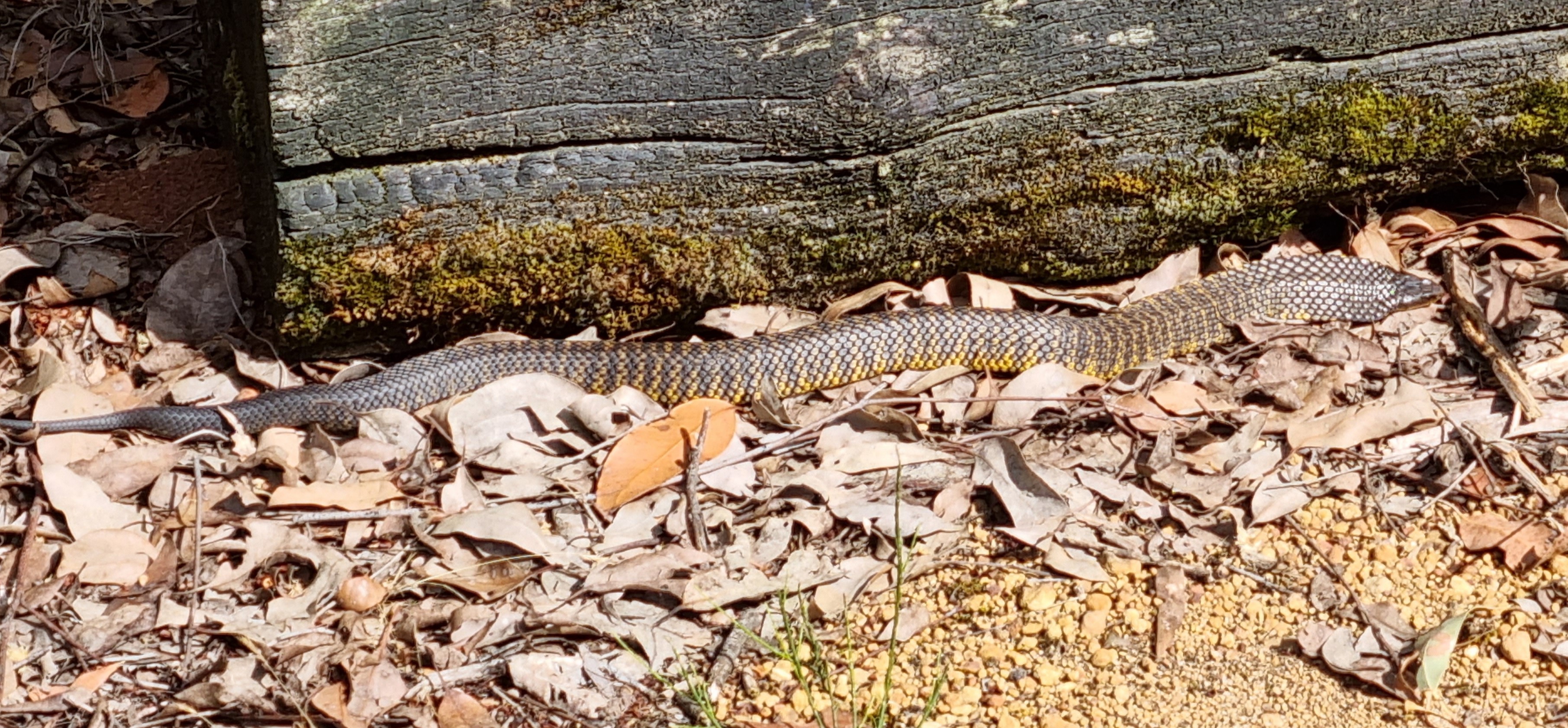
I really didn’t want to come off and possibly be stuck. There are a lot of snakes. People carry a compression bandage for this purpose. Bites are very uncommon, but you can see in this picture, taken near a hut, how you could be just walking around, step over a log and startle a very deadly snake.
The huts really make the ride. They are very well designed and are made to last probably over 100 years. They have good roof water. The gutters are covered with wire mesh and there is a first-flush system but no showers or electricity.
You get to stay in a town the next night and find a shower.
There are logbooks and note books in the cabins. In them there are a number of reports of people having to pause or stop the ride due to equipment issues, all of them around rear derailleurs, chains and cassettes.
There are a lot of sticks and branches that you can’t avoid. Cyclists with rear derailleurs told me they are on high alert to brake instantly they hear the sound of something getting caught. That does not happen with a carbon belt.
The Rohloff advantage of being able to change gears whilst stationary really came into its own. I’d see a hill and think I could get up it but often I’d get to the rear-wheel-spinning stage and have to get off. There’d be no time to change down and after a short walk I’m ready to start riding again. Being able to manually select any gear from a standstill is great on trails like this where there is a lot of unplanned stopping.
I’ve never been a walker (beside the bike), but it is happening a lot on this trail. Same with everyone else. But people are often only going 50-70km a day and don’t mind.
On the Gibb River Road, which I did with 40mm tyres, I only walked 100m and on the Munda Biddi Trail, with 2.25” (57mm) tyres, I walked several kilometres.
Already on the second day I was thinking I would have thrown the ride in if I had 40mm tyres as on the road-tourer.
Here I only have 35psi so I can ride on bits that I could not ride on with 55-60psi in Schwalbe AlMotion 40mm tyres.
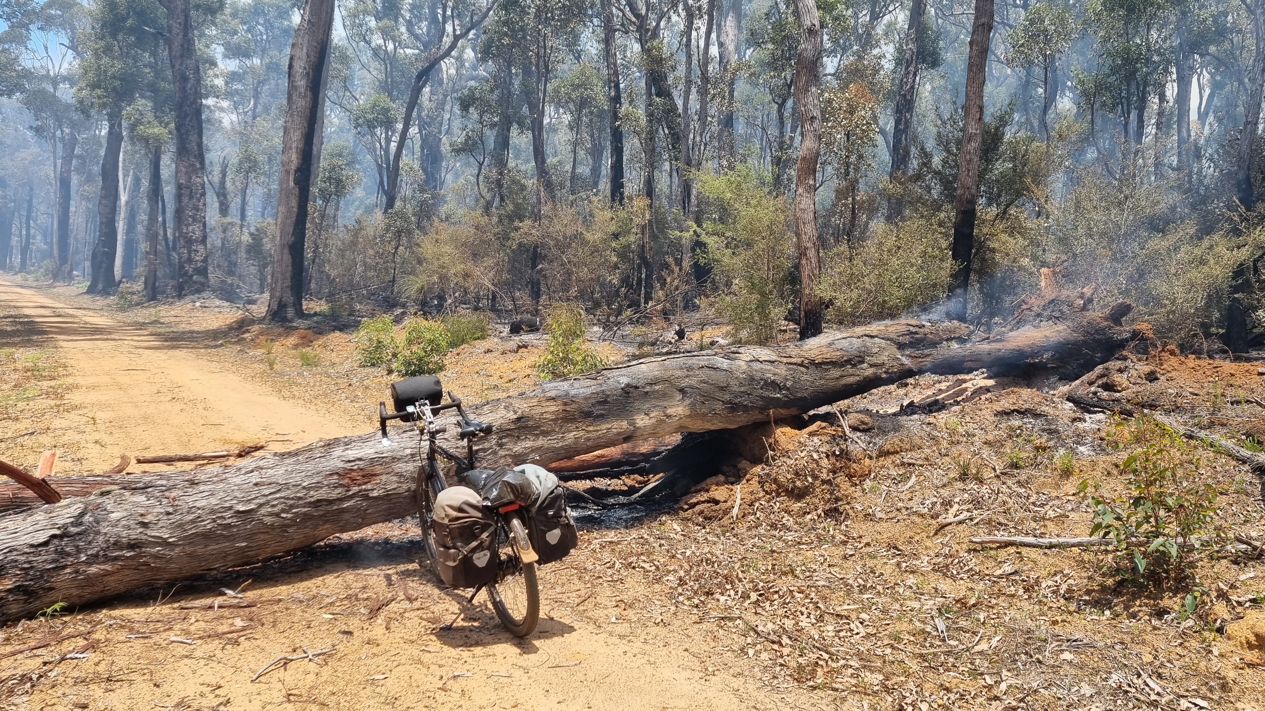
There is some controlled burning at the moment. In this case the diversion tape must have been removed and I am on a 10k section that is still burning.
Panniers are easy to remove and return. There are a lot of logs needing to be got over.
A BOB trailer would be disastrous.
Trail maintenance goes on
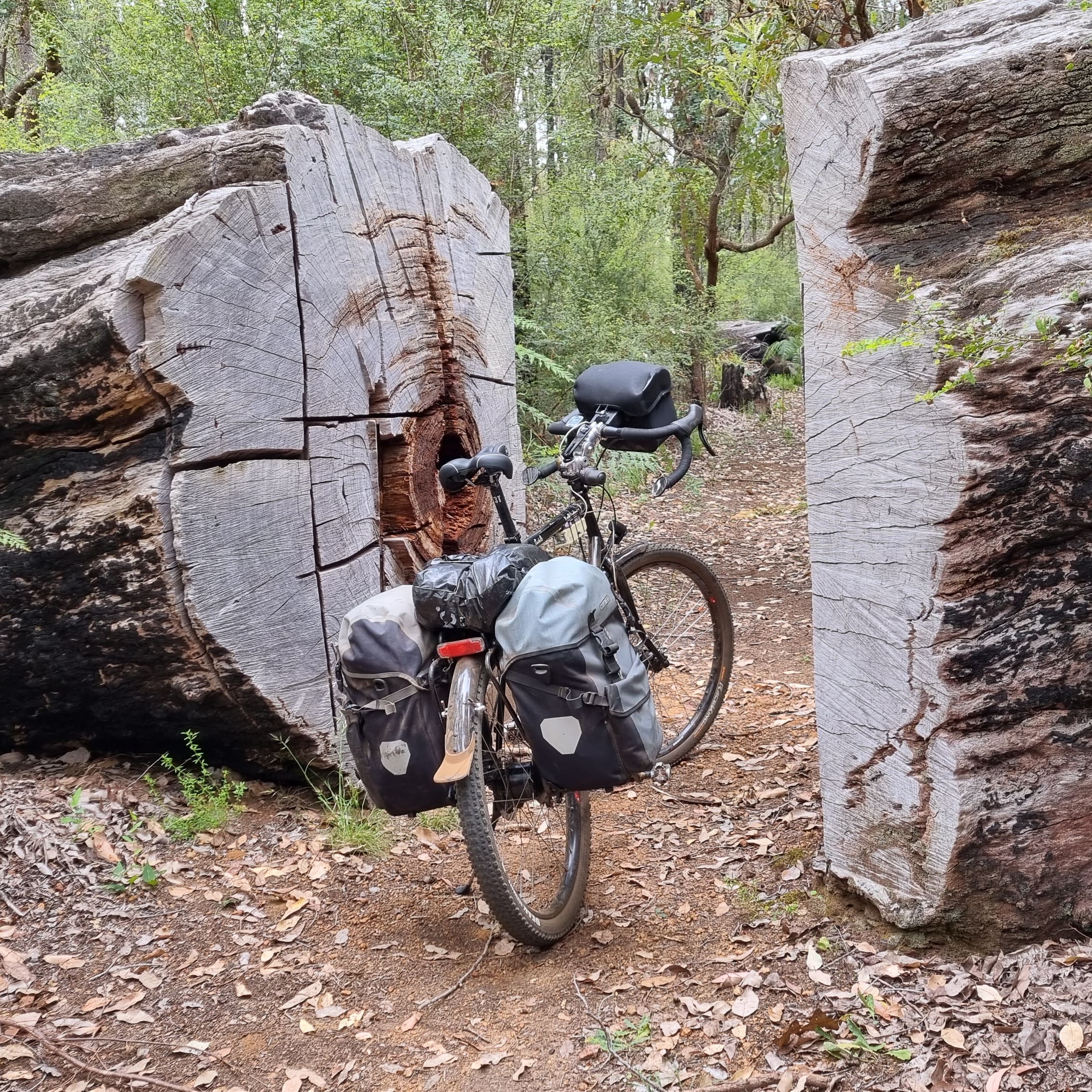
Not all of the fallen trees need to be clambered over.
This is one of the biggest. You can’t just walk around them with the bush being so dense and the trees so tall.
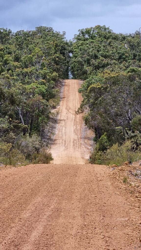
The notorious Munda Biddi pea gravel
Without a doubt, the worst thing to ride on. It’s like trying to ride on ball bearings. There is a lot of it.
Especially in the quieter months there are lots of places where you would see no one else for a day or two. Many are really beautiful, like this very old railway bridge that has been restored for cyclists.
If you happen to be fascinated by ant nests then you’ll love the Munda Biddi Trail. There are many impressive ones of many different types. There are also a lot of lizards that try to invade ant nests.
Sand is hard to ride in and there are several stretches of it. In my few weeks on the trail, it only rained once and that was at night. The next day I found that the sand was a lot easier to ride over. Probably, riding the trail in wetter times is ok in this sense.
But there are also a lot of sections prone to water logging where you would have to get off in those times.
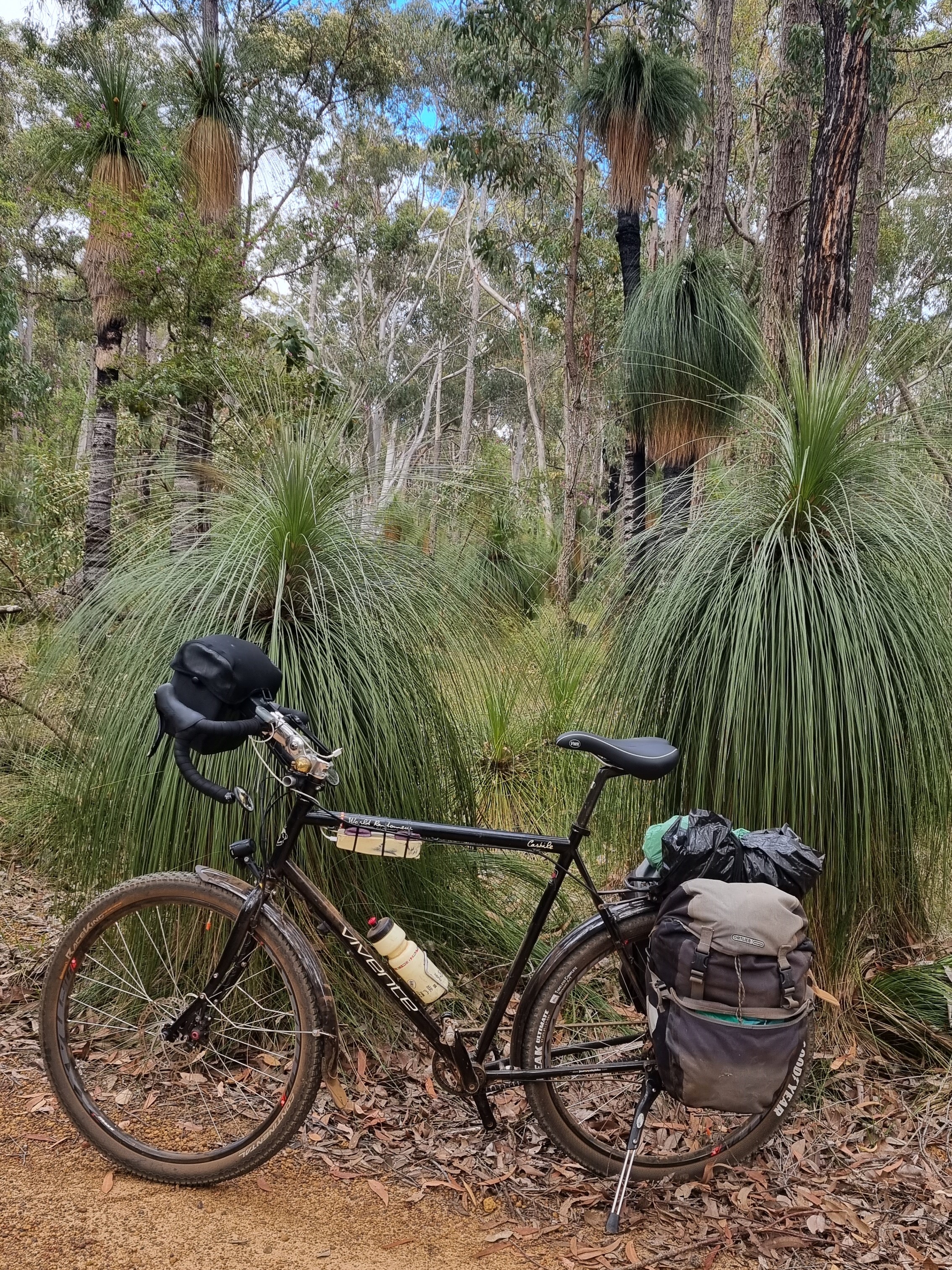
There are lots of these classic Western Australian grass trees.
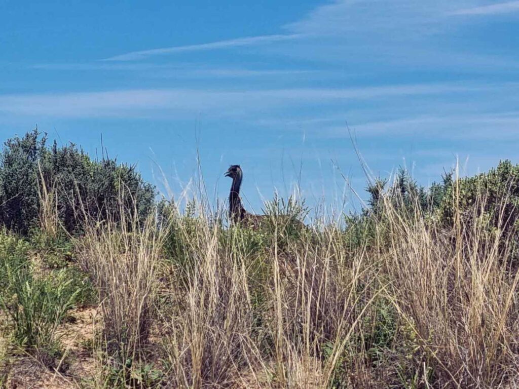
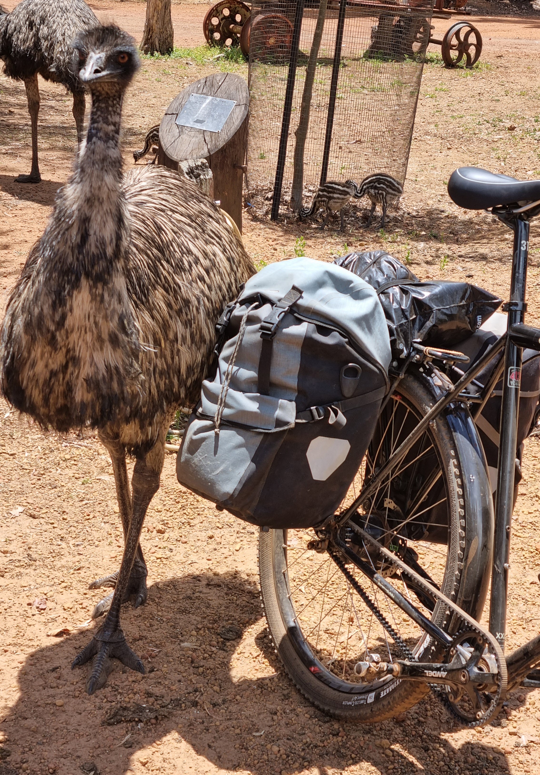
Did you know that the male emu looks after the chicks?
I was not expecting emus. There were a lot. Sightings of the birds are reasonably common.
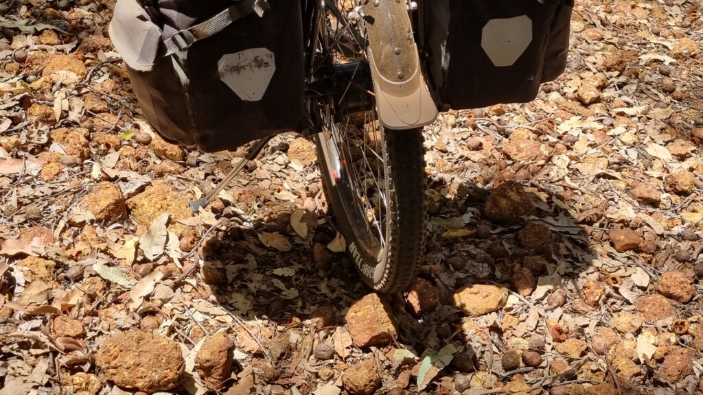
What I discovered was that they have very distinctive shit, and this reveals more about how many there are.
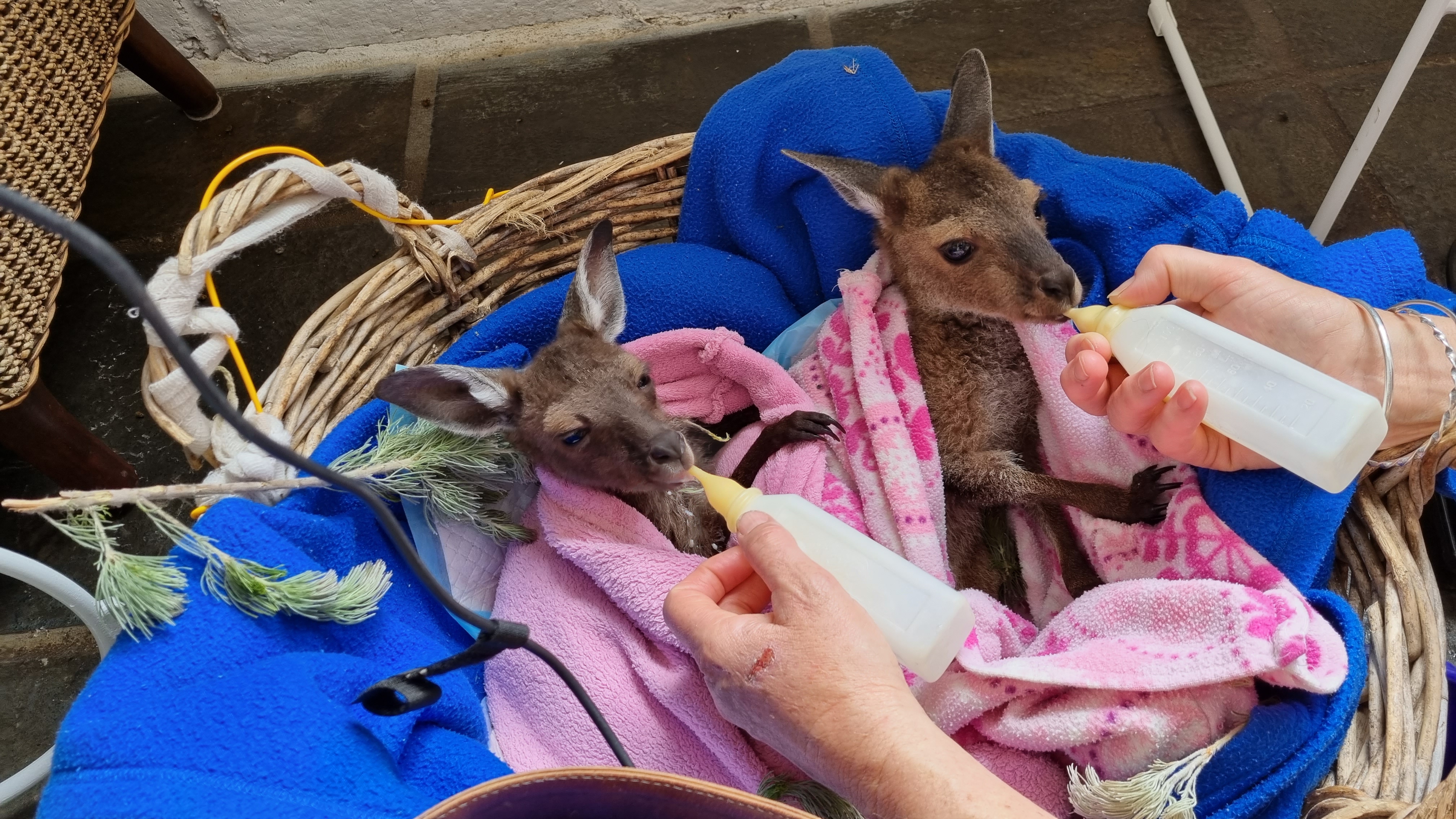
Near Elleker, a very impressive woman runs a wildlife rescue operation. She explained that kangaroos can keep a foetus for up to three years and only let it develop when the conditions are right. They have two nipples and can have one giving milk good for a very young joey while, at the same time, the other is giving milk for a much older joey. How smart and amazing is that!
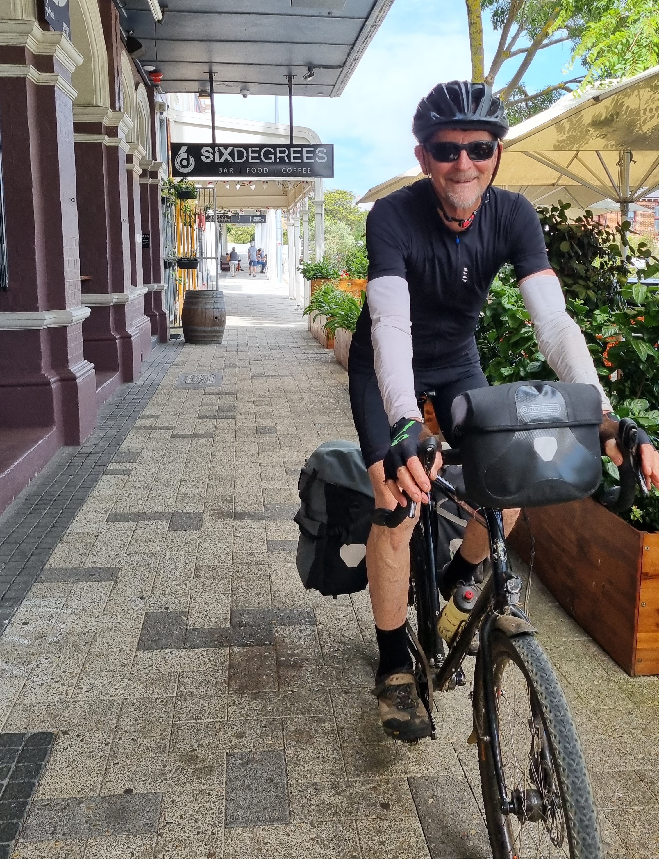
Pulling into Albany
Along the trail, riders share knowledge about where to stay in the towns and the SixDegree Hotel was the place in Albany.
When I researched this ride, I needed to work out how to get back to Perth with the bike. I chose to fly on Rex which turned out to be a small plane. Fortunately, they did accept the bike carton but commented that if it was a full flight, it would have gone on standby.
On the ride, someone mentioned that you can take a bike back on the bus (front wheel and pedals off) as long as you phone them the day before to say that you want to and as long as you can cover the bike to protect other peoples’ luggage. That’s probably the best way.