Trips
It’s a long way from Australia and seeing this part of the world had waited until I was in Europe anyway. Eurobike was in Frankfurt and I flew to Oslo from there. I’m lucky to have friends here.
It’s a big country and I only have a few weeks. In addition to warm-up rides close to Oslo, I’ll concentrate on Bergen to Trondheim.
The roads are a bit narrow so it’s best to find less-busy routes. That’s not hard. There are SO many tunnels and they normally say “No Bikes or Pedestrians” (for good reasons).
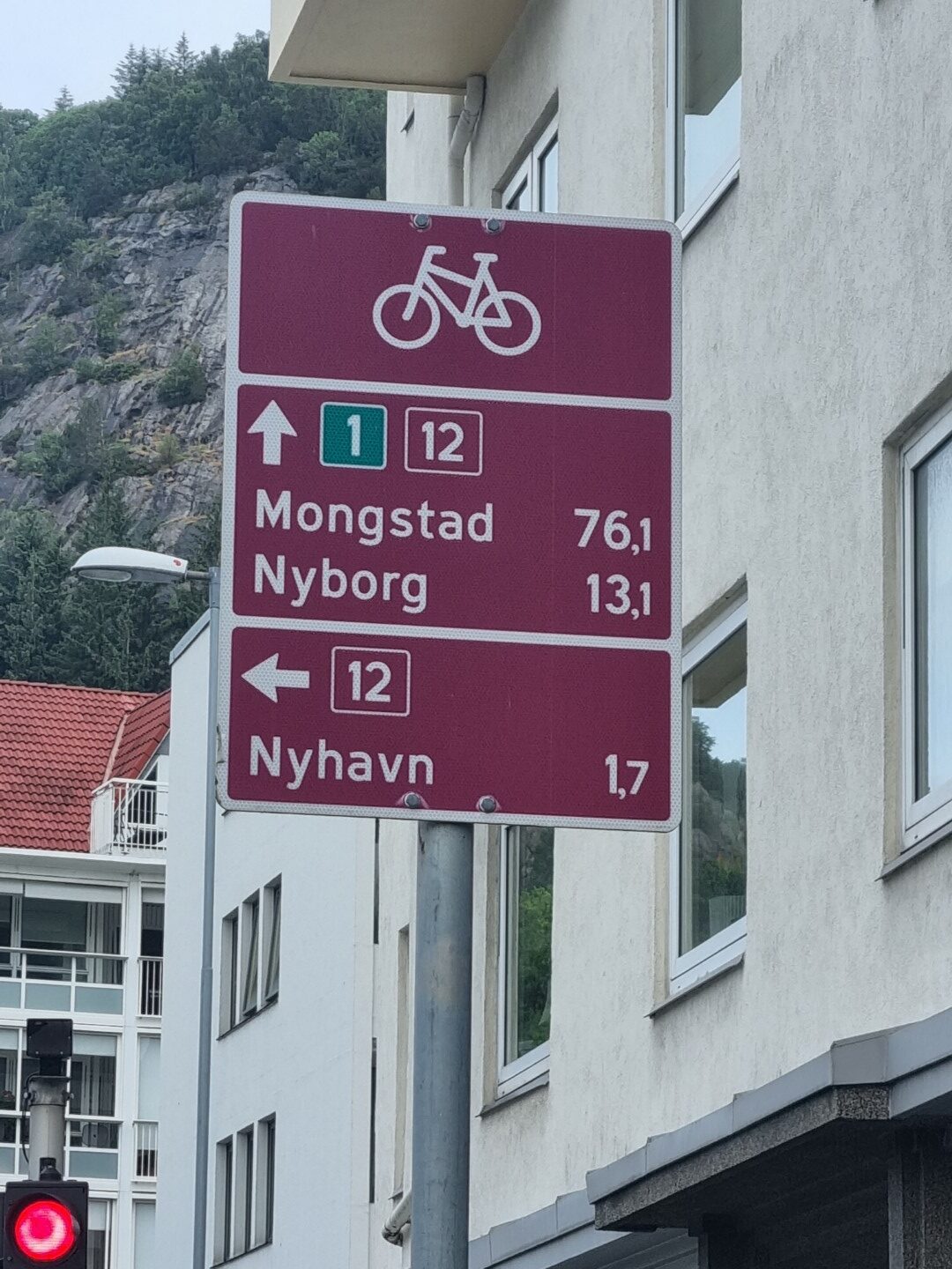
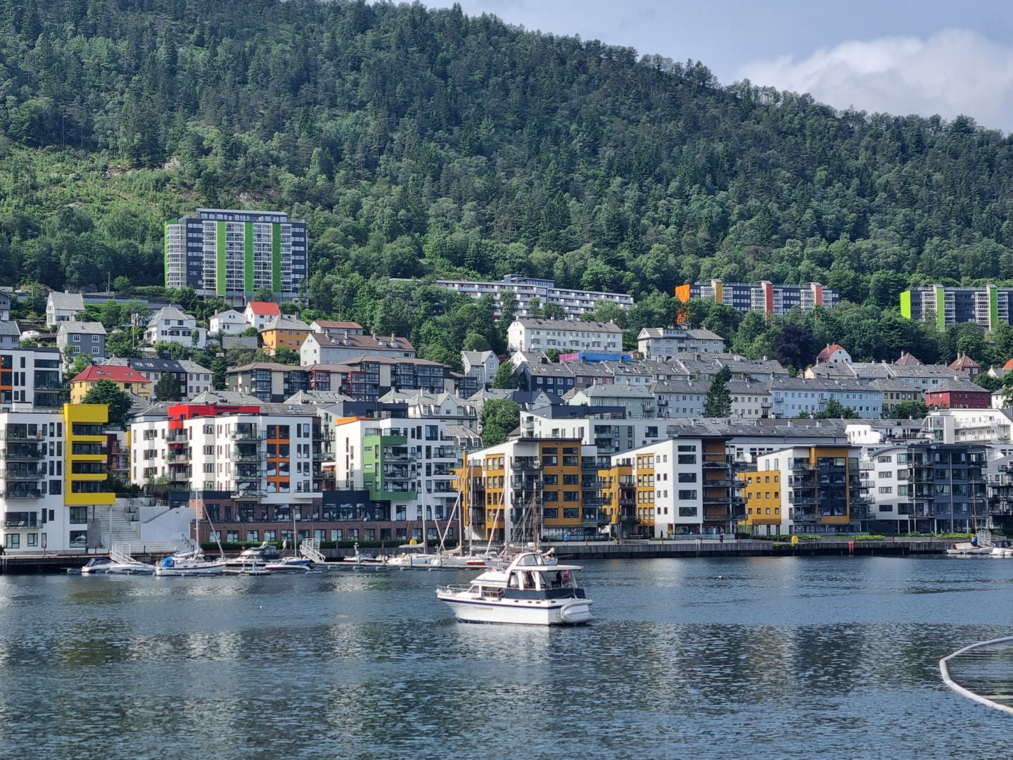
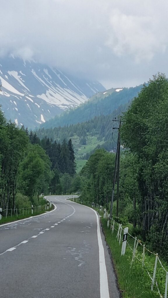
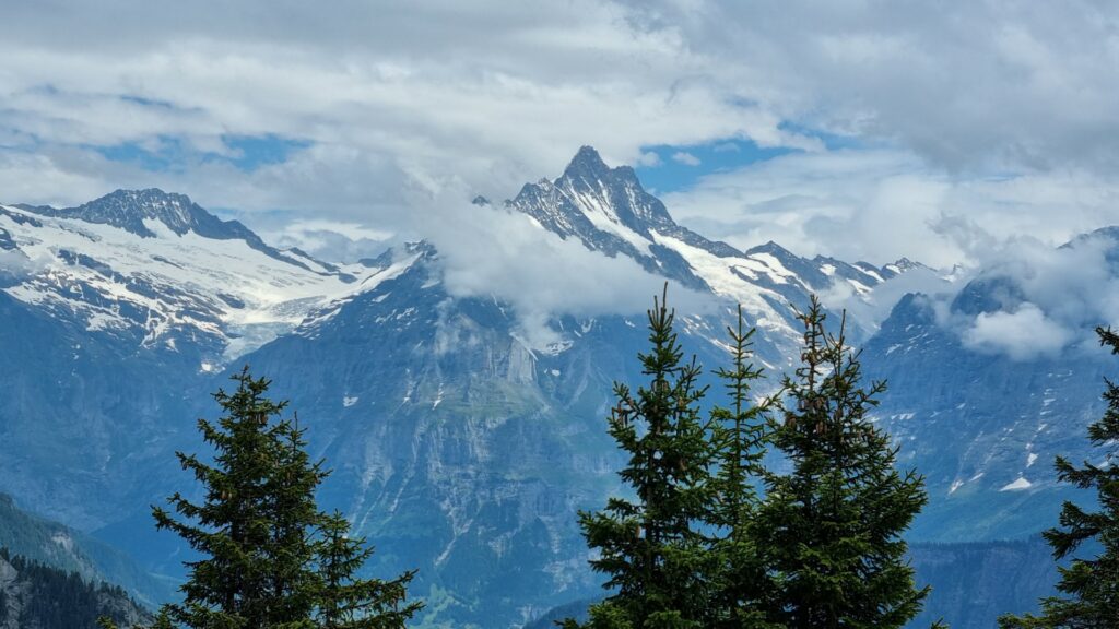
Bergen happens to be the wettest city in all of Europe. Fortunately it was fine. The route north is well signposted.
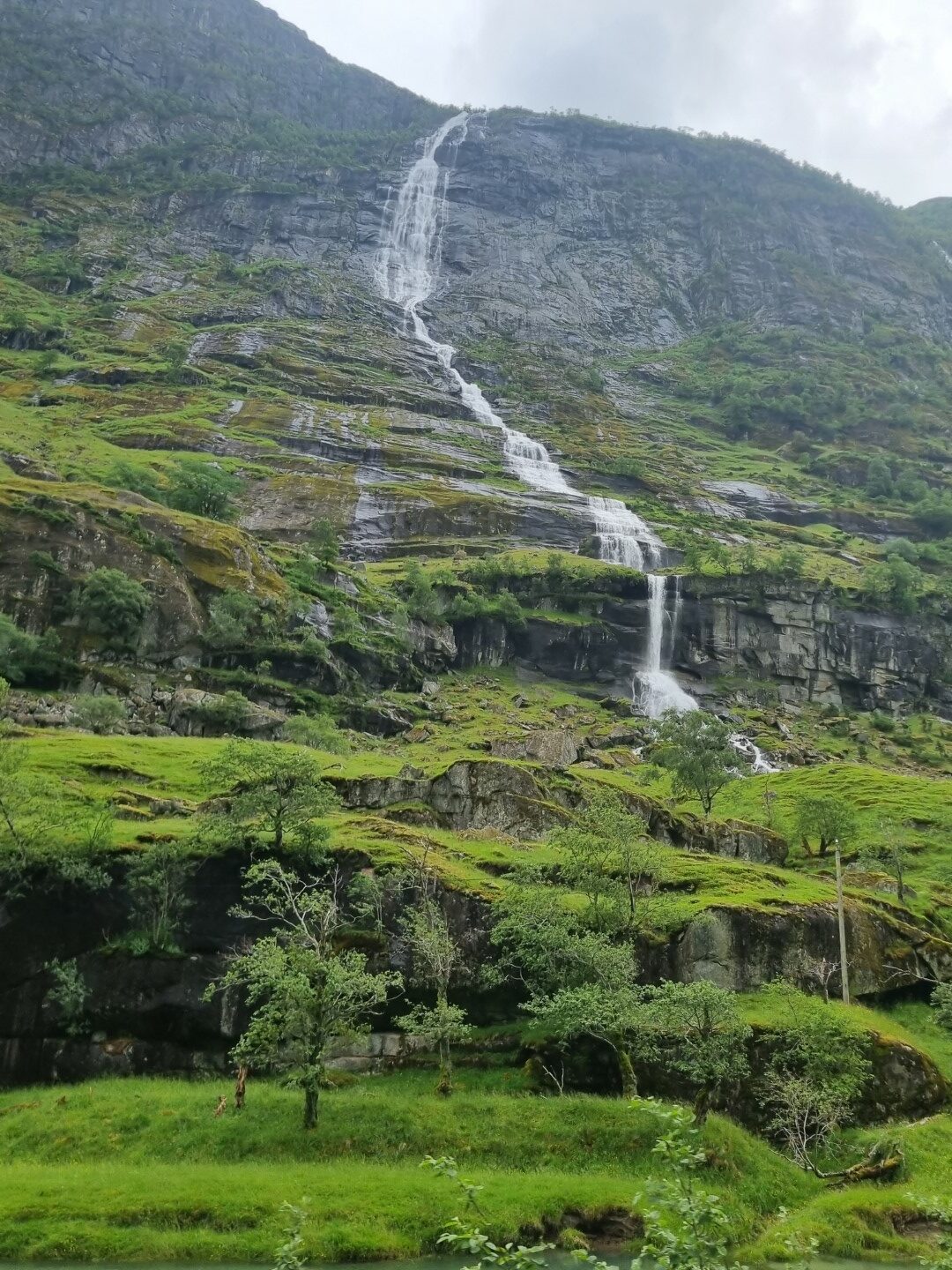
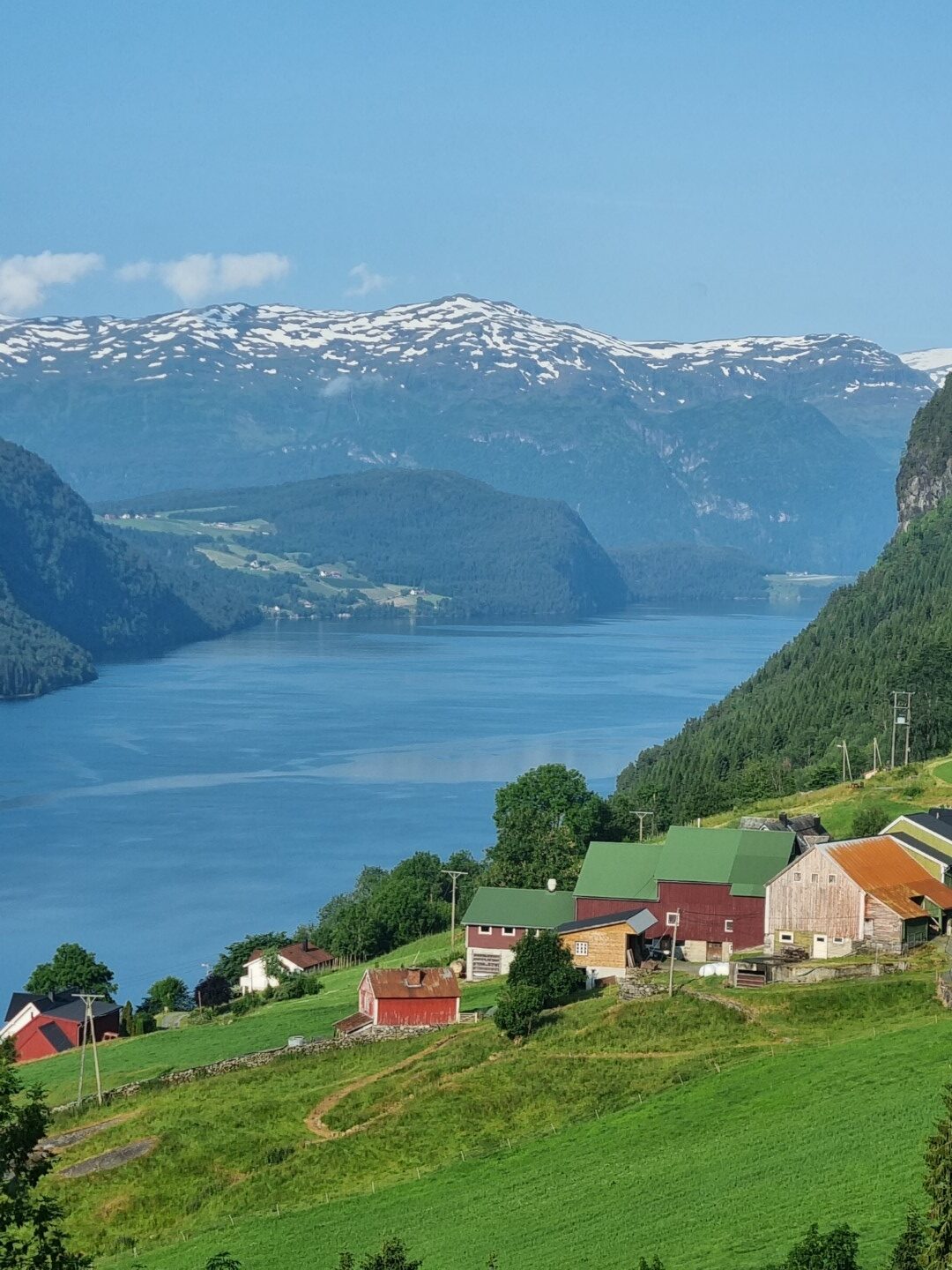
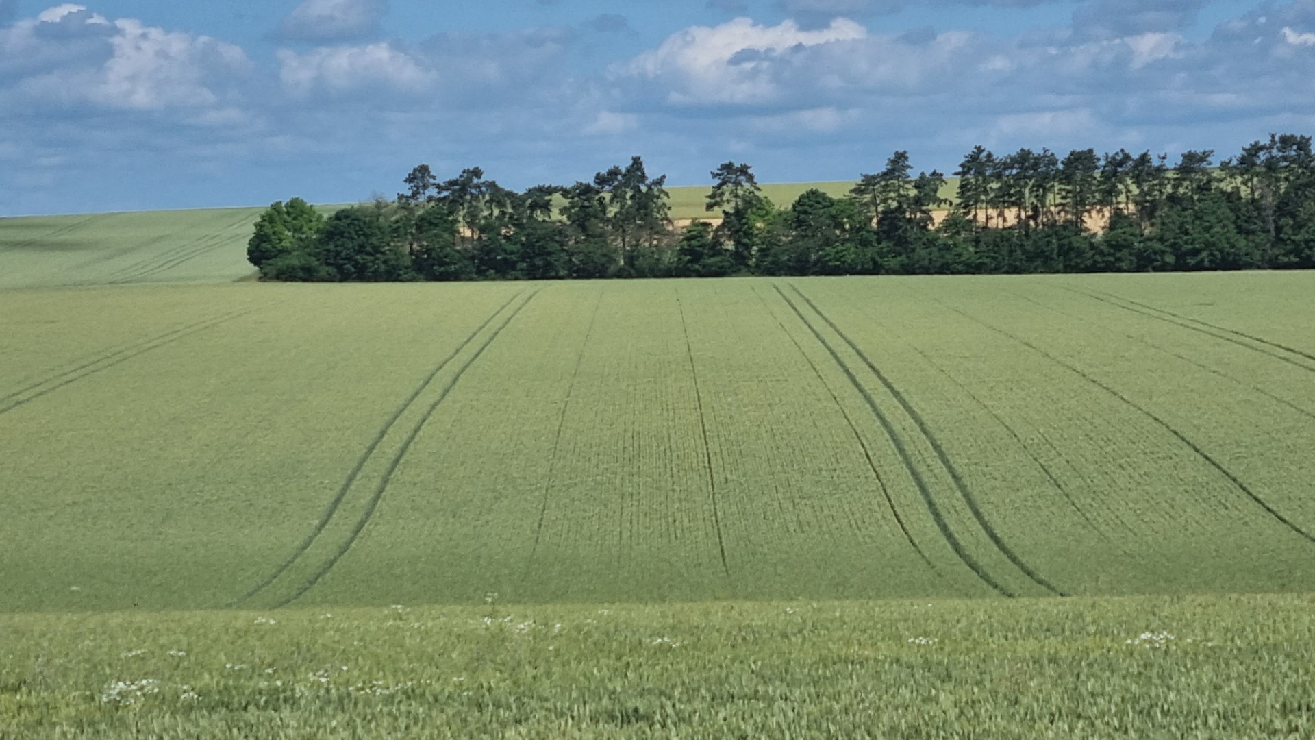
There are waterfalls coming off the U-shaped valleys virtually everywhere. It’s snow melt as it has not been raining much.
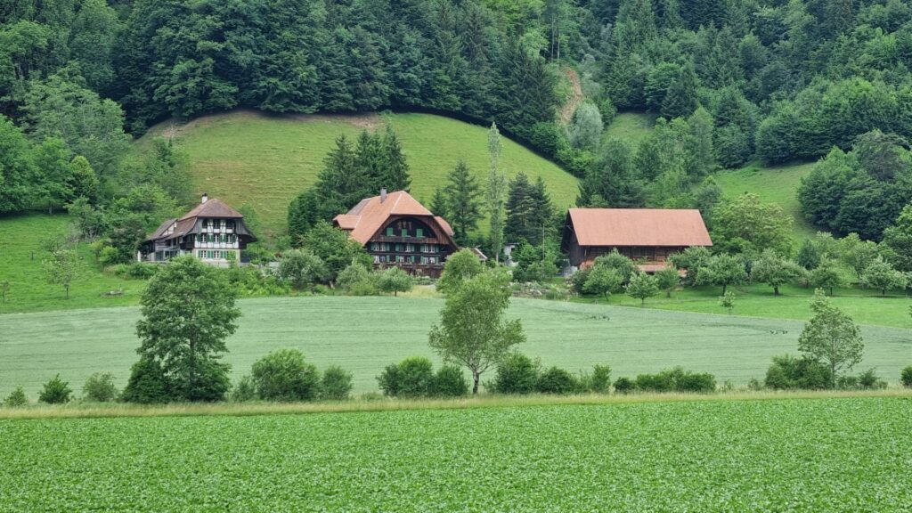
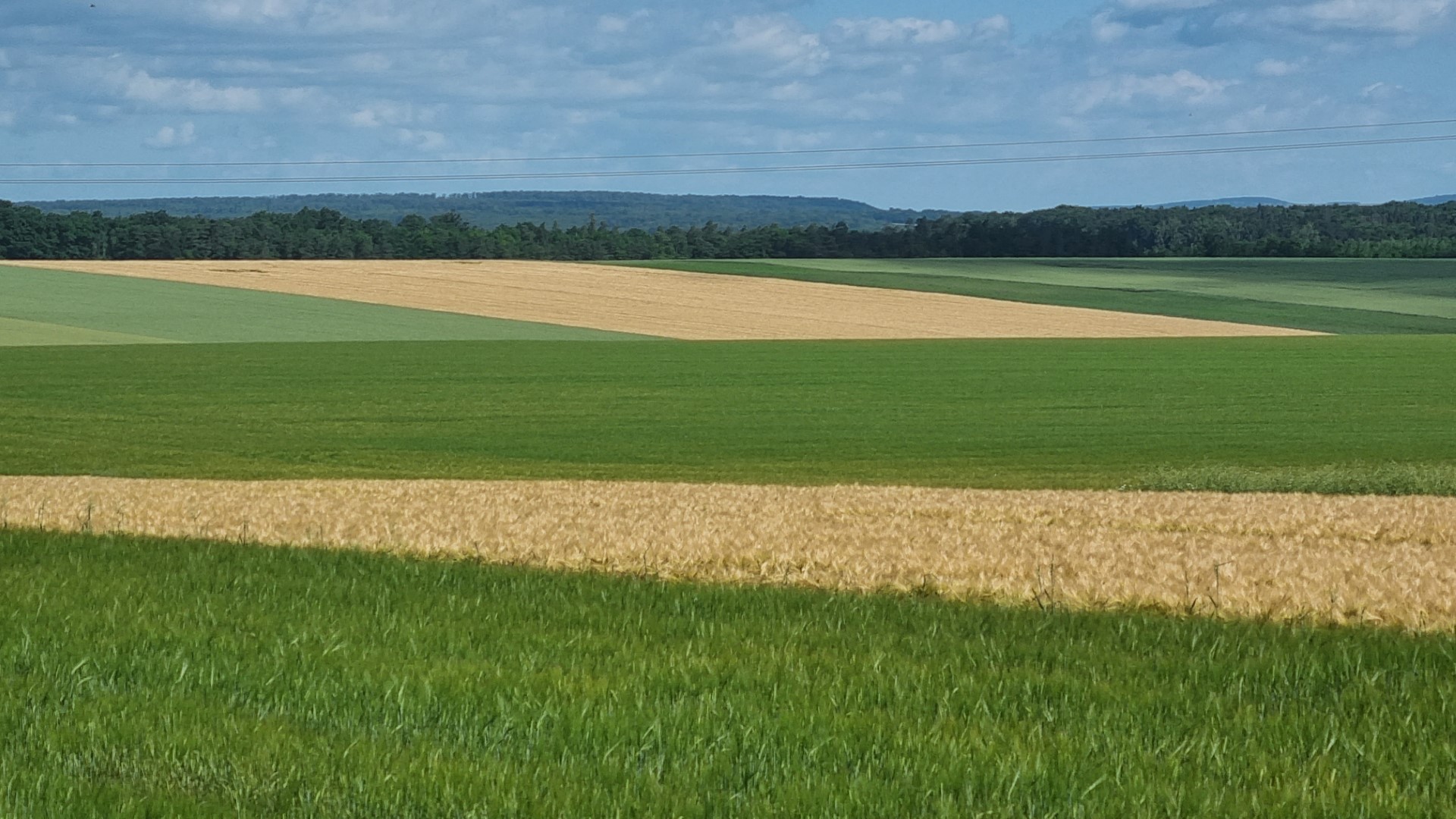
There is a long-term government policy of having human settlement throughout the country. This has meant long-term farming subsidies. Often small farms that can only grow grass and other animal feed, can actually survive.
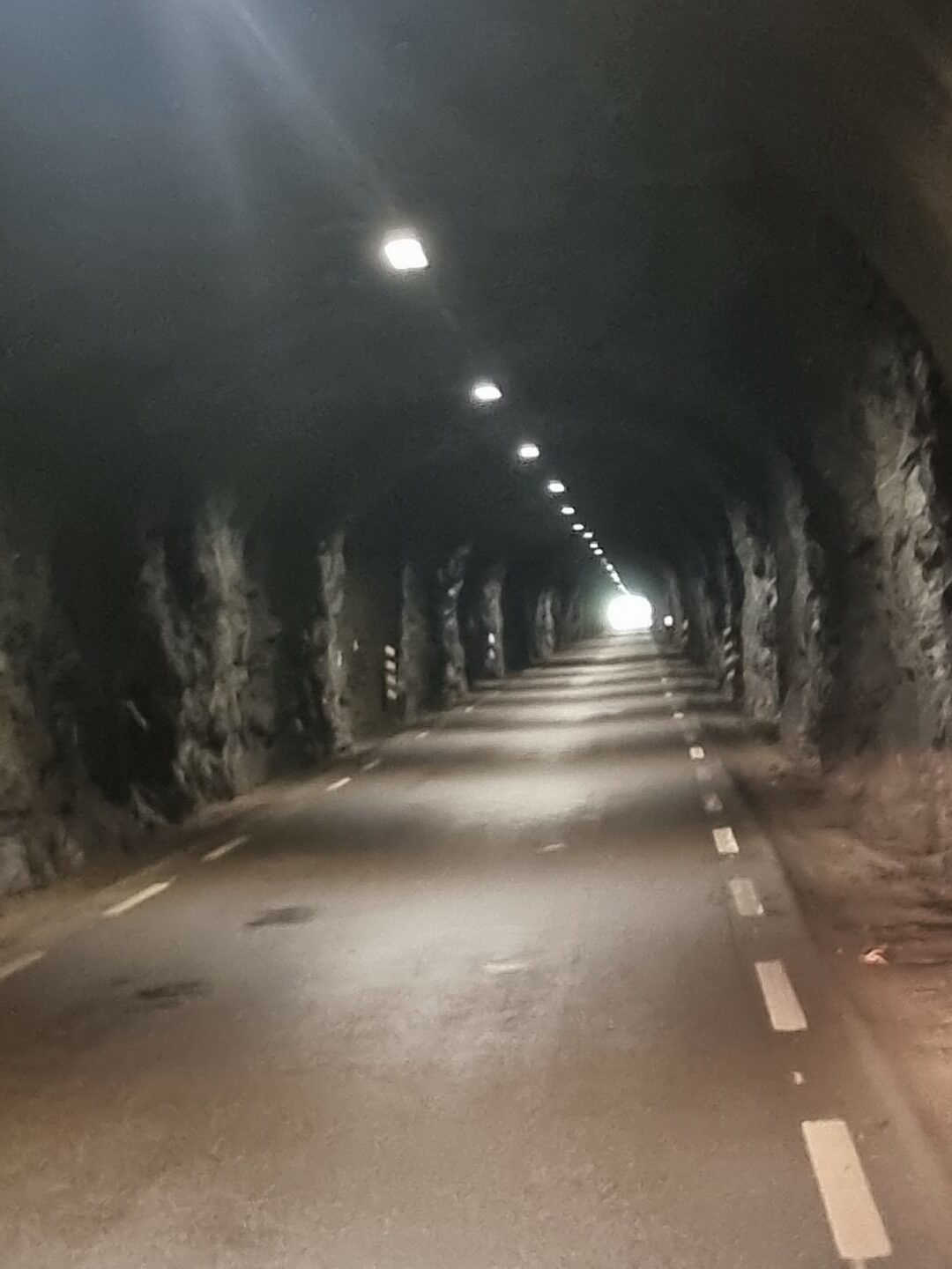
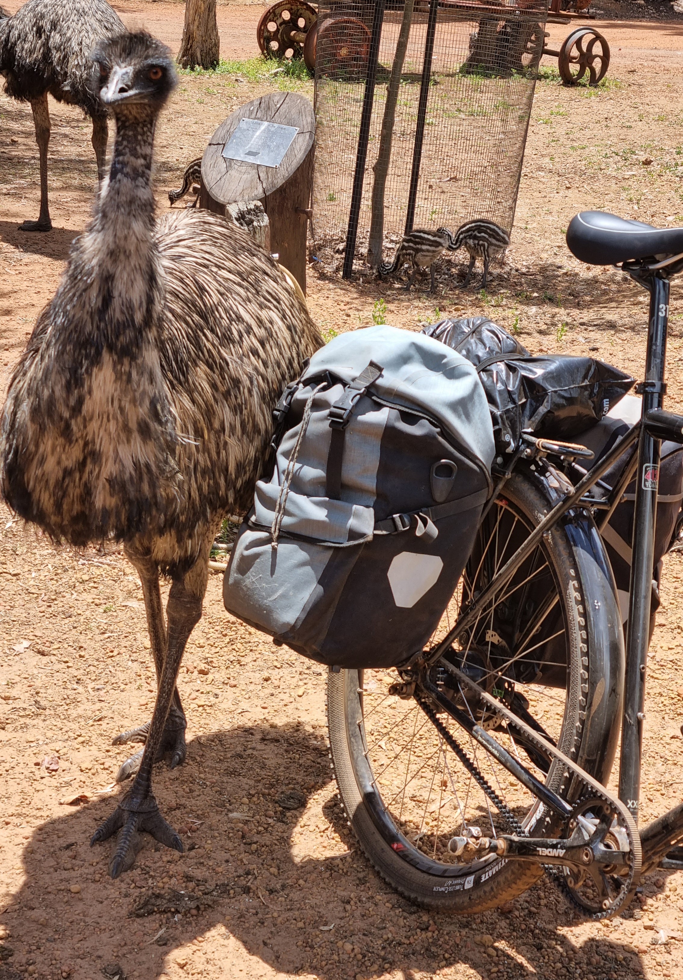
This tunnel didn’t have the No Bike sign. Nor did it say how long it was but there was so little traffic so I went for it. It was only 1.1km. The B&M headlight is great.
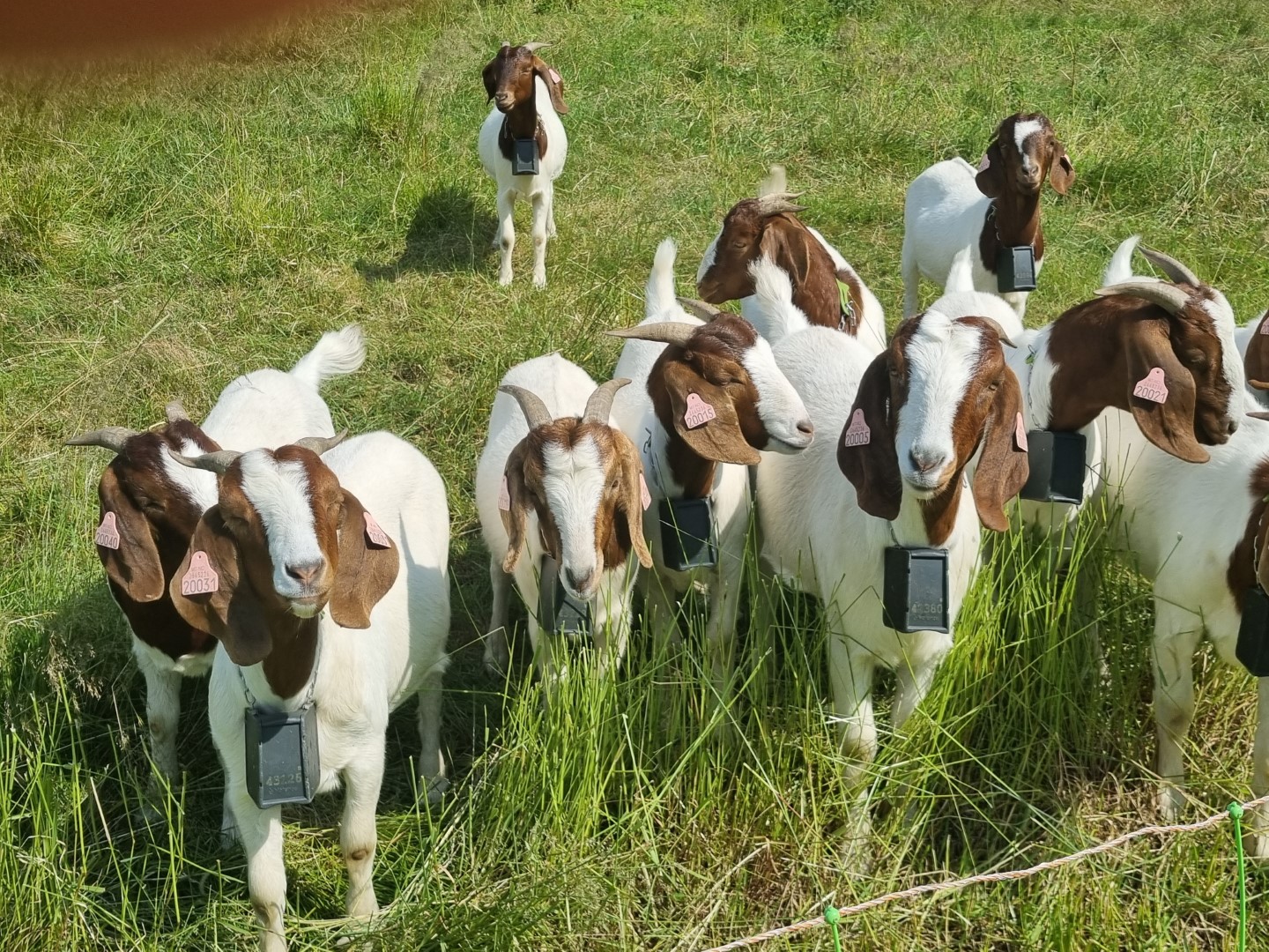
Boer goats doing well in an environment very different to where they originate from.
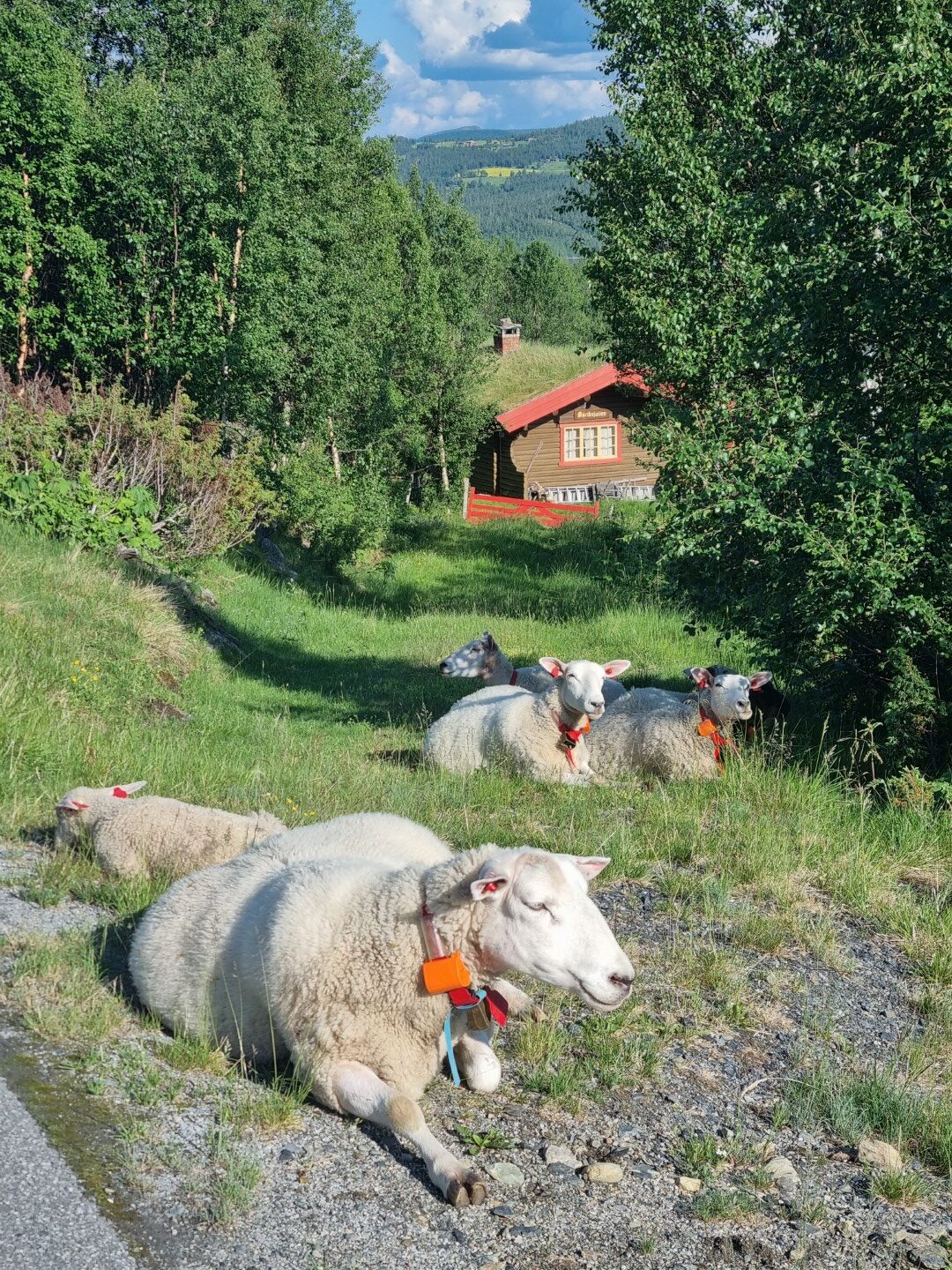
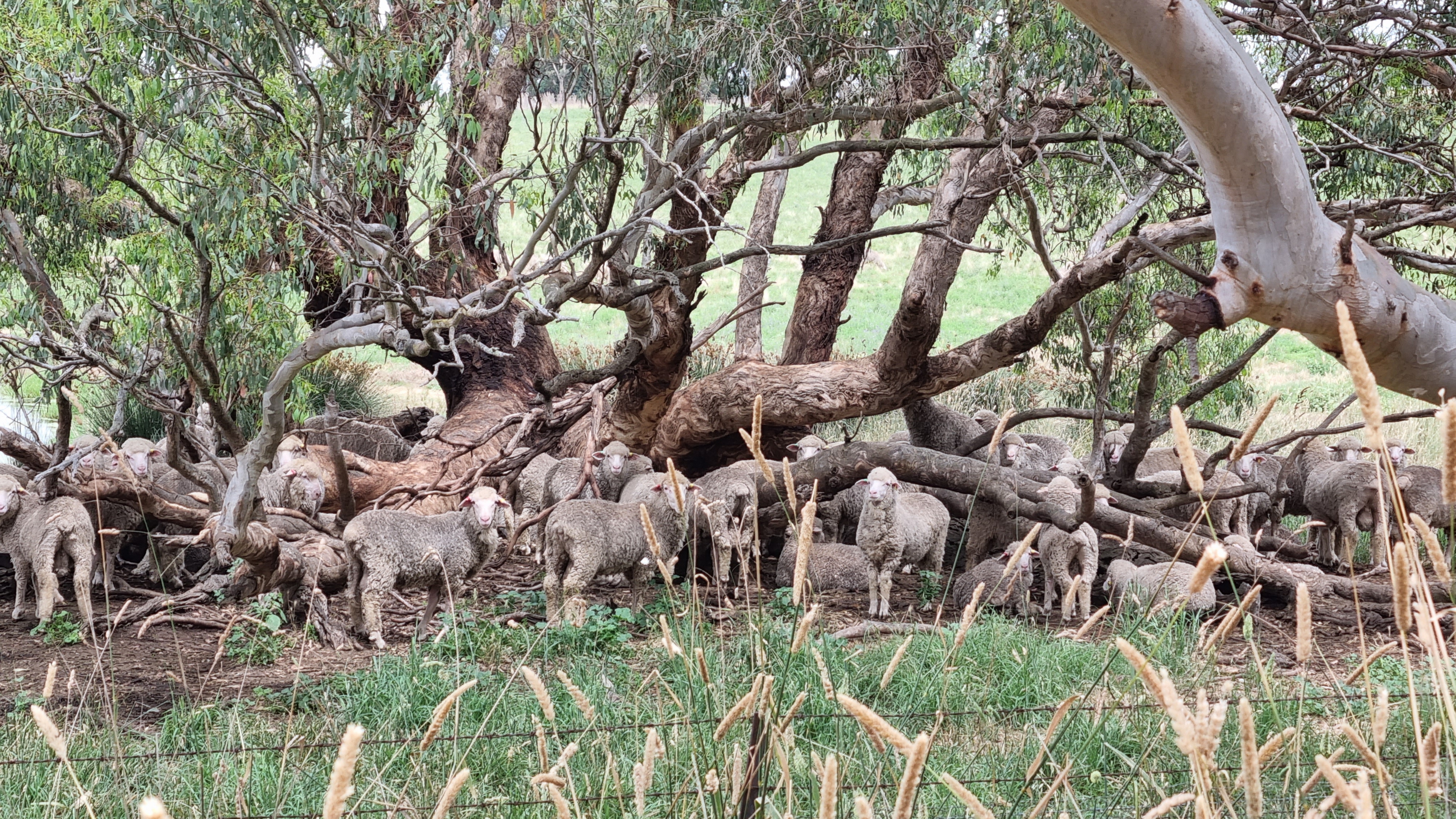
There are also quite a lot of sheep. Kept indoors for months and in the summer allowed to graze on roadsides in the mountains. They have bells and are not at all afraid.
Some days it’s too far between towns. I’m finding Airbnb’s on farms, booking one day ahead. This is out the window from one West of Stryn.
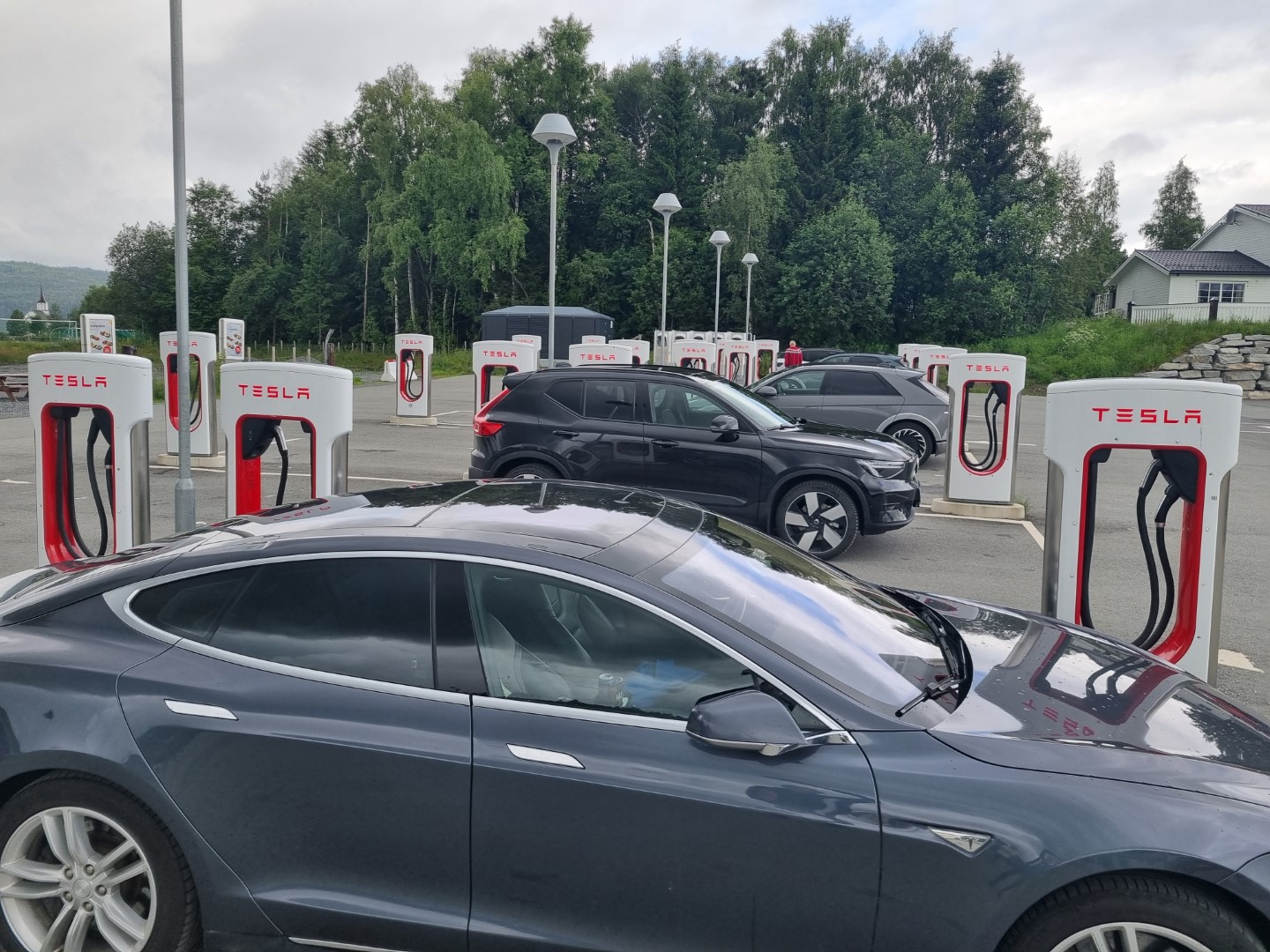
Norway is a rich country having discovered oil off-shore six decades ago. This is government owned, allowing Norway to have a big sovereign wealth funds. It’s actually the biggest in the world. But they can see the future and have policies that make an electric vehicle cost only half of its diesel/petrol equivalent. 80% of new vehicle sales are electric. The highest level in the world.
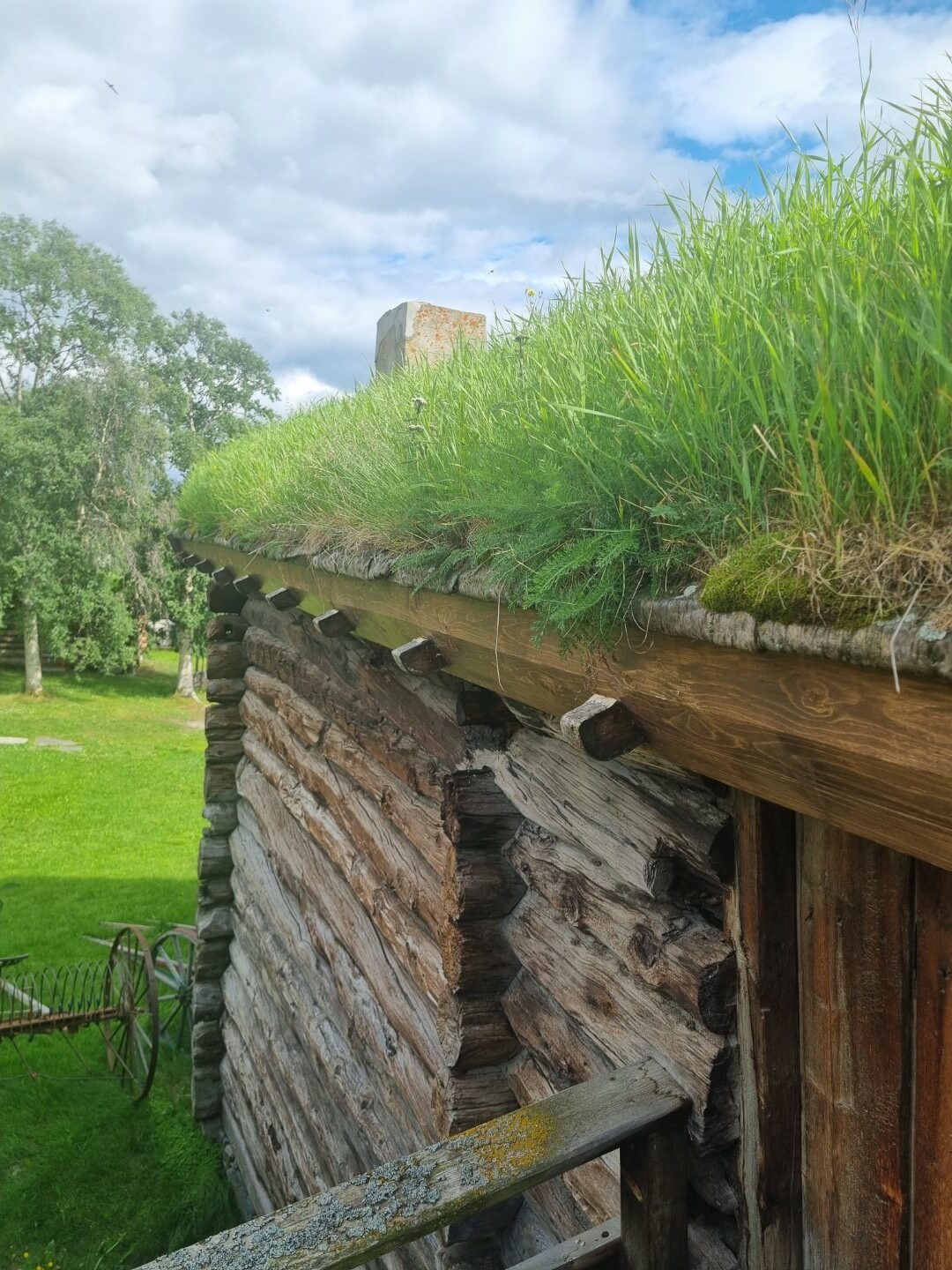
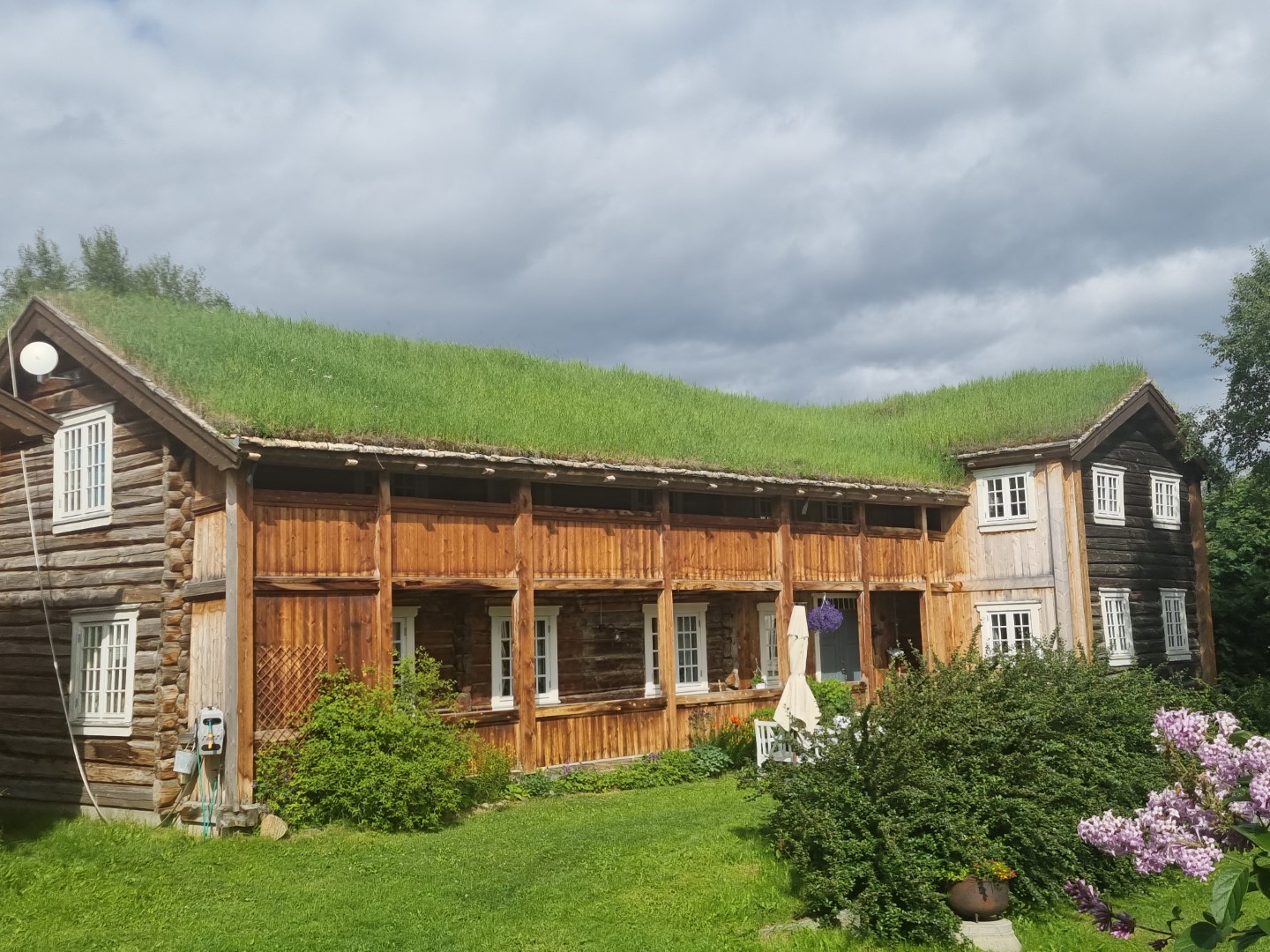
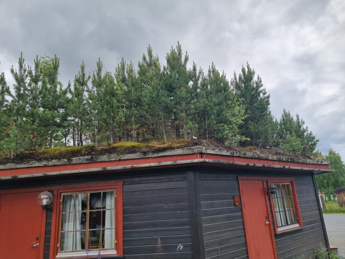
Norway must be the home of sod roofs. Or are they spread around the globe at this latitude? They even have sprinklers set up to water them. They even allow trees to grow on them! You may well wonder how this does not just hasten the failure of the roof? Apparently not so though. The barrier between the wooden substructure and the sod is a layer of birch bark. Newer ones use a sheet of plastic. The sod roofs weigh it all down and help reduce the spaces between the logs.
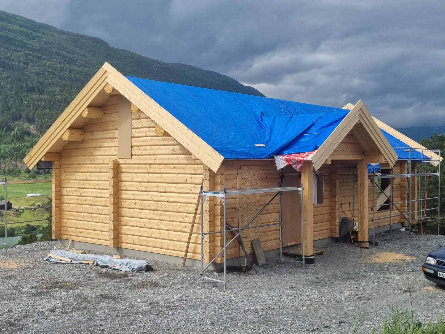
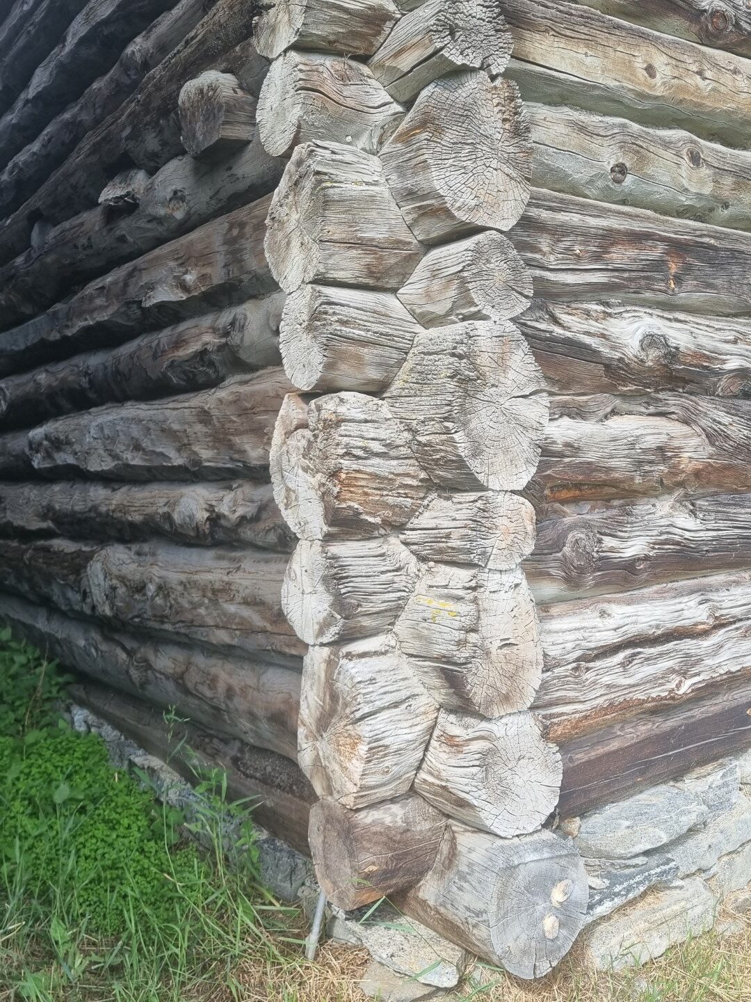
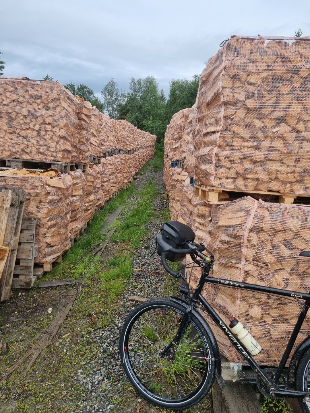
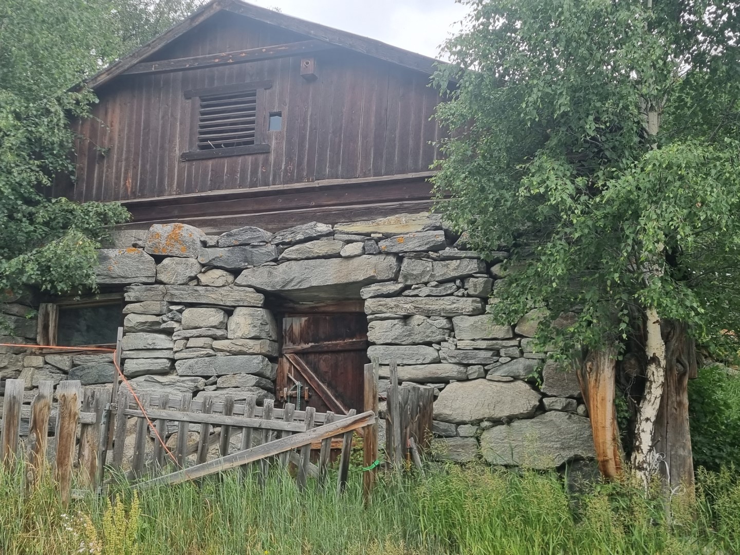
Timber has always been the primary building material and source of heating. Small farms often have additional forest land and PTO-driven splitters with elevators loading up 1.5CUM cut-wood baskets. It’s all softwood. Houses are super-well insulated. They test the seals by pumping air into houses and measuring the pressure decline rate!
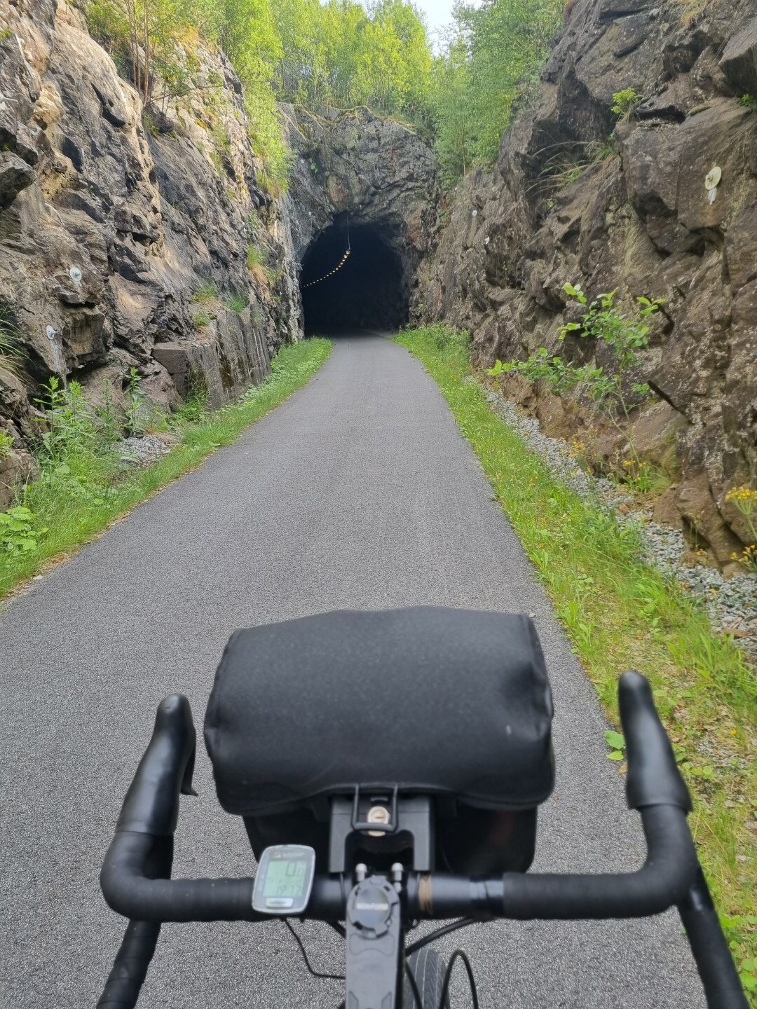
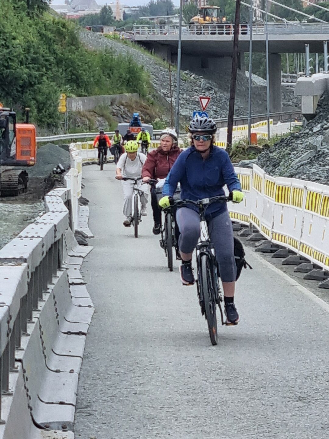
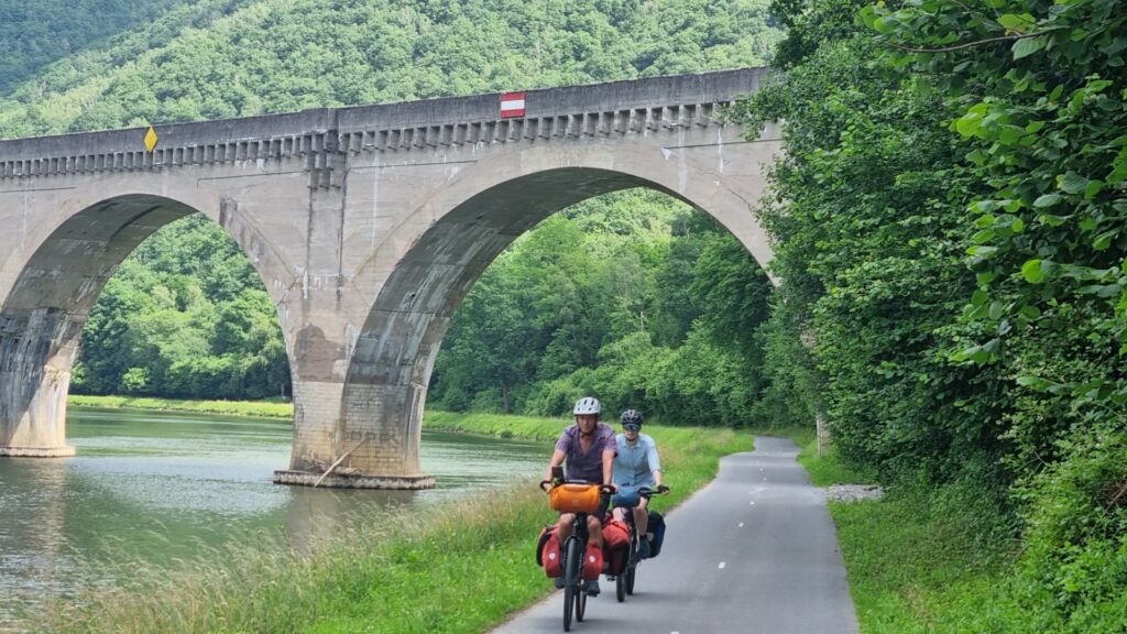
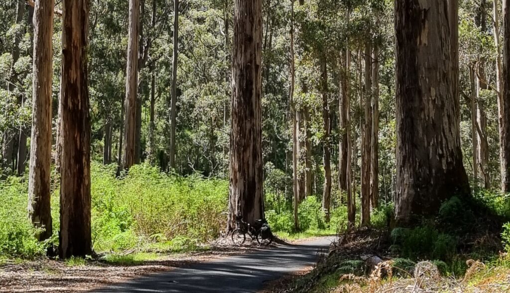
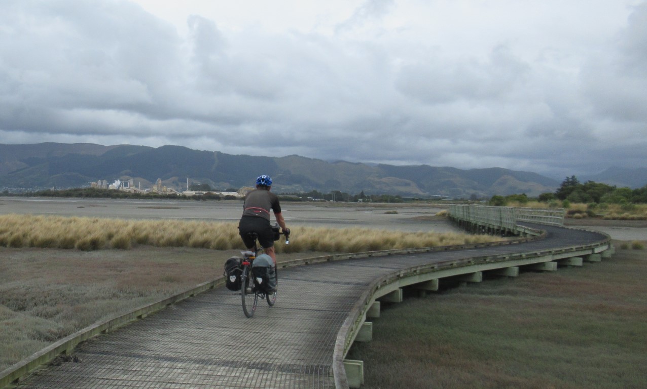
You can’t expect separate bike paths everywhere but there are plenty along fjords, through old railway tunnels, and alongside major roads.
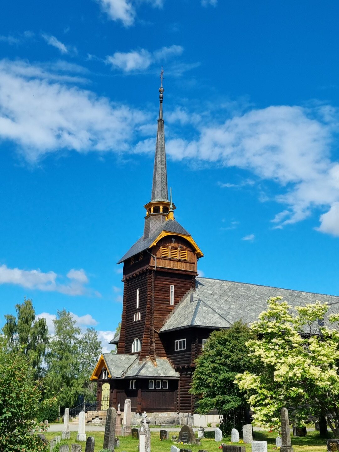
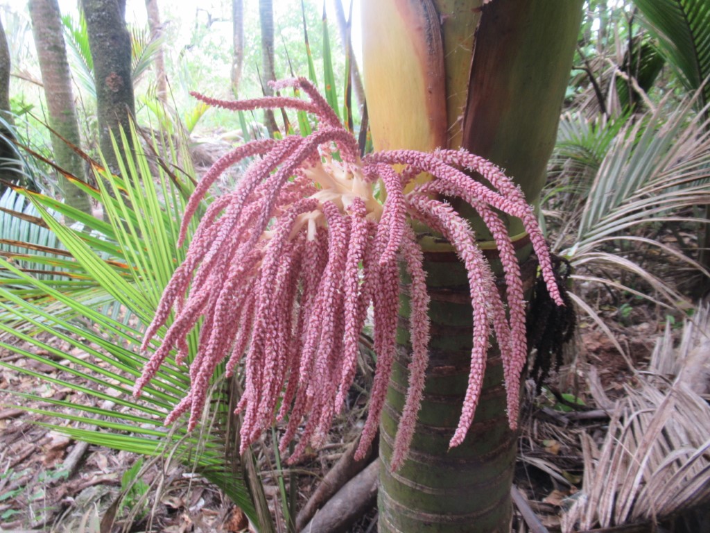
An impressive wooden church. Some are many hundreds of years old.
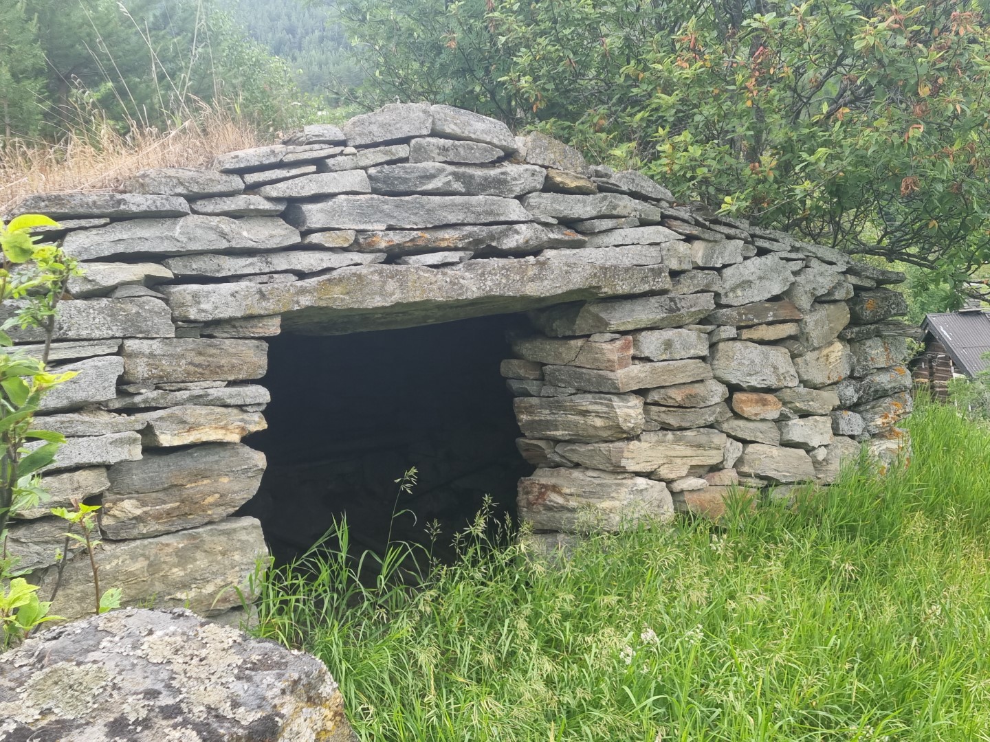
Called a Potato House, this is cool-room for vegetable storage through a cold winter. Rock is used extensively. Norway is basically rock.
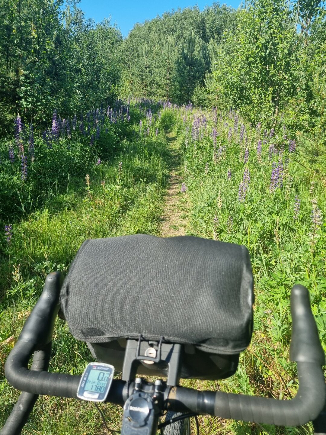
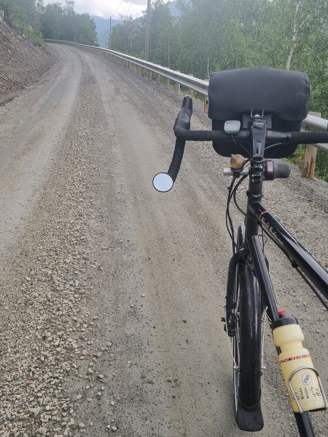
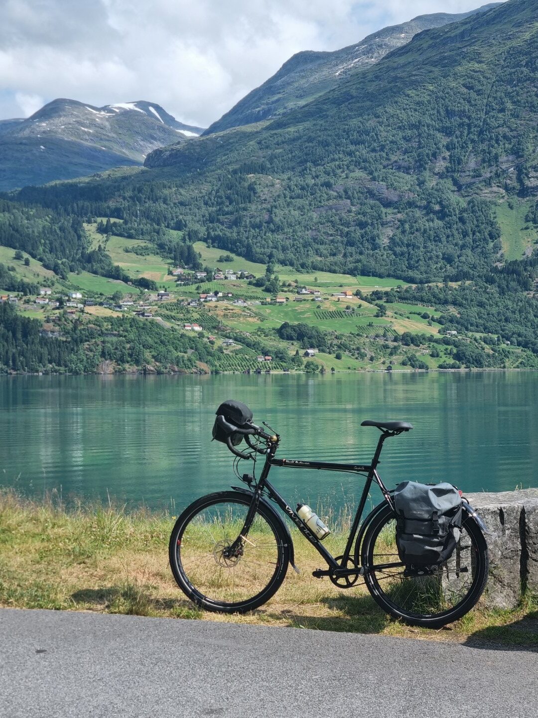
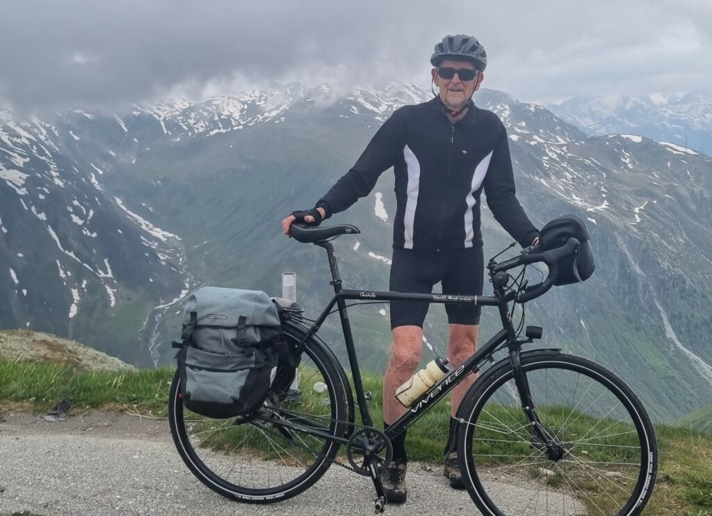
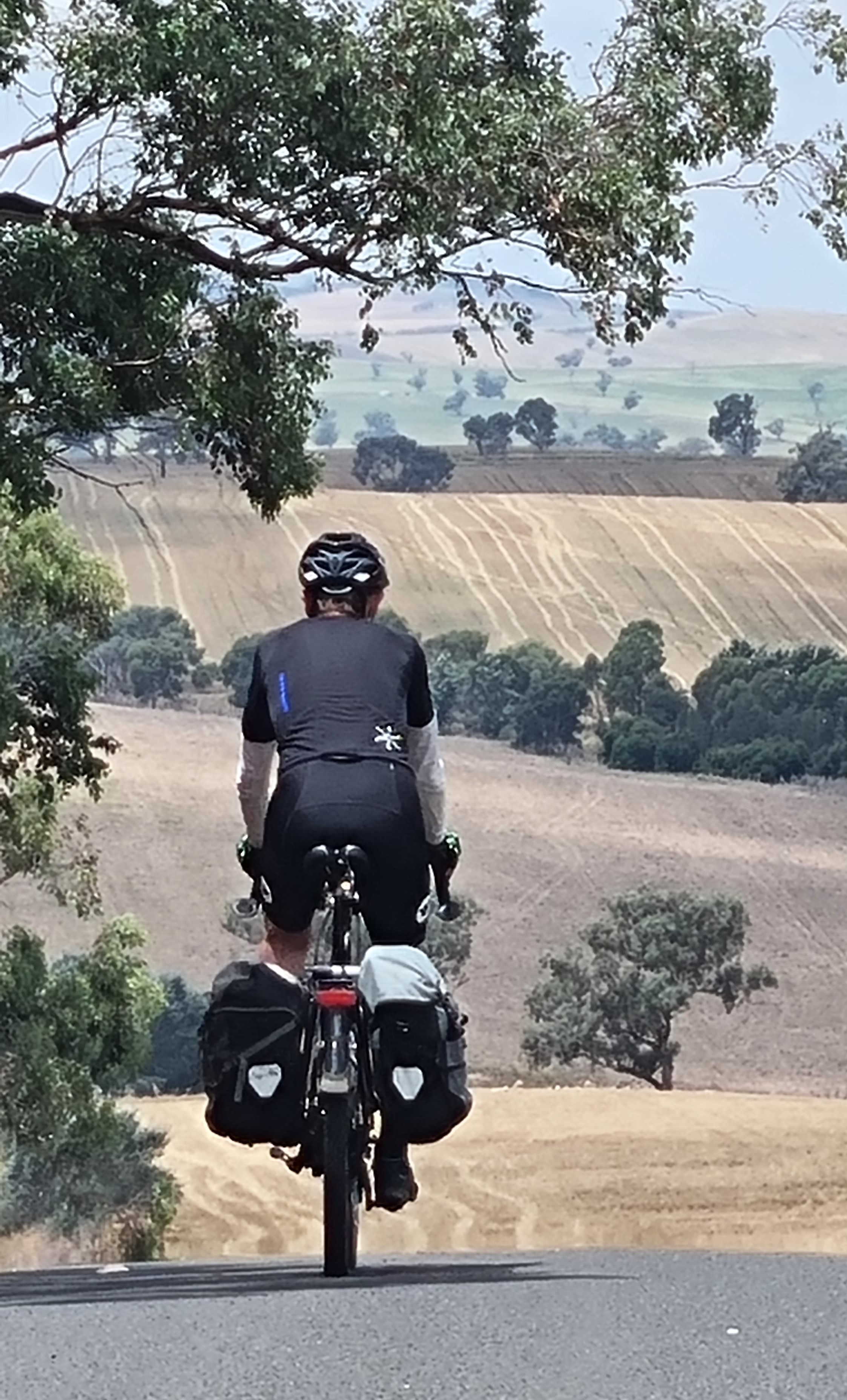
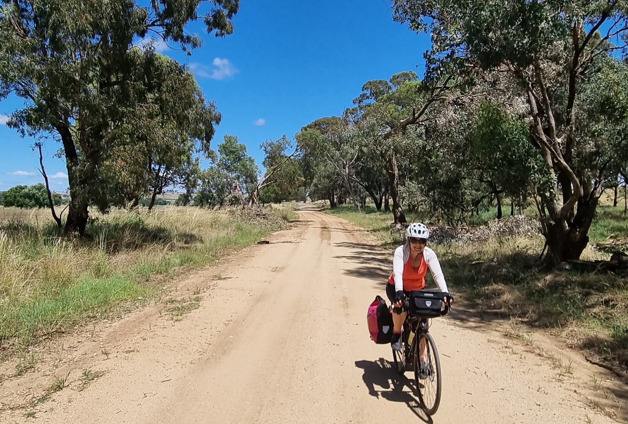
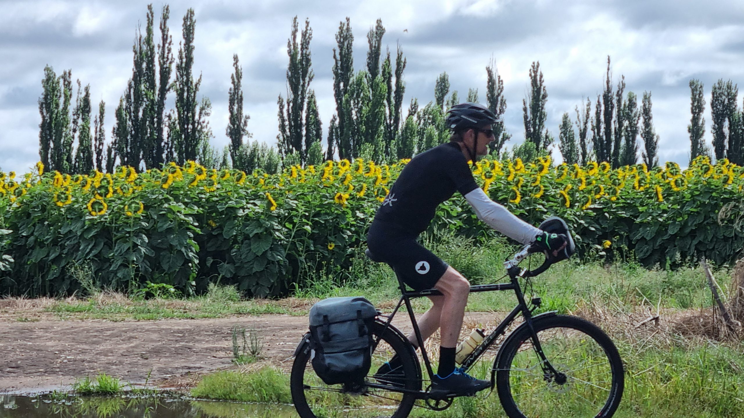
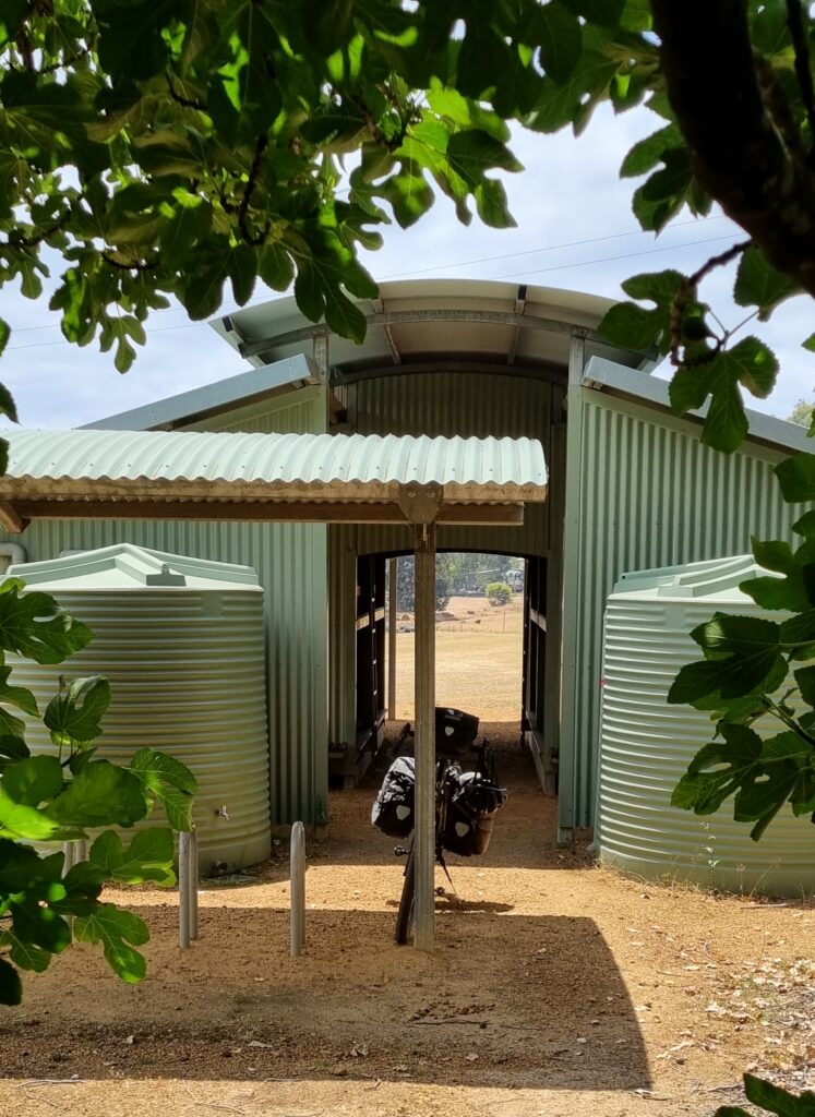
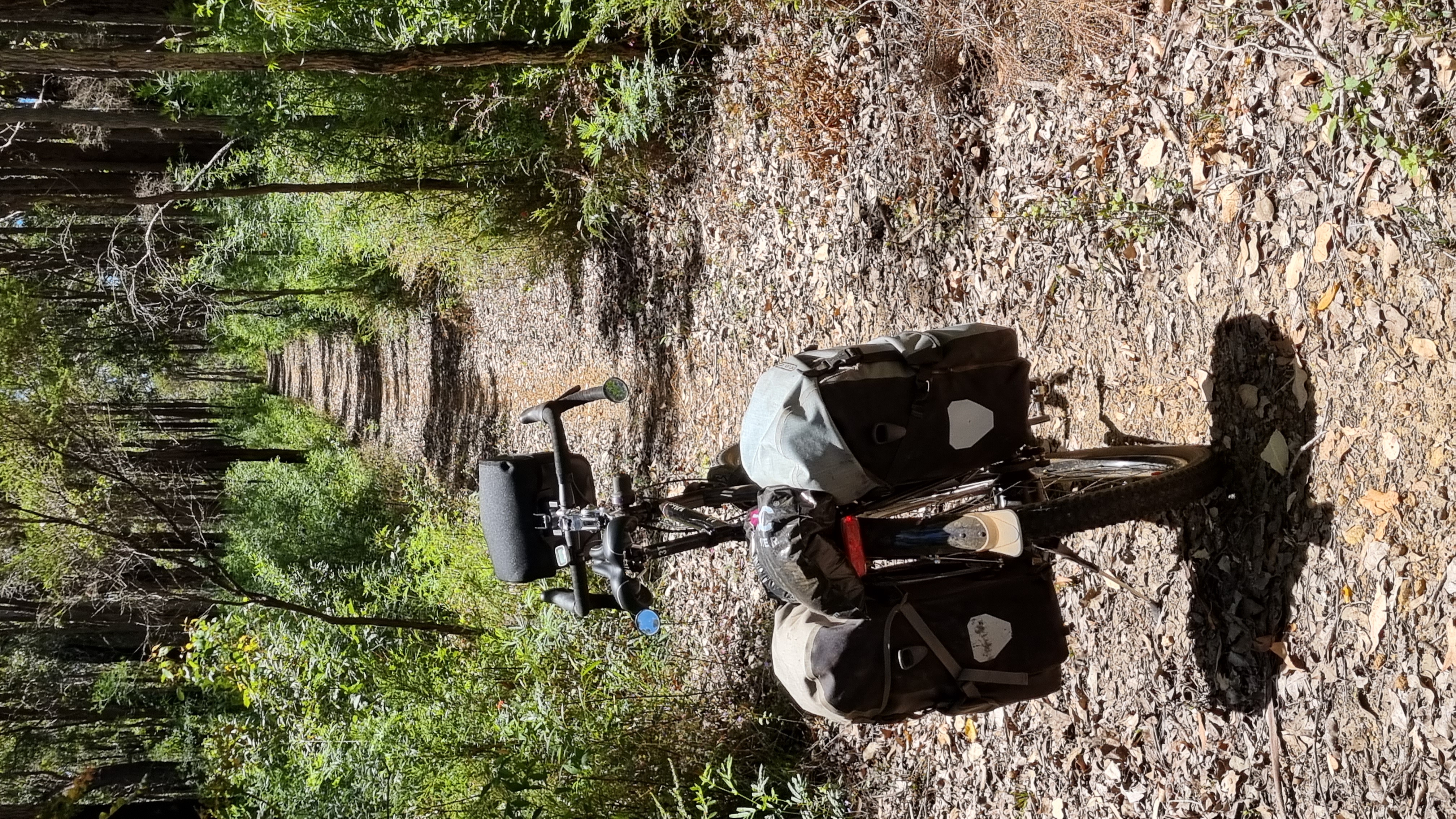
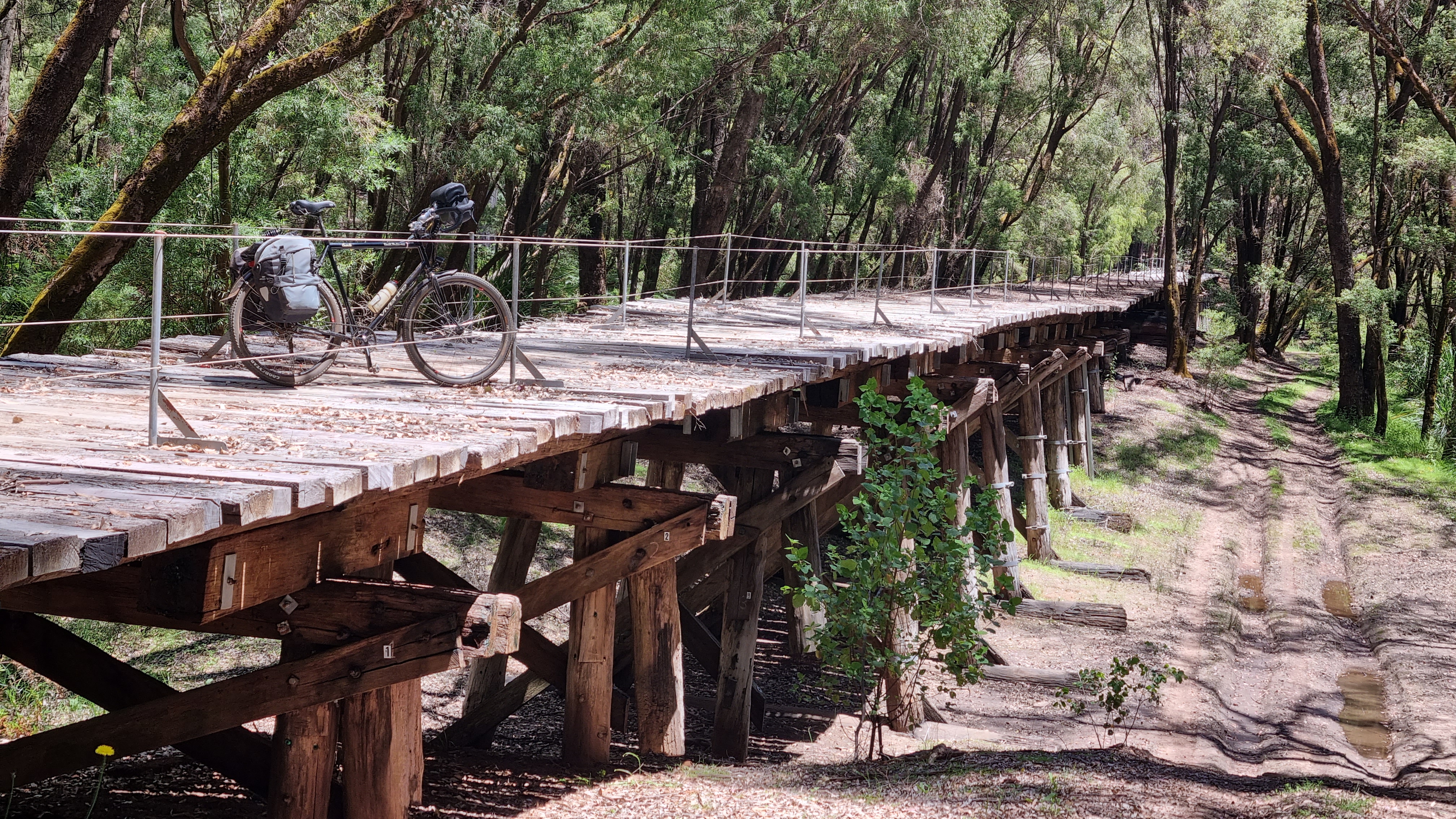
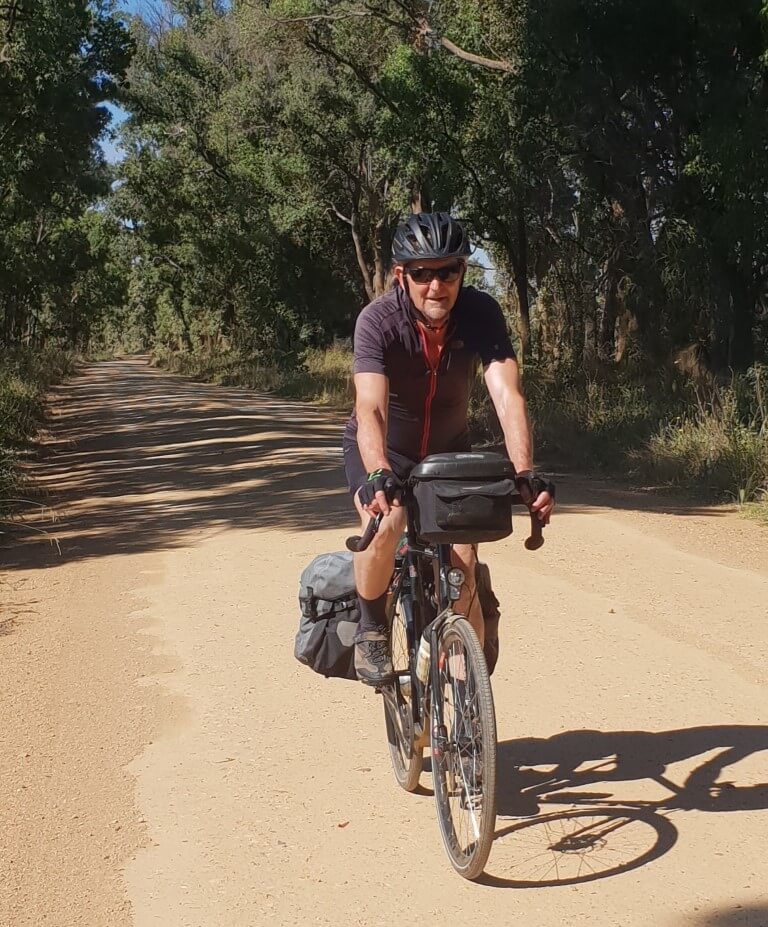
I chose 650B wheels and 50mm tyres for this ride and I sought out off-road trails
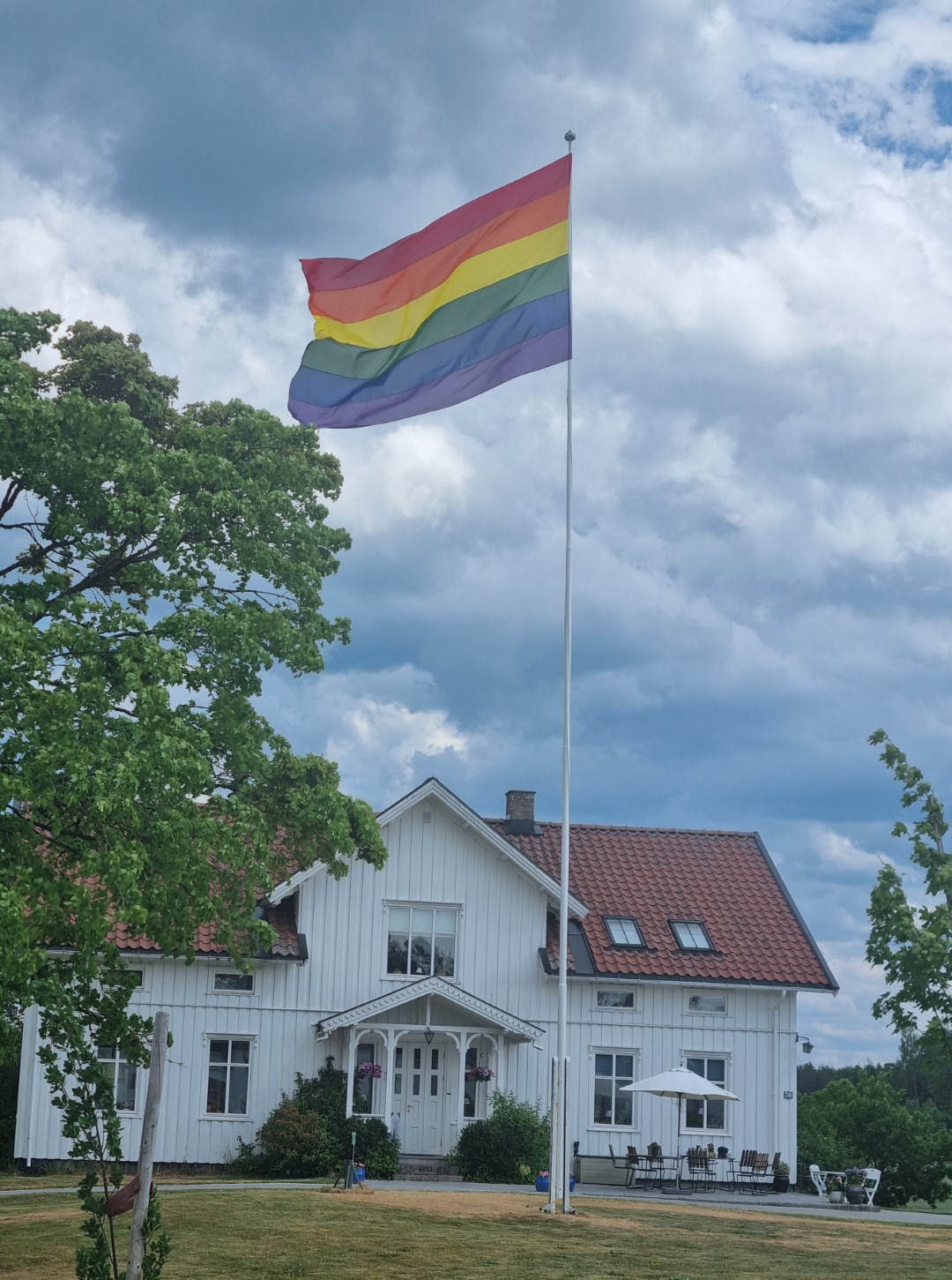
Norway celebrates diversity. It was Gay Pride Week and there are rainbow flags everywhere.
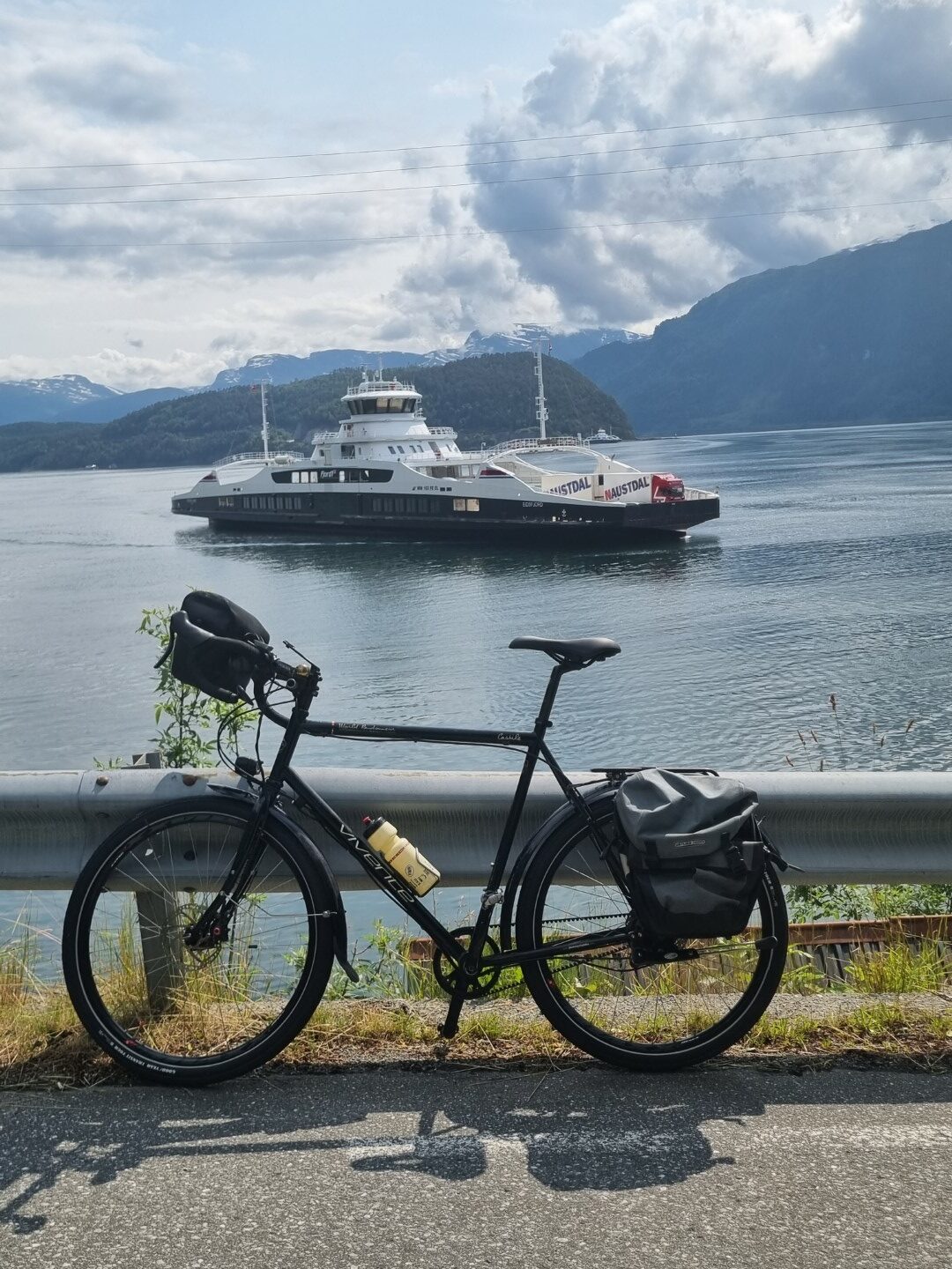
Ferries cross the fiords on the coast. Some fiords run inland over 100km so these are considered part of the road network. They run frequently and are free.
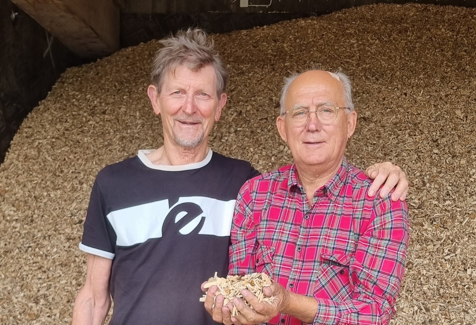
Catching up with an old mate. Agriculture is pretty challenging here. Mainly it is growing food for animals.
Coming into Trondheim in peak hour. It is 63.5degrees north. (Hobart is 43 S. Ushuaia is 55 S. Anchorage is 61 N.) Norway is warmed by the Gulf Stream.
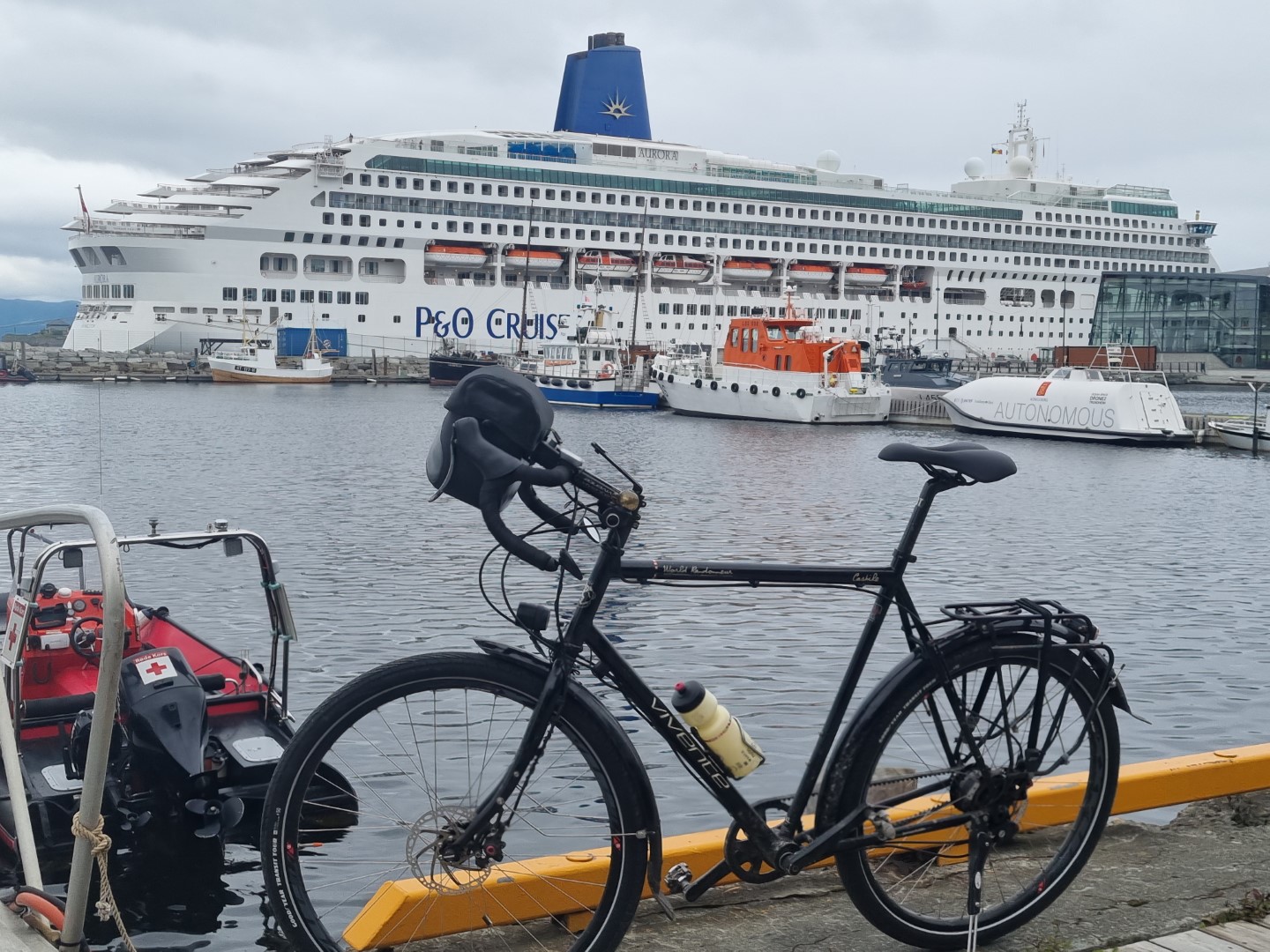
The other way people visit Norway is by cruise ship along the coast.
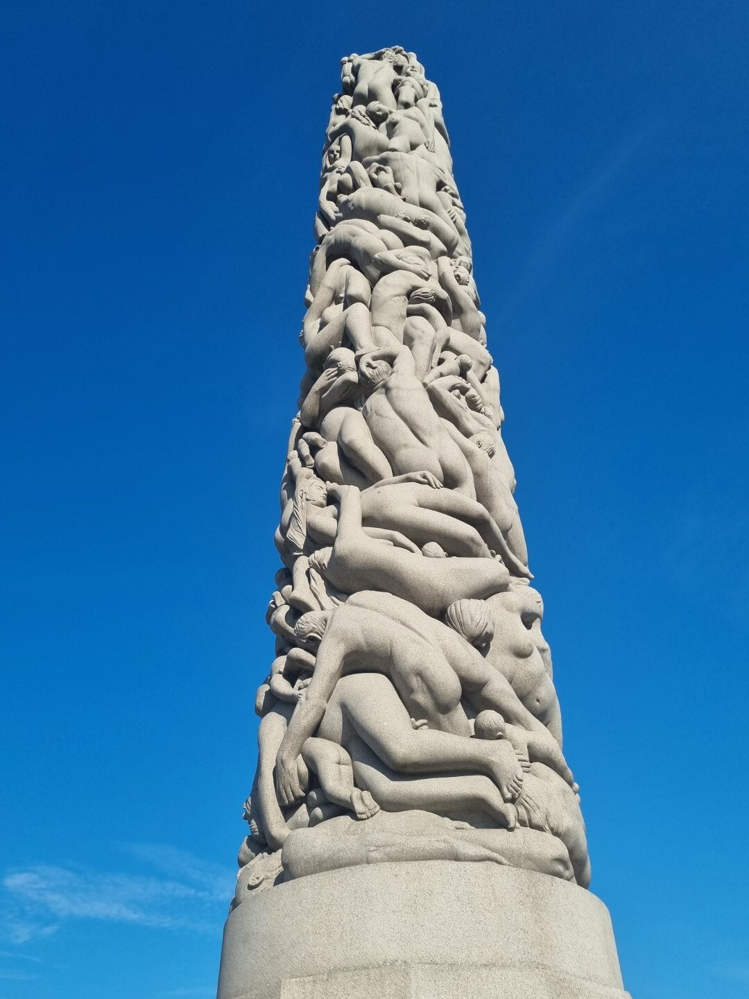
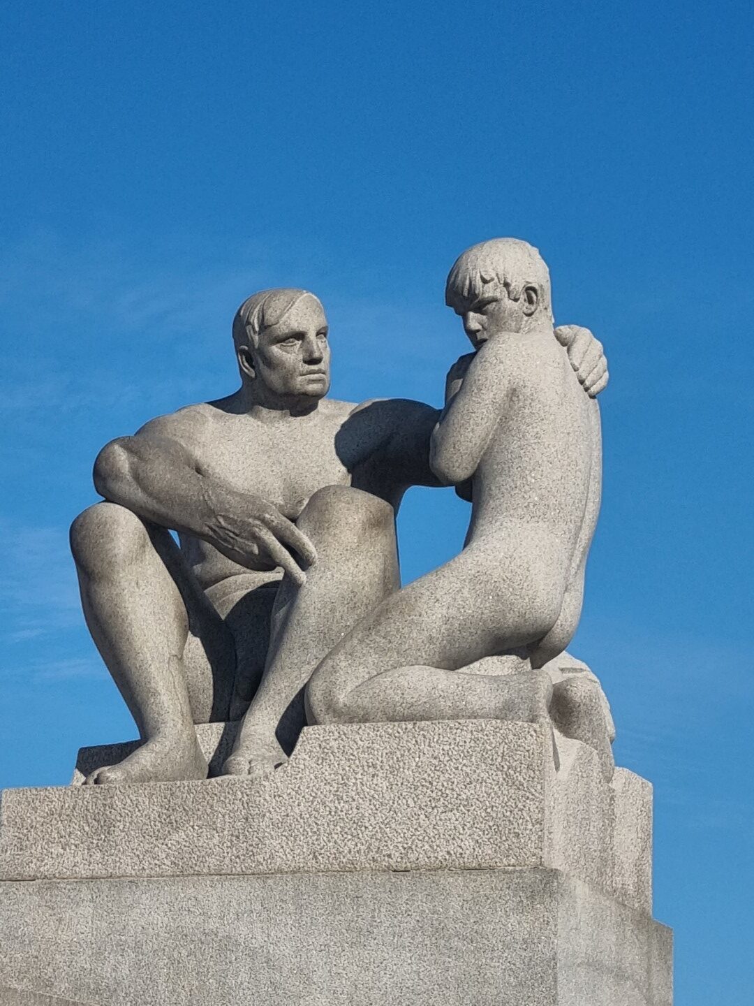
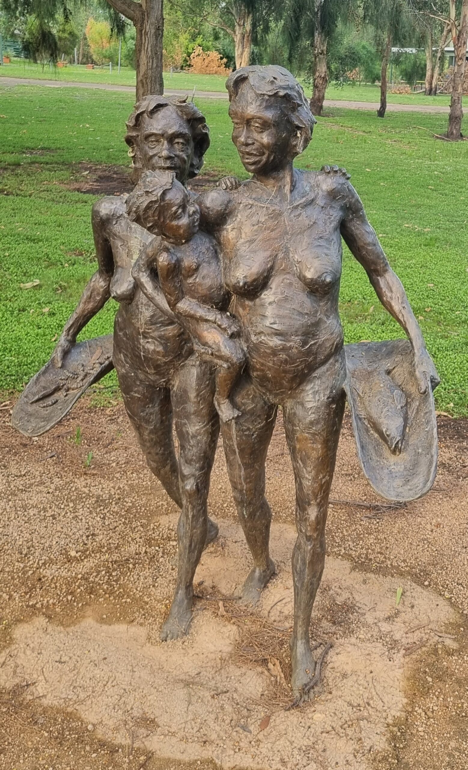
Vigeland Sculpture Park in Oslo is indescribably beautiful. There are 200 pieces. It is fantastic.
Heading out. Getting away from the country scenes and being reminded how modern living is a mix of realities. Or maybe just a very different way of experiencing them.
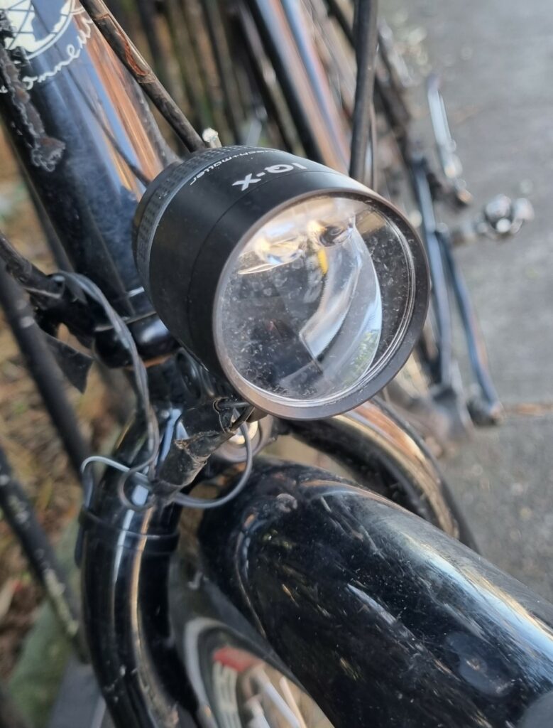
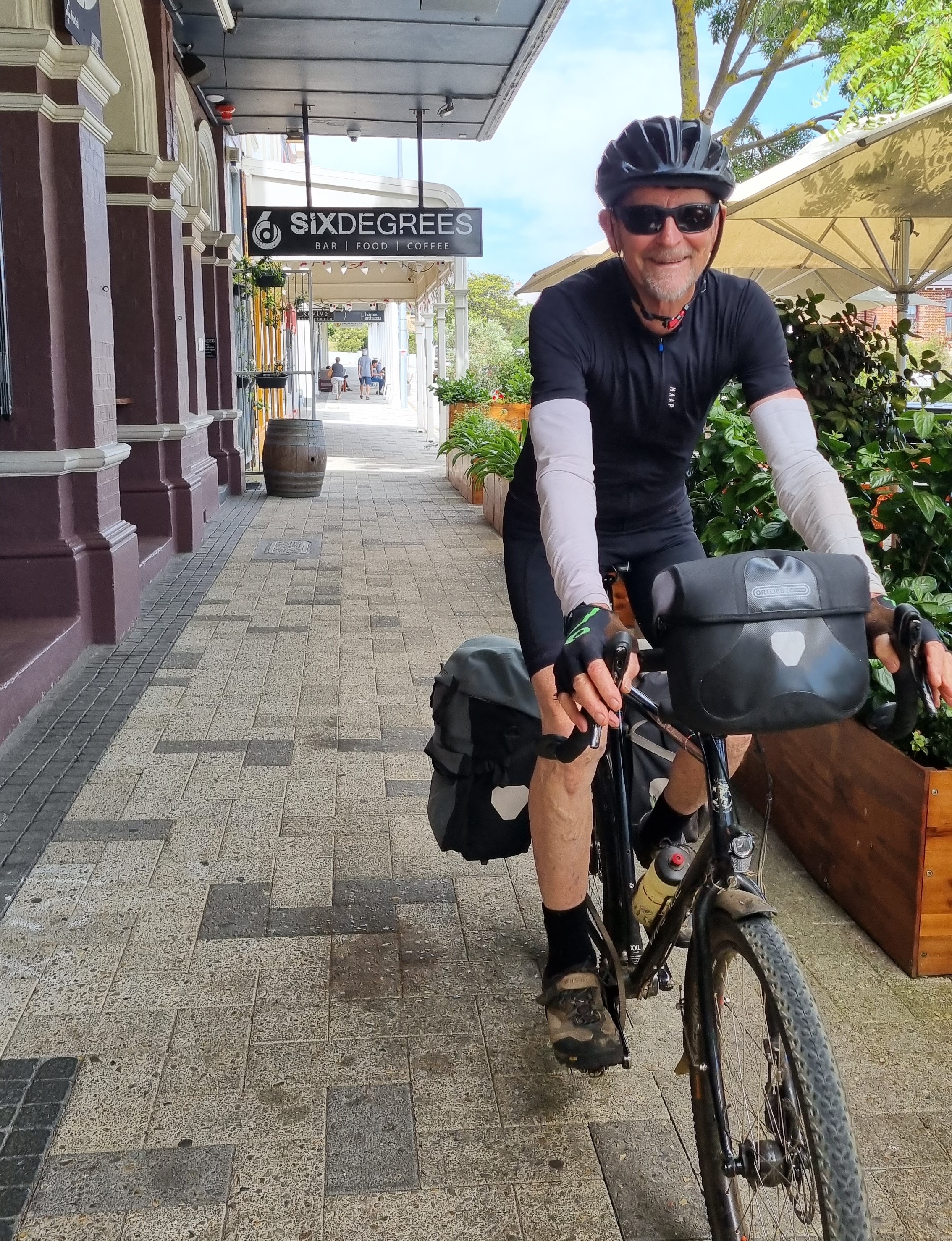
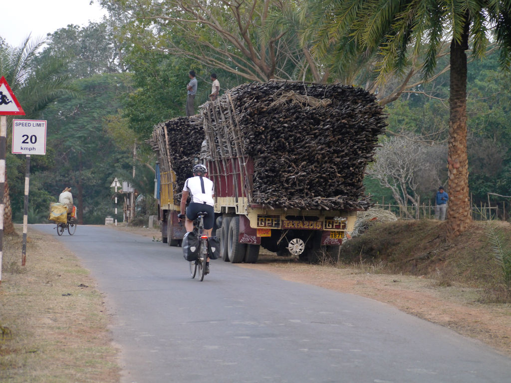
A 1,200km A to B ride in mid-summer, returning to Chicago and O’Hare airport on Amtrak. We are riding a Swabia and a Deccan, testing a few things including the new Busch & Muller IX-Q 100 lux headlight, Goodyear Transit Tour tyres, Rokform and Magsafe smartphone mounts. See the Test Report at the bottom of this page.
The ride takes us over the July 4th long weekend and there are flags everywhere. The weather is perfect, mid to high 20’s. The roads are so good that there is seldom a need to seek out bike trails. There is always a wide shoulder. There are some bumps in the tar due to harsh winters.
Drivers are courteous. In fact, they are some of the best drivers in the world, which I admit surprised me. We have been on several rail trails because google selected them and they have been great. Google route mapping has been good 99% of the time. You don’t need to plan routes much as there is just so much paved surface.
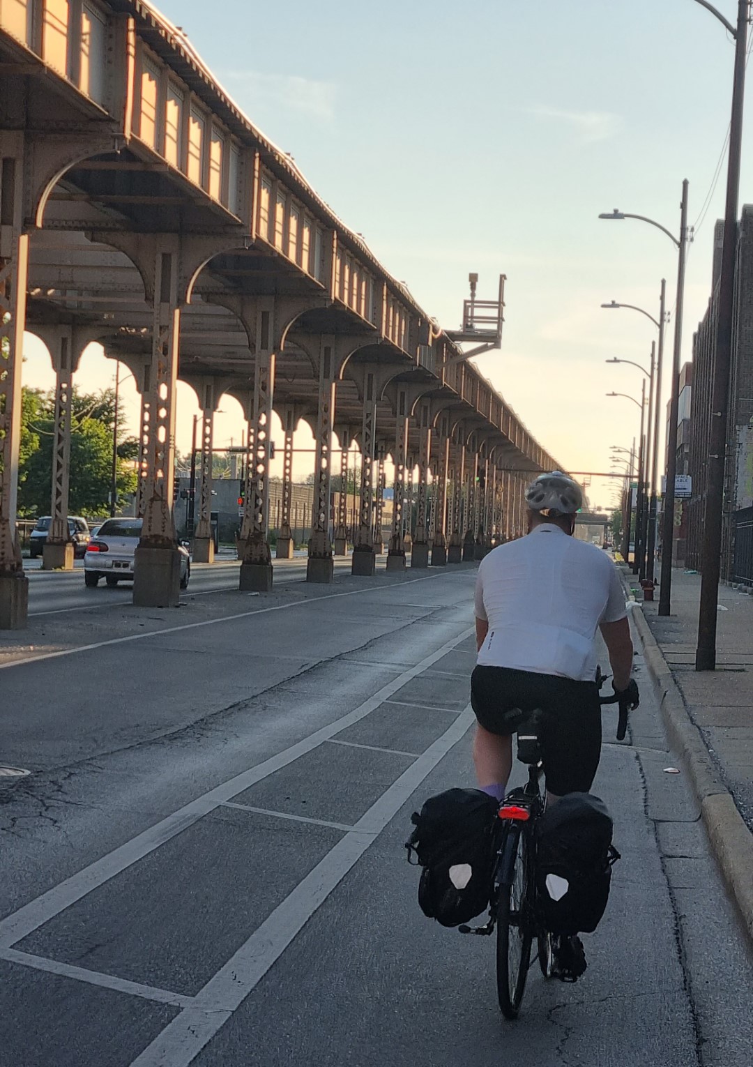
After landing at O’Hare, we put the bikes together and try to ride out but soon encounter a twelve-lane ring road. Instead, we catch the train 1 stop and then ride to Des Plains station and get the metro (NW) train to the city outskirts.
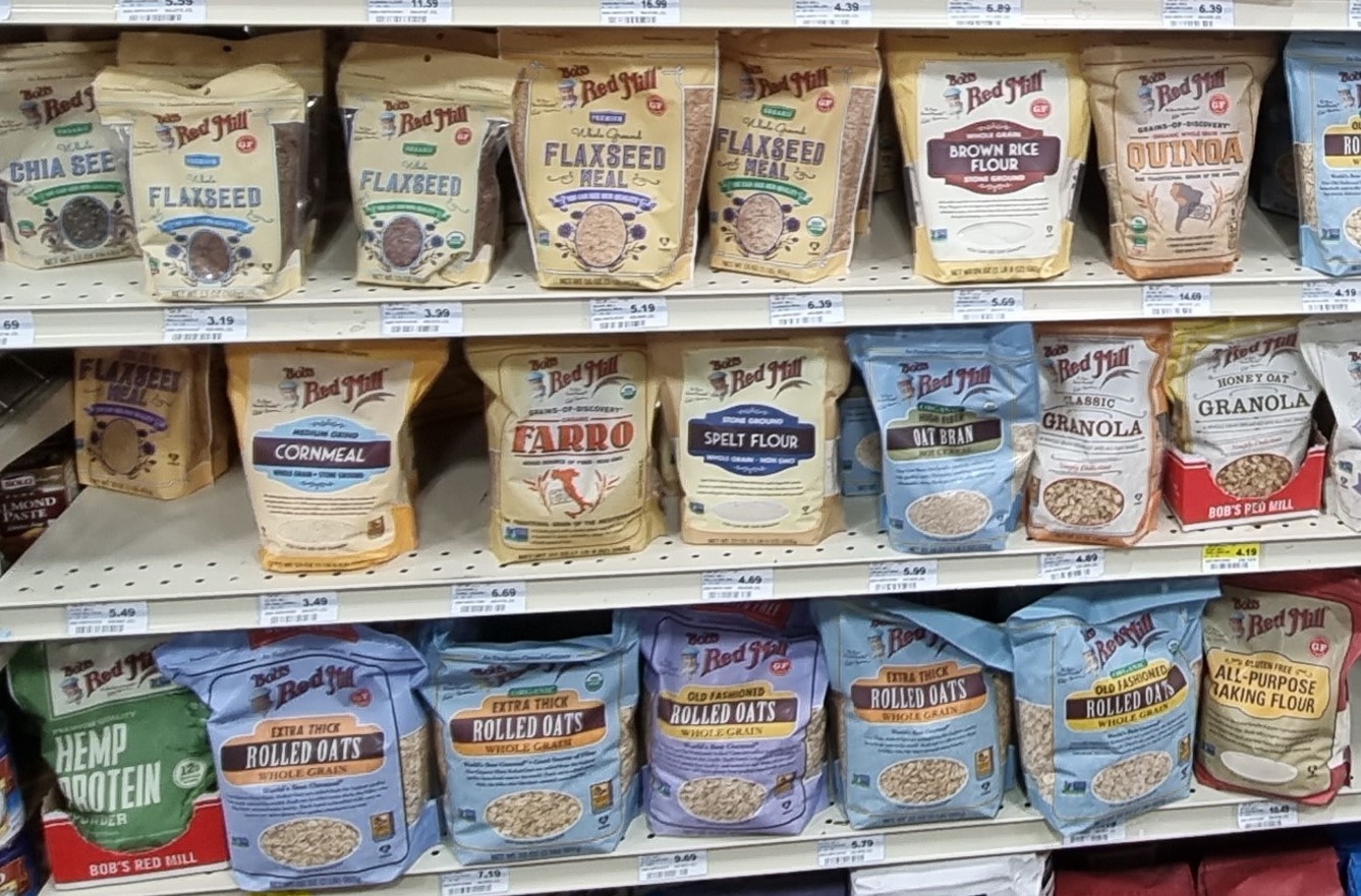
These days, my breakfast is a combination of grains (which I carry), fresh fruit and dairy. I soon find the grains (linseed, flax, oats etc.). Blueberries and strawberries are in season. I’ve never eaten this many strawberries!
We head north over the state line into Wisconsin. Over the next three nights stay at Delavin, Watertown and Princeton.
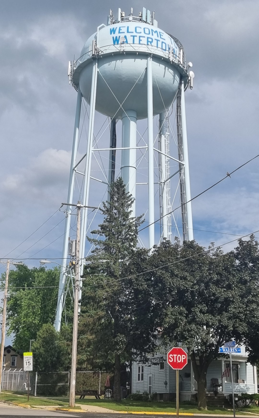
Just about every town has a water tower, often impressive and a landmark we can see from a distance.
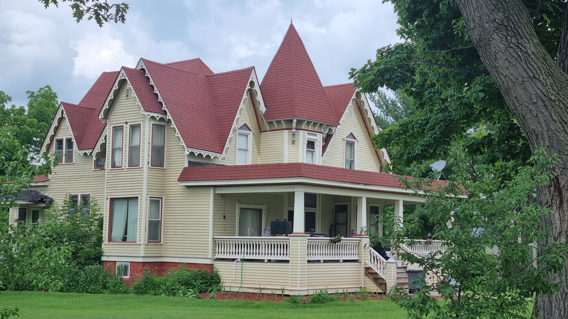
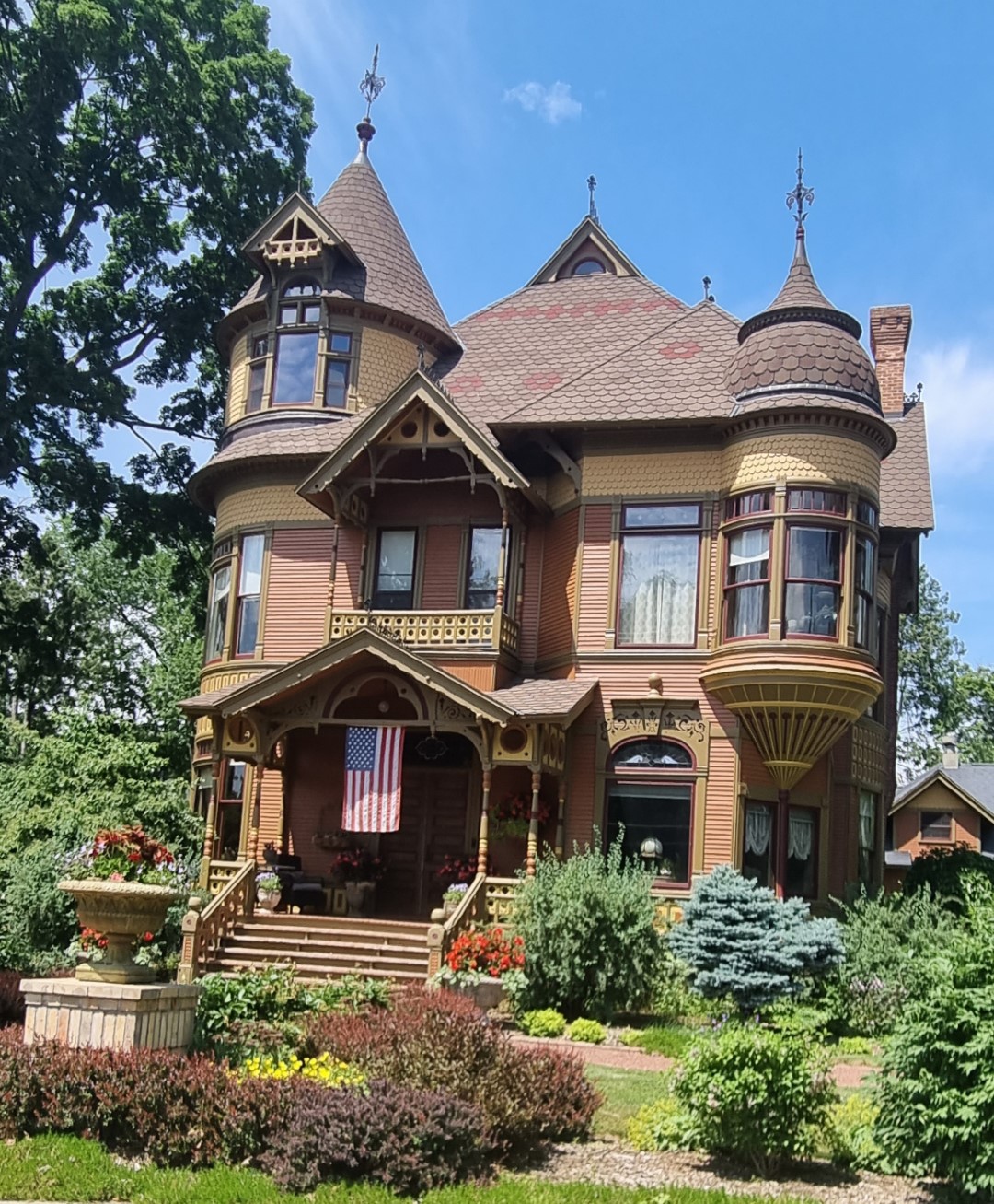
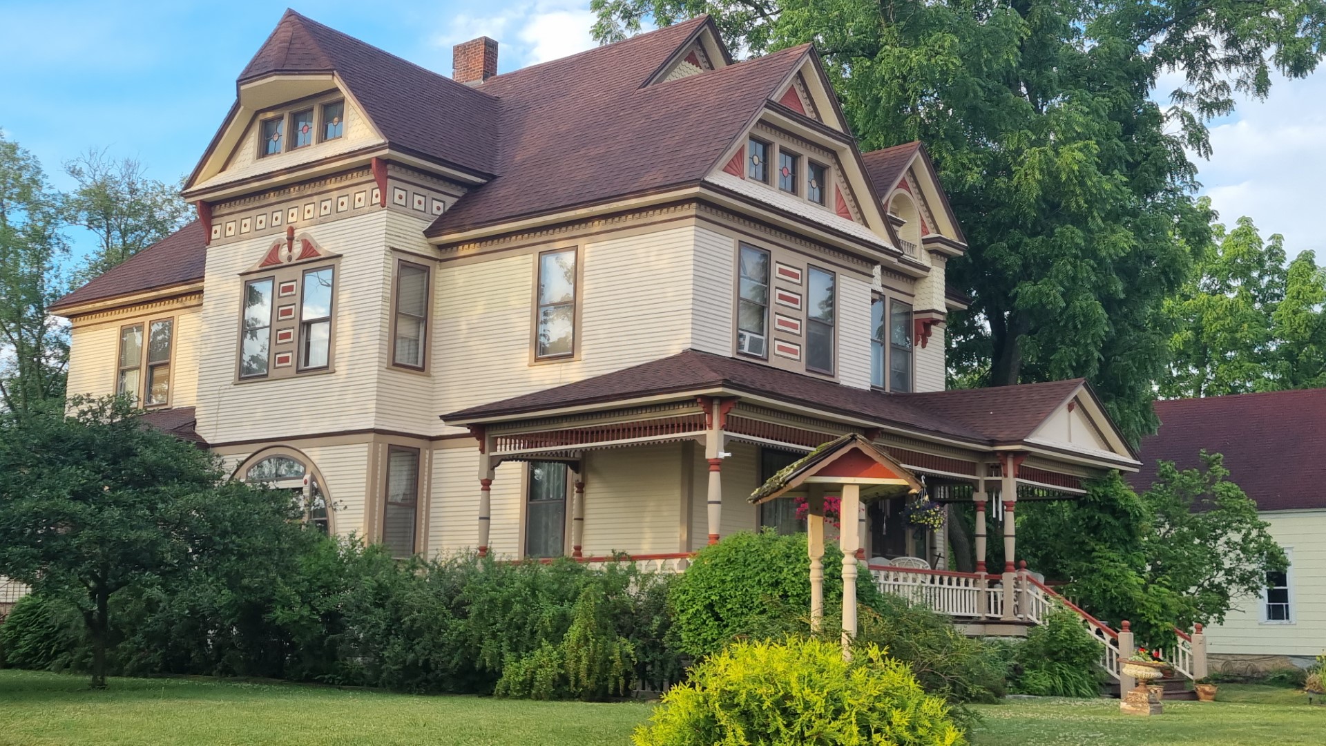
There are some fine examples of old timber houses in Wisconsin country towns.
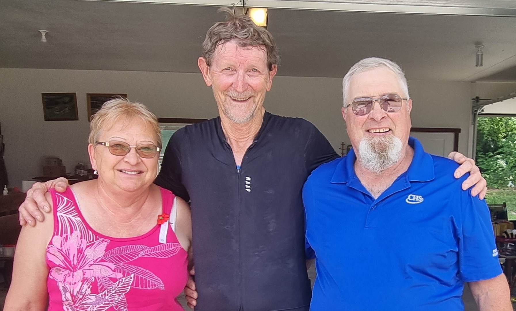
We call in on my brother and his wife near Waupaca. I was a foreign exchange student here when we were both seniors in high school. It’s so good to be back together and to catch up with old friends.
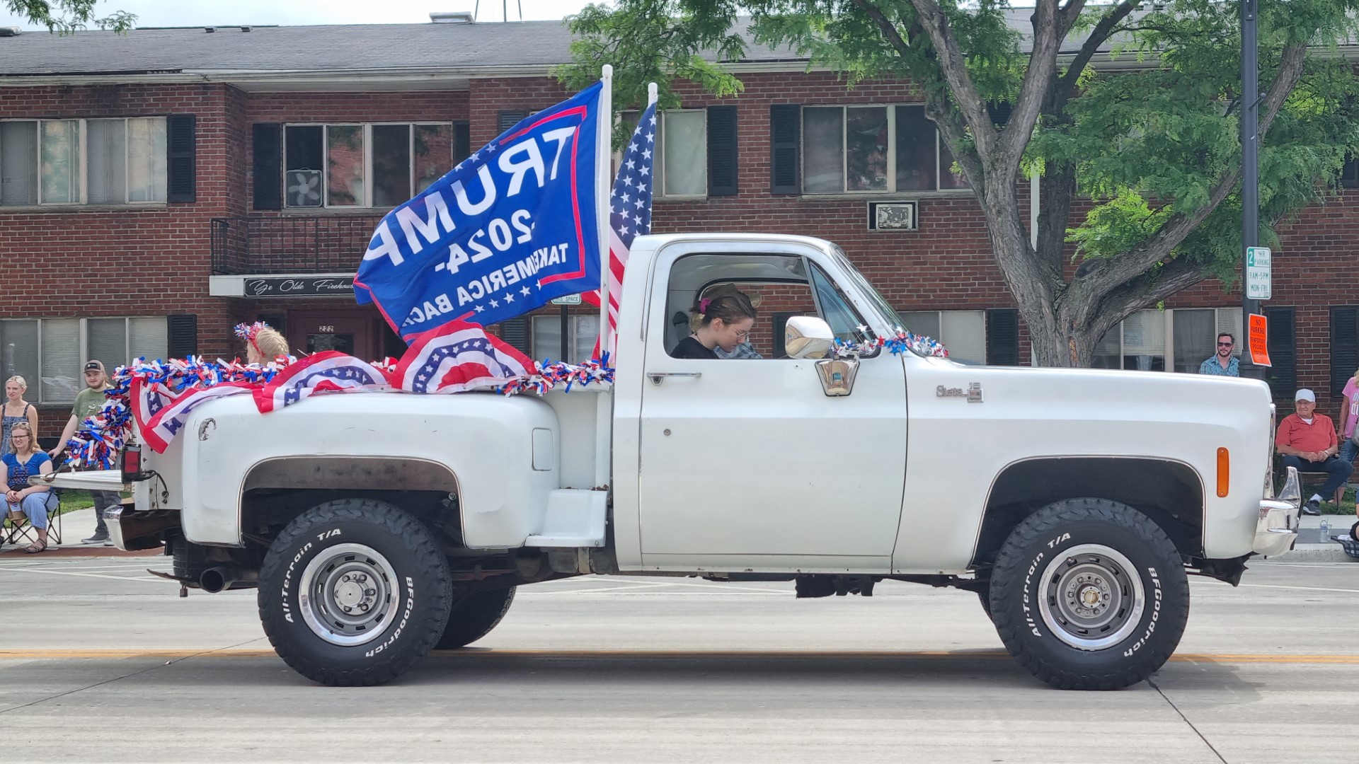
We are watching the Fourth of July parade in this central Wisconsin town. There are marching bands, veterans, fire brigade, active seniors, candidates for sheriff in the looming elections and the local branch of the GOP.
Mr Trump’s effort to still be the president, even though he was not elected, is not seen as an irony on this day when the country celebrates freedom from an unelected British king. That’s what 4th of July is.
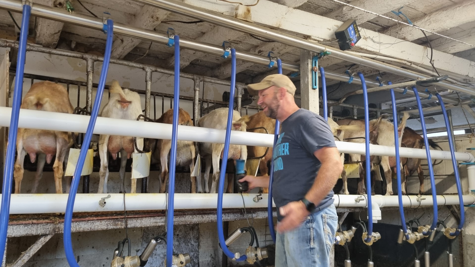
A dairy goat milking parlour. Tom and Kari are milking 120 does a day and each one averages one gallon (about 4.5l) a day.
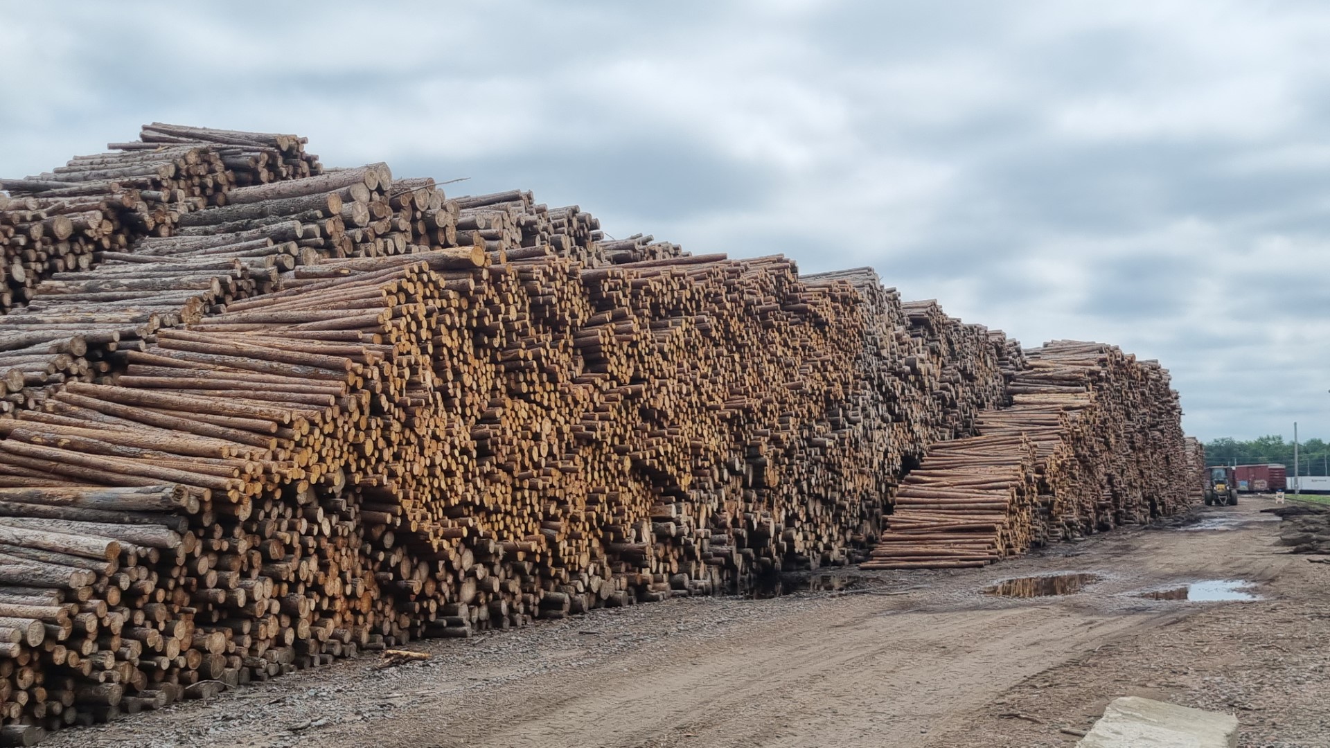
At Wisconsin Rapids we pass a massive paper mill. This is a small part of the pine log stack.

Christian faith is strong here and sometimes the church signs make grand claims.
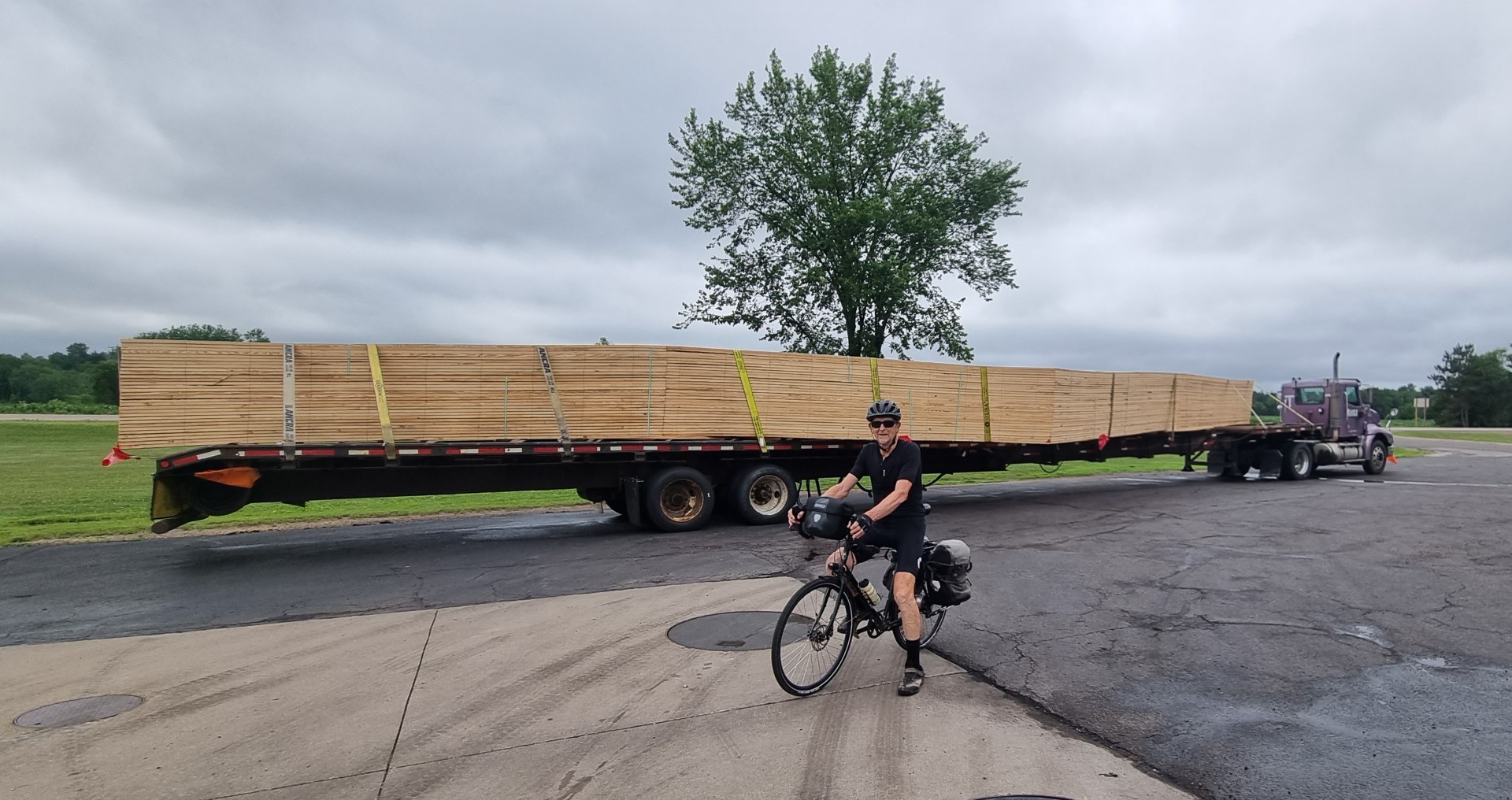
Long load shot. These are roof trusses.
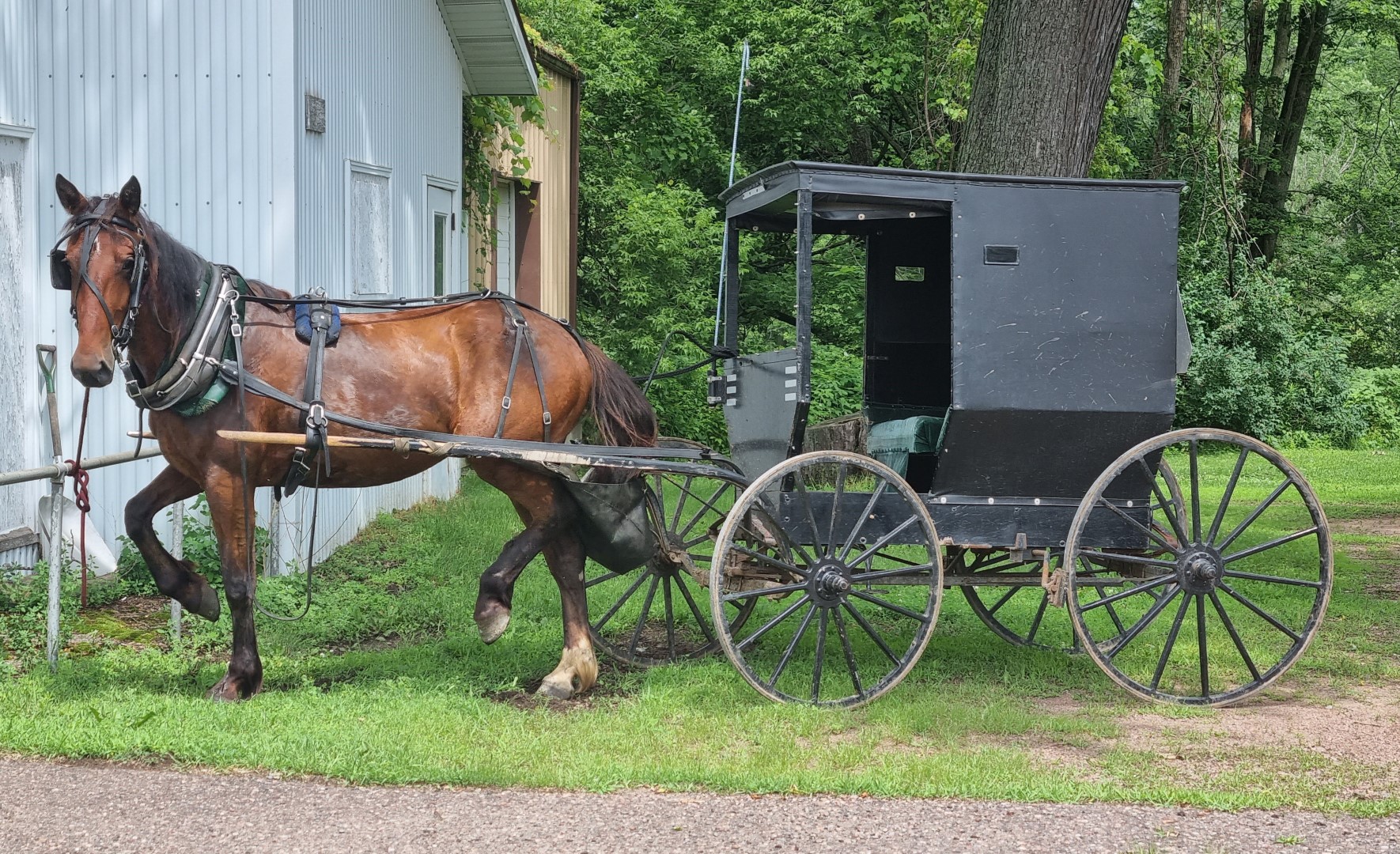
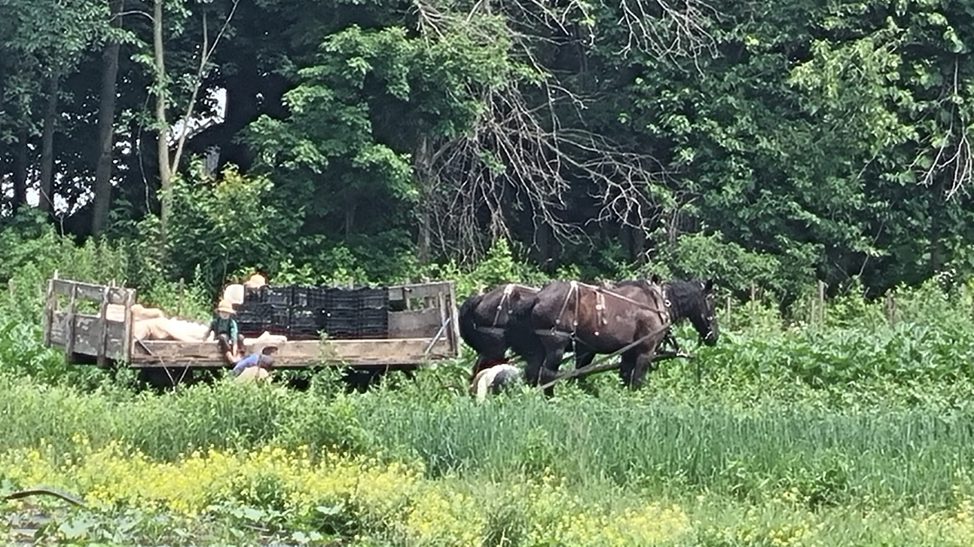
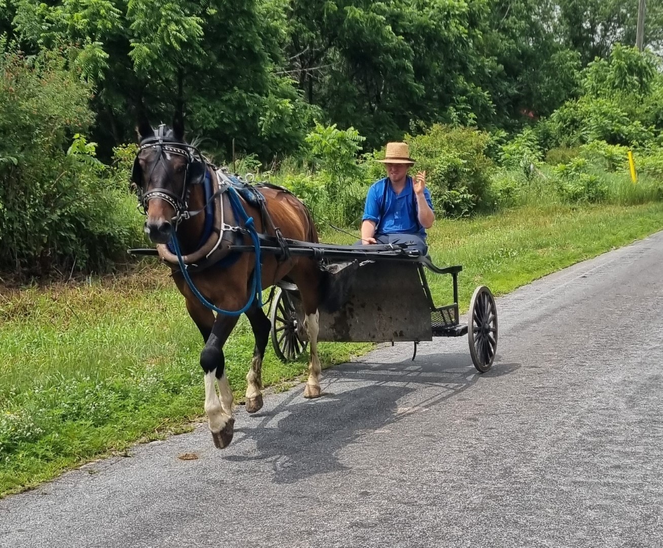
We are passing Amish communities daily. They use buggies to get around and use Clydesdales in the fields.
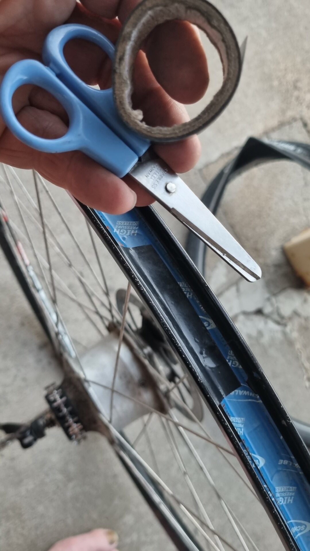
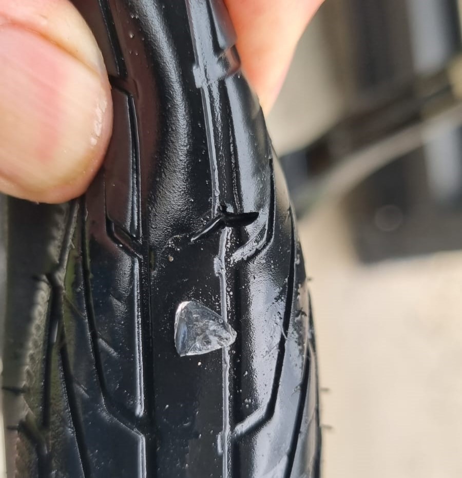
A plug for carrying a bit of insulation tape and a small pair of scissors. This Schwalbe rim tape is one of the extra strong ones made for tubeless systems. It has cut the inner tube.
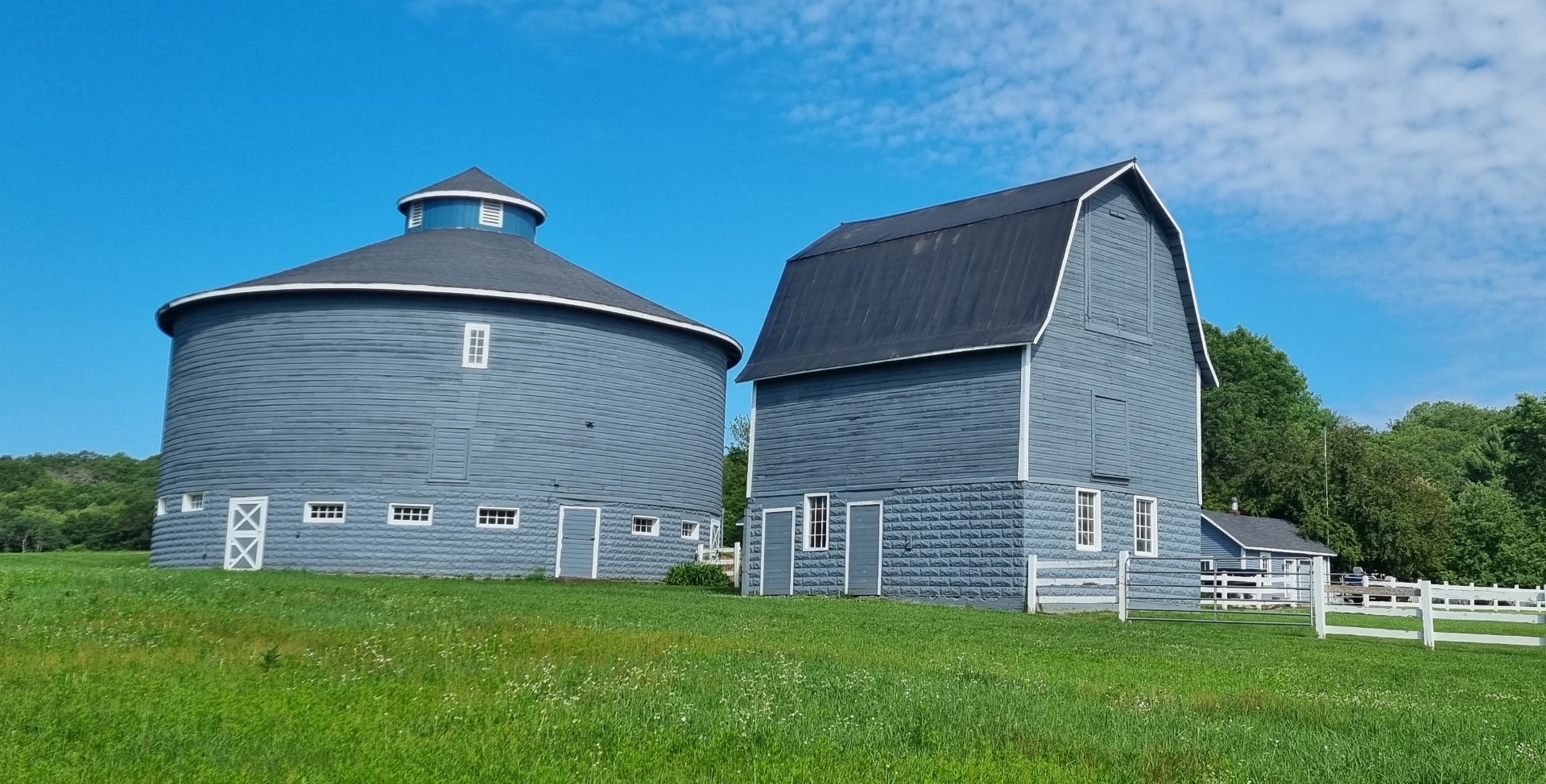
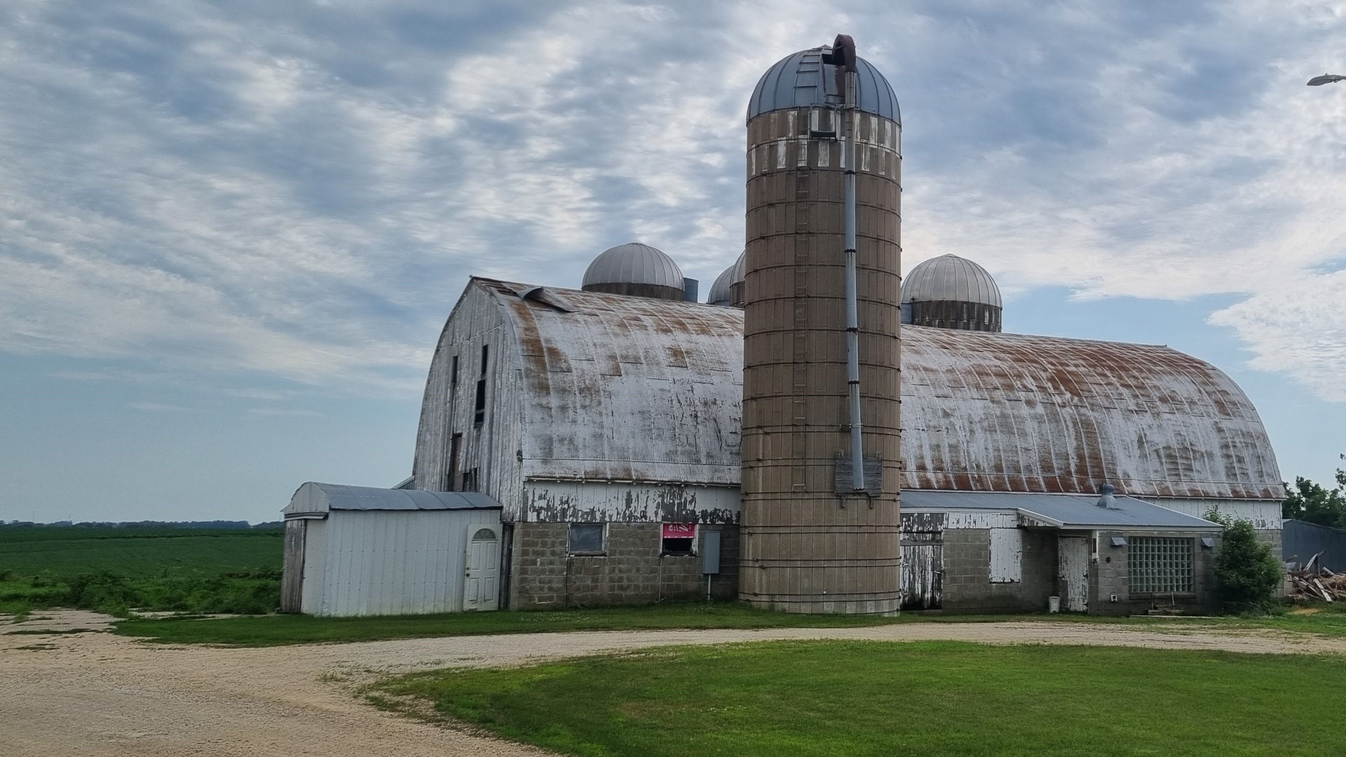
Farm buildings in Wisconsin and Minnesota. What they can grow in 4-5 months needs to be stored for the long winter.
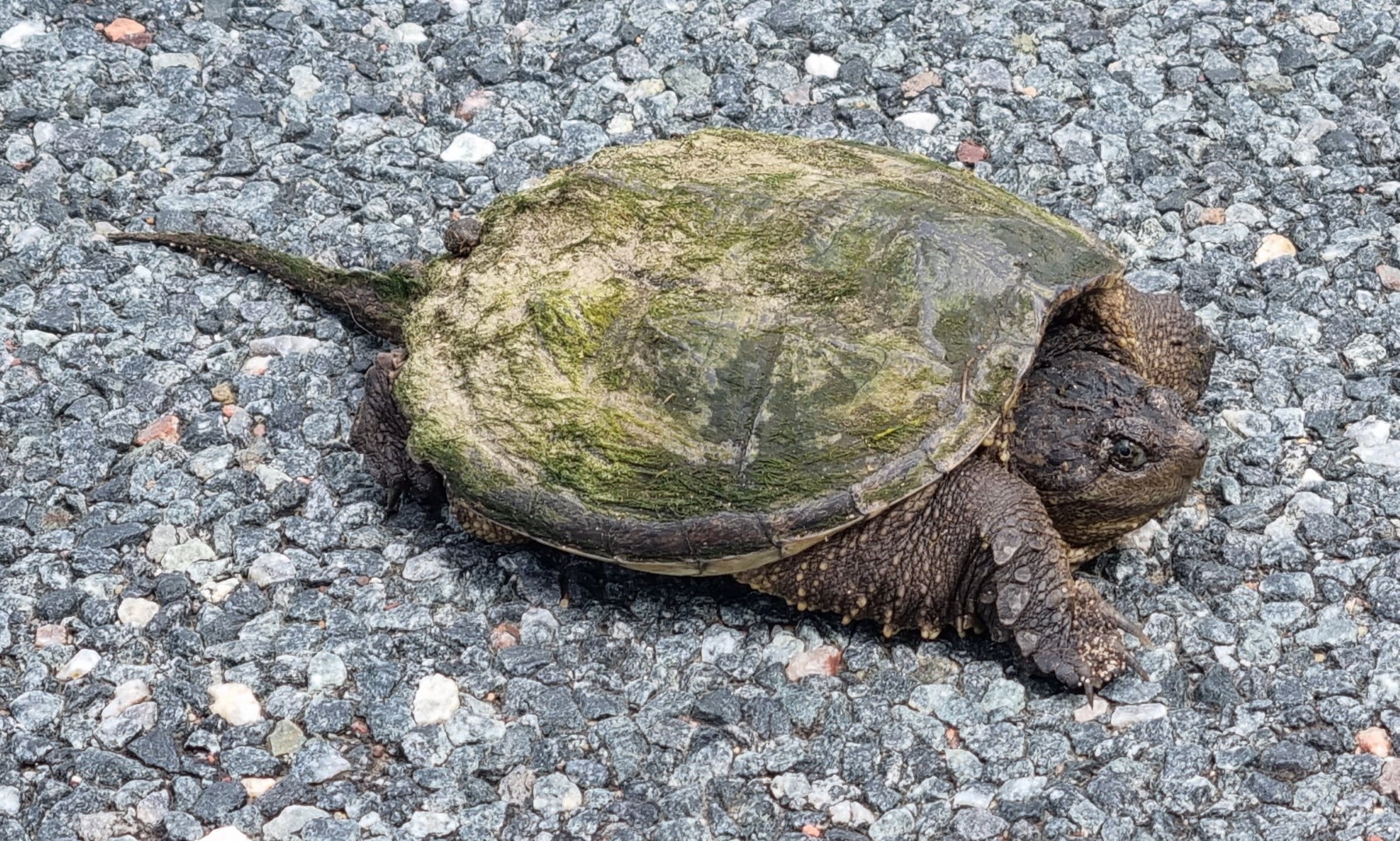
It’s not uncommon to see turtles when bike touring. Being reptiles, they sometimes sit on roads to get warm, and they sometimes get run over. So, I always move them off the road. Usually that is not hard as they retreat into their shells.
But this one (called a Snapping Turtle) is aggressive and objected strongly. It tried to bite me. She was not moving so I pushed her off with a stick.
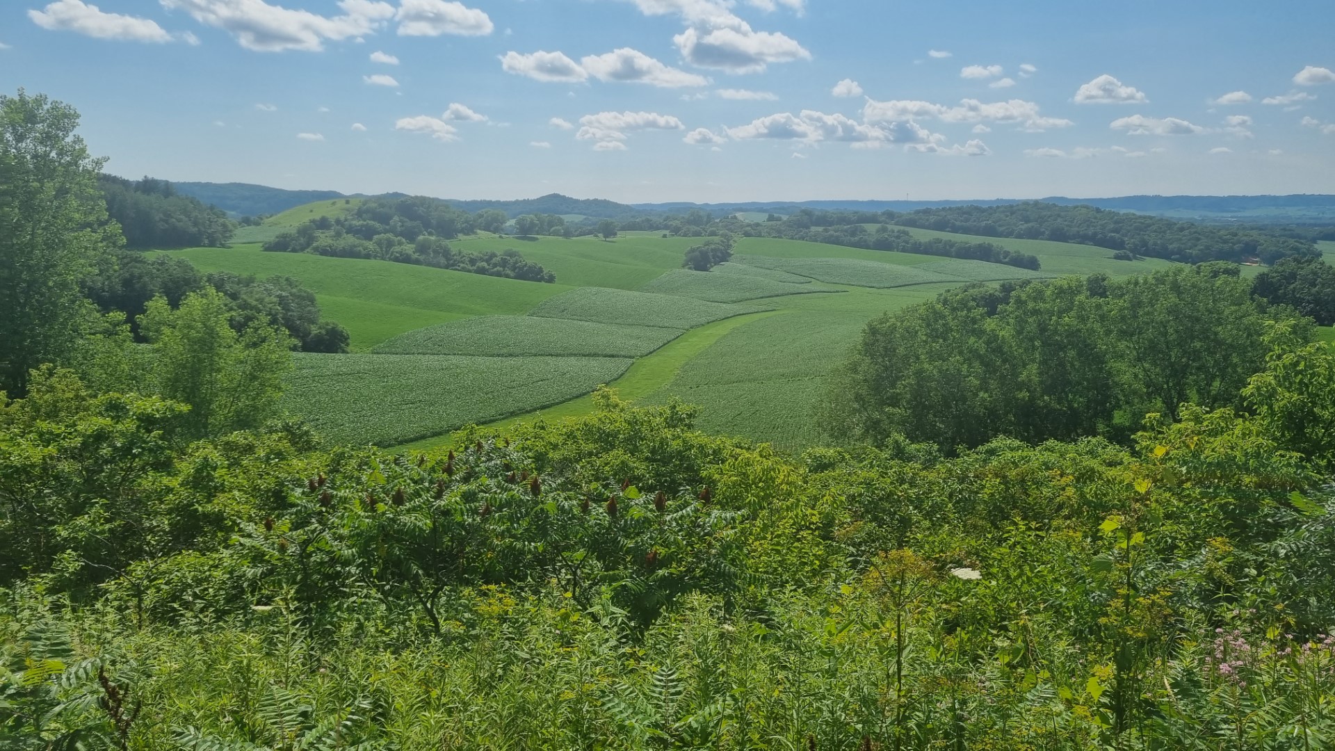
The “Driftless Area”. What is called moraine in Europe, in the USA is called “drift”. In southwest Wisconsin and southeast Minnesota there is an area that was not covered by glaciers.
Most of the upper Midwest was. The hilltops were not shaved off and the valleys were not filled by soil and rock (drift) as the glaciers melted. Hence this is called the Driftless Area. We are in hilly country for a few days.
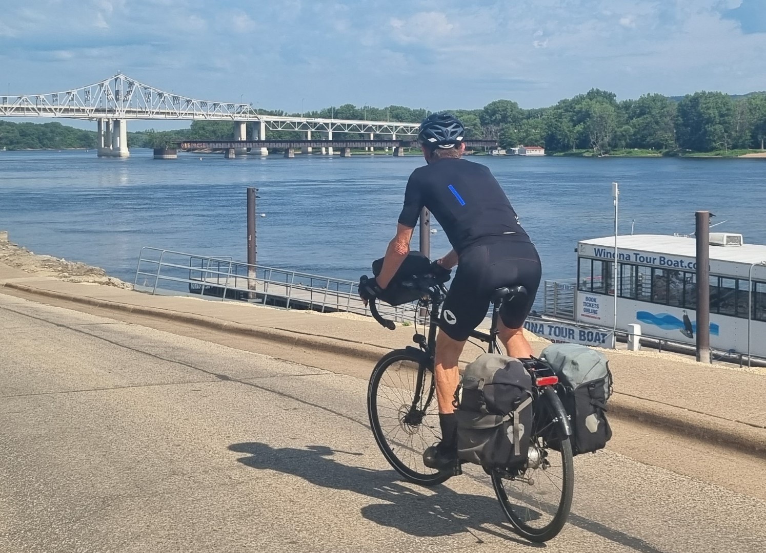
The mighty Mississippi
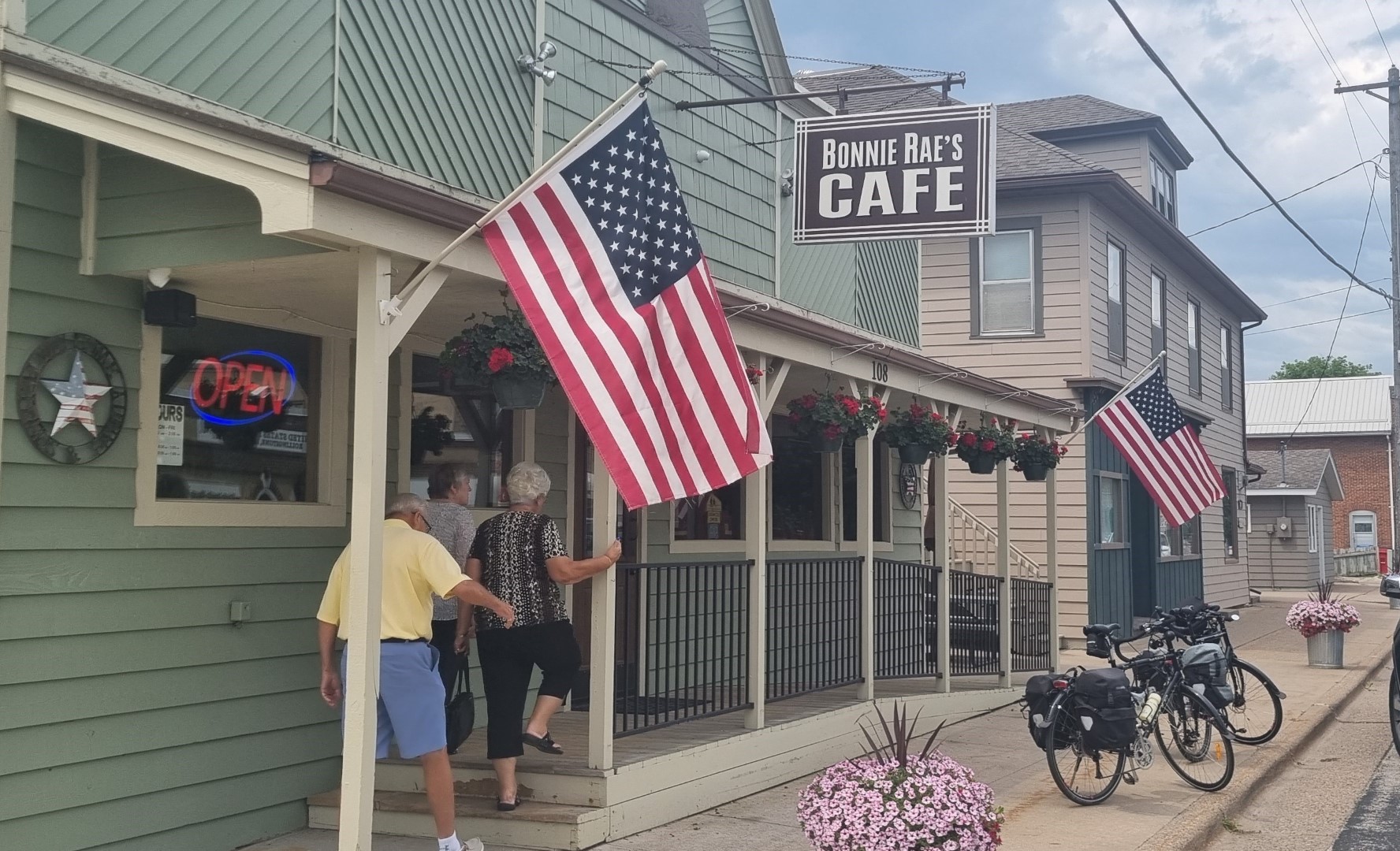
The small-town cafes and diners are good. There are flags everywhere. (By contrast, in Sydney there is a flag on the GPO and another on the Sydney Harbour Bridge. That’s about it.) But the US flag means very different things to different people.
Minneapolis. This is a bike friendly town. It was also George Floyd’s town and there are Black Lives Matter signs outside a lot of the homes.
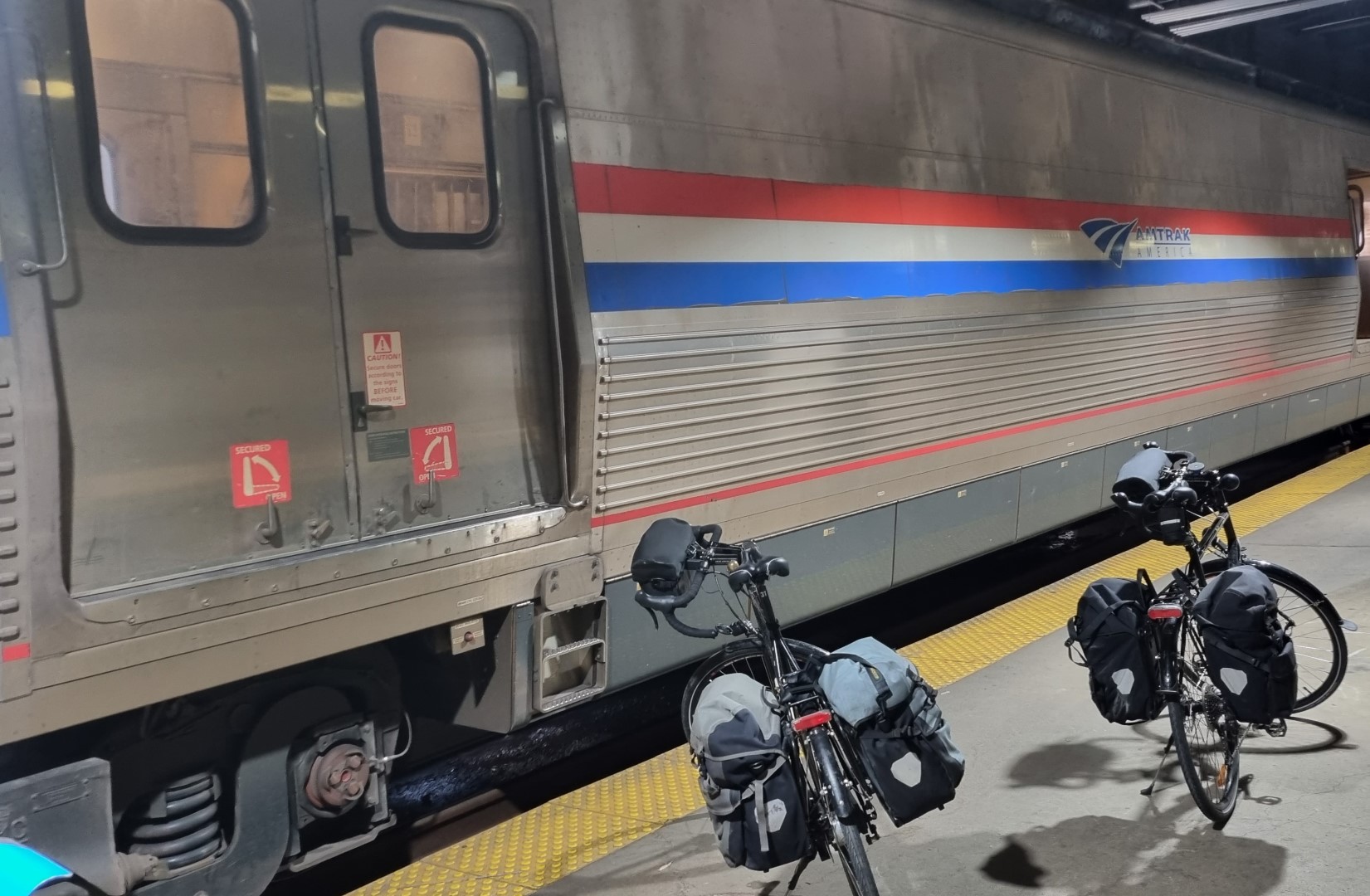
We use Amtrak to return to Chicago in preparation to depart from the USA. Not all Amtrak lines have Baggage Cars (checked baggage service). Those that do, only offer to add or remove luggage at some stops. The “Empire Builder” from Seattle to Chicago does have a baggage car and we could put our bikes on at Minneapolis and get them off at Chicago. US$20 per bike.
Given the hostility of US airlines to oversize luggage, it’s worth remembering that Amtrak can move you and your bike around.
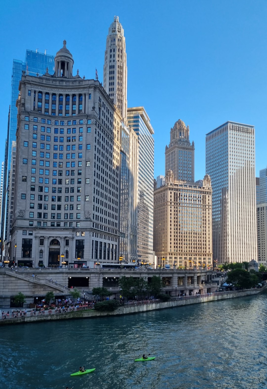
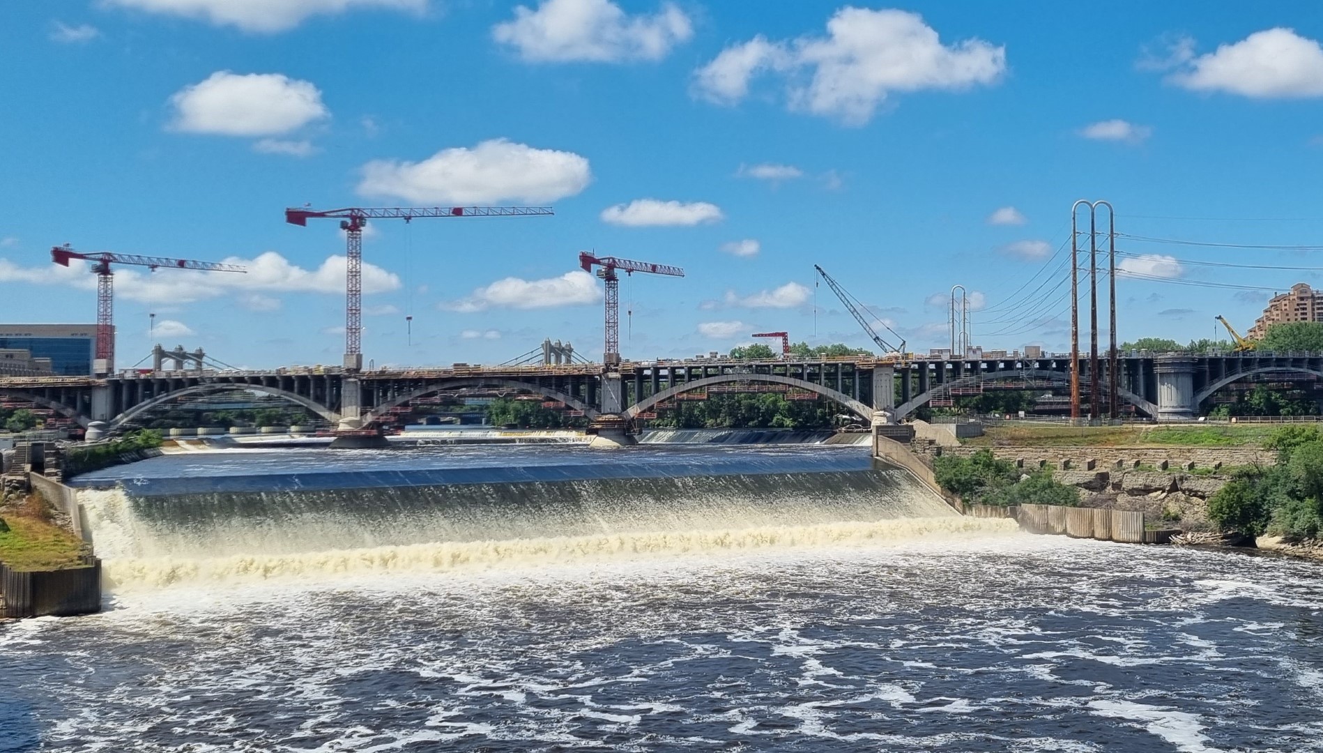
Chicago is a fantastic city to ride in. Very good bike routes.
Packing in the USA
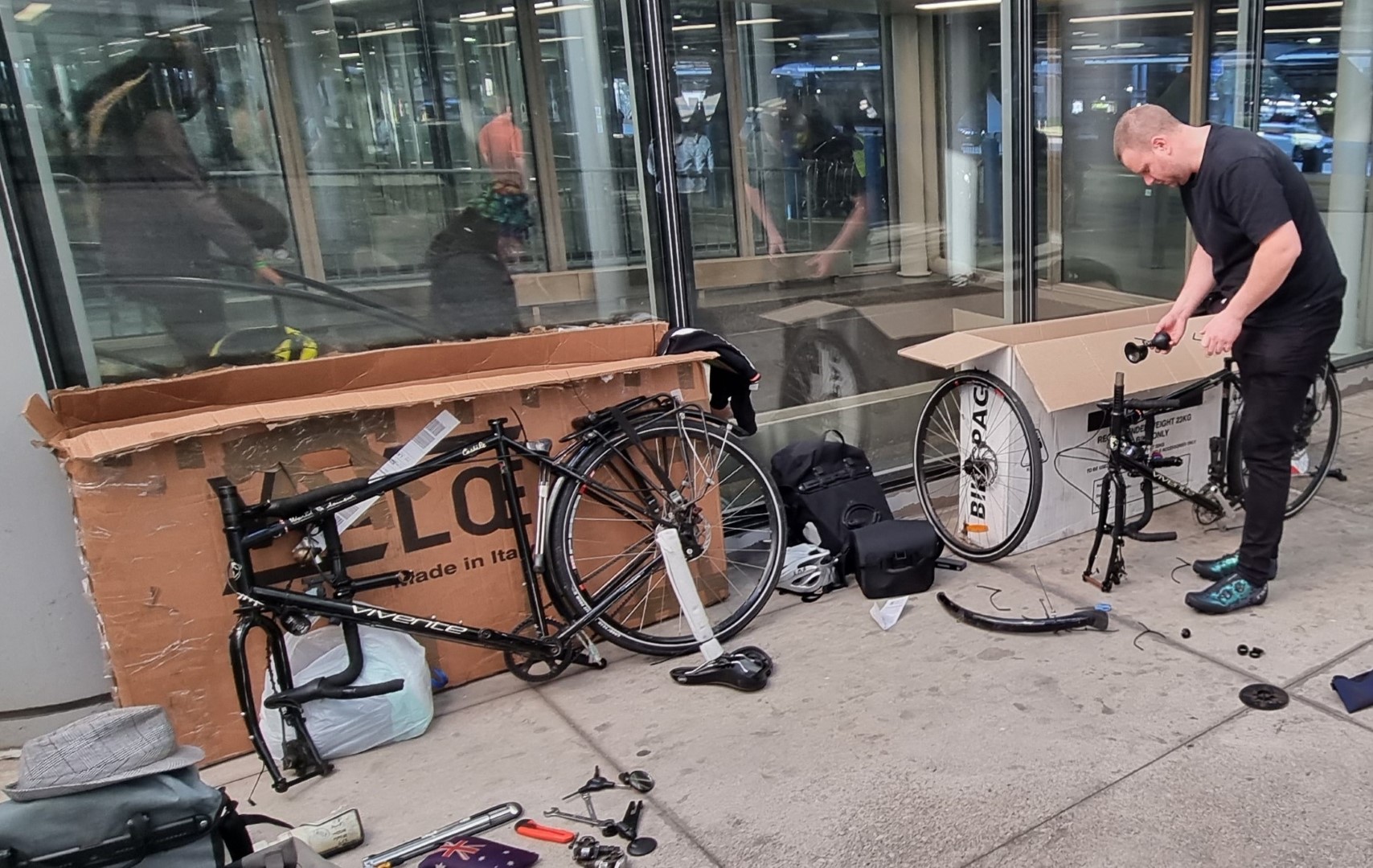
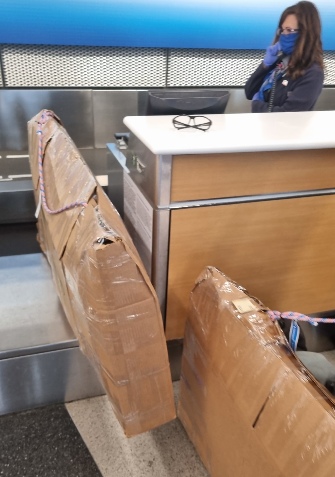
For starters, you cannot buy a bike carton at an airport. We have Qantas return tickets which means, even though we are catching AA flights from Chicago to Los Angeles, we are covered by QF baggage rules. So, we just need to pack the bikes somehow.
We choose a motel 5km from the airport that has an airport shuttle service. We can do the packing at the motel. There’s no bike shop for miles and, even if there was, how would we get cartons (if they had any) to the motel?
It’s raining and there are no taxis anymore. But nearby there is a storage place that sells removalist boxes. These are only 3-ply cardboard so are not really strong enough, but we have to make do. Learn how to pack your bike without a carton. In addition to the cartons, and from a hardware store, we buy a box-cutter, tape and zip-ties and some thick rope. We tie the rope to the headtubes and rear rack so that anyone wanting to lift the bike is forced to lift with the rope. It works perfectly.
Test Reports
Goodyear Transit Tour 700×40 S3 tyre
There was some glass on the roadsides, and I did get a flat due to a piece that probably would have punctured any tyre.
Busch & Muller IX-Q headlight
We have no issues with this headlight. It is the best light we have ever had. You leave it turned on all the time (DLR-Day Light Running).
Traffic can see it from a great distance. It does not blind oncoming cyclists on paths due to the beam shape. At 100 lux, it is bright enough and wide enough for very dark nights.
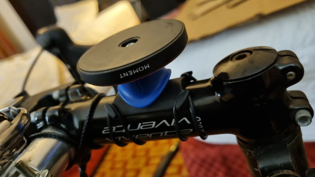
Rokform and Magsafe smartphone mounts
Our Rohloff bike has a Rokform mount and an android phone. We have used this mount for several years without ever having the phone come off. The Deccan bike was fitted with a Quadlock clamp with a Magsafe wallmount attached to it.
The iPhone was in a Magsafe case. Unfortunately, it did come off once when the bike hit a large pothole at speed. The phone survived with scratches, but it could have been smashed by traffic.
Google Map Route management
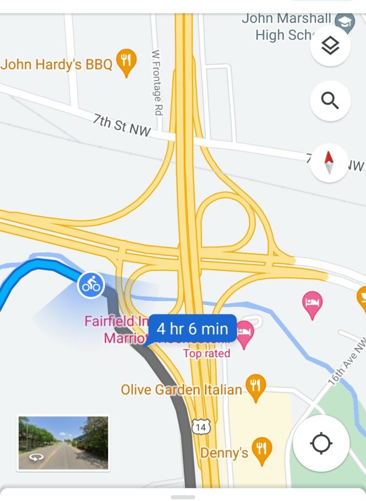
We’ve been test-riding and improving touring bikes since long before the internet was created. In the last 15 years google maps have been a steadily improving map option.
This ride was in the USA and there you can rely on Google Maps. Of course, that does in turn rely on you being on-line. Being able to zoom in and out, whilst riding, and confidently getting through, for example, massive road interchanges make the old paper-map days just a bad memory.
A post-Covid, A-to-B ride, from Milan to Brussels. If felt strange to be on a big plane again. A 100% packed A380, with everyone wearing masks. Everyone was going to Europe, and nothing was going to stop them.
I’d cycled across northern Italy before but not as far north as the lakes. And I’d cycled through Switzerland a few times but had never crossed the alps that separate Mediterranean and Germanic Europe.
There are a few routes, but I chose the Nufenenpass and the Grimsell Pass. These days there is the Gotthard Road Tunnel, which is 17km long and starts near Airolo in the south. It keeps most of the traffic off the old road over the mountain pass which is good except that there are a great number of motorbikes. On the Grimsell pass, for every 100 “vehicles”, 65 are motorbikes, 30 are cars and 5 are bicycles. That’s a lot of bicycles when you see the size of the alps. In most countries, on big mountains you see no bicycles.
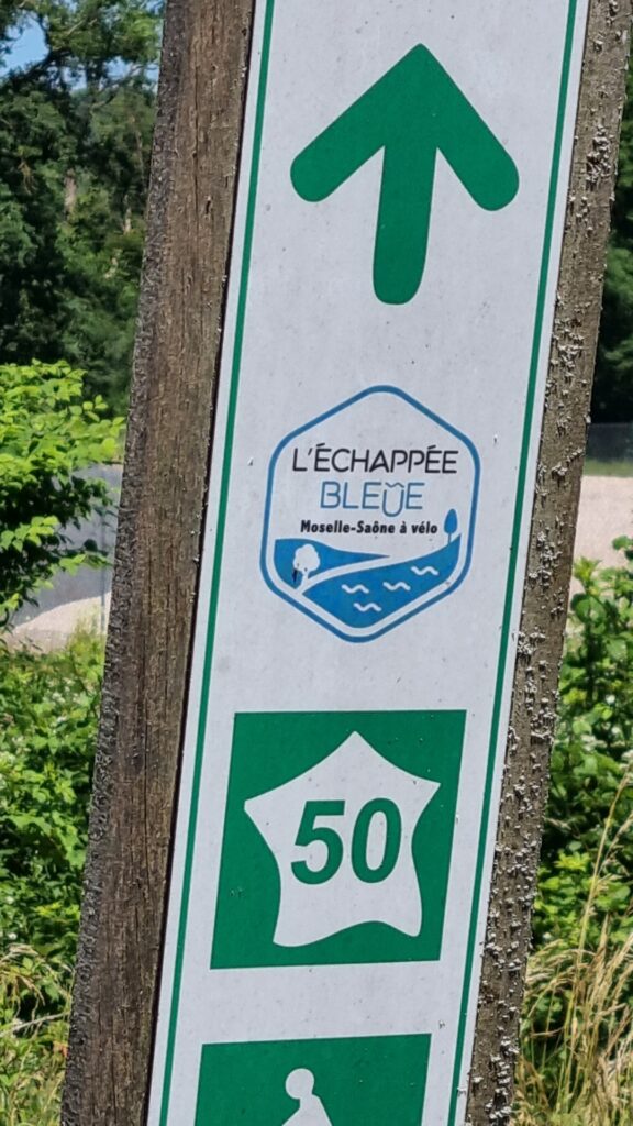
Once over the mountains, I spent a few days in Interlaken and then headed to Rheinfelden near Basel, before turning west into France, at first on the Moselle, and then over to the Meuse Valley. This was supposedly a EuroVelo route (EV19) but the start of it is still in the planning phase.
The Lorraine region is a great cycling destination, and it was busy on the bike routes. The Meuse eventually reaches Belgium. I departed from Brussels, heading back to the Tasmanian winter.
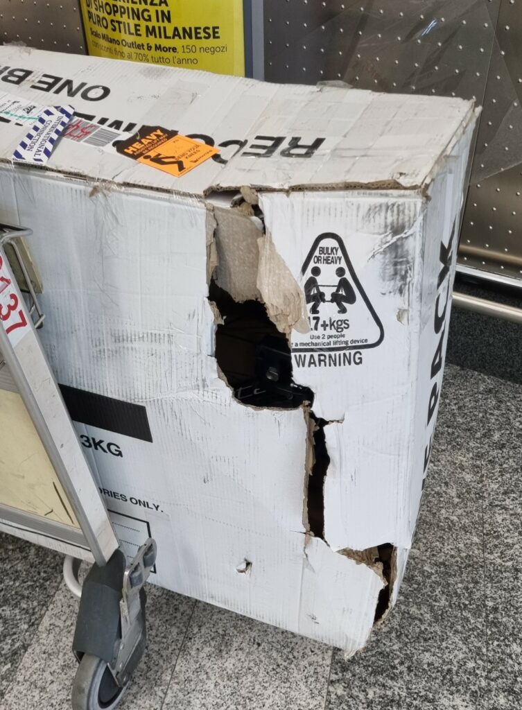
Bad start. My carton had been damaged. Most likely because it was raining in Melbourne when the small plane from Tassie was being unloaded. Nothing had fallen out because I always attach things to the bike because this damage can happen.
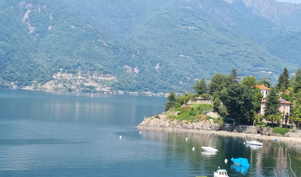
The Italian Lakes. This is Lake Verbano. There are bikes everywhere, mainly roadies in training.
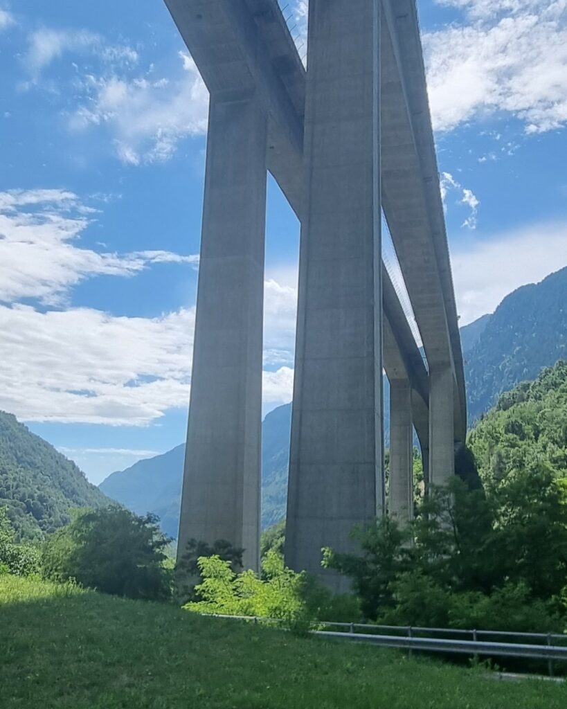
Starting to climb
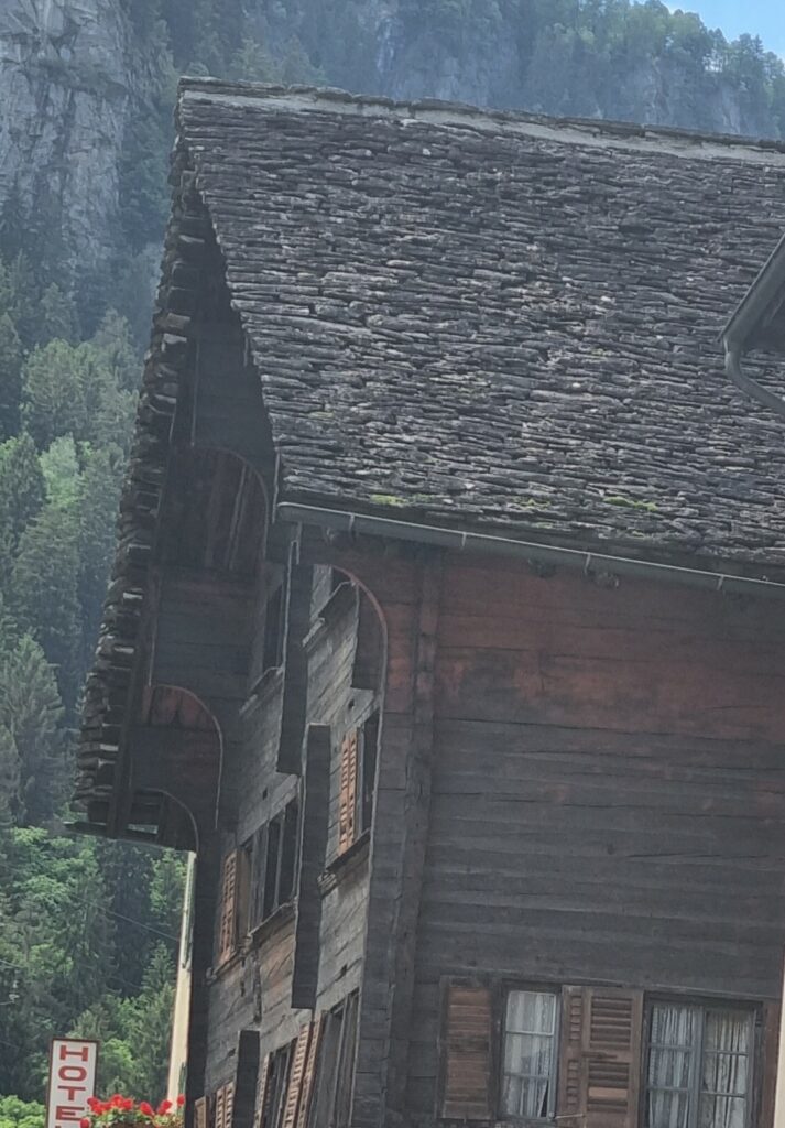
Stone roof. It is always amazing to see this. Imagine the weight of it!
Out of Airolo the climb gets underway. Weather is ok.
Atop the Nufenenpass. About 2,500m. It’s ridiculously cold. According to Fabian Cancellara, this is the hardest climb in Switzerland. And he doesn’t have panniers! That night I stayed in Ulrichen.
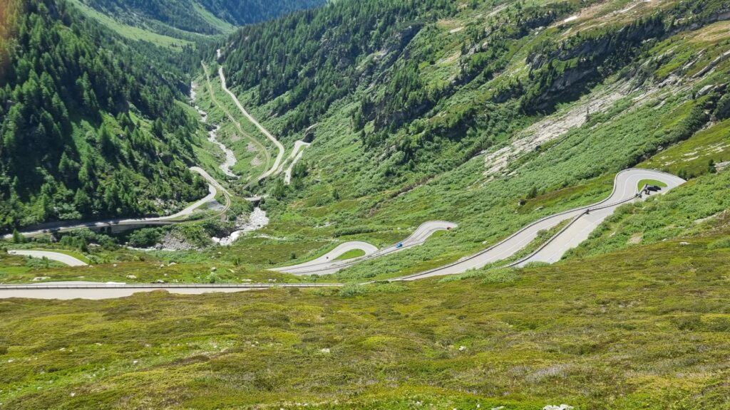
Climbing the Grimsell. This pass is a bit lower (2,160). The descent on the north side to Meiringen is 1,650m in only 32km. So, you need good brakes.
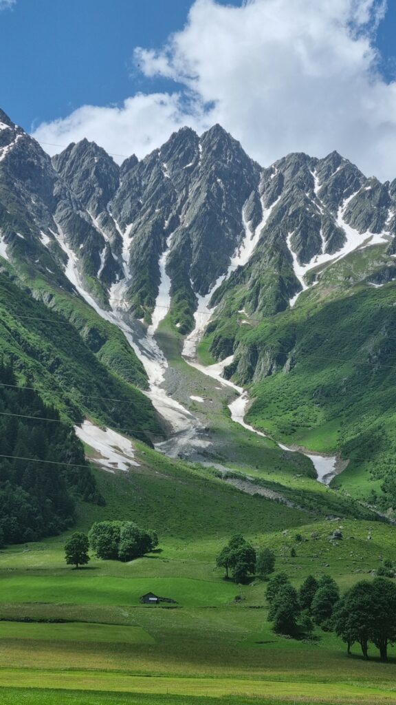
The Swiss scenery is classic.
More classic scenery. The bicycle is the way to see it as you can stop whenever you want.
Farmhouses east of Bern. I always stay at Airbnb’s in this part of the world. I look for places in or near villages that have a supermarket.
The bike path goes left here, and this pair make sure that I stick to the route. I could not capture it on the shot, but they gave me a nasty greeting.
After passing the corner where France, Germany and Switzerland meet, I’m heading down the Moselle bike path.
After passing the corner where France, Germany and Switzerland meet, I’m heading down the Moselle bike path.
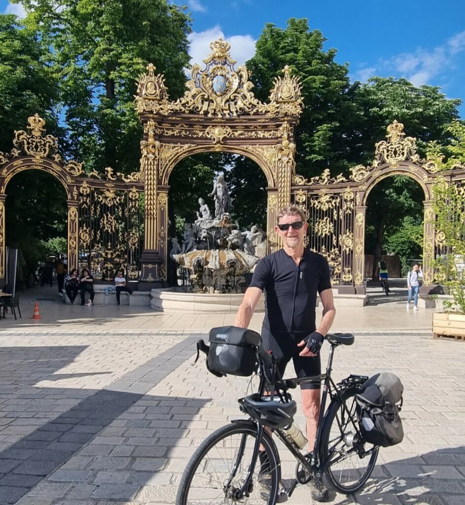
Back at Place Stenislas in Nancy. I rode through here years ago. This is a stunning baroque square that is impossible to capture in one photo.
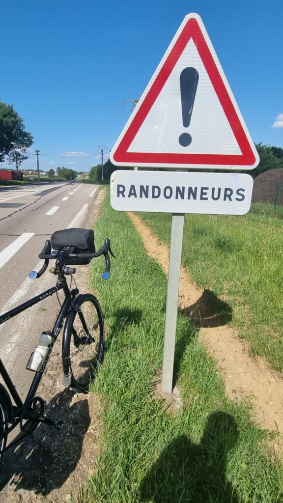
In the Lorraine region, motorists are urged to take care and respect travelling cyclists (randonneurs).
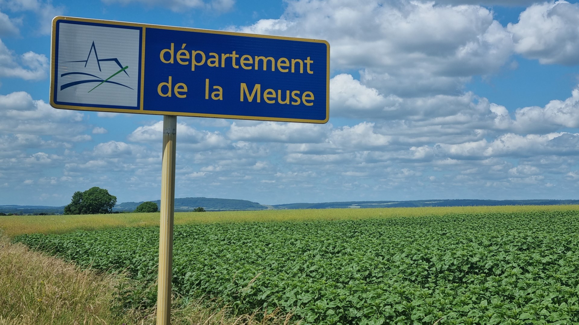
The Northeast of France is gorgeous. A real pleasure to cycle through.
A few days following La Meuse which is quite popular with randonneurs.
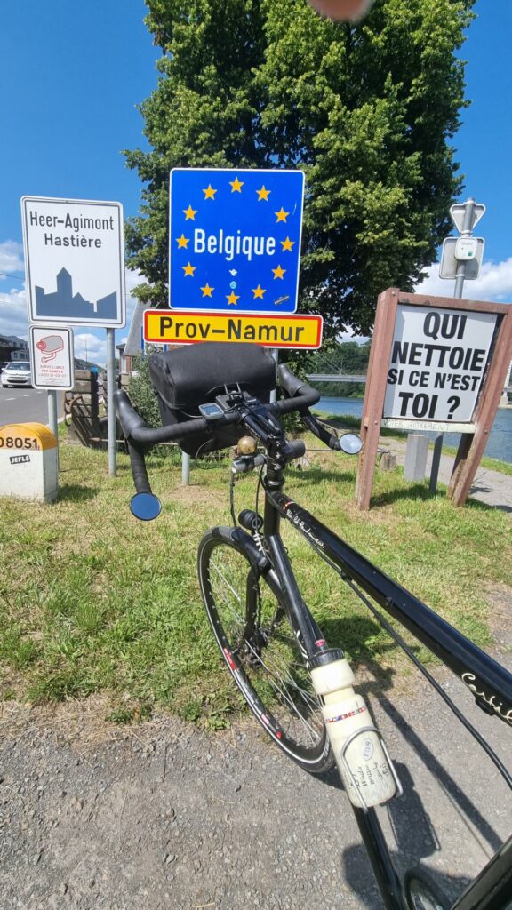
Into Belgium.
In Belgium, cyclists are everywhere. This is the bike parking outside a train station.
My tour ends in Brussels. I call into Velonaut, a great bike shop, very near to the Atomium, to see an old friend and he kindly supplies me with a bike carton.
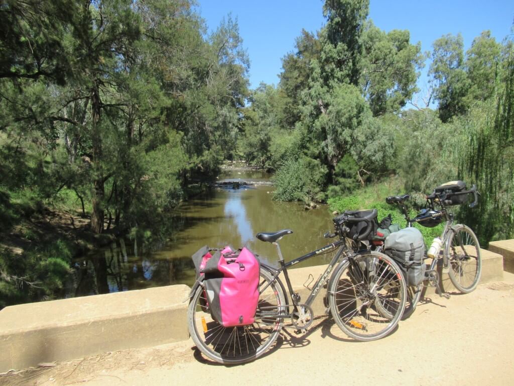
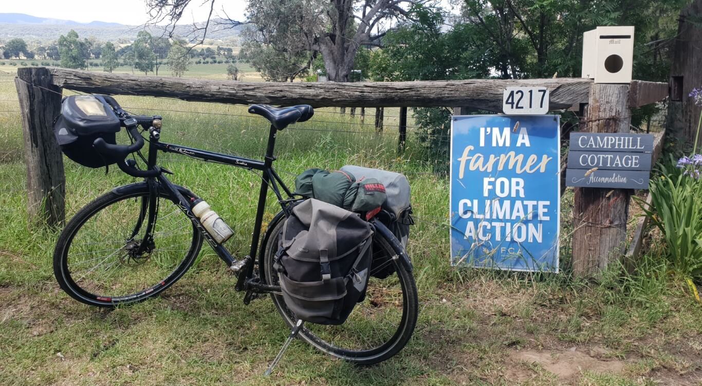
A Covid-period, A-to-B ride, using walk-on and off metro trains to access both ends of the route. We start in Bathurst and end in Goulburn, to catch a train back to Sydney. Riding out of Bathurst, we visit Orange, Mandurama, Cowra, Canowindra, Forbes, Parkes, Eugowra, Grenfell, Young, Harden, Galong, Boorowa, Crookwell, Taralga and Goulburn. 900km, mostly on secondary roads. We will write up a discussion about this as a case study in finding and managing routes within reach of the big cities.
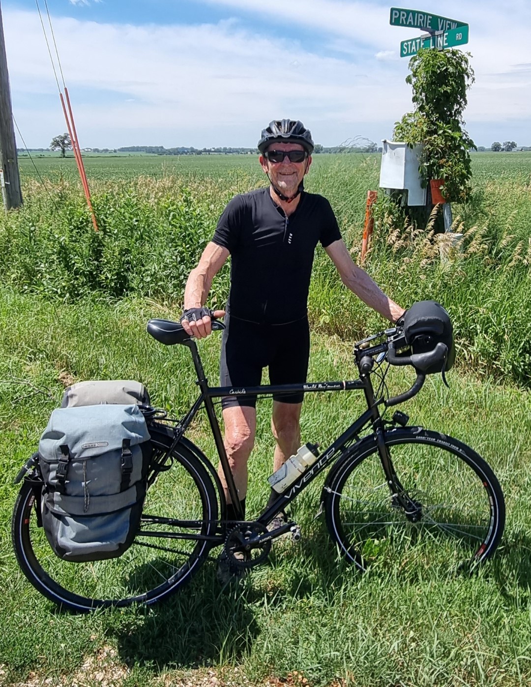
We are both on Rohloff models. A Swabia (700c with 40mm tyres) and a Castile (650B with 2.25” tyres). Last January we rode the Central West Cycle Trail, a mostly gravel road ride, slightly to the North. Then we were both on 40mm tyres and did not think at the time that we needed wider tyres. This time the route is mostly on sealed but very low-traffic roads. I’m interested in observing how the off-road tyre version is to ride on tar. Does it feel slow? How do the fatter tyres handle? Can I still come down hills fast?
This region can be hot in January. But if you look at the averages, it is not too bad. We have a few days around 35℃ but most are mid to high 20s.
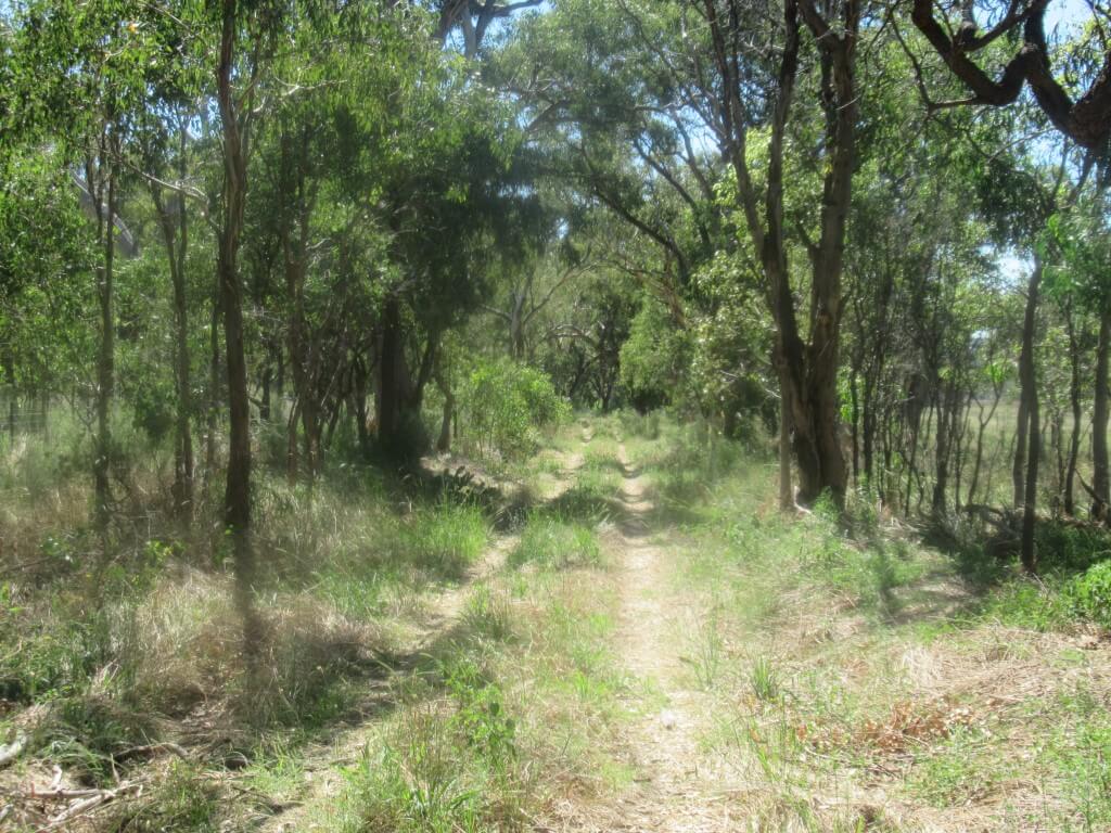
We start this tour with few real plans and no accommodation bookings beyond Bathurst. Each night we check the weather (wind and rain) and look for back roads using OSM and google maps. This is one of the best things about cycling on the western slopes of NSW. It is a vast area with towns large enough to have lodging in any direction. Mostly there is a main road plus optional back roads, many of which are sealed and yet quiet. We could zig-zag in many ways.
Wiradjuri Country
The ride is almost all in this tribal area.
The first Europeans to arrive simply followed tracks that the indigenous people had travelled for tens of thousands of years and now we are riding many of those tracks.
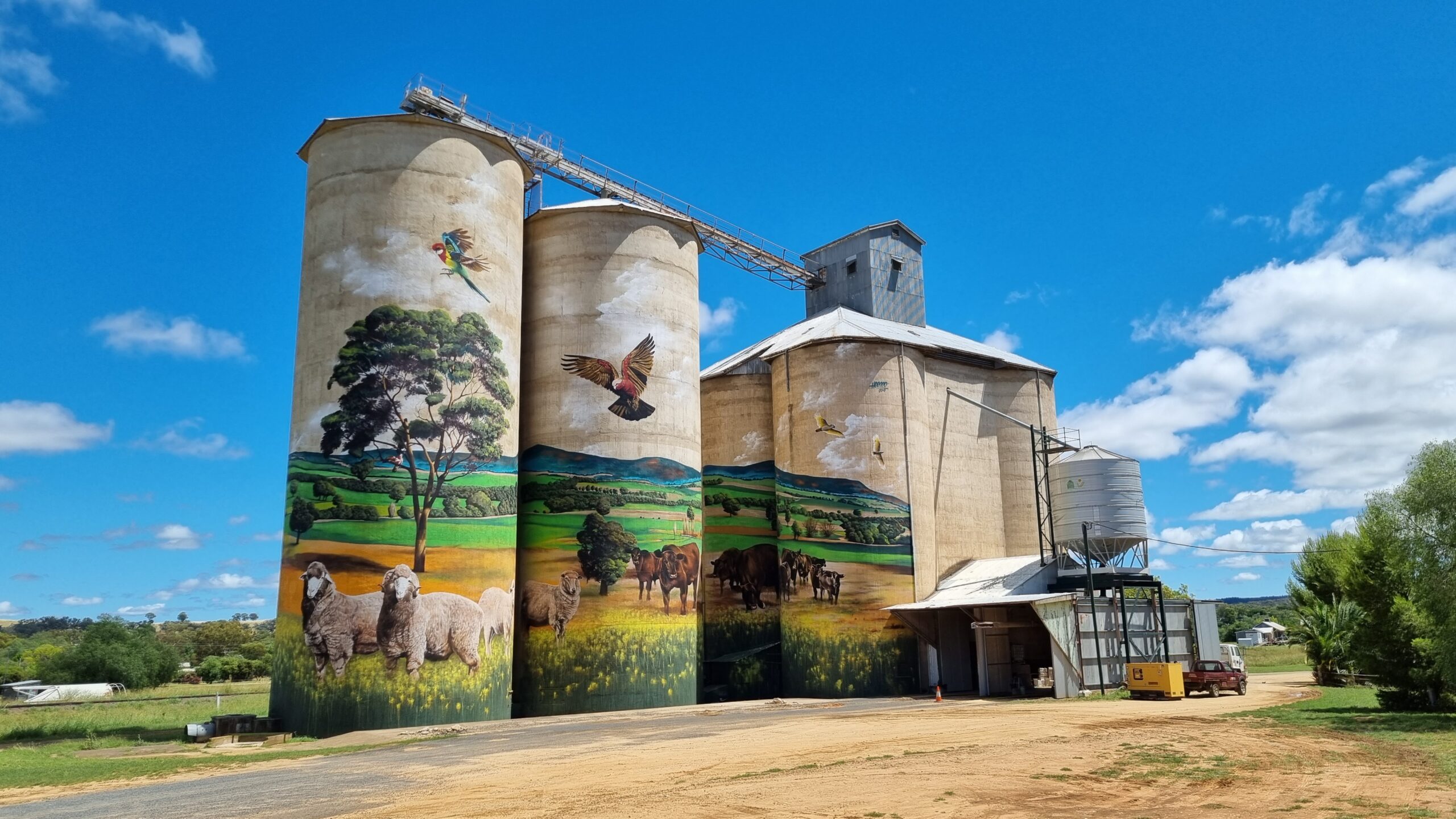
Painting massive murals on grain silos is a thing in Australia. This is a particularly good example at Grenfell. The design was a local collaboration and the artist was a Mongolian!
South of Harden. The local council is a consolidation of former and smaller councils. This is now aptly called Hilltops.
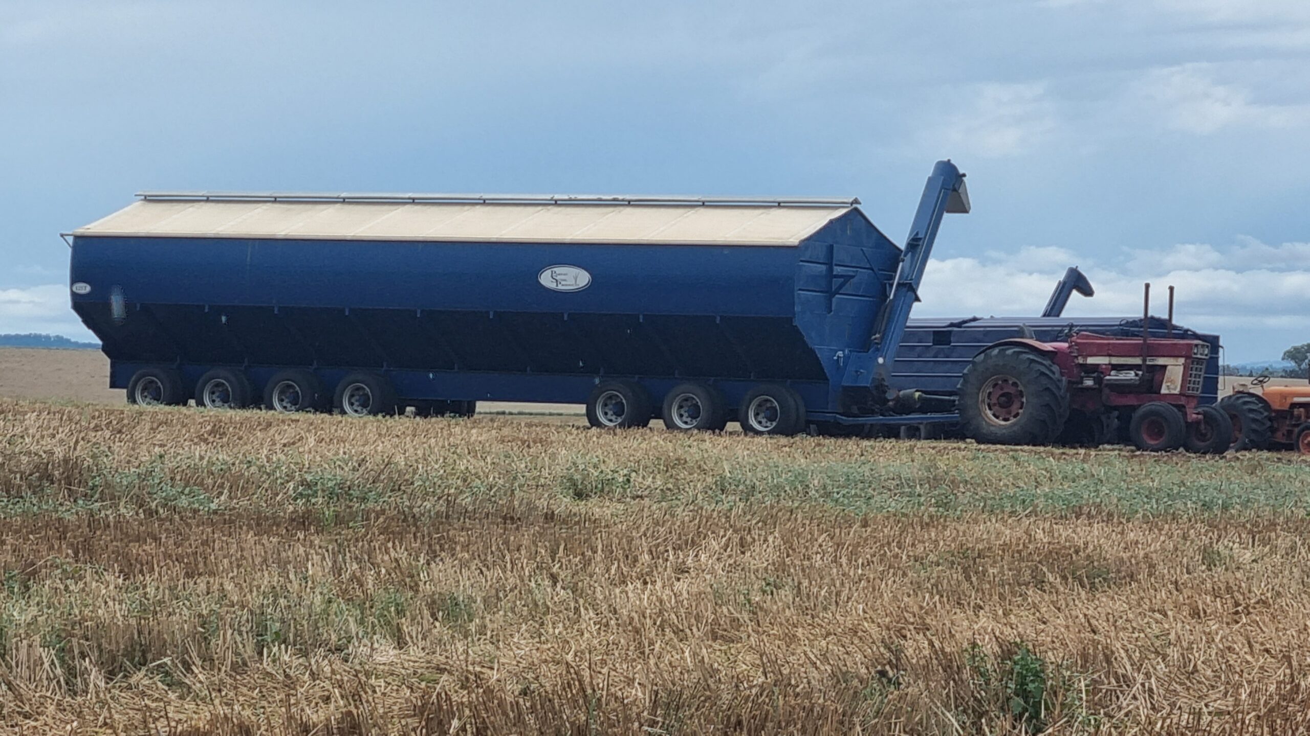
The wheat harvest has just finished. This is a bin that the harvesters transfer their grain into. It can take about 150 tons.
Around Canowindra we came across this interesting modification of a Vivente. Some people like drop bars, especially for the location of the brake hoods, for riding and for being able to occasionally use the drops. But sometimes they wish the bars were wider. I had this issue on the Munda Biddi Trail in WA. This pic shows accessory drop bar ends attached to a 35 degree swept -back riser bar. Is it a riser bar bike with drops or a drop bar bike with riser ends?
Many of the towns ignore the fact that until less than 200 years ago, the land was owned by the Wiradjuri.
They never ceded sovereignty. Forbes, as a town, is an exception. On the lakeside there is a beautiful park dedicated to the Indigenous people.
We are in sheep country most of the way. Prices are high and the farmers are happy.
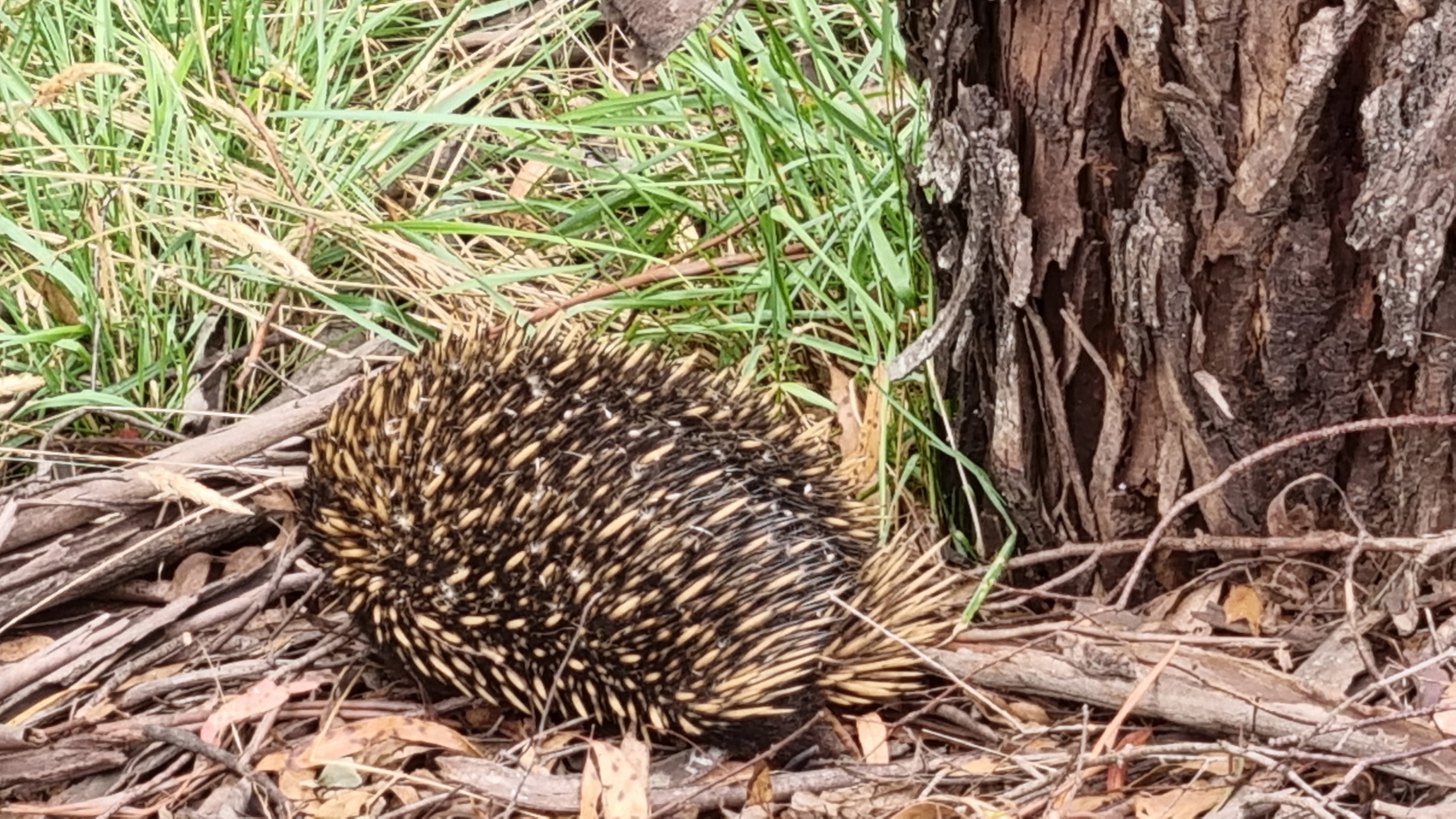
We are seeing a lot of animals but it’s hard to get pics of wildlife when you are riding a bike. This is an echidna but we also see turtles, superb parrots, peregrine falcons, snakes, blue-tonged lizards, foxes, kangaroos, magpies, white cockatoos, galahs and many other birds.
Between Galong and Taralga there are Superb Parrot sanctuaries The roadside trees are very old with lots of hollows. We see some huge wombat holes but no wombats in the daytime.
Every day there are options to take the quieter roads.
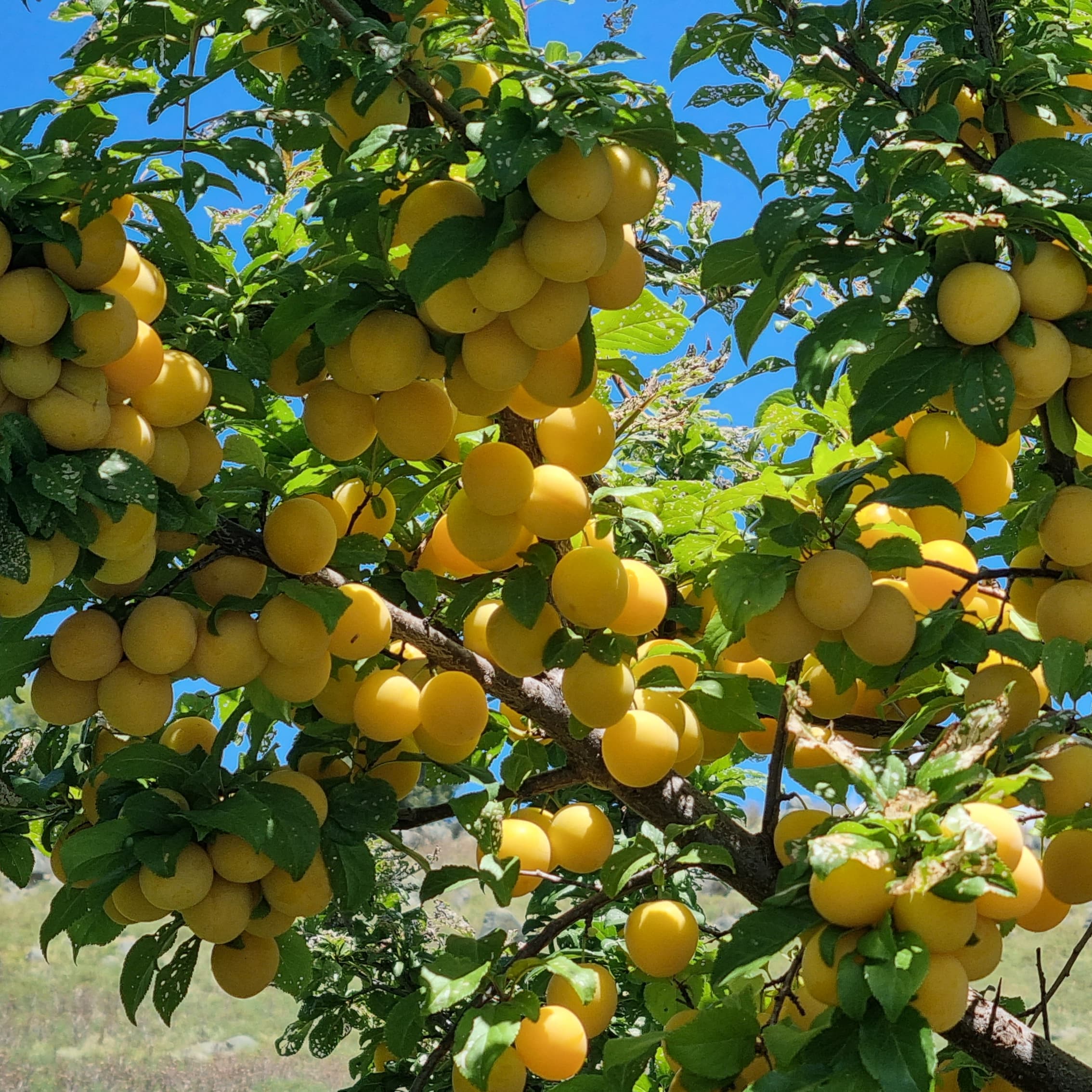
So many fruit trees on the roadsides. Also, asparagus that must have escaped the farms and can be easily picked for a snack.
Travelling along.
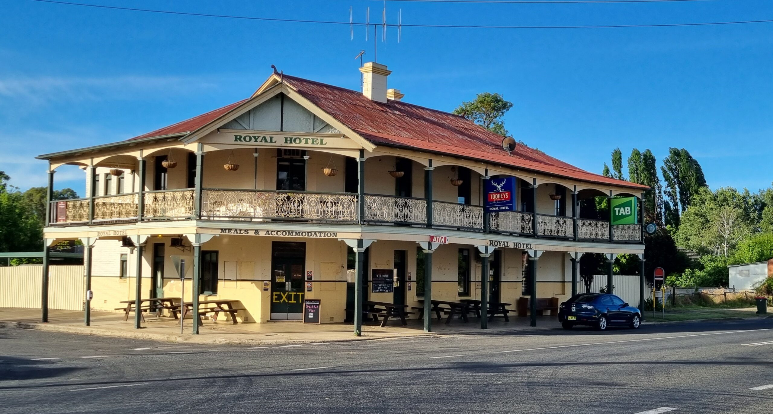
We stay in lots of classic old pubs.
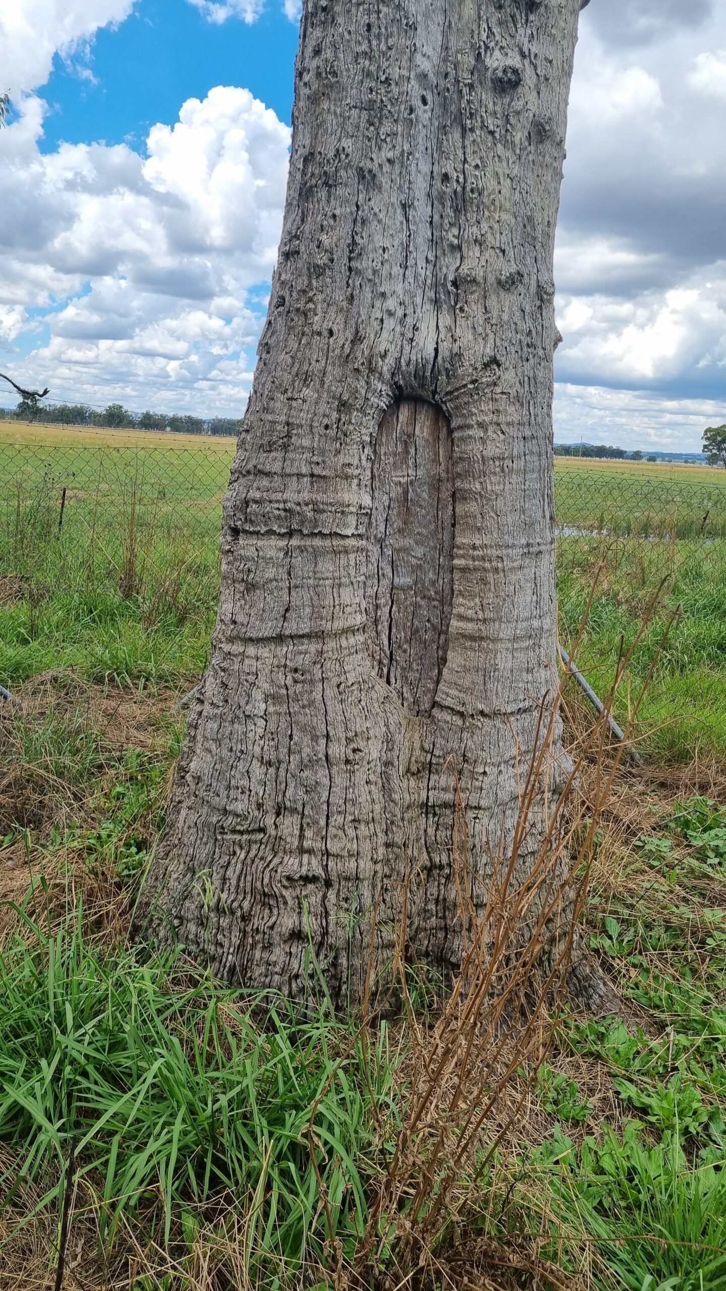
A scar tree. One of many still there in Wiradjuri Country.
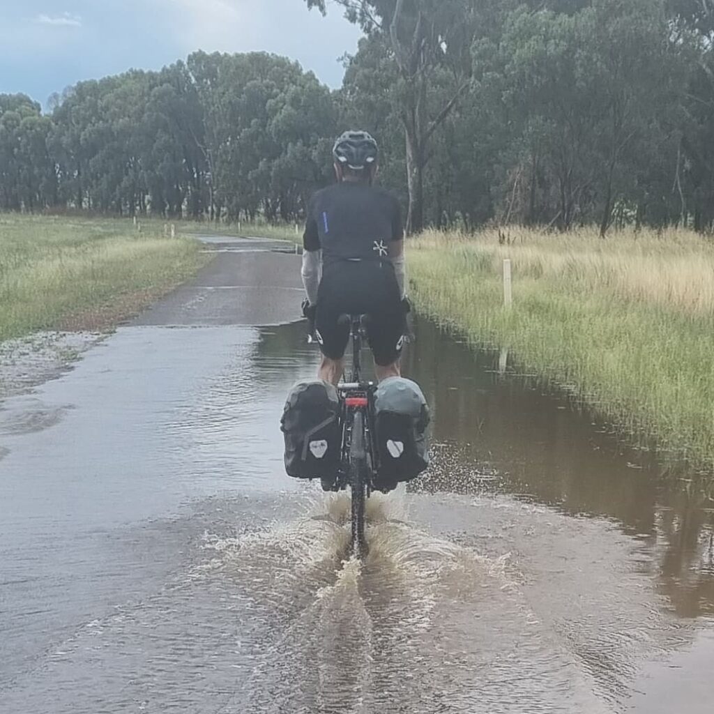
It’s a wet season and we manage to ride just after rain on several days. There is such an amazing smell in the air the from the eucalyptus.
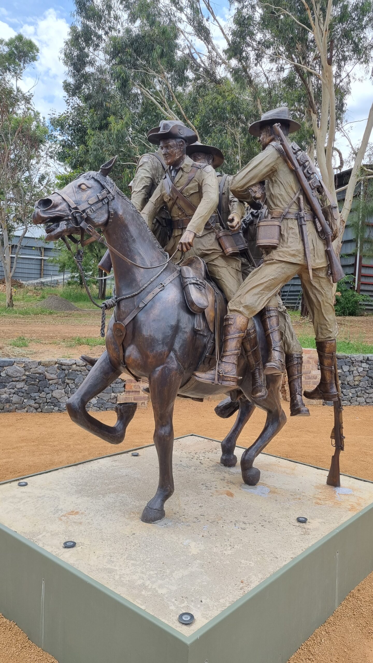
This is a really-worth-stopping-for piece of bronze work in Murrumburrah. It commemorates a horse, from that region in WW1. A horse that saved a lot of people.
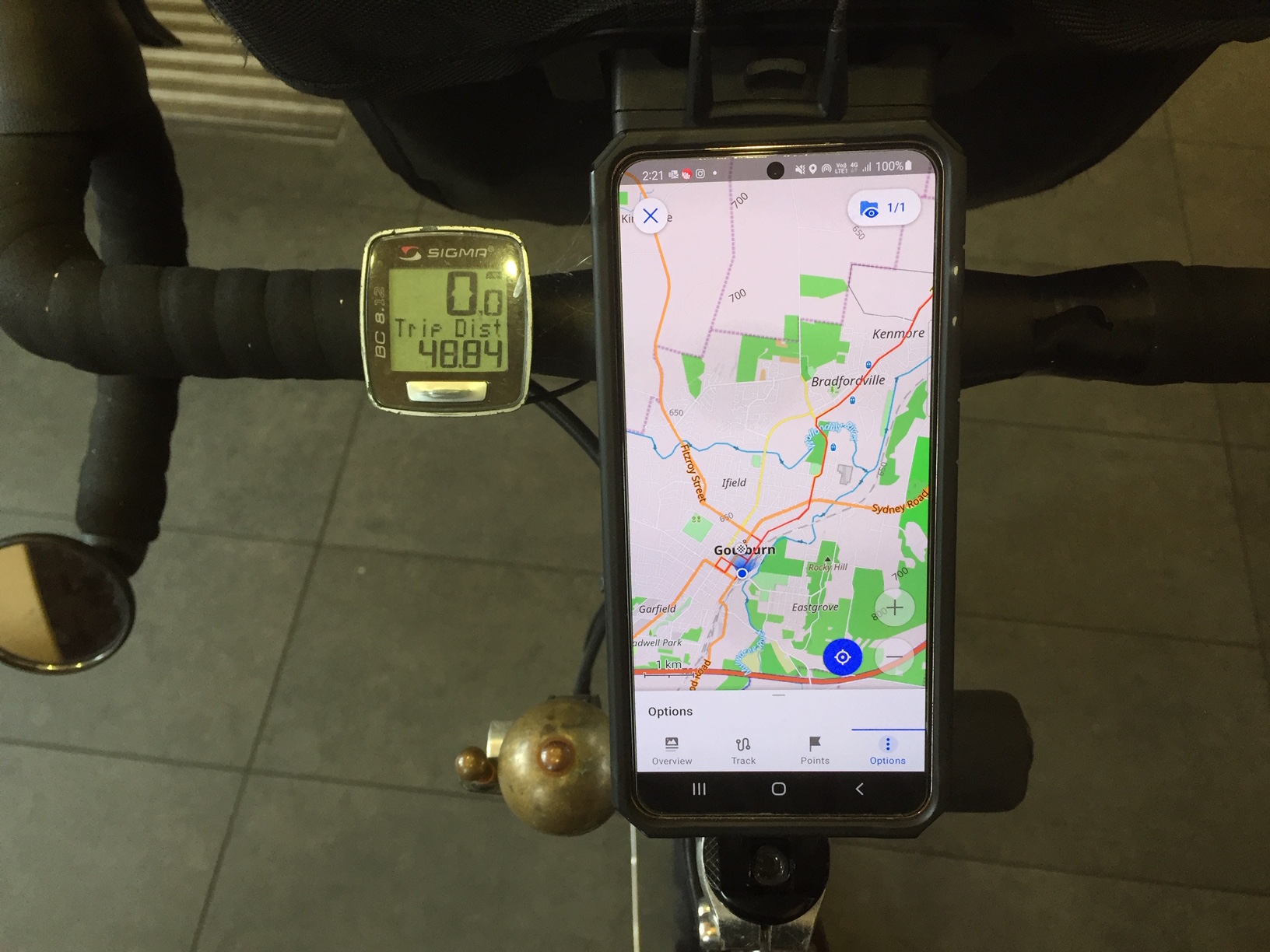
We are at Goulburn station now.
I’m using my S21 (android) smartphone a lot on this ride. It is mounted on a Rokform mount that attaches to the top of the steerer. It can be tilted. I have a strong urge to be able to
- carry just one device
- refresh route planning any day
- not need to have phone/internet connection during the day,
- not need to carry power packs
- have a highly detailed and easily obtainable map (of anywhere) able to be embedded in the device
- always know where I am in relation to a planned embedded route
- to be able to view whilst riding
- to be able to share the route as a clean gpx file
- be able to zoom in and out
There is one step that is still unclear and we plan to raise it in a news posting soon.
A COVID-period ride in Western Australia (WA), made possible because I was in Tasmania, the only eastern state from which you could enter WA in November.
The Munda Biddi Trail was opened in 2013 and at the time was stated to be the longest (1,050km) off-road bike trail in the world.
“What is the widest tyre I can put on with the mudguards still fitted?”
It’s a region that gets most of its rain in winter so winter was out due to wetness, cold (and the need to carry more clothes), and short days. I chose the last week of November and into mid December. From the logbooks in the huts the most popular times are May-April and September-October, the latter being the best for wildflowers.
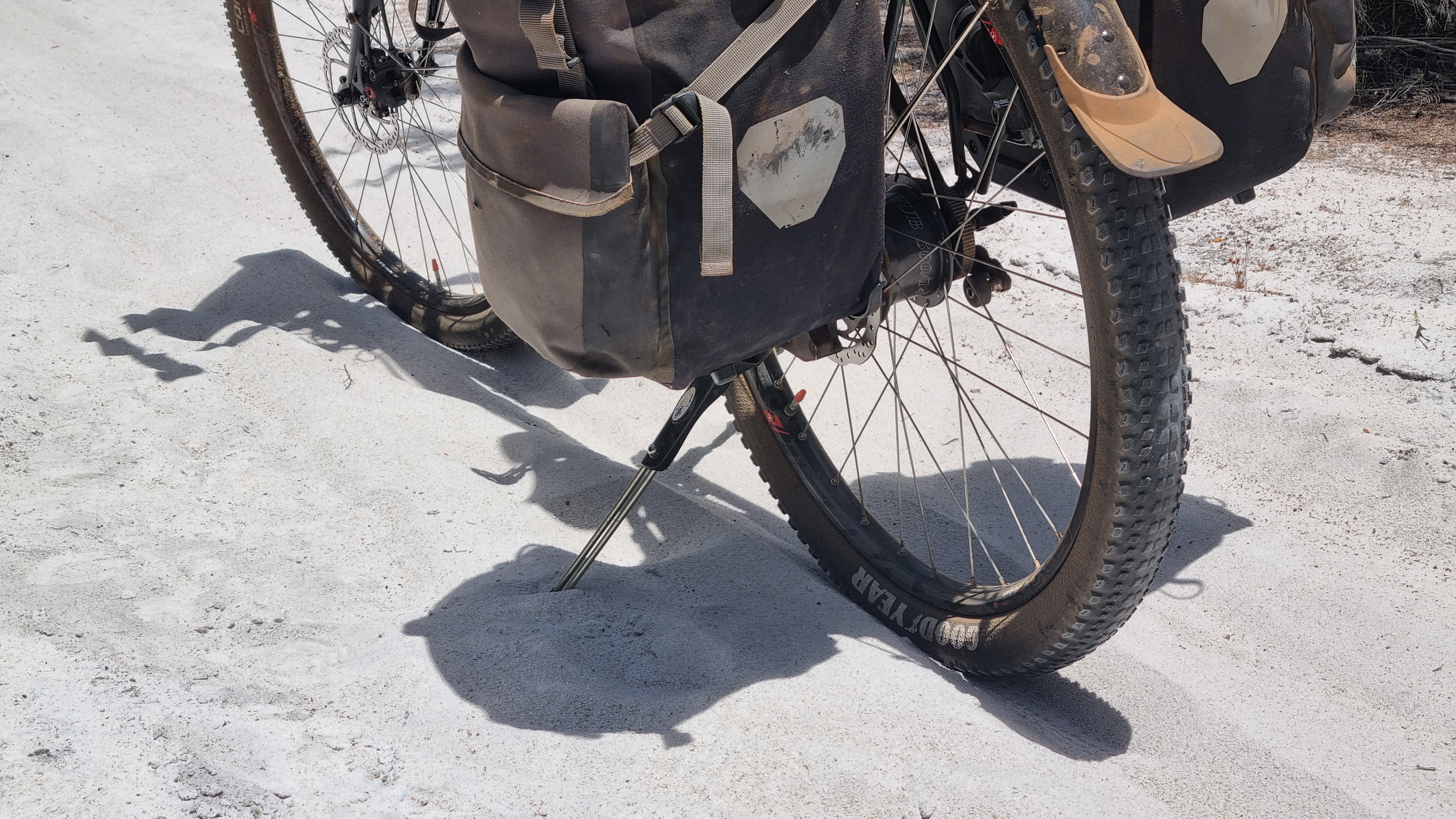
Bike-wise, primarily this is testing a 2.25” wide tyre, Rohloff version of the World Randonneur bike from recent production, fitted with 650B rims and tyres and wider mudguards. Over the last 7-8 years a frequent question has been…”what is the widest tyre I can put on with the mudguards still fitted”. Using 650B, it is probably 2.8”.
This is a long ride. It will really test several issues that might not be as noticeable on a day ride. Front suspension is one. Many off-road trails are not actually rough, but this one is. You are going over seas of big gum nuts, lots of fallen branches and some rocks. Will the lower pressure, bigger front tyre make it ok for my hands and wrists or is suspension necessary? To find out I’m testing a suspension stem. “Bottoming out” is the problem that all other suspension stems suffer from. But this one can’t bottom out.
I am also gathering date for electronic engineers that are working on better ways to save power via a reengineered dynamo hub and a super-capacitor storage system. A prototype front hub is fitted.
The Munda Biddi is undertaken from the North or from the South. I’m starting in the North in early summer knowing that the climate is a bit cooler and wetter in the south.
Although it is off-road, the MBT goes through several towns. There are caravan parks with tent sites and cabins, Youth Hostels, pubs and motels.
Mostly you are in forests.
In between most of the towns there are huts. You can’t book them. They are not getting maxed out. In fact, it’s common to be the only one at a hut.
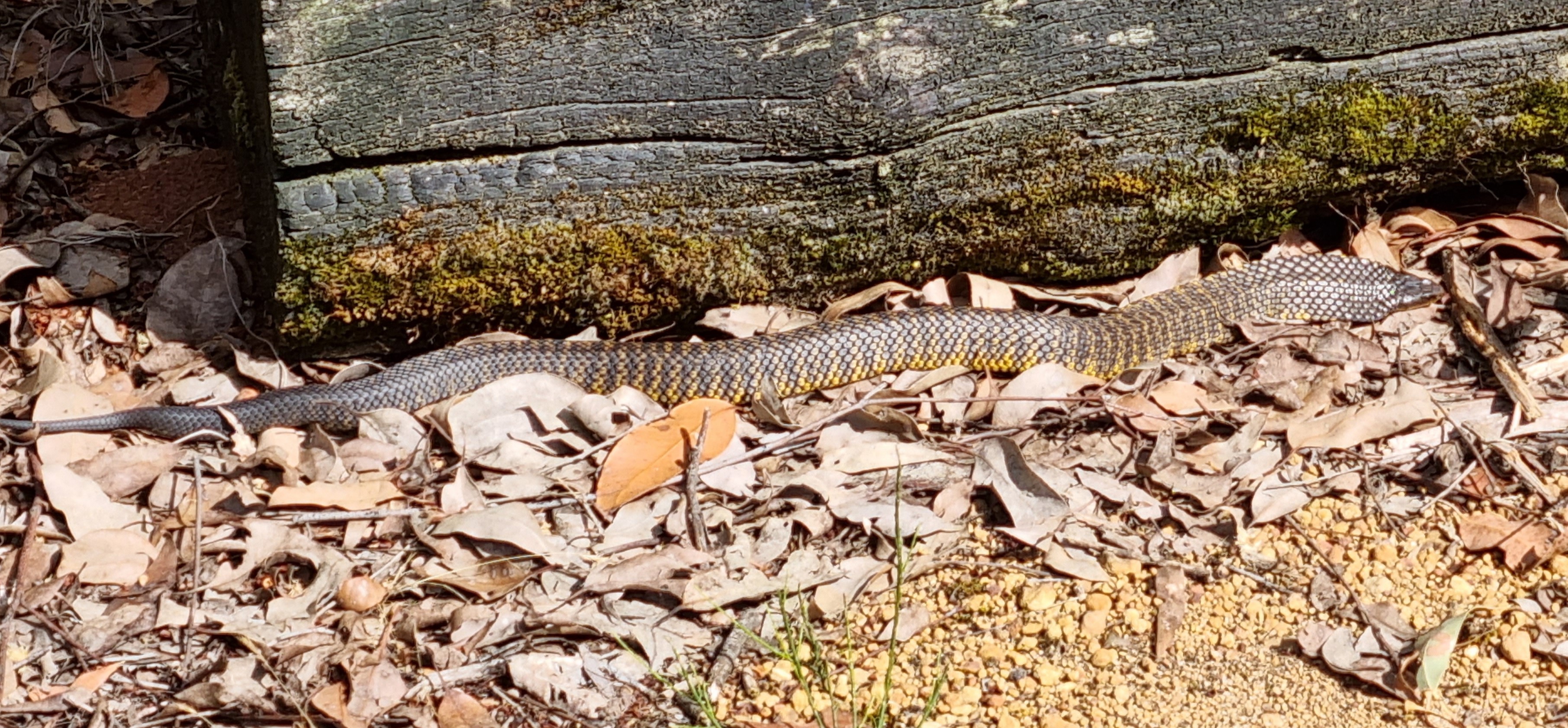
It is recommended to carry a personal locator beacon (PLB) because there is no phone coverage in large areas. On this ride there were two pairs of days when I did not see another human. I found myself descending gravelly steep hills very carefully.
I really didn’t want to come off and possibly be stuck. There are a lot of snakes. People carry a compression bandage for this purpose. Bites are very uncommon, but you can see in this picture, taken near a hut, how you could be just walking around, step over a log and startle a very deadly snake.
The huts really make the ride. They are very well designed and are made to last probably over 100 years. They have good roof water. The gutters are covered with wire mesh and there is a first-flush system but no showers or electricity.
You get to stay in a town the next night and find a shower.
There are logbooks and note books in the cabins. In them there are a number of reports of people having to pause or stop the ride due to equipment issues, all of them around rear derailleurs, chains and cassettes.
There are a lot of sticks and branches that you can’t avoid. Cyclists with rear derailleurs told me they are on high alert to brake instantly they hear the sound of something getting caught. That does not happen with a carbon belt.
The Rohloff advantage of being able to change gears whilst stationary really came into its own. I’d see a hill and think I could get up it but often I’d get to the rear-wheel-spinning stage and have to get off. There’d be no time to change down and after a short walk I’m ready to start riding again. Being able to manually select any gear from a standstill is great on trails like this where there is a lot of unplanned stopping.
I’ve never been a walker (beside the bike), but it is happening a lot on this trail. Same with everyone else. But people are often only going 50-70km a day and don’t mind.
On the Gibb River Road, which I did with 40mm tyres, I only walked 100m and on the Munda Biddi Trail, with 2.25” (57mm) tyres, I walked several kilometres.
Already on the second day I was thinking I would have thrown the ride in if I had 40mm tyres as on the road-tourer.
Here I only have 35psi so I can ride on bits that I could not ride on with 55-60psi in Schwalbe AlMotion 40mm tyres.
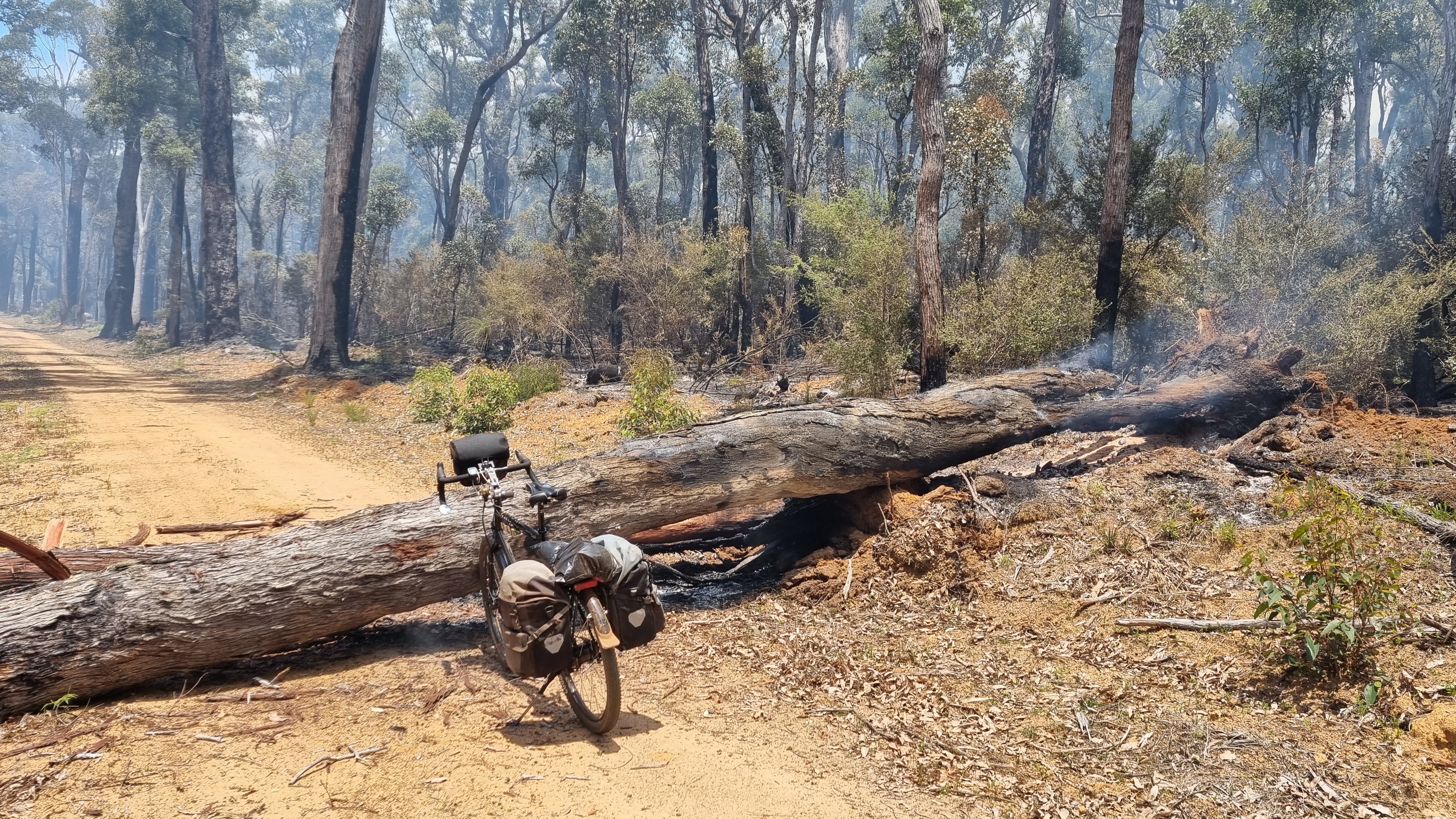
There is some controlled burning at the moment. In this case the diversion tape must have been removed and I am on a 10k section that is still burning.
Panniers are easy to remove and return. There are a lot of logs needing to be got over.
A BOB trailer would be disastrous.
Trail maintenance goes on
Not all of the fallen trees need to be clambered over.
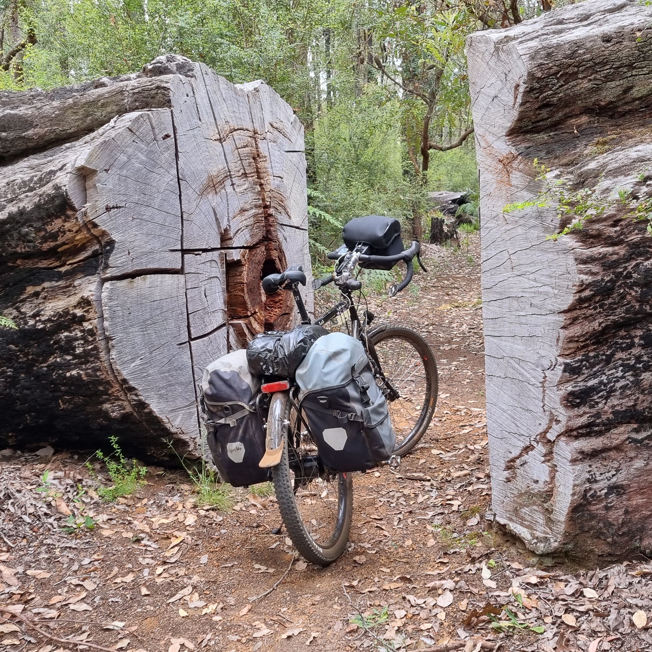
This is one of the biggest. You can’t just walk around them with the bush being so dense and the trees so tall.
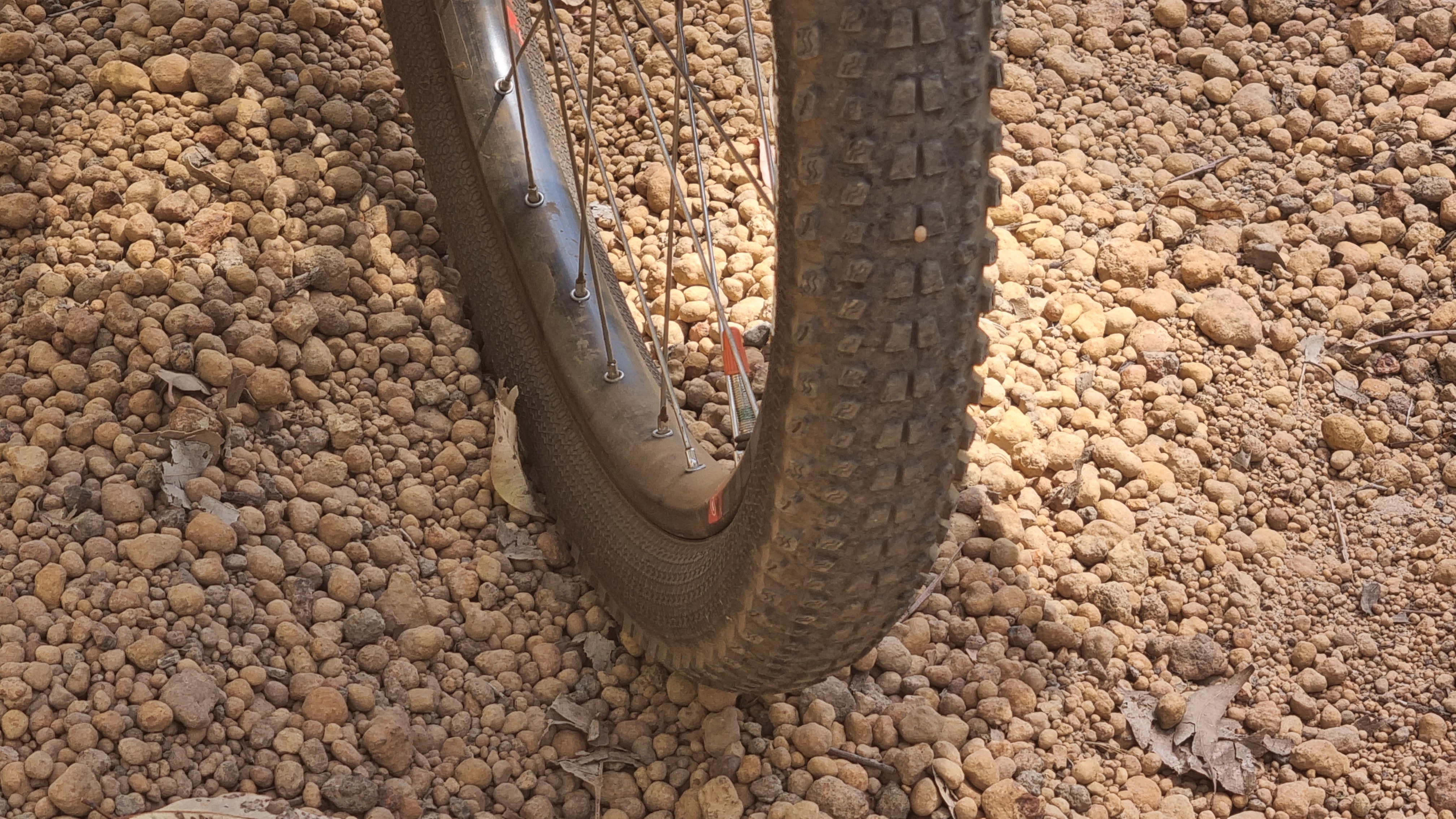
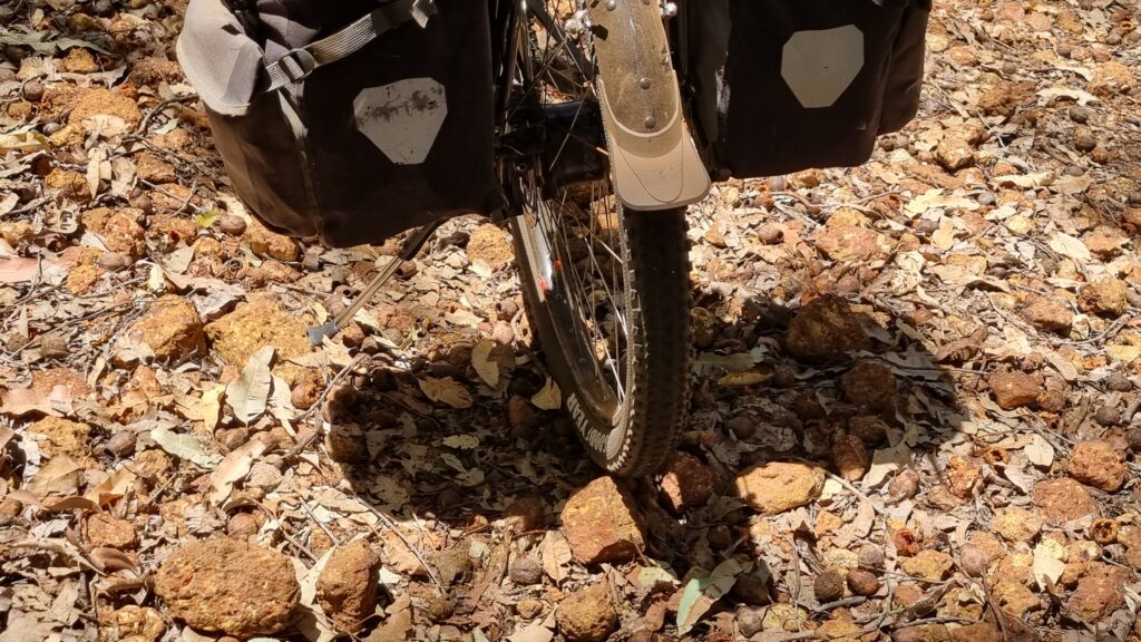
The notorious Munda Biddi pea gravel
Without a doubt, the worst thing to ride on. It’s like trying to ride on ball bearings. There is a lot of it.
Especially in the quieter months there are lots of places where you would see no one else for a day or two. Many are really beautiful, like this very old railway bridge that has been restored for cyclists.
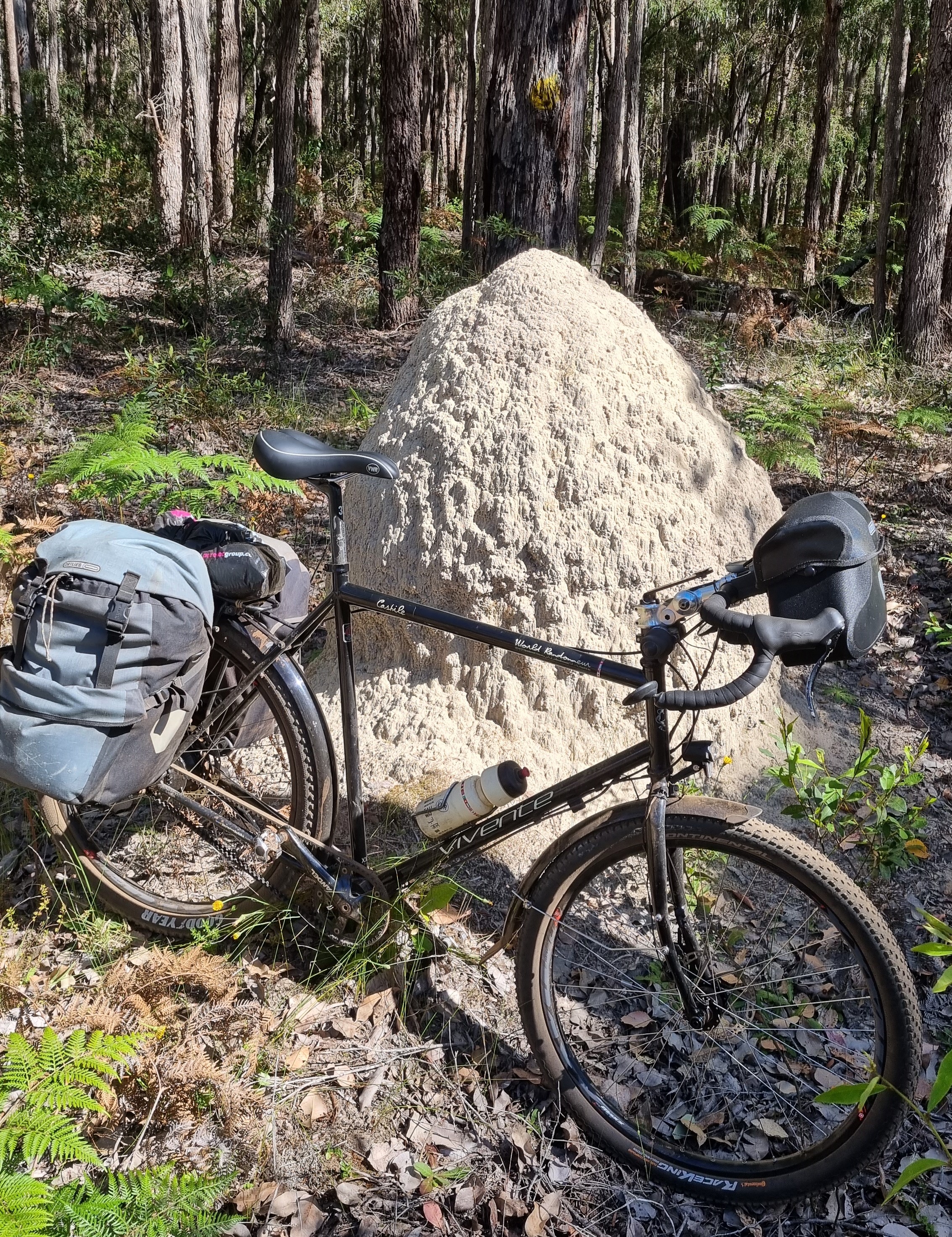
If you happen to be fascinated by ant nests then you’ll love the Munda Biddi Trail. There are many impressive ones of many different types. There are also a lot of lizards that try to invade ant nests.
Sand is hard to ride in and there are several stretches of it. In my few weeks on the trail, it only rained once and that was at night. The next day I found that the sand was a lot easier to ride over. Probably, riding the trail in wetter times is ok in this sense.
But there are also a lot of sections prone to water logging where you would have to get off in those times.
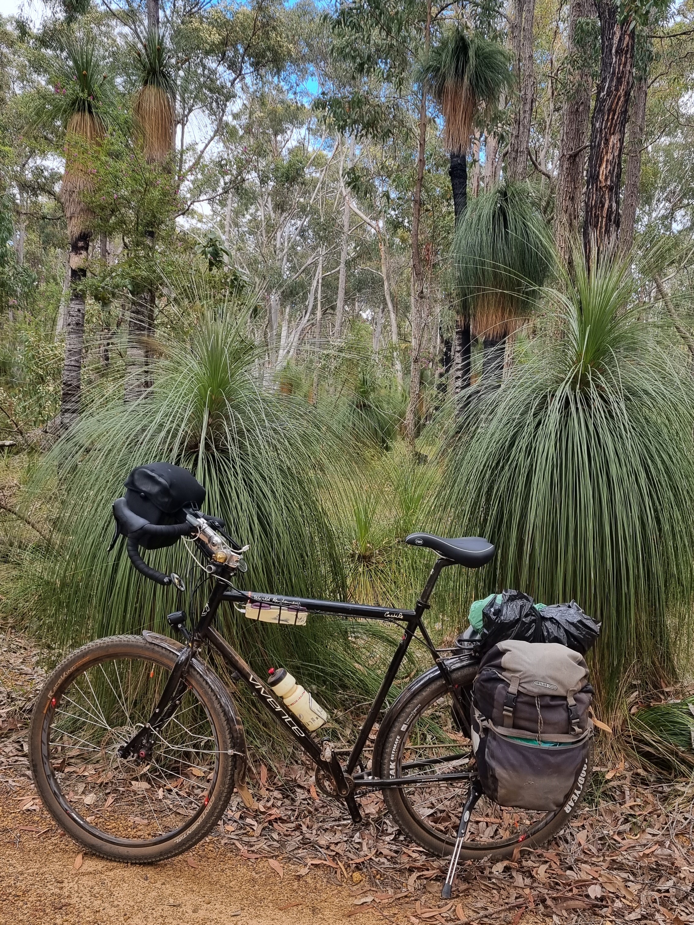
There are lots of these classic Western Australian grass trees.
Did you know that the male emu looks after the chicks?
I was not expecting emus. There were a lot. Sightings of the birds are reasonably common.
What I discovered was that they have very distinctive shit, and this reveals more about how many there are.
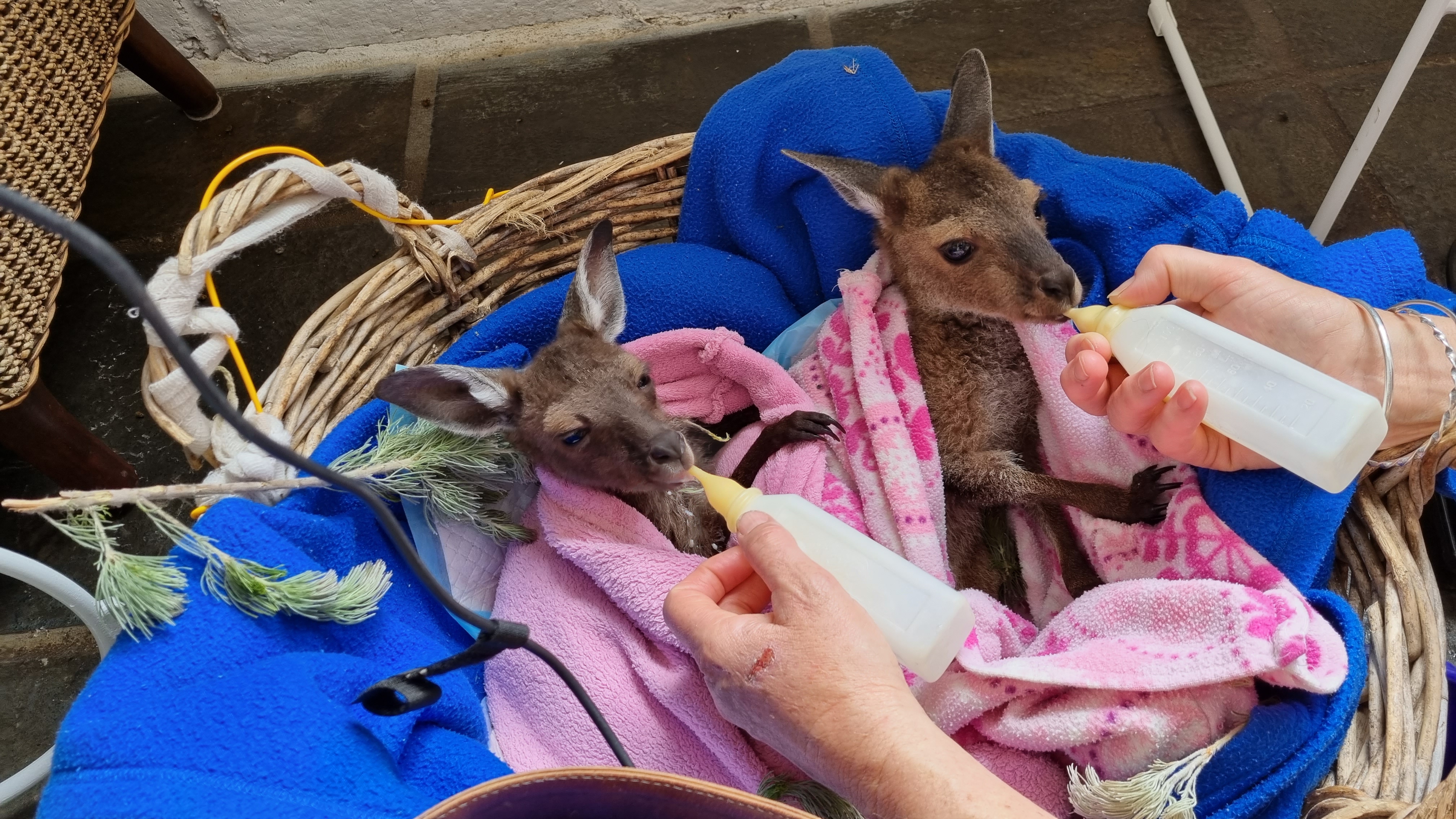
Near Elleker, a very impressive woman runs a wildlife rescue operation. She explained that kangaroos can keep a foetus for up to three years and only let it develop when the conditions are right. They have two nipples and can have one giving milk good for a very young joey while, at the same time, the other is giving milk for a much older joey. How smart and amazing is that!
Pulling into Albany
Along the trail, riders share knowledge about where to stay in the towns and the SixDegree Hotel was the place in Albany.
When I researched this ride, I needed to work out how to get back to Perth with the bike. I chose to fly on Rex which turned out to be a small plane. Fortunately, they did accept the bike carton but commented that if it was a full flight, it would have gone on standby.
On the ride, someone mentioned that you can take a bike back on the bus (front wheel and pedals off) as long as you phone them the day before to say that you want to and as long as you can cover the bike to protect other peoples’ luggage. That’s probably the best way.
A Covid-period ride, staying within one state, using walk-on and off public transport to access the route. Wanting it to be easy. We are on Swabia models from 2018 and 2020. Pretty much everything is settled on these bikes. But one of them is running 46-22 Gates sprockets (instead of 50-19), representing a gear reduction in top and bottom gears of 20.5%. That’s a lot, considering the normal 20” bottom gear has not been a problem.
Starting out from Mudgee it is flat and the new gearing is not even apparent. As the ride develops, there are a few times when I’m happy to use the new and remarkably low 1st gear, plus a few times when I would have used the old top gear if I still had it. But on the occasions of good downhill runs where I was now only able to pedal up to 45-46km/h, to go faster I just had to lay down flat. I rolled at up 65km/h a few times, so it is not like I was robbed of going fast.
Popularity for this trail is growing rapidly
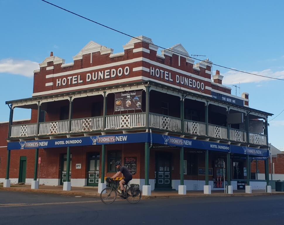
The 400km Central West Cycling Trail in central NSW. The CWC literature, which sends you anticlockwise from Mudgee, is good. Tracks can be downloaded and viewed in OSM etc. You pass through some tiny places here. Some with only one place to stay (although camping is available if rooms are booked out). Not many people are doing the route in January as it is a bit hot. However, the trail is growing in popularity quickly. It is doable as a family. Very little traffic. No really hard climbs. Distances are 40-80 km a day.
Although it is only a 2-½ hour train ride from Sydney and then a 1-½ hour bus ride, we are out in really isolated country most of the time.
The CWC folks have done a great job finding and mapping these backroads.
Some towns we stop in are big enough to have a few pubs. The growing number of cyclists spending money in the towns and generally looking like the fine people that cyclists are, already has a few other small towns saying…”what about us? Can the route come here too?”
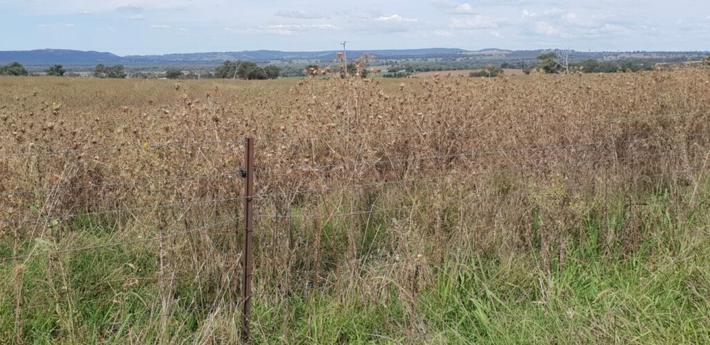
You might not realise what this is. It is one of the many paddocks of thistles that have become almost totally out-of-hand in the region.
Some of these roads are incredibly peaceful
Want to wind down? Go bike touring in these quiet places where the only sounds are numerous bird calls.
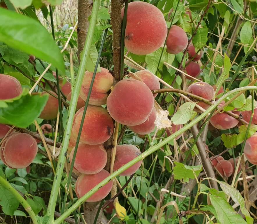
Ripe fruit off the tree, growing wild on the roadside, no insecticide, no fruit fly, and plentiful. There are lots of apple trees that would be ripe in about April, apricots that would have been ripe last month (in December).
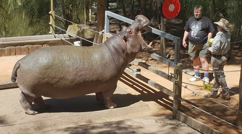
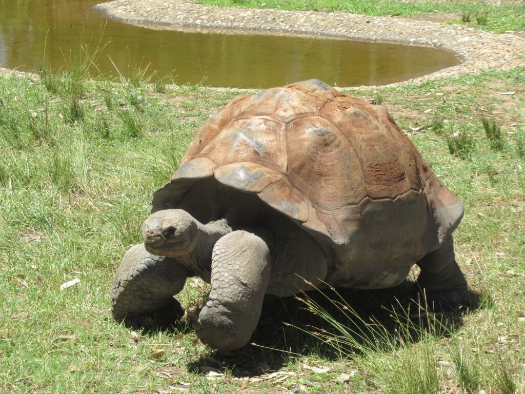
There is a big zoo at Dubbo and it warrants a rest day. The type of rest day where you ride out there and ride around the zoo, marvelling at the fine exhibits.
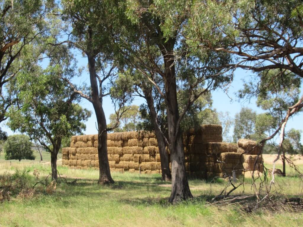
This is not hay. It’s straw. Or stubble. After a grain crop is harvested the stubble needs to be got rid of. Ploughing it in pulls nitrogen from the soil to rot it. Burning it starts bushfires and creates so much smoke so farmers bale it up often. It’s currently worth $60 a bale.
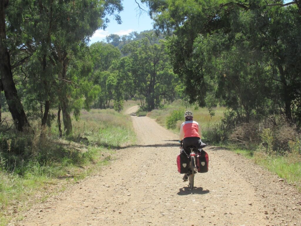
We are so lucky to be able to do this ride. It is easy to set out on it and the route is laid out for us. In many sections there is not one vehicle for tens of kilometres.
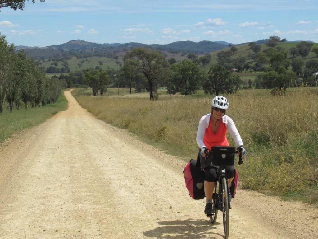
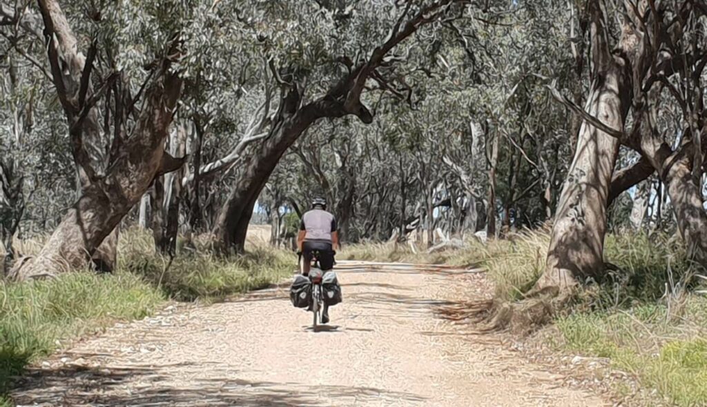
Much of the surface is unsealed but almost none is hard to ride on. We had no punctures on our two bikes. I walked for only 30 meters and was delighted with my 40mm Schwalbe AlMotion tyres on the combination of tar and gravel.
Down on the Cudgegong River at The Twelve Mile.
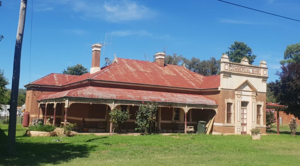
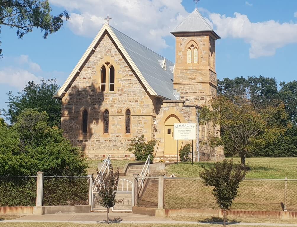
In the few towns that we go through there are some well-preserved historic buildings.
Deciding to keep going all the way to Lithgow
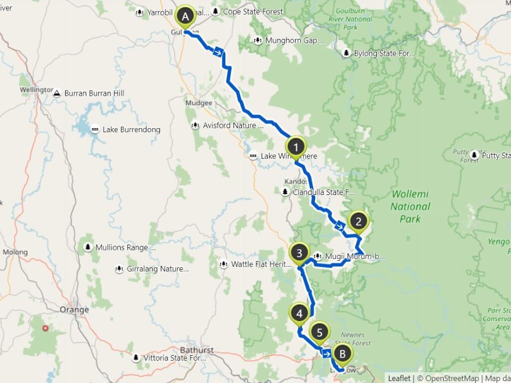
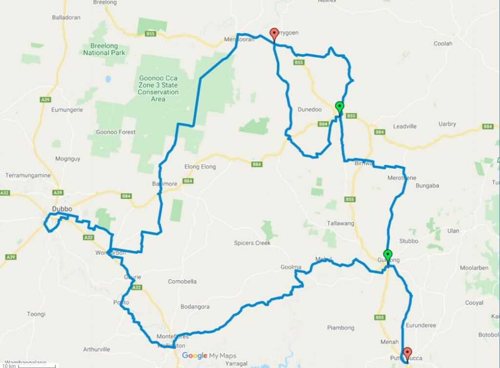
Arriving back in Gulgong we decide to ride back to Lithgow station over three days, going through Rylstone, Glen Alice, Capertee, Cullen Bullen, Portland and Wallerawang. This was just one of the advantages of not having flights booked and using walk-on-walk-off trains. There is no schedule being forced onto us.
One of several impressive stone buildings in Rylstone. There are stonemasons, using local stone, based here.
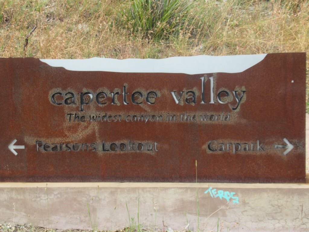
Climate and environmental politics is playing out in the Capertee Valley. We could see the results of the recent frightening bushfires on the eastern escarpments. Some vineyards completely died in the recent drought. Coal mining is feeling the heat, especially at Wallerawang. People here are protesting against a proposed lead mine at Lue. The influential Shooters Party wants feral deer so they can shoot them. Irrigators here want to dam the Macquarie and are meeting resistance. A major donor to the National Party is the cotton industry that wants more dams and less environmental river flow.
Abbots Lane. Only 2km and downhill for us. Not a section to do in wet weather. At one point a kangaroo bounded past.
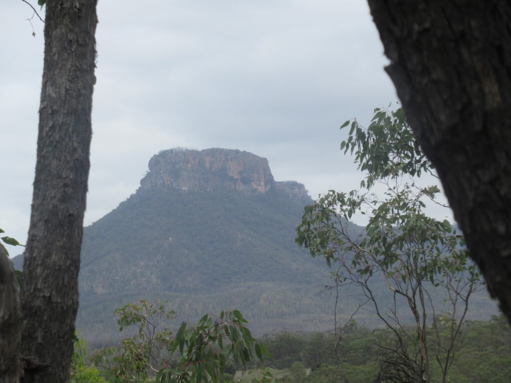
This valley, which we had not heard of, has turned out to be special. It is apparently one of the “widest canyons” and biggest “enclosed valleys” in the world. There are sandstone cliffs around virtually all of it and it drains to the sea through a narrow cutting in the mountains to the east.
The trees are beautiful here. Several artists reside in this valley. An echidna crossed the road around here.
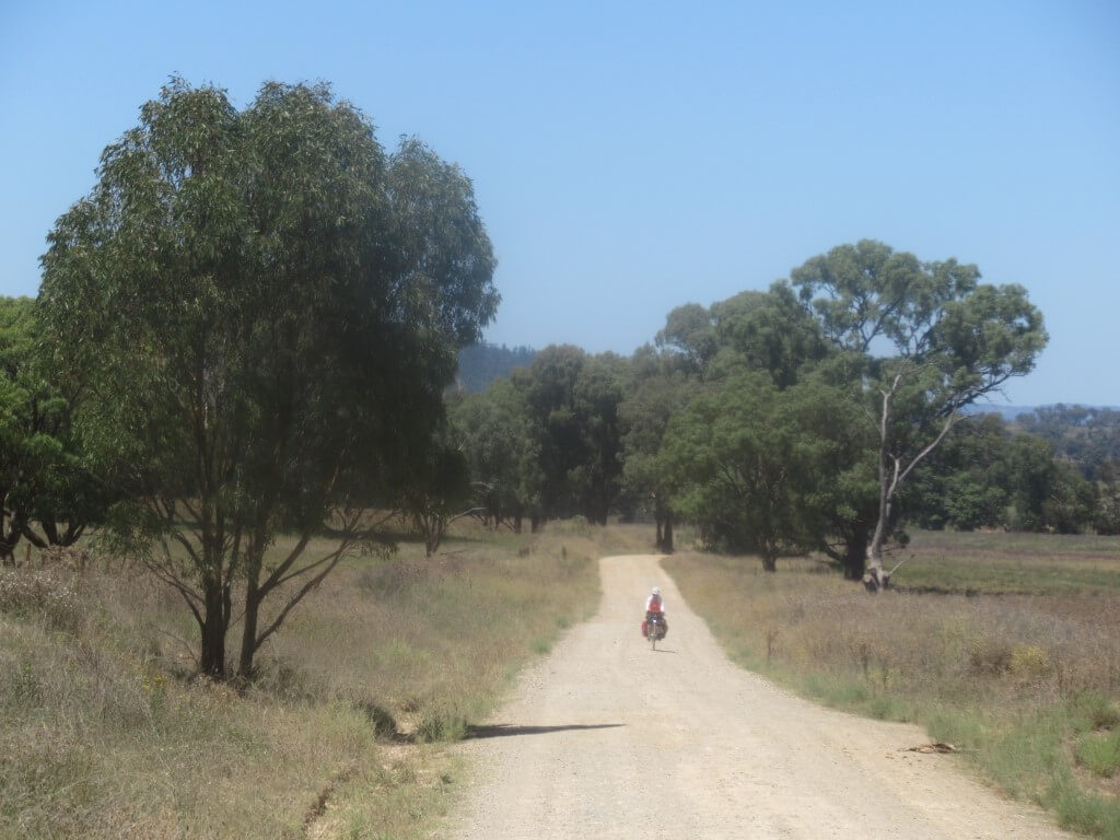
It’s not part of the Central West Cycling Trail but has been a great addition to it as we needed to get back to Lithgow anyway. And why not ride!
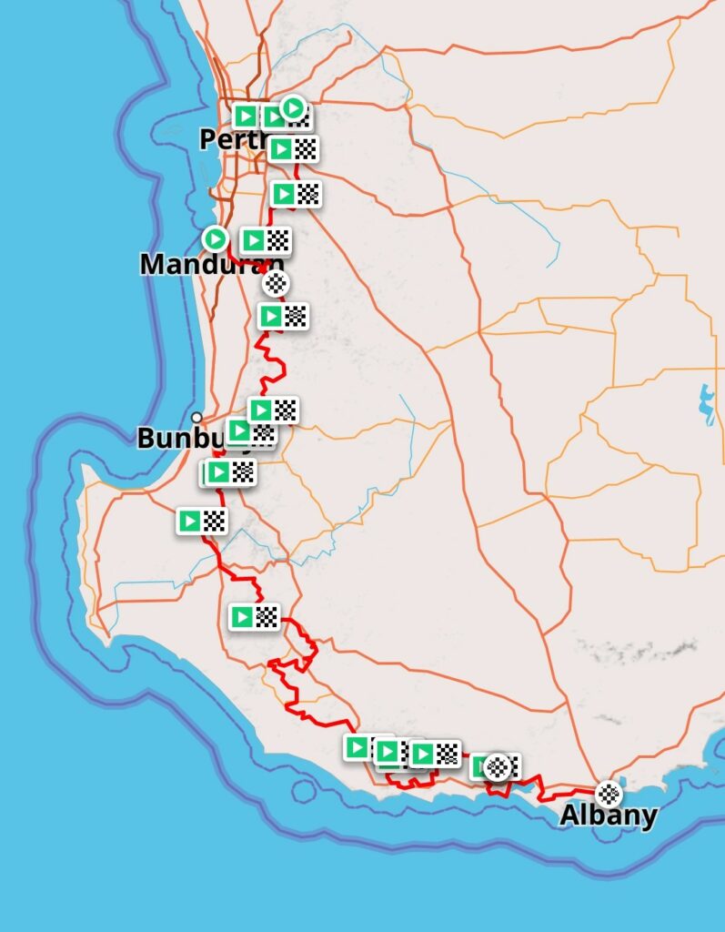
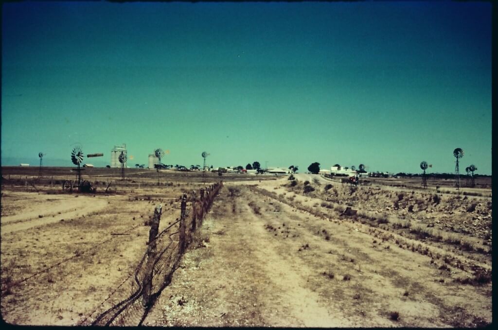
The last section of the Nullarbor had been recently sealed and, in Sydney, riding to Perth had become ‘a thing’. Two of us set off on a route that went through Young where we visited a farm because the cherries were just starting to ripen. Then through Griffith where we could visit family. Then to Adelaide. To Ceduna, to Norseman then South to Esperance, west through Albany, to Cape Leeuwin, then north through the forests to Perth. About 5,000km.
Only 5 photos have survived so let’s have a bit of text first.
Just before this ride we had ridden up the east coast and could camp on water every night. Mostly, running water. On the plains of the western Riverina, we ran out of creeks and billabongs. In the south west of WA, there was a bit of surface water but it was often not usable. Fresh water became a treat for many weeks.
In North West Victoria, we were hit by wind so strong that we had to stop and shelter in a school bus stop, not because we couldn’t ride but because of how much the sand blowing on our legs hurt.
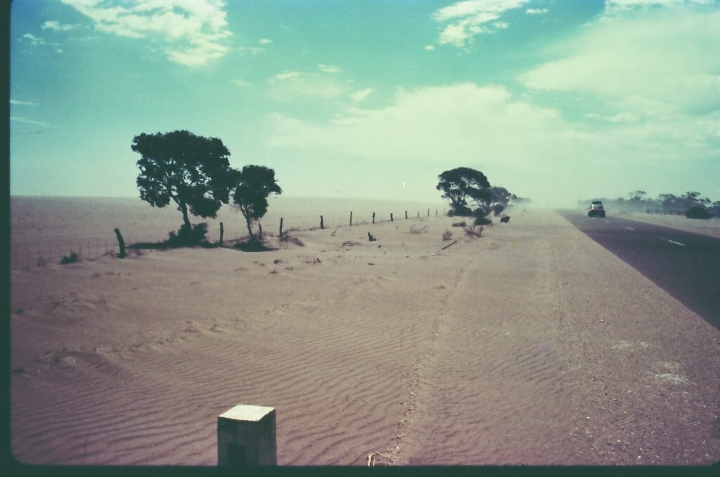
We saw land that had recently been overtaken by the desert. The mallee should never have been cleared. It was so obvious that this ecological disaster was manmade.
In Adelaide, at Clearlight Bazzar, a hippie place selling incense, candles and the like, we bought ingredients to make up a lot of muesli. We had to mix it in a garbage bin in the caravan park. Imagine that! Anyway, we used plenty of bleach first to clean the bin. Powdered milk and sugar were included so it was a “just add water” product. We had a transport company take our muesli to their depot at Ceduna, the last town for 1,200km. This food would get us across the vast desert.
One of the great things about this crossing is that you start off with a ton of food but by the end you have none. You are many kilos lighter yourself so, you feel better and better as you travel.
After the section north to Port Augusta, where we swung west, we hit a shocking headwind and lots of three-corner jacks the second you got off the road. We had to even descend hills in 34-34, the bottom gear in those days, because of the wind. That was a bit depressing.
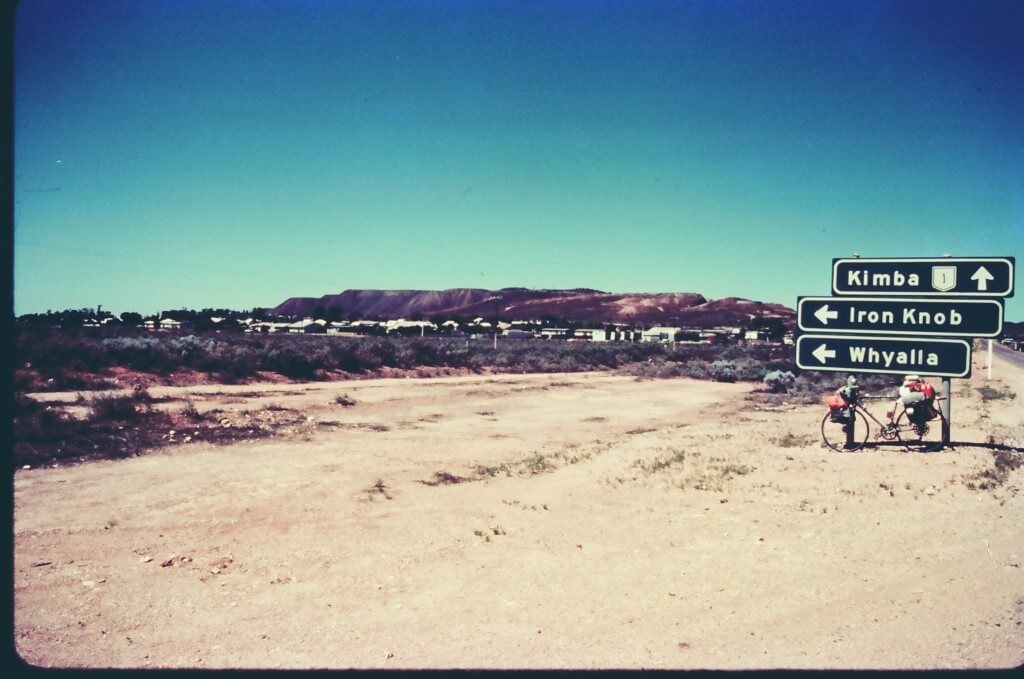
In the section from Port Augusta to Ceduna, water was pretty scarce. We were carrying a 12” shifter and on a few occasions had to tap into the water pipeline that goes all the way to Ceduna. Maybe that is no longer permitted but it was ok in 1977. At Kimba, we stayed with some friends which was a treat.
We stayed at the caravan park in Ceduna for two nights. Generally, that never happens as the motorists don’t need rest days. Every morning a huge westbound convoy departed Ceduna pretty much at the same time. Each day, this convoy would pass us but a bit later each day. Even after 1,000km, they are still in a convoy. Safety in numbers?
There were a few roadhouses along the way and we generally only purchased one thing – 600ml frozen chocolate milk. Many. Of. Them. They had to freeze the milk out there and, of course this was just fantastic for us, being summer and us limited to only muesli day after day. Sometimes we did not ride together. Whoever got to a roadhouse first would send a frozen choc milk back to the other with a random person we’d meet at the petrol pump and who was always obliging. Once someone asked me why we were riding and I said because it was faster. “It took me 3 weeks to make the money for this bike and it’s taking 7 weeks to ride. That’s 10 weeks. How long did it take you to make enough to buy that car?”
A day before we got to Norseman we spotted a small sign saying Newman Rocks. It was a large area of granite with some pools of water. It looked at the time like no human had been there in years. We camped there.
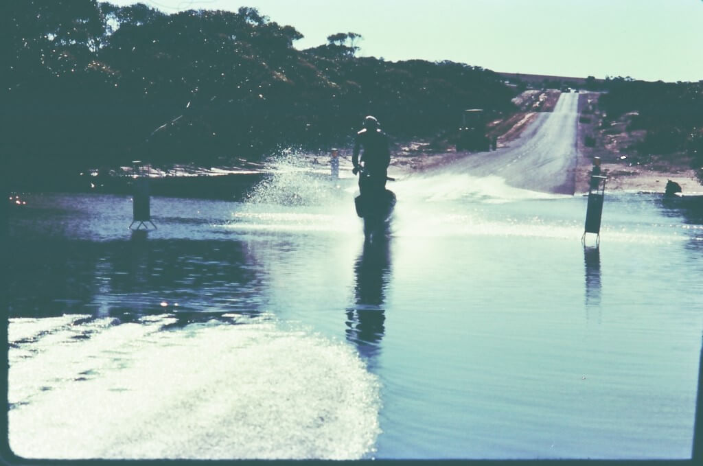
Heading south from Norseman, we went through the aptly named Salmon Gums. Here there was a downpour and sudden flooding.
Heading west from Esperance, we went through hundreds of kilometres of wheat country where there were no towns. It seemed that the workers must only be there for the planting and harvesting seasons. No one was around when we rode through. The wheat farms were on a massive scale. There were some abandoned old shacks occasionally and we camped in them. One had what must have been the world’s biggest beehive inside. It took up a small room.
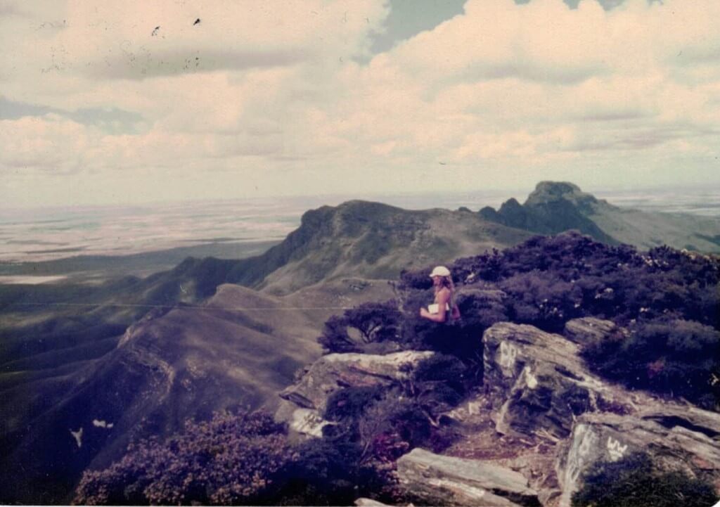
We did a side trip to the Stirling Ranges, climbed Bluff Knoll and, decades later, Vivente named a Rohloff bike model after this beautiful region.
At Cape Leeuwin, the most SW corner of the Australian continent, we parked and walked down to the actual cape. When we got back to the bikes, there was an old codger studying them. He looked up as we approached, stroked his long beard and said, “When I was young, only poofters had gears”. Hmmm, interesting mate.
As we rode up through Nannup, we had many nice encounters with the local hippies. That was a real scene in those days and probably still is.
Arriving in Perth we celebrated with a big container of ice cream which we ate whilst sitting on the footpath on Hay Street, unable to wait and unwilling to sacrifice a single degree of coldness.
A ride from Greymouth to Hamilton along the west coast. This included a flight from Nelson to Wellington. There is no road around the NW corner of the South Island. But there is a walking track that takes 4 days. We had the bikes bussed around. This was our fifth New Zealand tour and I am sure there will be another. It is such a good country to tour on a bike.
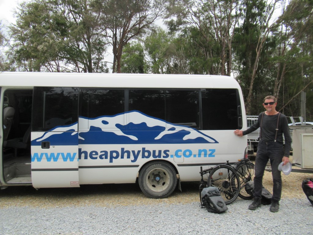
Having flown into CHC, stayed at the airport Jucy Pods, bussed across the island on Atomic Coaches, stocked up at the Four Square, we are heading north 200km before the start of the walk. In Karamea we stay at the Last Resort and the Heaphy Bus Co picks up our bikes and panniers there to take them the 425km by road to the other end of the Heaphy. On the ride to Karamea we have the extra luggage of backpacks and hiking boots.
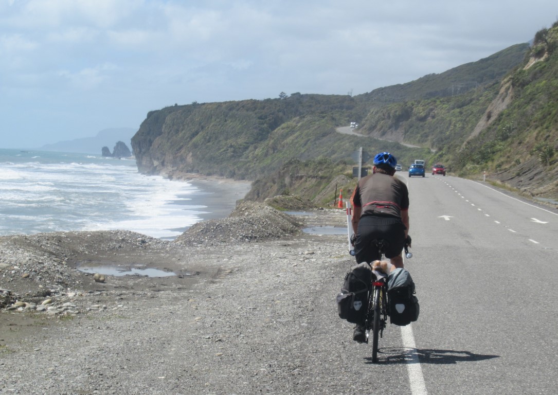
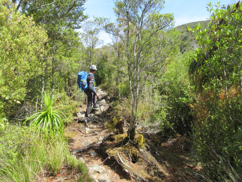
We are on the Heaphy now. The first day is coastal with amazing palms flowering and wonderful views. The idea of including one of New Zealand’s Great Walks in a bike tour is looking good.
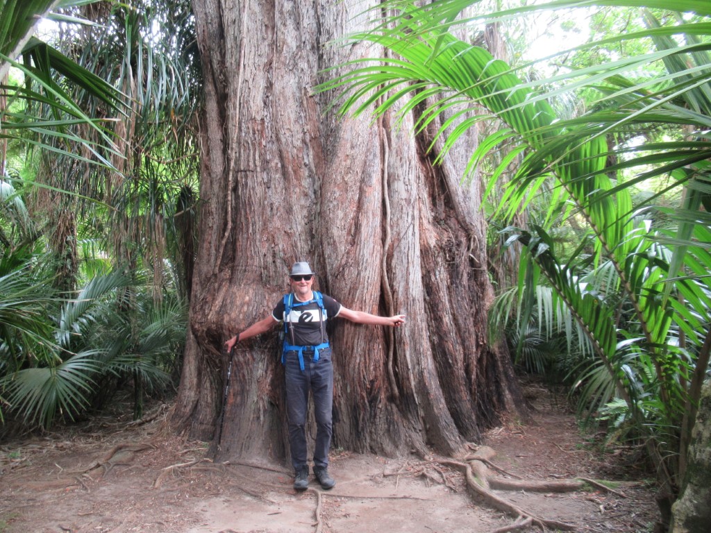
New Zealand prides itself on being so “natural” however most native forests were ripped out and many other disastrous things happened (including at the hands of the Maori 600 years ago). Along the Heaphy though, things are as they were.
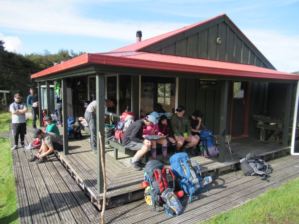
The Dept of Conservation (DOC) runs several huts. You have to book well in advance. It means you only need to carry sleeping bag and pillow and food and water during the day. This is Saxon Hut, leaving in the morning.
A side-track to one of the lookouts.
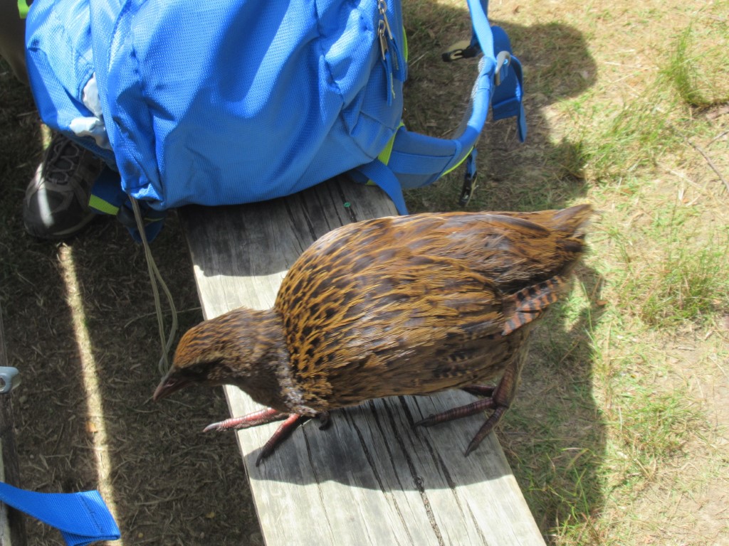
Weka. Watch out for your food!
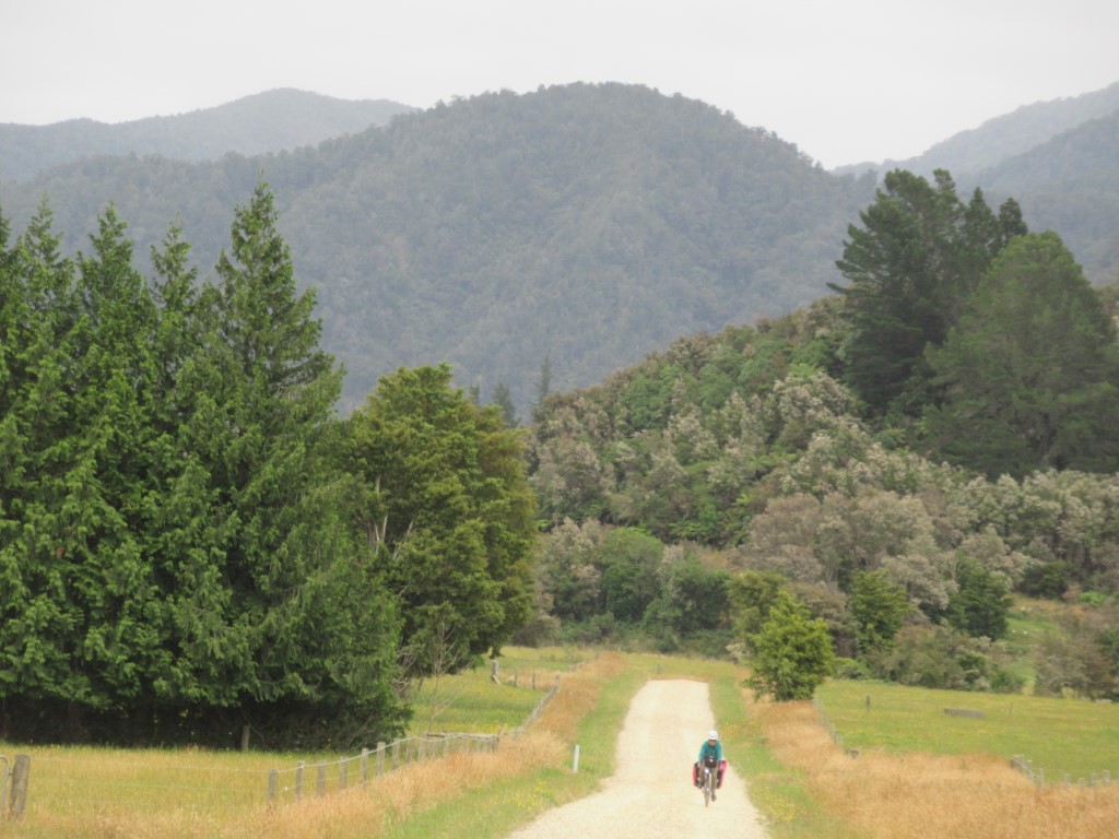
Love the Heaphy Bus Company. They arrived on Schedule after we arrived from Brown Hut. We put the bikes together and continued North on gravel and then tar.
Riding down the Aorere Valley to Collingwood.

Bike friendly. Press the button and traffic behind you gets warning lights for a few minutes. This is in the Golden Bay region, arguably the best in New Zealand. A bit isolated because there is only one road in and that is over the scary Takaka Hill.
We’ve been over the hill before so this time we are going round it.
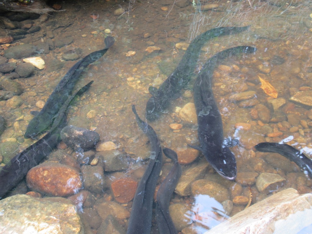
There are a lot of eels in New Zealand although there used to be more. Their lifecycle is amazing. When they are decades old they swim out from rivers to the ocean and to the tropics where they breed and die. The fertilized larvae float back on the ocean surface. They grow and swim back up rivers into small streams like this.
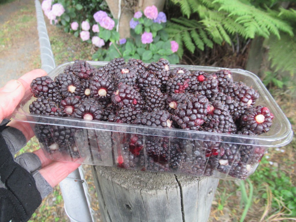
A land of plentiful berry fruits at roadside stalls.
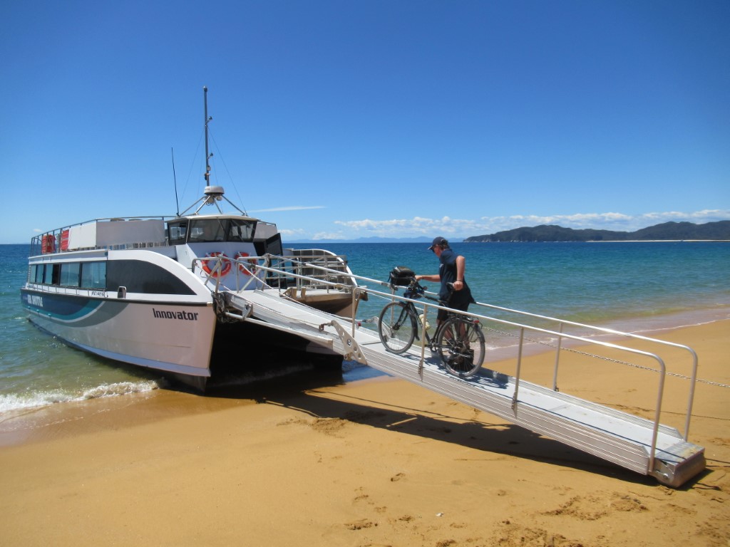
Approaching Nelson. We will fly tomorrow. A few years ago, when riding in this area, I went to the airport to ask if they carried bike cartons and they did. Today on the way into town, I check again and yes, they have stock.

On the North Island now. Heading around to Whanganui and passing cycle tourers regularly.
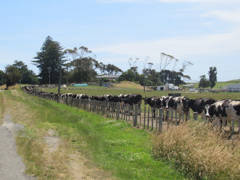
The cows dutifully line up to be milked.
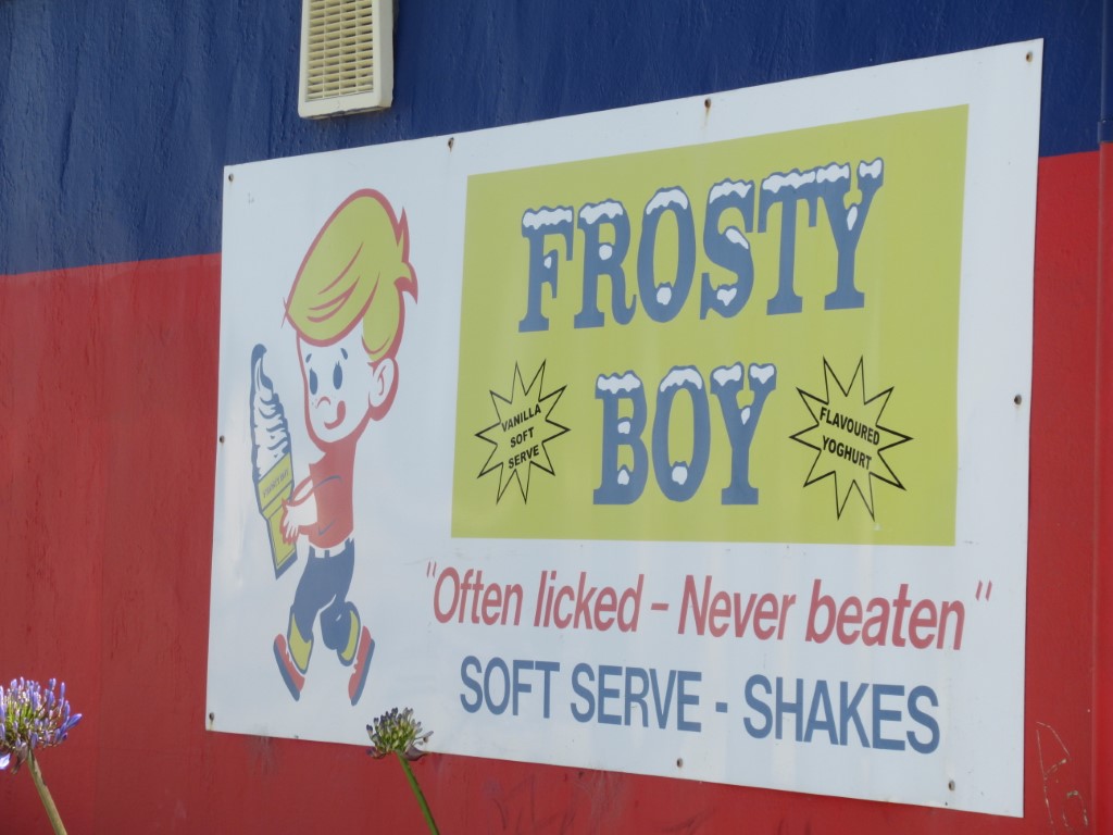
Often licked. Never beaten.
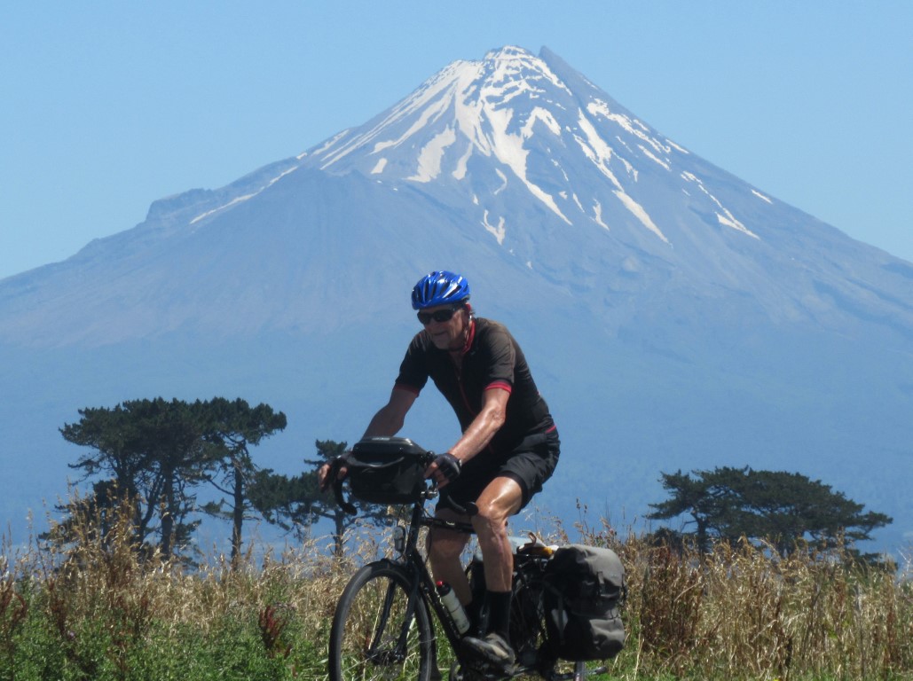
Mt Taranaki, close to New Plymouth. It is a first time for me to see this corner of New Zealand.

Heading up the Awakino Valley. This region is quiet and beautiful. These days mainly beef cattle and sheep.
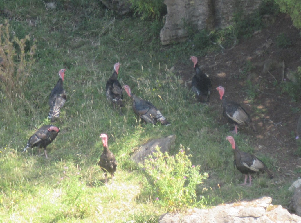
Wild turkeys. There have been several rafters over the last few hundred kms.
After coming out of this valley we will be in Hamilton, and at the end of another great bike tour.
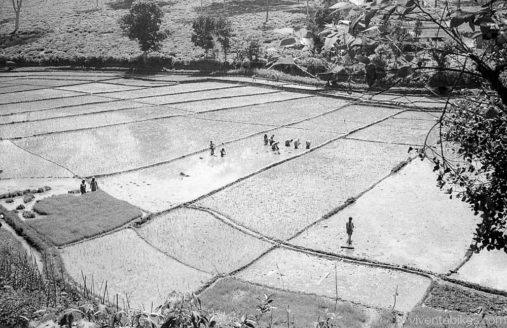
A ride in northern Odisha. We landed at Vizasg, the only international airport in the region. We used the train system to get to Bhubaneswar and back. The focus was in the forested and tribal hill areas of Odisha State.
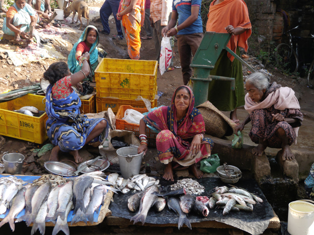
The vibrancy of the street sellers tells us we are really in India again. It is such a stimulating and amazing country.
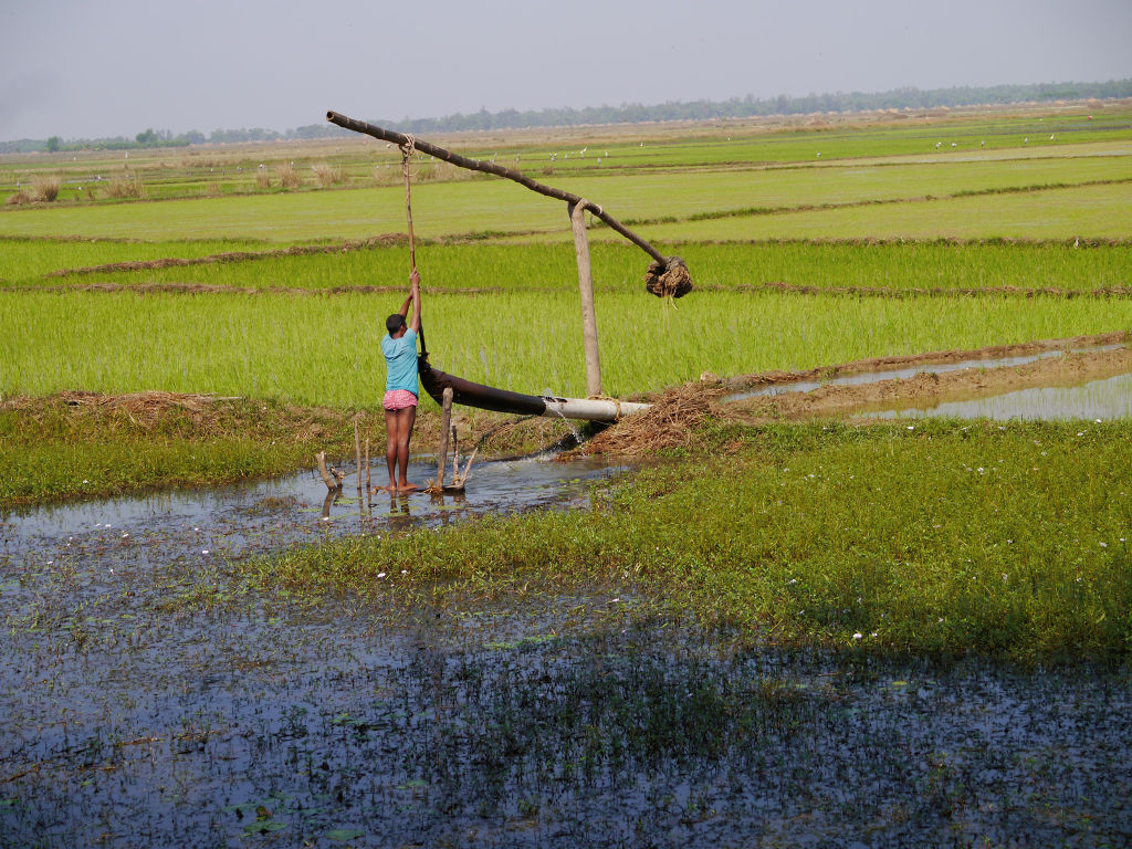
A farmer uses a water lift to manage the level in his paddy.
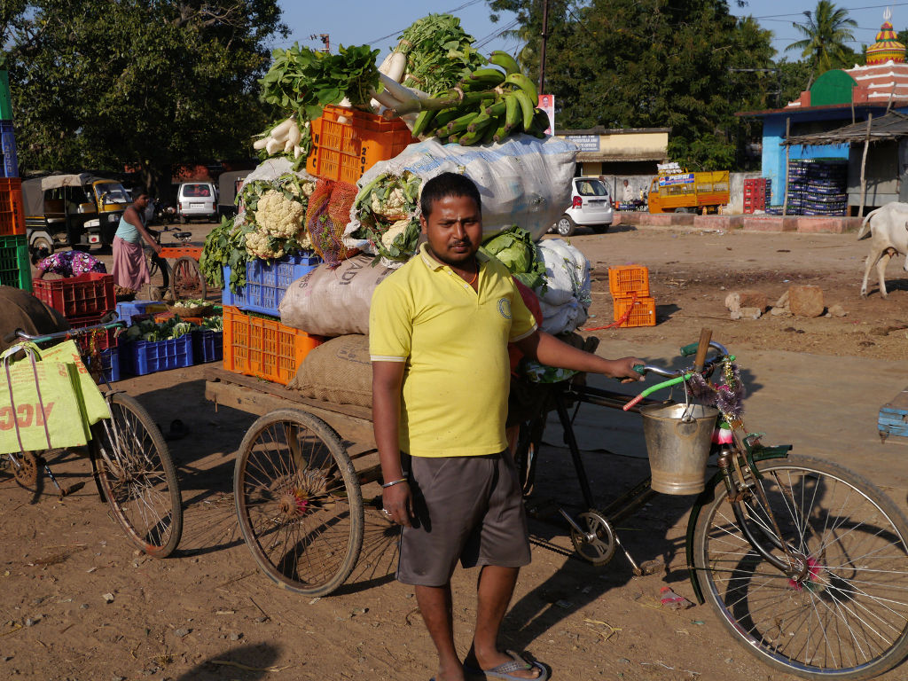
Check out how much load is on this rickshaw at the markets.
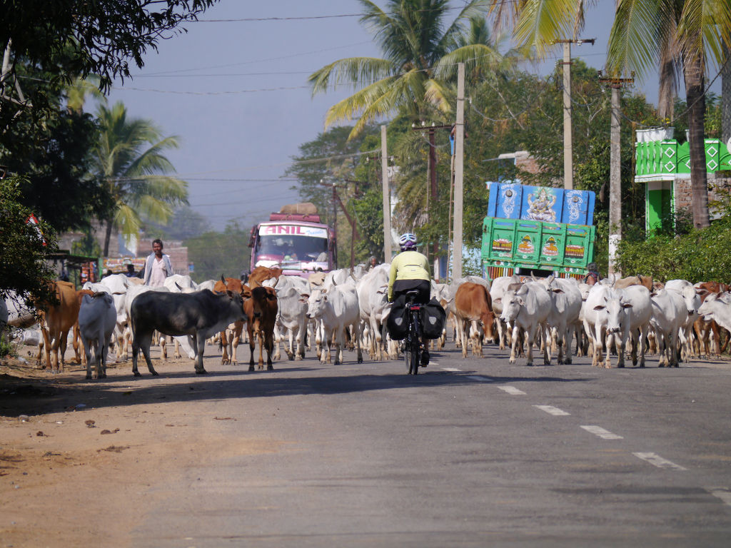
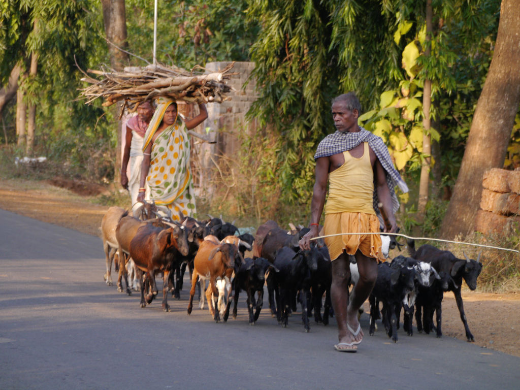
We pass herds of cattle as we head inland.
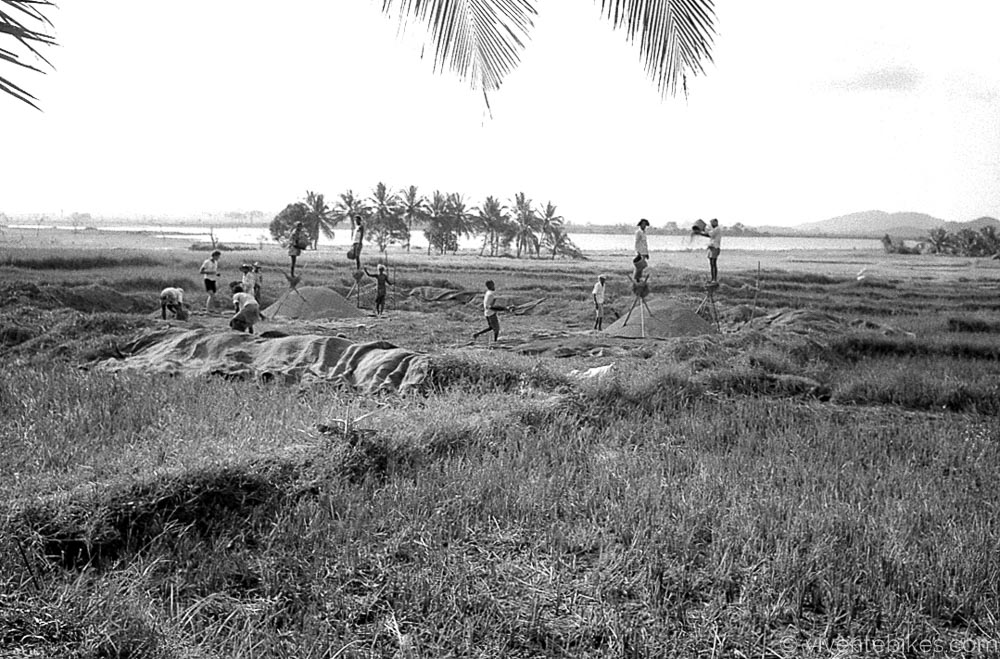
With another rice harvest done and the grain threshed out, the straw is being carted to haystacks.
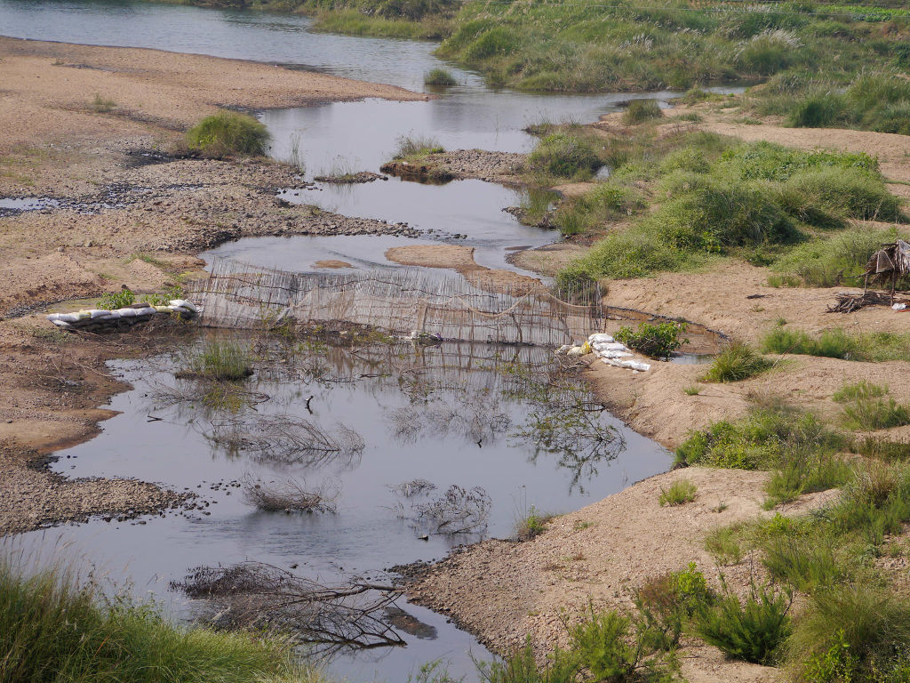
A fish trap.
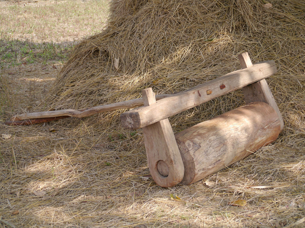
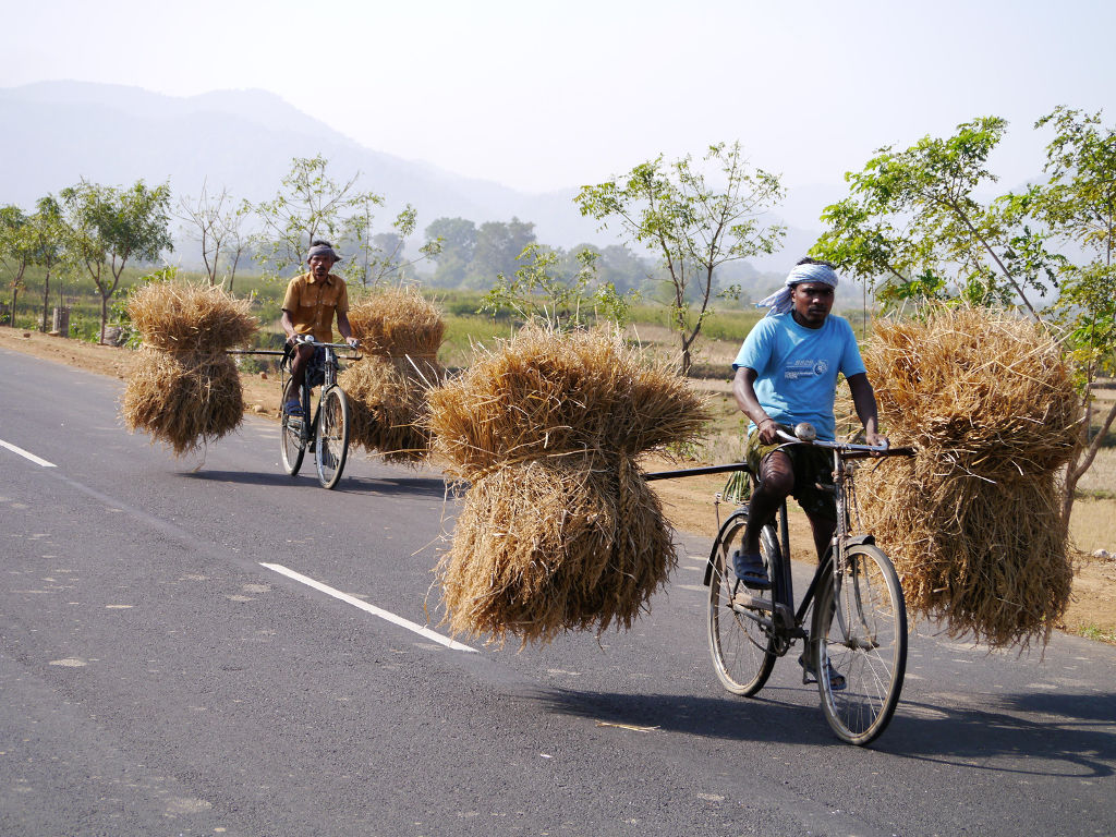
There are lots of ways that grain is threshed in India and often in a given area one way is favoured. Around here it is the cattle-drawn heavy log-roller. We see them every day. The roller is pulled round and round in circles.
Heavy load passing.
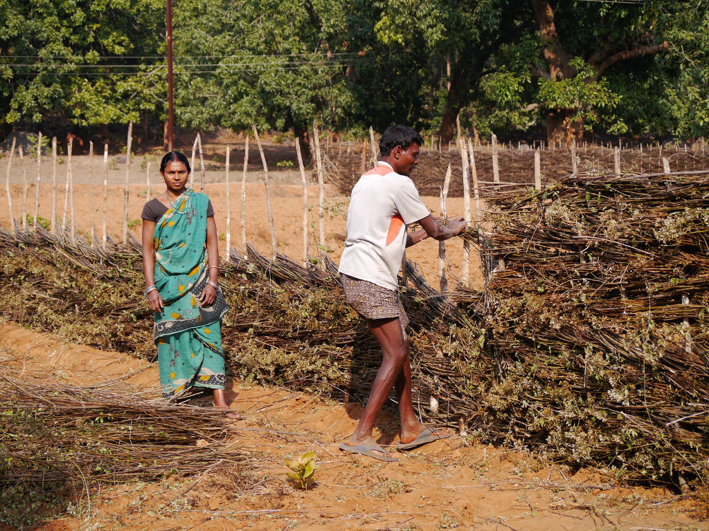
Making an enclosure to either keep animals in or out. Natural materials being woven through sticks dug into the ground.
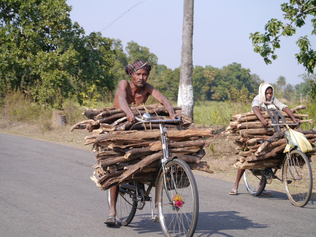
The never ending transportation of firewood on bicycles. One of so many shots like this I’ve taken on this trip.
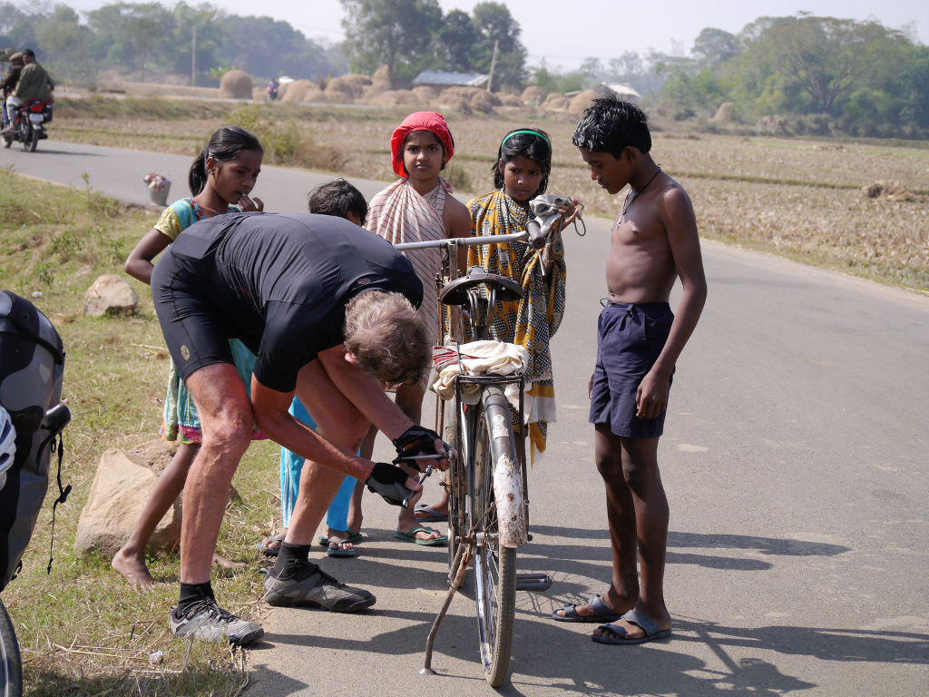
When touring in poorer areas of India I carry pedals to replace the broken pedals so many of these local bikes have.
Beautiful pastoral scenes. Classic India.
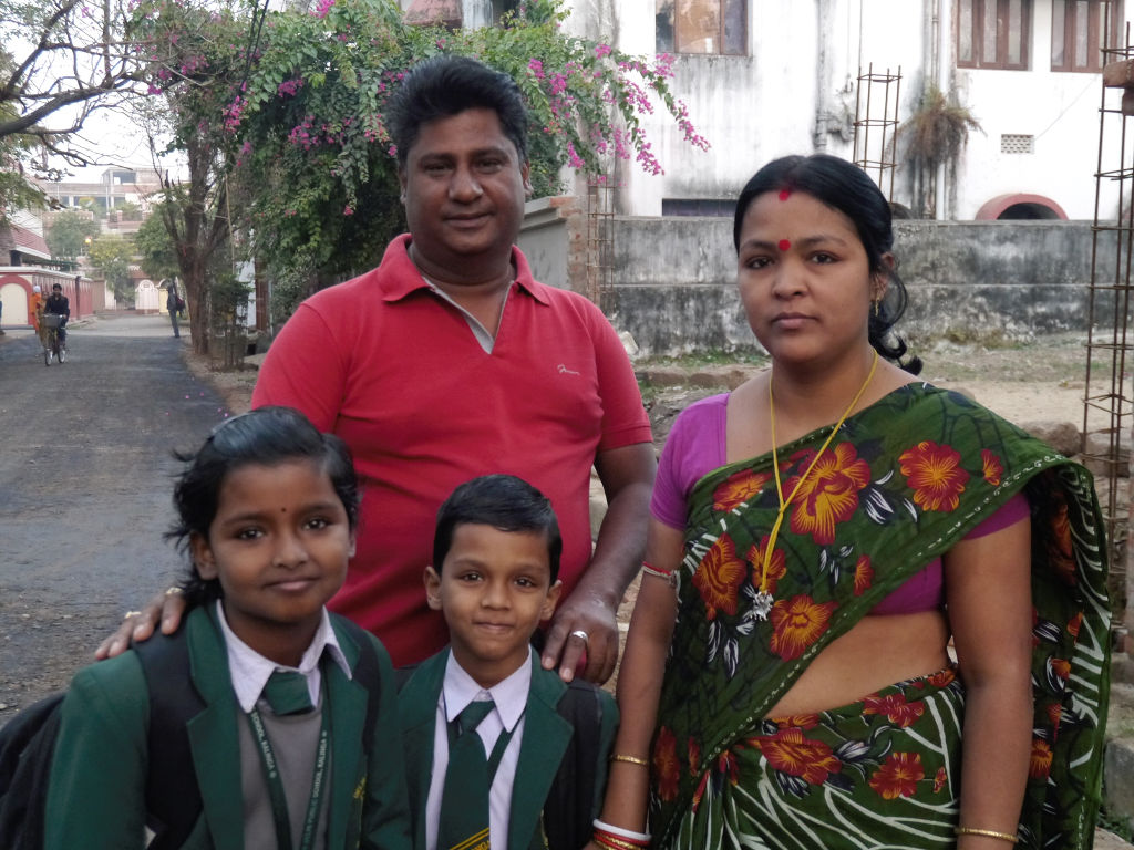
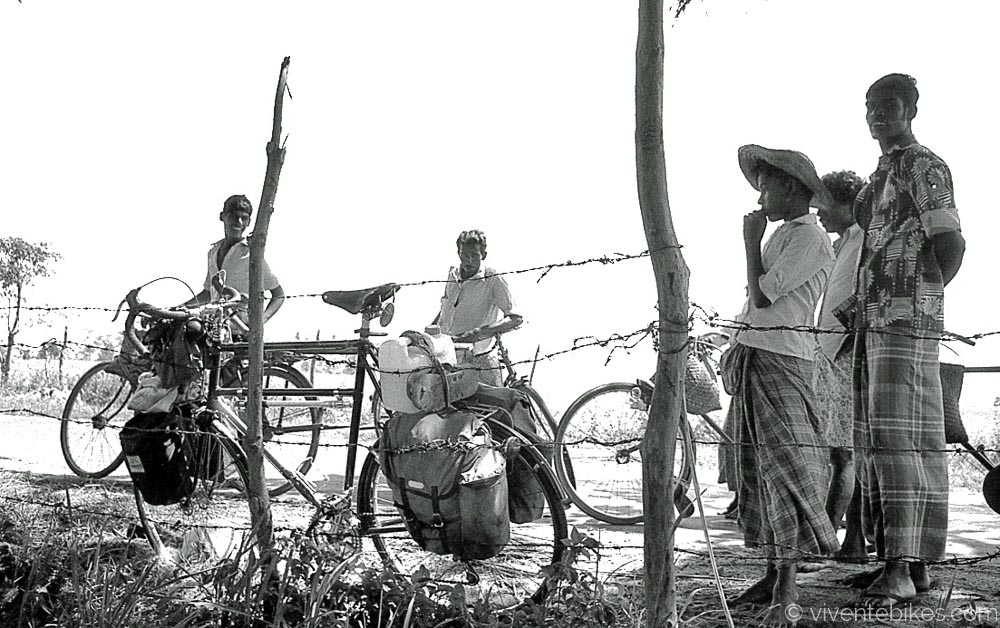
The man in this picture met us on a road 50km out of Cuttack and asked us to stay at his humble home in Cuttack (where we were headed). Words can’t express how gracious and kind he and his family were.
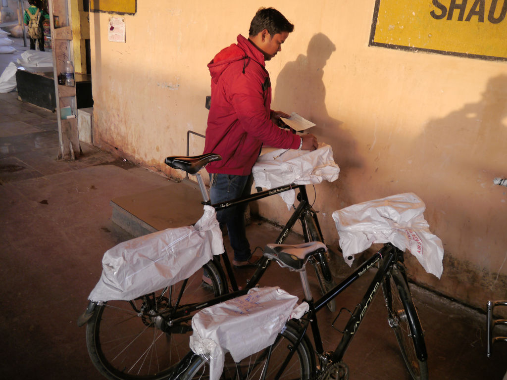
At the train station in Cuttack. The regulation is that bikes have the handlebars covered and a reference number and destination is painted on the wrapping. When you arrive, you wait for your bike at the luggage depot. The bikes don’t necessarily even come on the same train. Once they even came the next day!
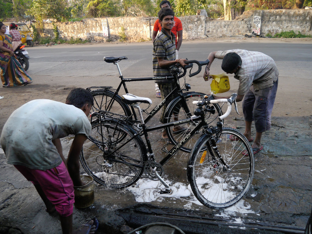
These are the same boys that washed my bike in Vizag last year. They were so stoked that I came back. They did a great job.
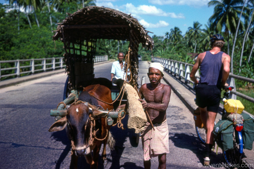
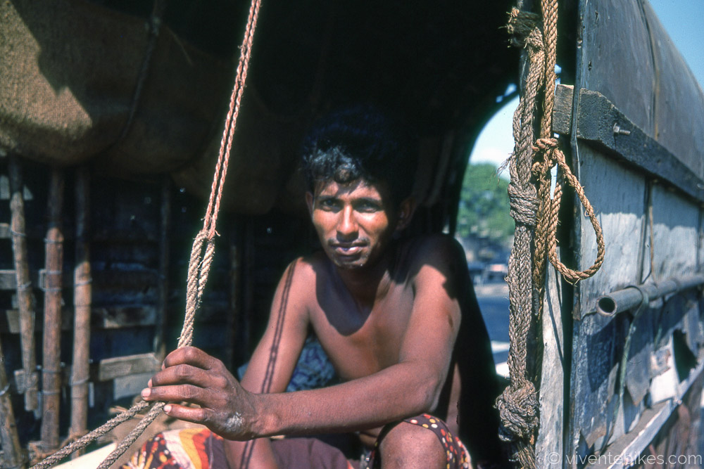
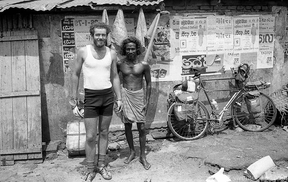
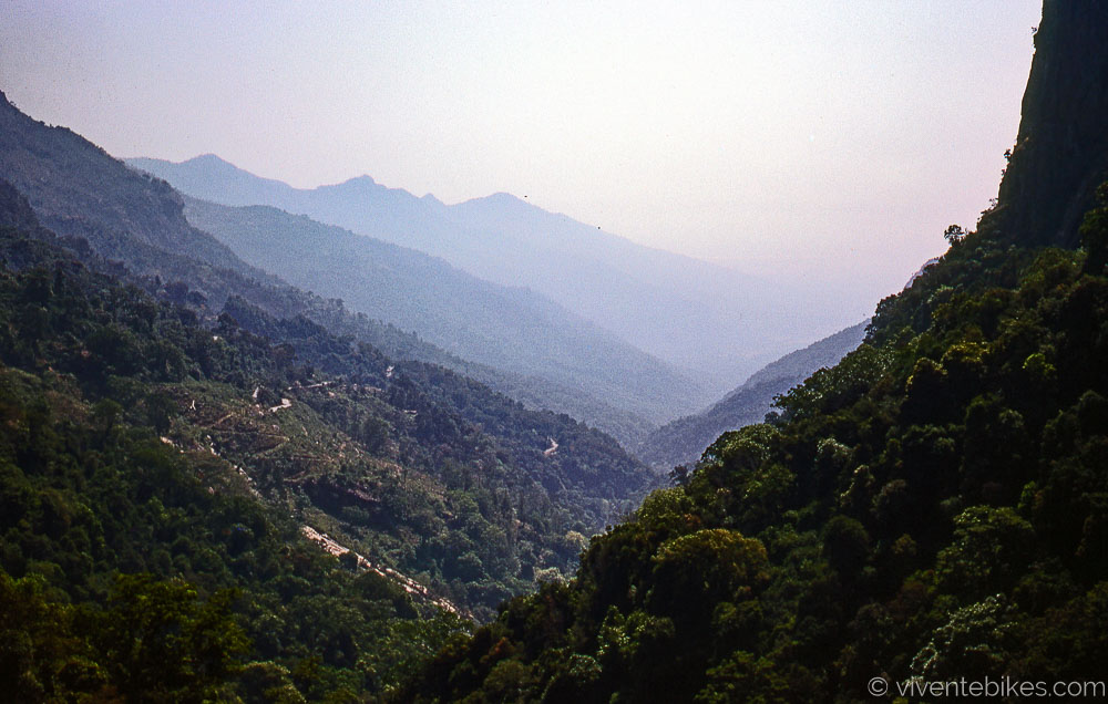
In 1978 a six month, 5,000km tour of Sri Lanka and India. Inspired by Louis Malle’s groundbreaking six-hour documentary, Phantom India. Noel and Danny started searching for it. We started in Colombo and followed the coast around to Hambantota. Then up the east coast to Trinco. The east coast had just been hit by a typhoon and coconut palms were on the ground like match sticks. There were no bridges north of Batticaloa and we used canoes 13 times. From Trinco to Anuradhapura then north through Elephant Pass to Jaffna. The peninsular was later closed for decades so it was special to be touring there. Then down to Talaimannar to get the boat over the Palk Strait to India.
Sri Lanka was to be our preparation for India but from day one we were blown away by the difference coming from a mainly Buddhist society to a Hindu/Muslim and poorer one. We had no particular plan and made it as we went. Firstly we rode across Tamil Nadu and Kerala to Cochin on the Malabar coast. Then up inland to the Ooty hill station and back through Salem and Erode to the east coast and Pondicherry which where there was an alternative commune. Then up to Madras as it was called, staying at Broadlands in Triplicane.
Summer had arrived. Dan got the train to Bombay and I rode up to Hyderabad myself. A few weeks later we found each other in Hyderabad by leaving messages at the Poste Restante. It was unspeakably hot. We got the train up to Nagpur to reassess. It was still too hot so we got the train to Delhi. From there we started riding again, across the plains to Chandigarh. Now the mountains began, and we first got to Shimla. From there we went on to the Kulu Valley reaching Manali. As we rode up that valley there were people lining the road cheering us on, possibly as the first cycle tourers to arrive in the region.
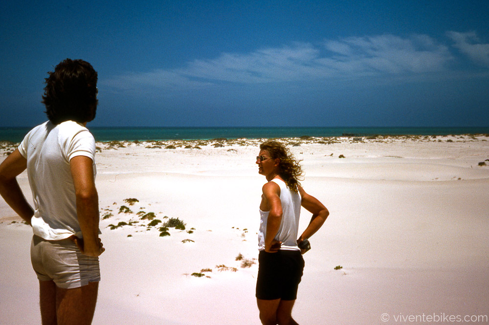
The journey started with us driving across Australia to Perth. The flight was Perth-Negombo. This shot was at the Eucla sand dunes.
Off we go. Notice the gallon water container on the back. We were boiling all of our water and eventually carrying two gallons each (9l).
It is a very steady pace of life on the road.
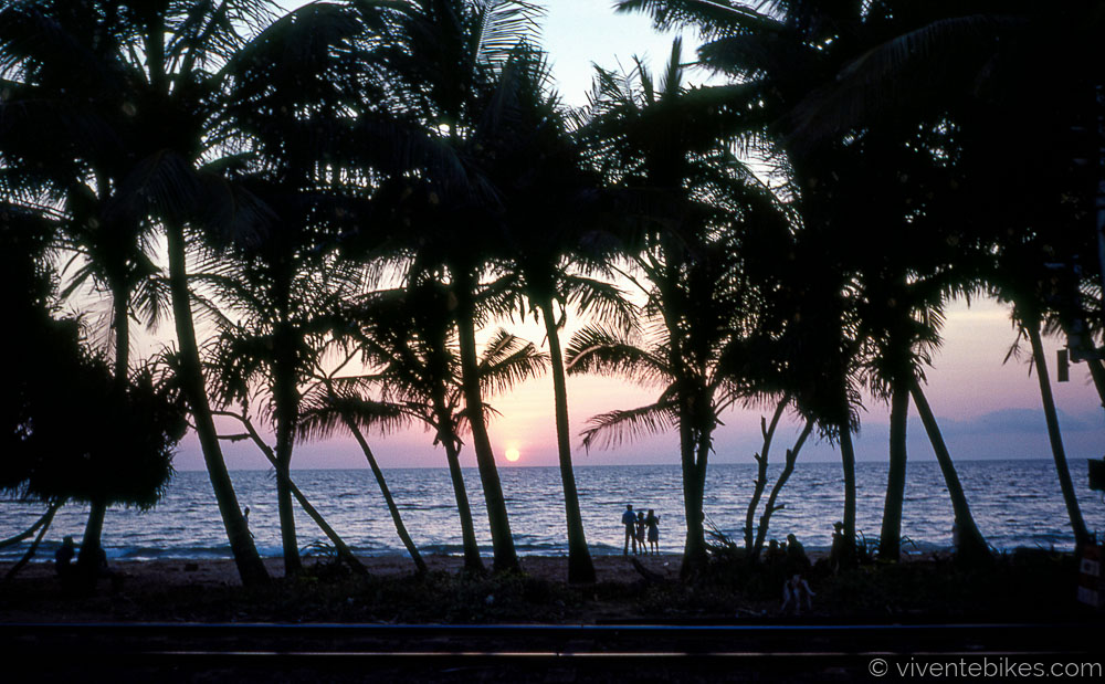
The Sri Lankan coast is picturesque.
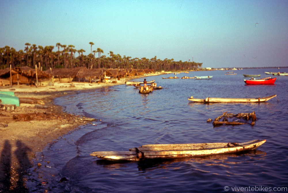
Another fishing village. Everything depends on coconut. The huts are thatched with the fronds. The structures are all in the timber. The rope is coir from the husk. Cooking oil is coconut. Pittu (coconut and rice) is a main dish.
Danny with a fisherman.
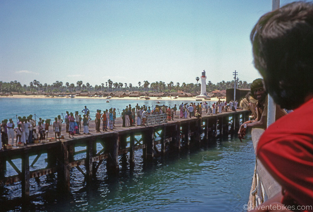
The wharf at Talaimannar taken from the boat. The bikes were hauled up the side of the boat with ropes.
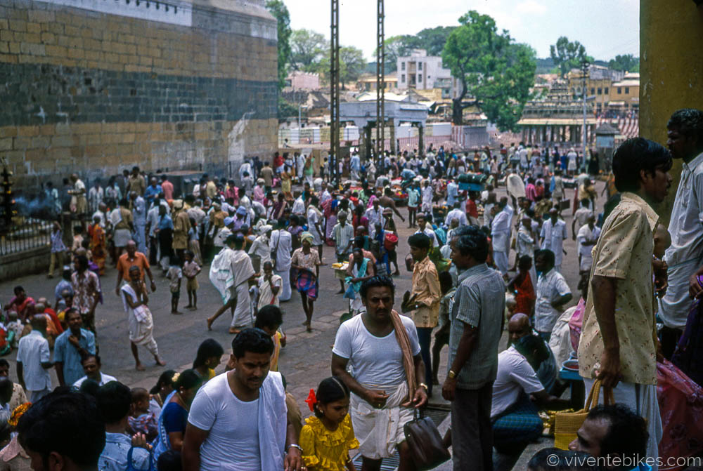
We were bowled over by the intensity of India. We developed the term “India Shock” to describe what the initial immersion into India is like. As months went by we came to feel at home here. I cried when I eventually left, five months later on another boat (Madras to Singapore).
Along the road. Many of the roads were very rough and at one point I broke my steel seatpost just from the constant hammering.
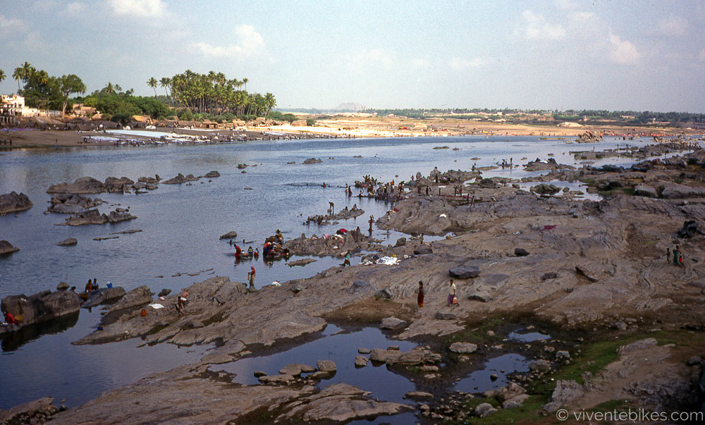
The mighty Kaveri. In the dry season the big rivers virtually stop running. The women and kids are there doing the washing.
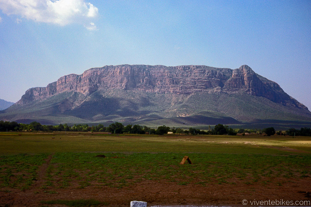
We are arriving at the western ghats. The Indians call them hills but the passes are mostly between 1,500 and 2,000m.
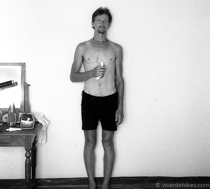
Noel at 26 years of age.
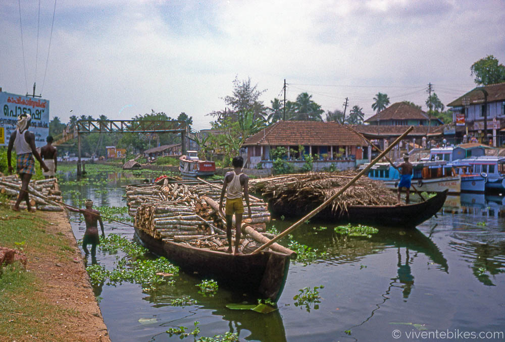
The canals around Alleppey (later renamed Alappuzha) in Kerala.
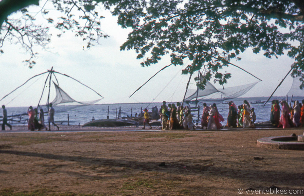
In Old Cochin these fishing nets are lowered into the water and when fish are seen to swim across them the nets are quickly raised up.
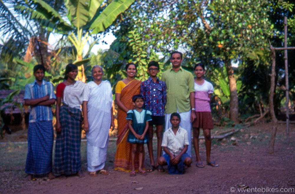
In the Keralan town of Nilambur we are taken in by this family. They were so kind.
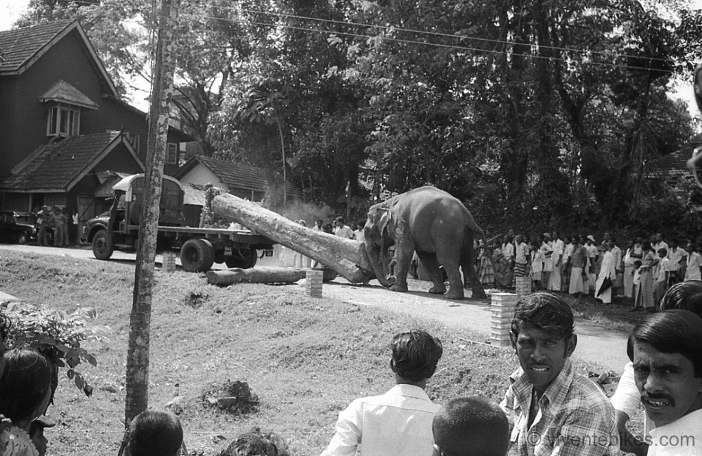
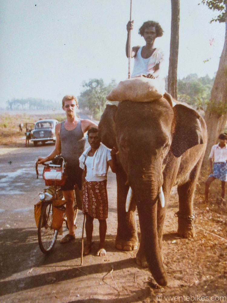
Elephants are in widespread use on the west coast, especially to handle the very heavy teak logs.
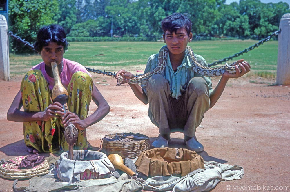
OK for the brave. Cobras are quite common but of course are deaf so playing the pipe is just for atmosphere.
Climbing the ghat road up to Ooty.
Coming down and heading east it is classic India.
As we ride across the Deccan the pastoral scenes are beautiful. Here the rice is being winnowed. When there is a breeze, they climb up on stands and slowly tip out the grain so that the husks and straw are blown aside.
There is always a sense of commonality when you are touring in countries where people walk and cycle. We are in it together.
In the big smoke! This is central Madras. Notice that the cars (mostly they are taxis) are all Ambassadors. India had bought an old car factory from England and almost every car in the country was an Ambassador.
Looking out from the verandah at Broadlands Lodge. We hired two rooms (one just for the bikes) and stayed a week. Broadlands at the time was an institution for hippy travellers in South India. In former times it had been a harem connected to the mosque behind there.
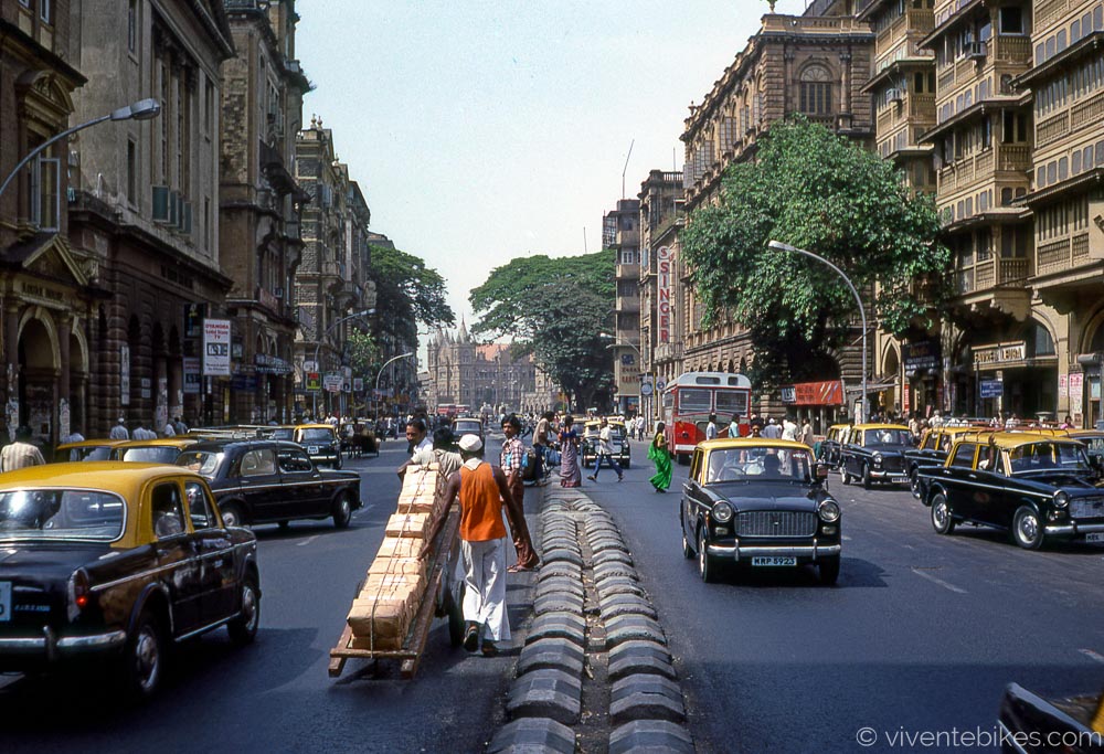
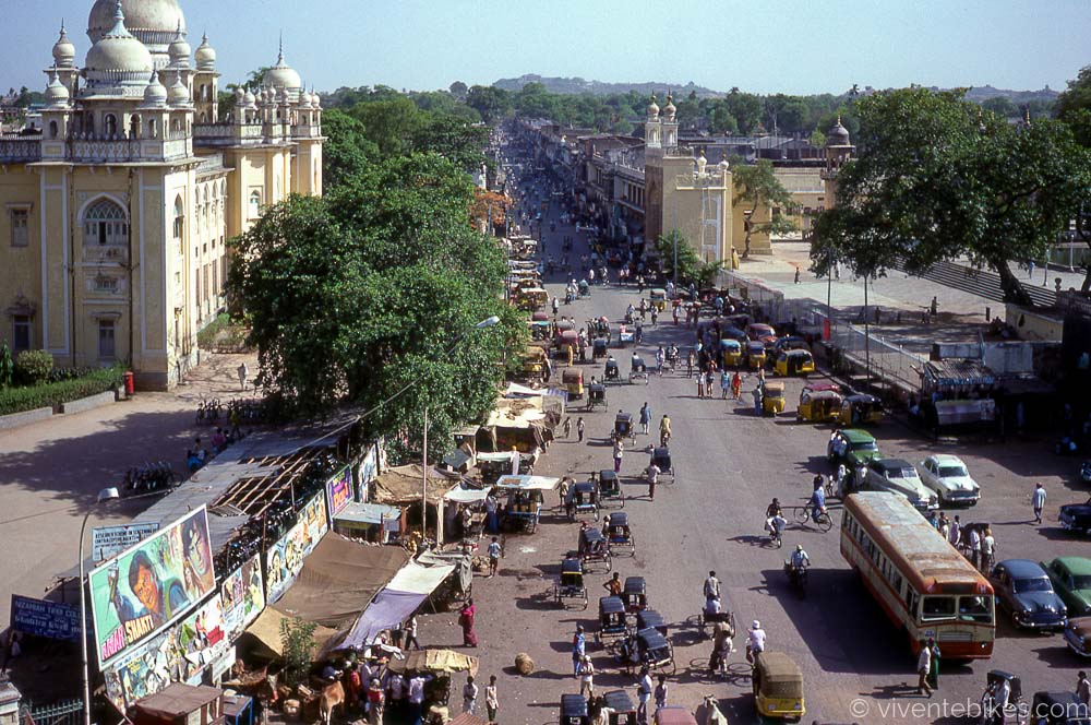
Charminar in Hyderabad. The ride from Madras to Hyderabad was tough because of the heat. I would start at 4am. Riding trough towns there were lines of people sleeping on both sides of the street. No one would sleep inside as it was just too hot. I would hire a room and leave the bike inside and sleep on the footpath. Every 10km or so I’d stop at a well and dump a bucket of water on my head. It would be 40 degrees by 9am. This is when I learned to only go to India in the winter.
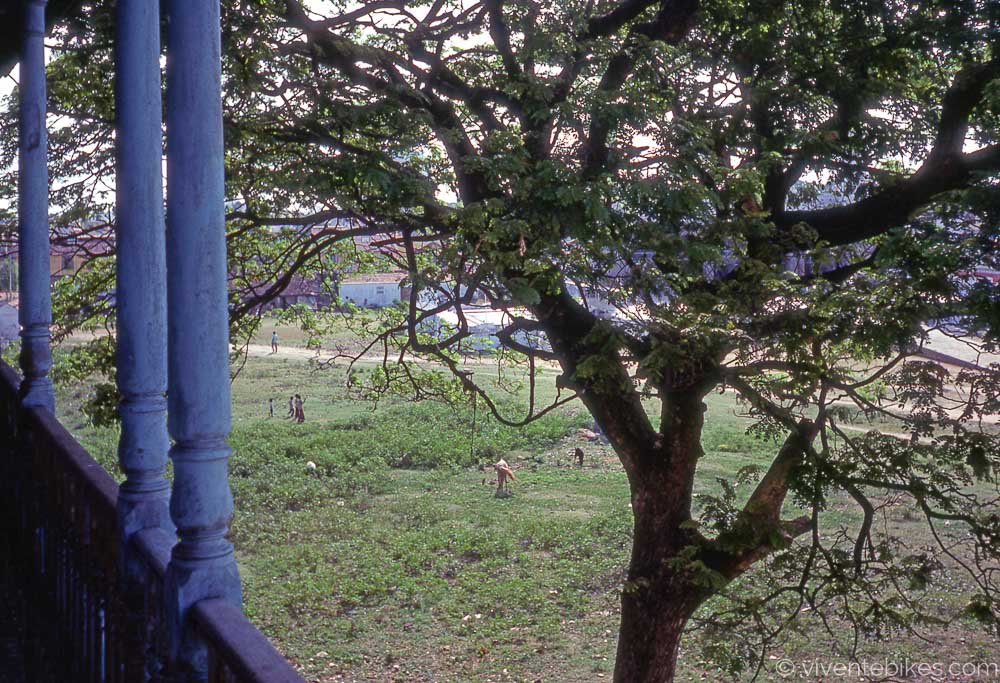
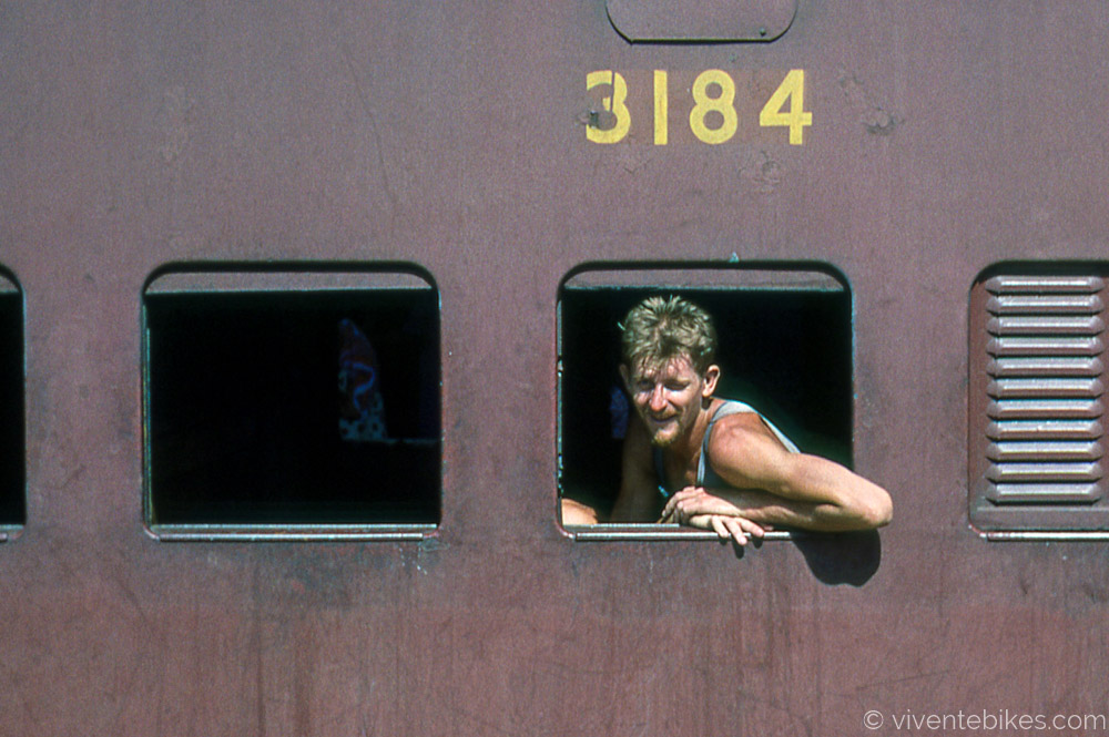
Out the window in Hyderabad. 1978.
On the train to Nagpur. Here we ran out of film and were unable to get more. We had the whole of North India ahead.